Ricko
Ricko
About
- Username
- Ricko
- Joined
- Visits
- 6,933
- Last Active
- Roles
- Member
- Points
- 10,582
- Birthday
- February 7, 1977
- Location
- merlo san luis argentina
- Rank
- Mapmaker
- Badges
- 22
Latest Images
Reactions
-
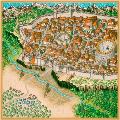
MY MUNDI IS READY!
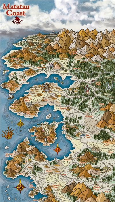
3 - Skeleton Coast


-
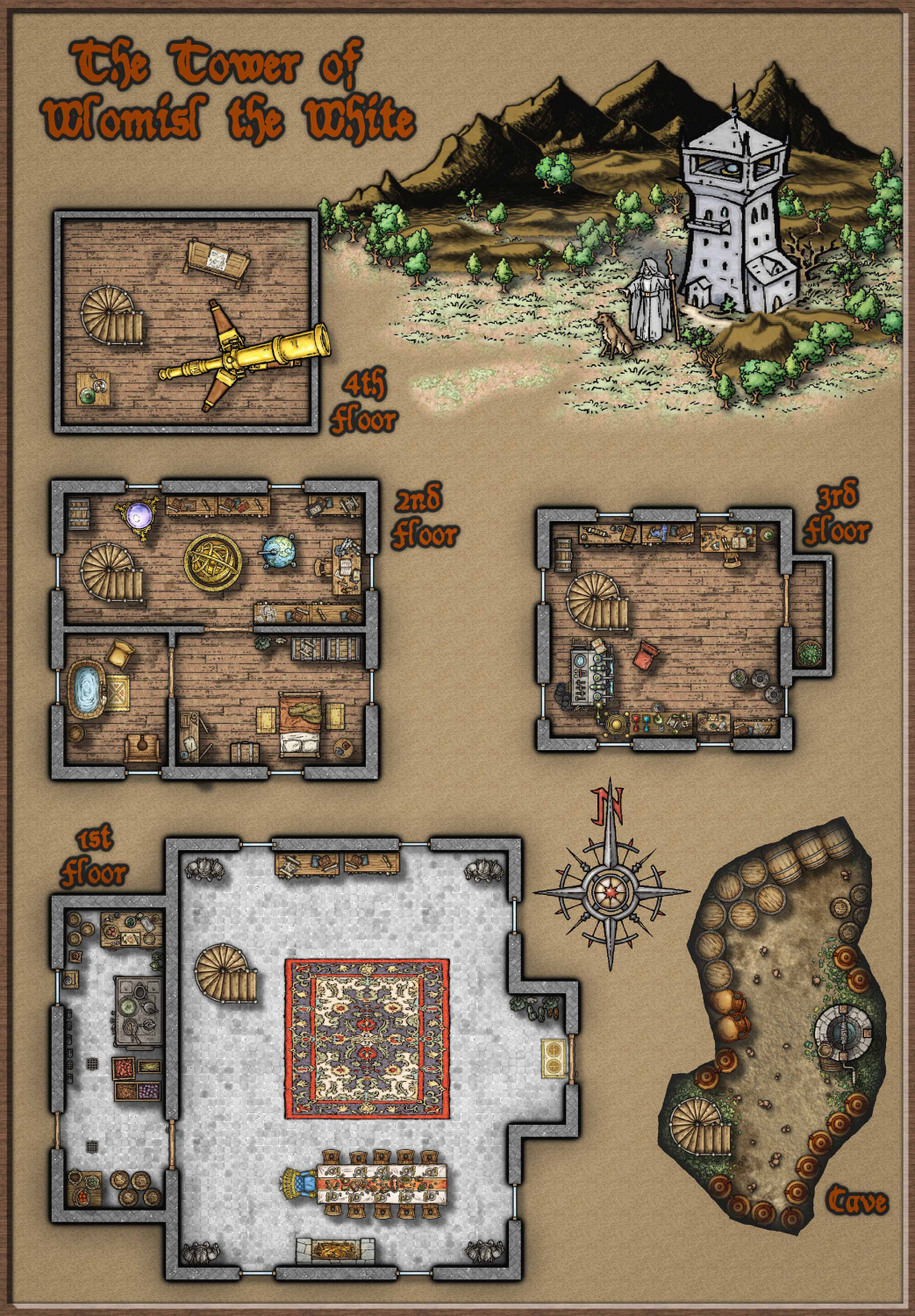
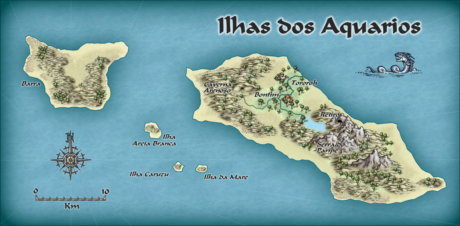
cOMMUNITY ATLAS - The Bucesi Nations - Wlomisl the White
-
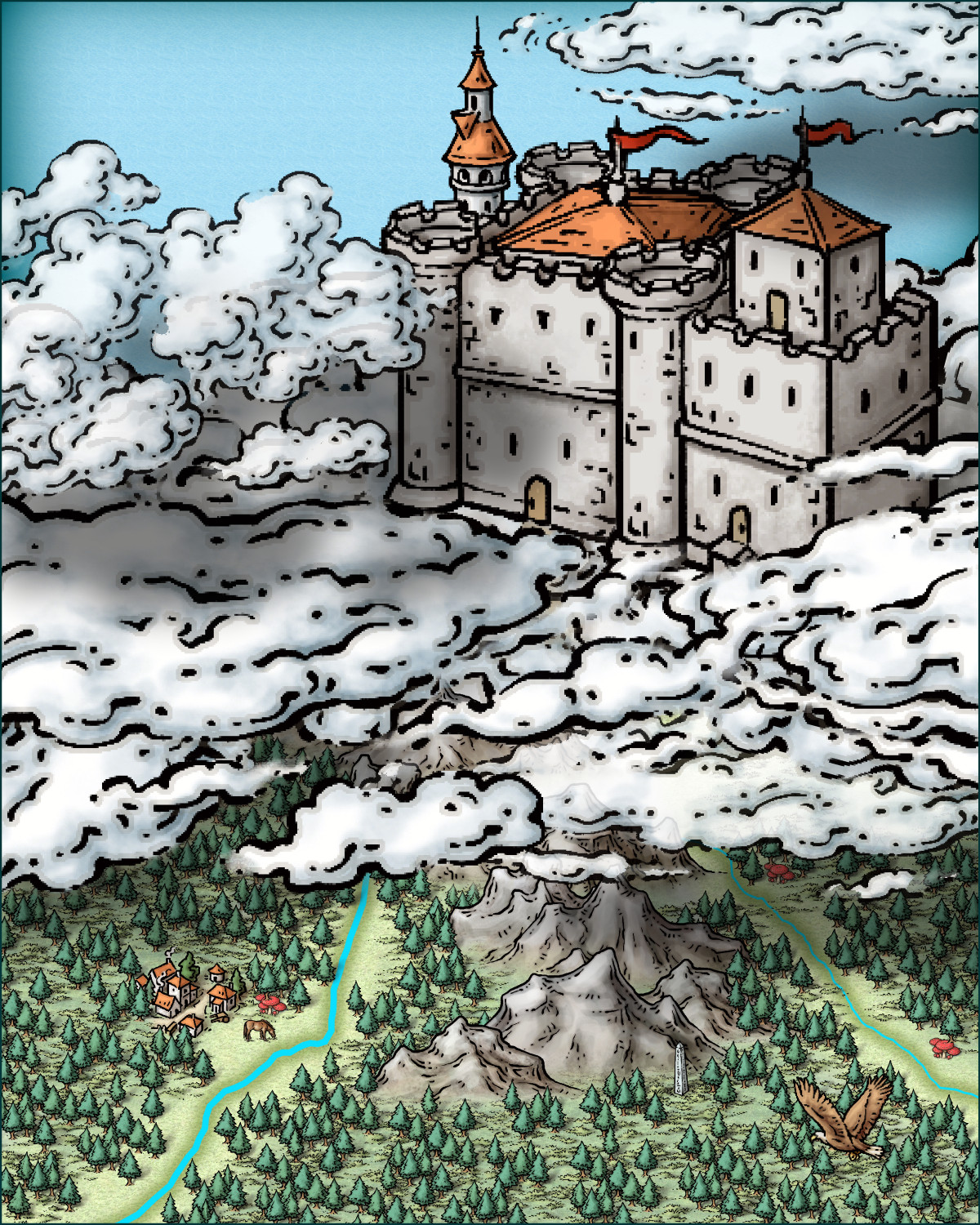
Castle in a Cloud
Hy @Royal Scribe !
I was looking at your post and was intrigued by the challenge. I had never thought too about creating a castle in the clouds before. So while watching a boxing match I made this small "Close up" image (size 40x50 - metric). I only used images from Mike Schley style and attach the FCW file in case you want to take a look.
Cheers


-
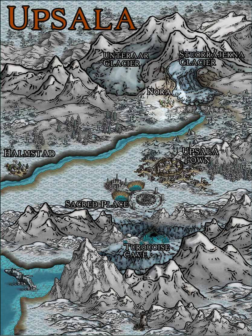
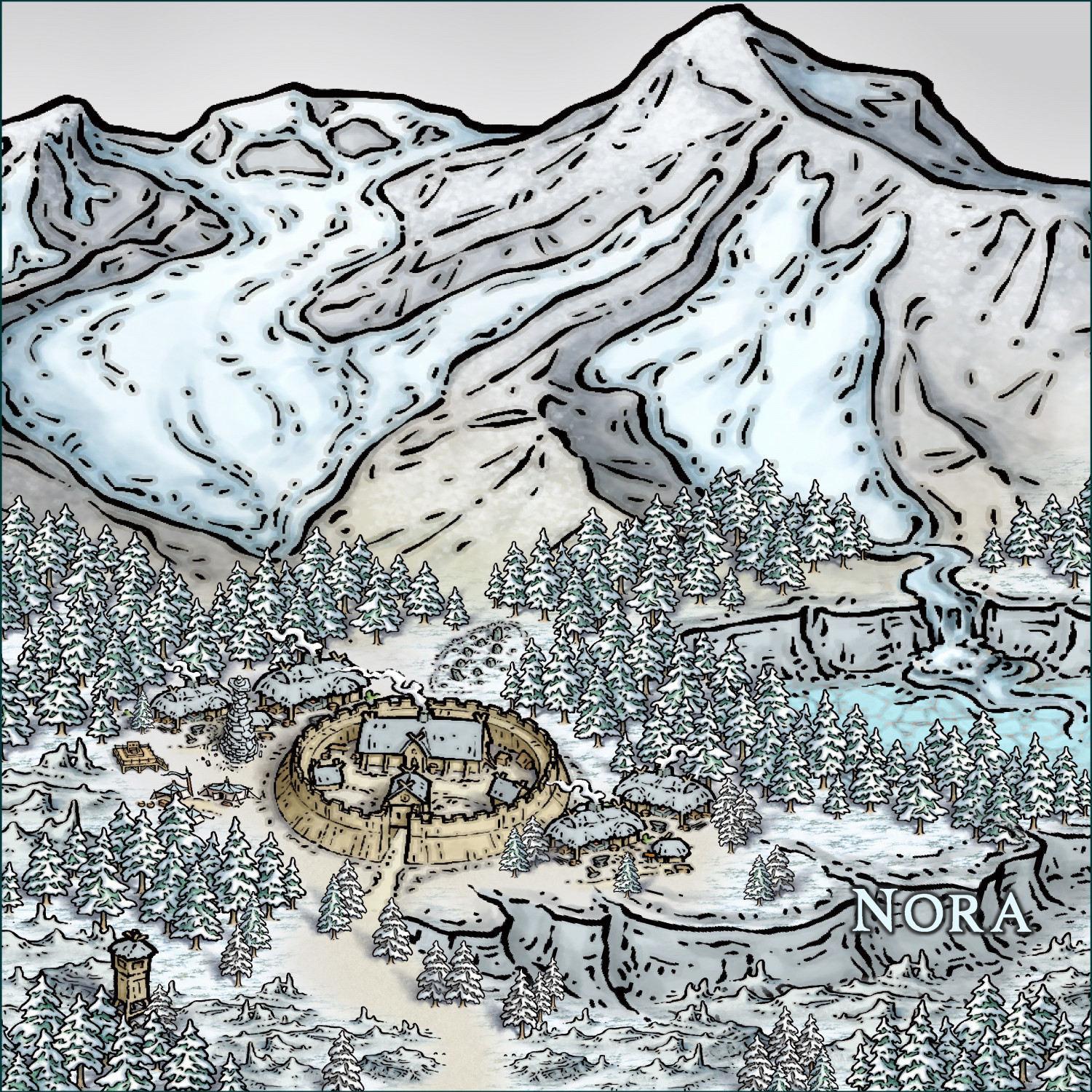
Community Atlas - Seven Maps from Seven Maps of the Day
This time, randomness led me to the cold region of Uppsala. I chose to bring to life the small and resilient village of Nora.


-
WIP - Largo the Cursed Village
this i was looking, found it!


-
Lost Throne A3 55x80 Battlemap
Cheers

-
On leprechauns and rainbows and pots of gold
Hey @Royal Scribe Beautiful work! Note that in the first image, the waterfall is not in the foreground.
In the second drawing, very beautiful by the way, you can improve it even further by using the trees or other symbols to "hide" the junctions of image with screen, or image with image. Note the points below.
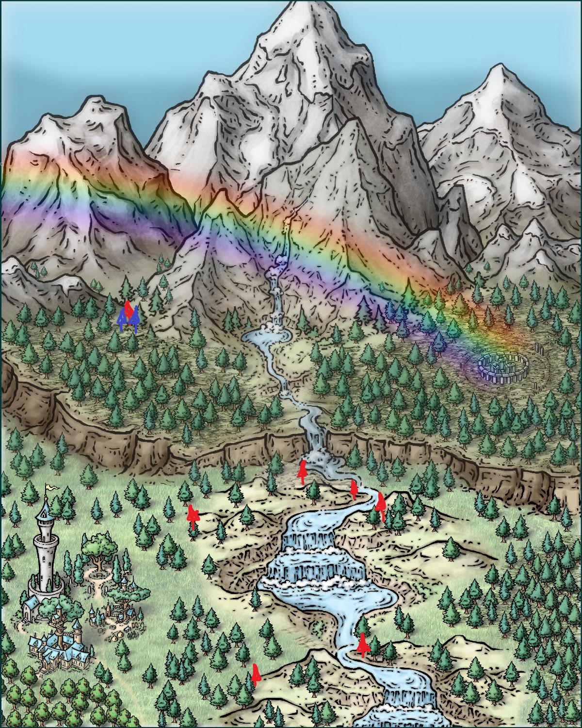
Also, if you want to show an apparent "use" of the magic circle of stones, you can leave it without grass and create a special sheet, above all, to use a hill background or mountain background and give the appearance of a ground "trampled".
Congratulations!

-
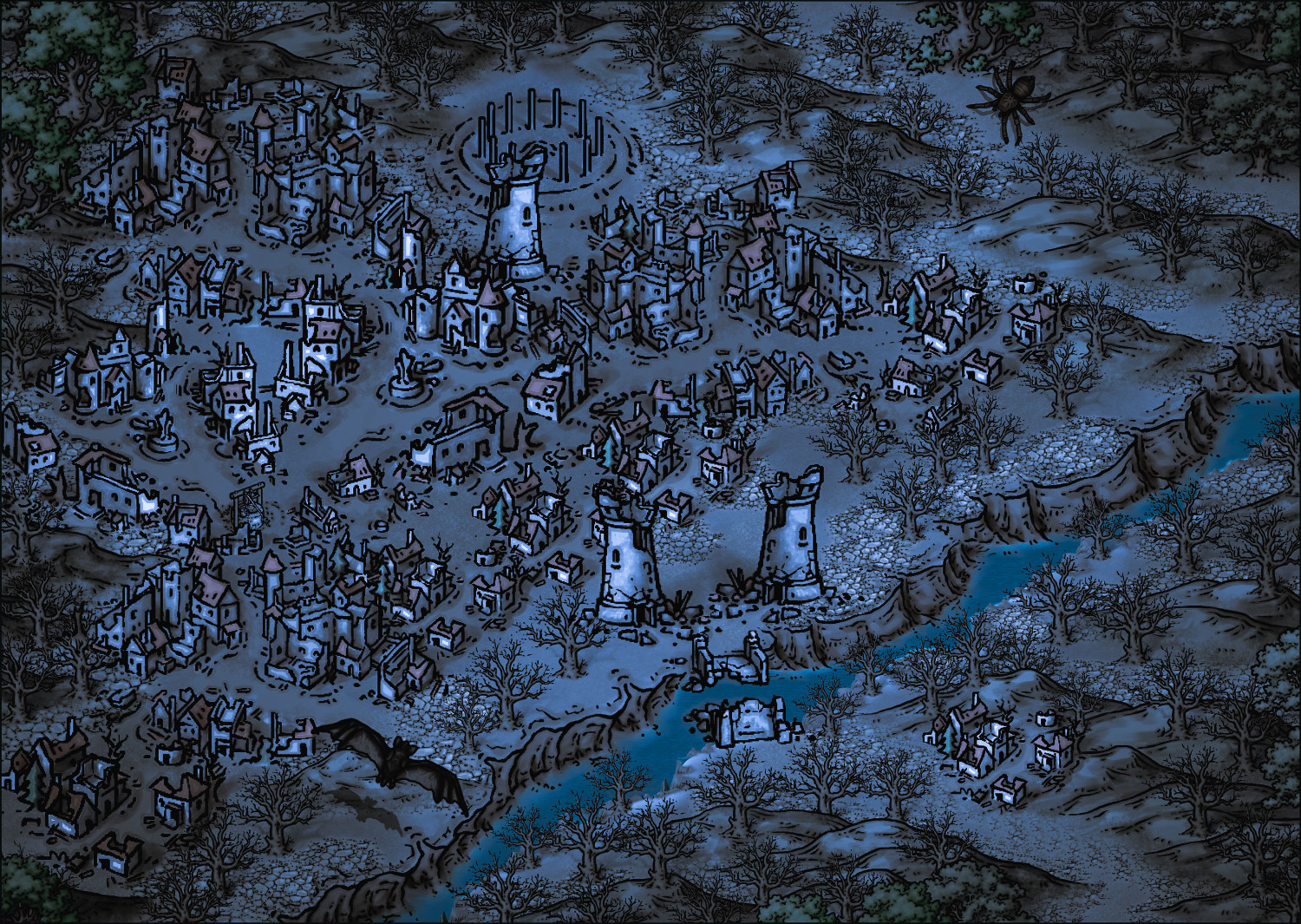
Community Atlas - Fonlorn Archipelago - Bleakness - Death Forest.
This time we're going with a ready-made mini adventure adaptable to any system, made in an unpretentious way to spend time with friends. =)
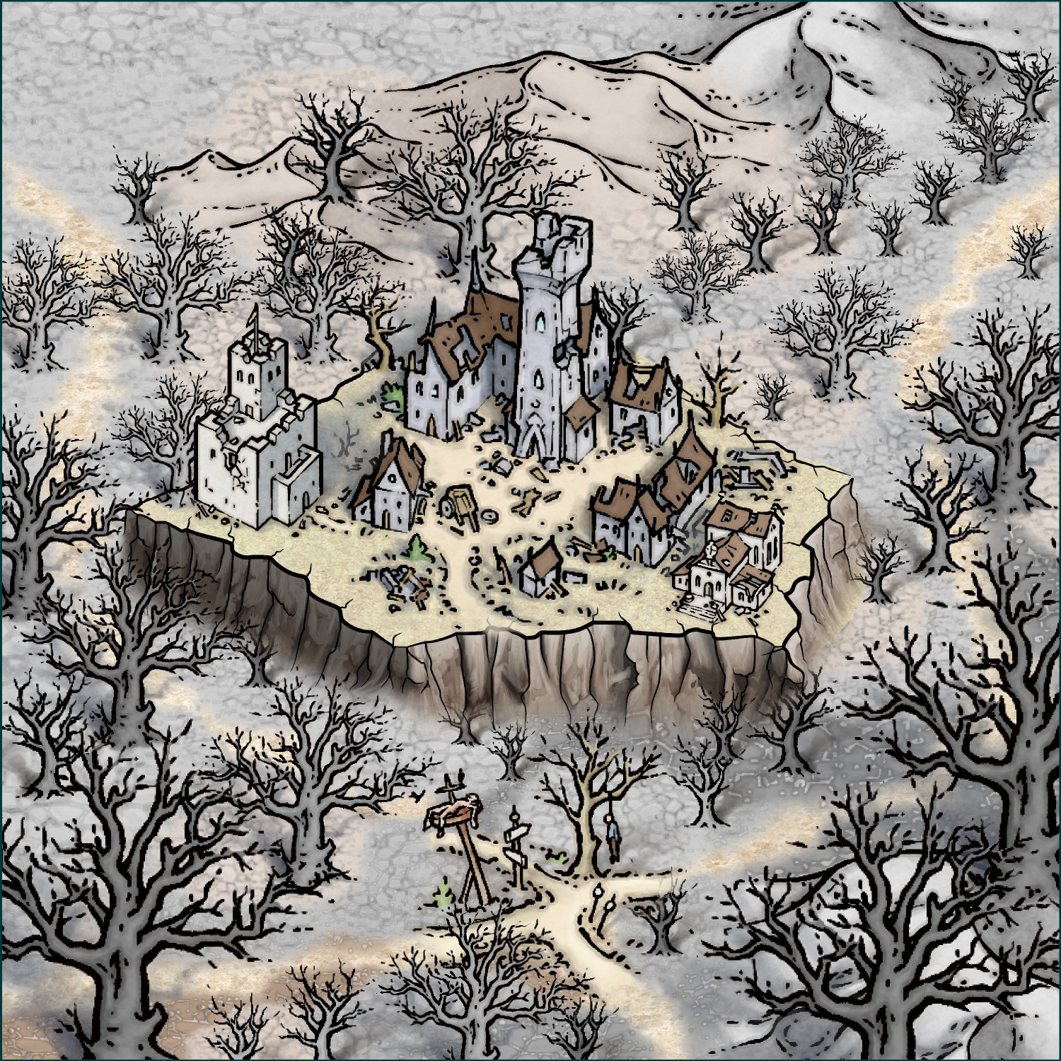
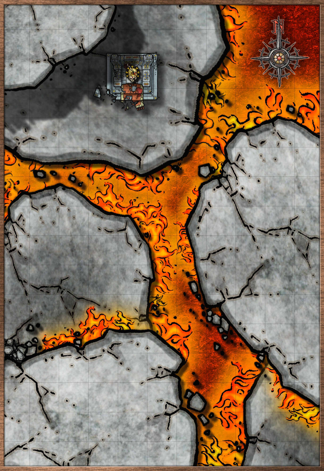
The Tower of Ancient Deceit ☠️
1.Introduction
On nights when lightning slashes the gray skies and the fog creeps like a living thing, the cracked bell in the ruined tower tolls alone. No wind shakes it, no mortal hand touches it—but its call echoes through the Death Forest.
The stories say that this tower, once a watchtower, was meant to warn the world against an ancient threat. But now that its guardians have vanished and its walls have crumbled, who or what watches over the depths below?
As the adventurers explore the ruins, they discover a forgotten staircase beneath the tower, hidden by rubble and volcanic ash. When they manage to open its door, a damp wind blows up from the depths, carrying the smell of rotting earth and something worse.
Someone or something awaits them down there.
2.The Underdark
What lies beneath the tower is older than the forest itself.
The passage leads to a set of forgotten chambers carved into the rough stone, decorated with unholy symbols and carvings that writhe in the torchlight, as if refusing to be read. The stone feels sweaty, hot to the touch, as if something throbs beyond its layers.
Further down, the passage opens into a vast hall, its cracked columns towering towering.
And the bell in the tower begins to toll again.
3.The Presence in the Shadows
The explorers are not alone.
Something ancient and infamous creeps in the shadows of the underworld, a being whose silhouette can never be seen in its entirety, as if its form does not belong entirely to this world. Its bony claws scratch at the walls, its breath a hot, damp breath, carrying the smell of things dead for centuries.
The Watcher, the last guardian of the prison, still roams these great chambers, its body twisted by its eternity of vigil. But he is no longer a protector—he is a blind, hungry aberration, driven only by the desire to protect this place at any cost.
And if the explorers go further, if they descend into the depths where reality itself twists…they will discover that the prisoner is still there. Waiting.
4.The True Purpose of the Tower
A small, abandoned library, tended for centuries, tells the story that the tower was built to watch over an unfathomable evil imprisoned beneath it. A being from before the dawn of man, sealed away by a forgotten order, watched over for centuries.
But the truth is much worse. The tower was never a watchpost. It was built to keep the ignorant at bay. And the prisoner was no monster…but a forgotten God.
5.The Prisoner
What lies (or lay) beneath the tower is called, in ancient whispers, Karalor, Who Pulses Beneath the Earth. He is no demon, nor an aberration—he was a god of vitality and thought, worshipped in the earliest times by the first peoples of this world.
But one day, other gods feared his rise. They manipulated mortals, twisting their myths, turning Karalor into a villain, and convincing civilizations to imprison him.
"Karalor never devoured souls."
"He never spread terror."
"He offered knowledge and health… and was silenced."
And the Sentinel, the last guardian of the seal, had fought furiously to prevent any change in order.
The bell in the tower is not a warning to a monster.
It is a call for help.
6.Options
Now, the adventurers have a choice before them (feel free to add another possibility):
1. Do they depart and leave the tower behind? The forest will once again consume the tower, and the cycle of fear will continue, the bell echoing until the end of time.
2. Will they attempt to reinforce the seal? To do so, they will need to discover how the ancient gods betrayed them, and perhaps pay a terrible price to prevent Karalor from returning.
3. Will they free the prisoner? But is Karalor a benevolent god, or merely a long-forgotten entity whose true purpose surpasses human comprehension?

-
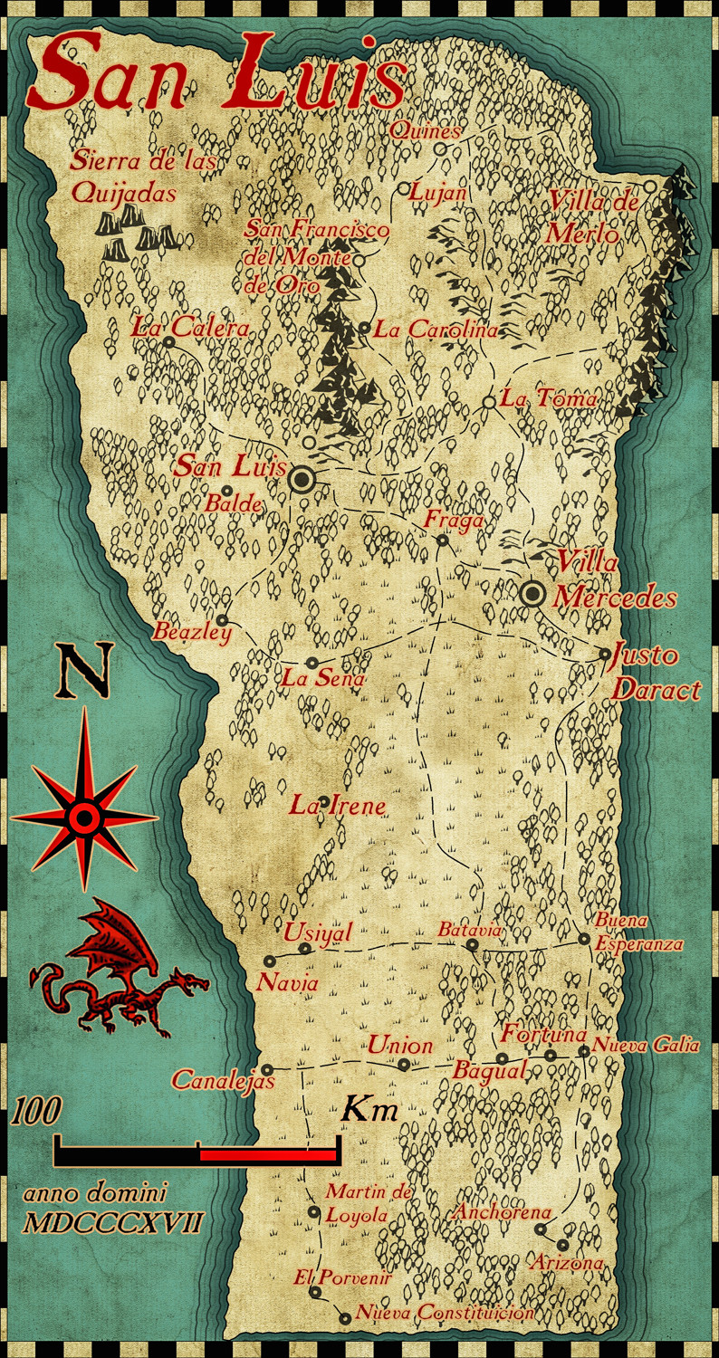
San Luis province - Argentina
![[Deleted User]](https://secure.gravatar.com/avatar/c75d9a245b74d9c59be0999ea81ca541/?default=https%3A%2F%2Fvanillicon.com%2F92add7f8c954488718110edc4896ad39_200.png&rating=g&size=200)


-
Community Atlas - Berenur - Urtrah Desert