


Quenten
Quenten
About
- Username
- Quenten
- Joined
- Visits
- 8,145
- Last Active
- Roles
- Member
- Points
- 3,110
- Birthday
- November 29, 1950
- Location
- Australia
- Real Name
- Quenten Walker
- Rank
- Mapmaker
- Badges
- 16
Latest Images


Reactions
-
Using Mike Schley symbols
Open the FSC file you wish the new pngs to go to - usually in a folder in the Symbols folder on your CC3+Data folder.
Click on Symbols menu, then Symbol manager. You will get a screen like this:
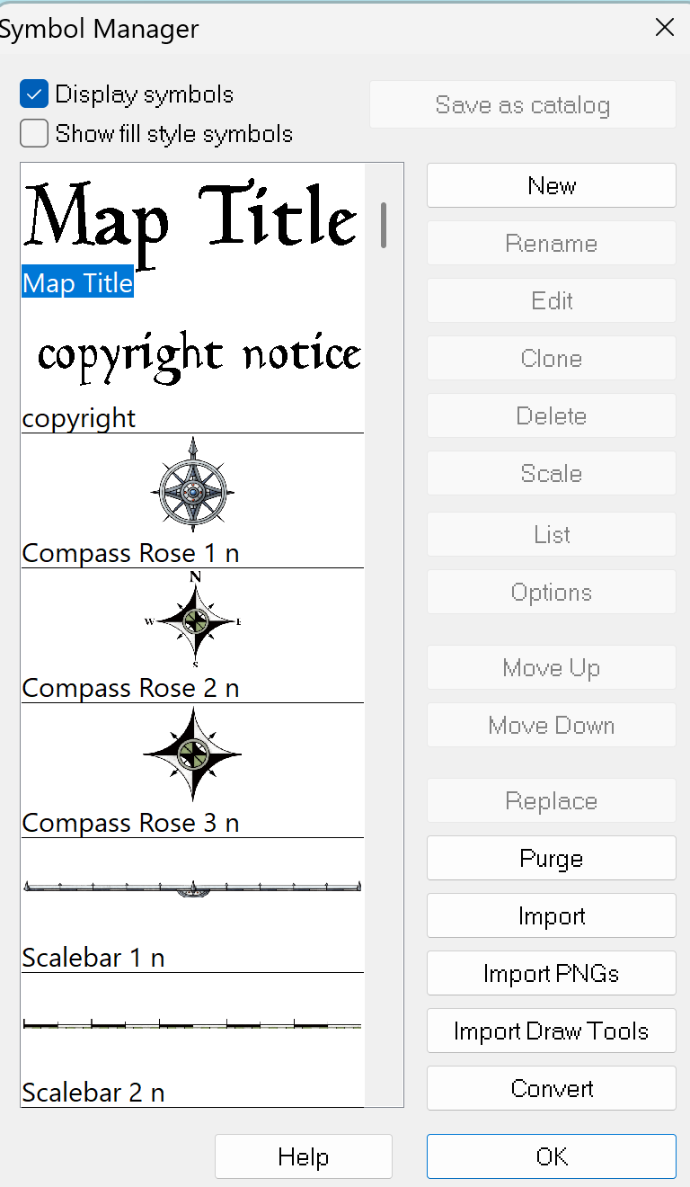
Click on Import PNGs and you will get a screen like this:
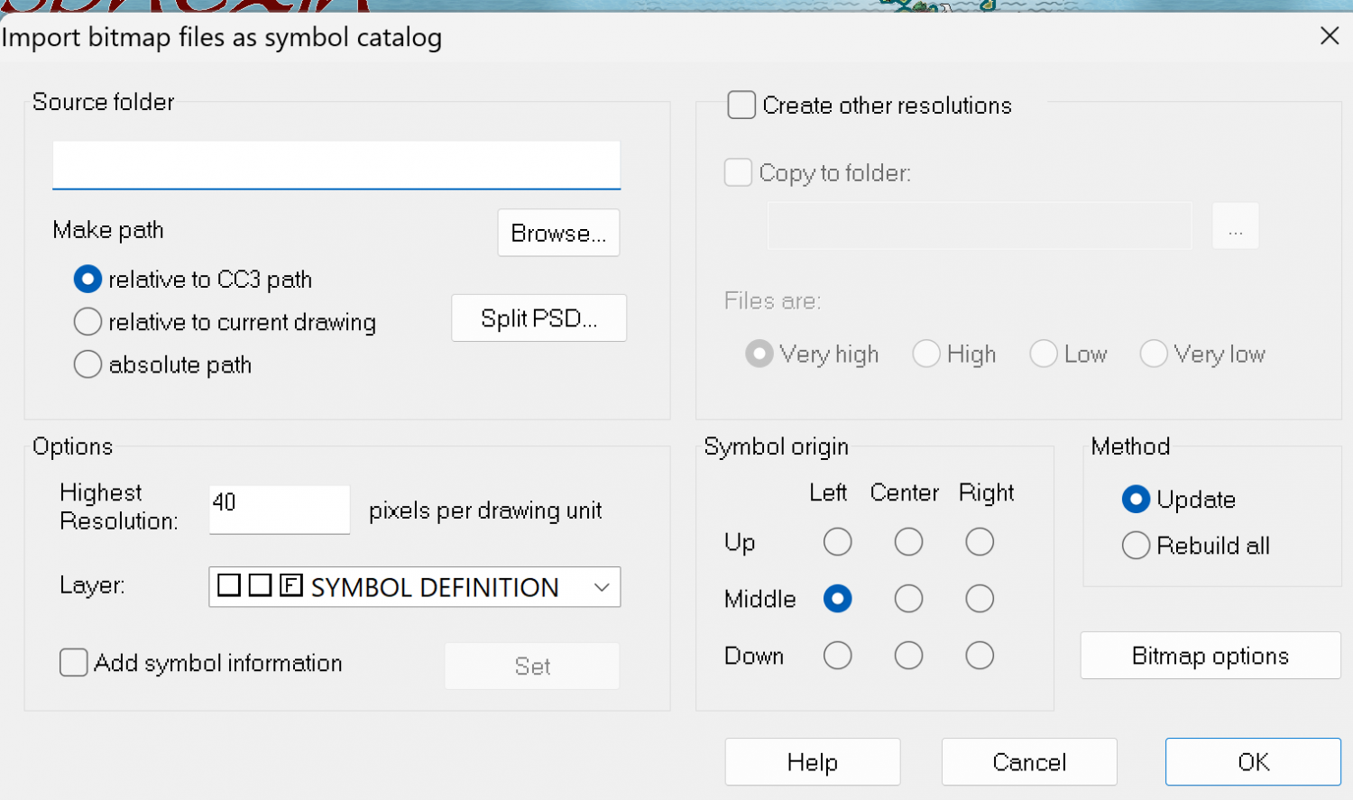
Click on Browse, and go to the folder which contains the PNGs you want. Open the folder and click on any of the pngs.
If the pngs already are in the 4 resolutions (Hi, Lo, VH or VL) then DO NOT CLICK 'Create other resolutions. If the png you want is NOT in the 4 resolutions, then do click on that. Then click OK.
When it is finished it will tell you how many symbols in the catalog and how many were updated or new ones created.
Then Open the Symbol manager again, and go through the symbols - the ones you added will be at the end of the list. You may have added pngs you don't want - just select them and press the delete button on the symbol manager menu (see above).
You can also reorder the symbols as they appear in the catalog.
Finally, click on the first symbol on the list, then select all the rest by using the Shift key on your computer and clicking on the last symbol. Then click Save as Catalog. Then click Save on the main menu, and you will have the new png along with all the other symbols that were in the catalog.
If you make changes to an existing official catalog, it is often better to give it a new name, otherwise it may be overwritten when there are updates, or if you have to reinstall everything.
Hope this is a little clearer than mud. Good luck.


-
Watabou City REVISED (annual 157)
Since this great annual came out, Watabou had done heaps of modifications. And as a result, the SVG to DXF conversion doesn't work as seamlessly as before, making everything lines, and therefore unable to use the method as outlined in the annual.
I have experimented with this, and come up with the following solution, which makes everything relatively easy again.
Please try it out, and let me know if there are any bugs. Perhaps we can convince Ralf to do a revision of this.
I have also added a few of my own idiosyncrasies in the sheet naming.
This is the png of the city I generated.
I also attach the SVG for any interested.
The first most important thing is to just export as a SVG the actual elements you want and cut out all the pretty stuff. It is, after all, the street and building layout that we really want.
So ... in the generator, first check colour - make this either B&W, or Ink in the Presets.
Next, click on Style, and make sure you check or uncheck the following. Whatever I don't mention, you can choose as you wish.
- GRAPHICS: Check thin lines, leave the rest unchecked.
- ELEMENTS: Districts Hidden. Check scalebar only (if you want it, leave the rest unchecked
- BUILDINGS: Roofs plain, leave Raised unchecked. Otherwise, choose what you want.
- OUTLINE: Check buildings, water and roads
- MISC: Check Solids; Uncheck Show alleys and Show trees. I advise against choosing farms - they can be added as you wish, and I use the farms from other styles, especially where I can easily align the furrows using Shaded Polygons.
You should get something like the png above. ie B&W, no text or trees or extraneous lines.
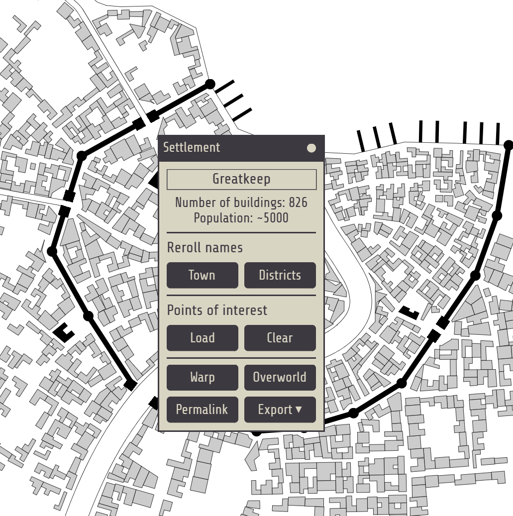
The number of Buildings and suggested population is available on the Settlement menu:


-
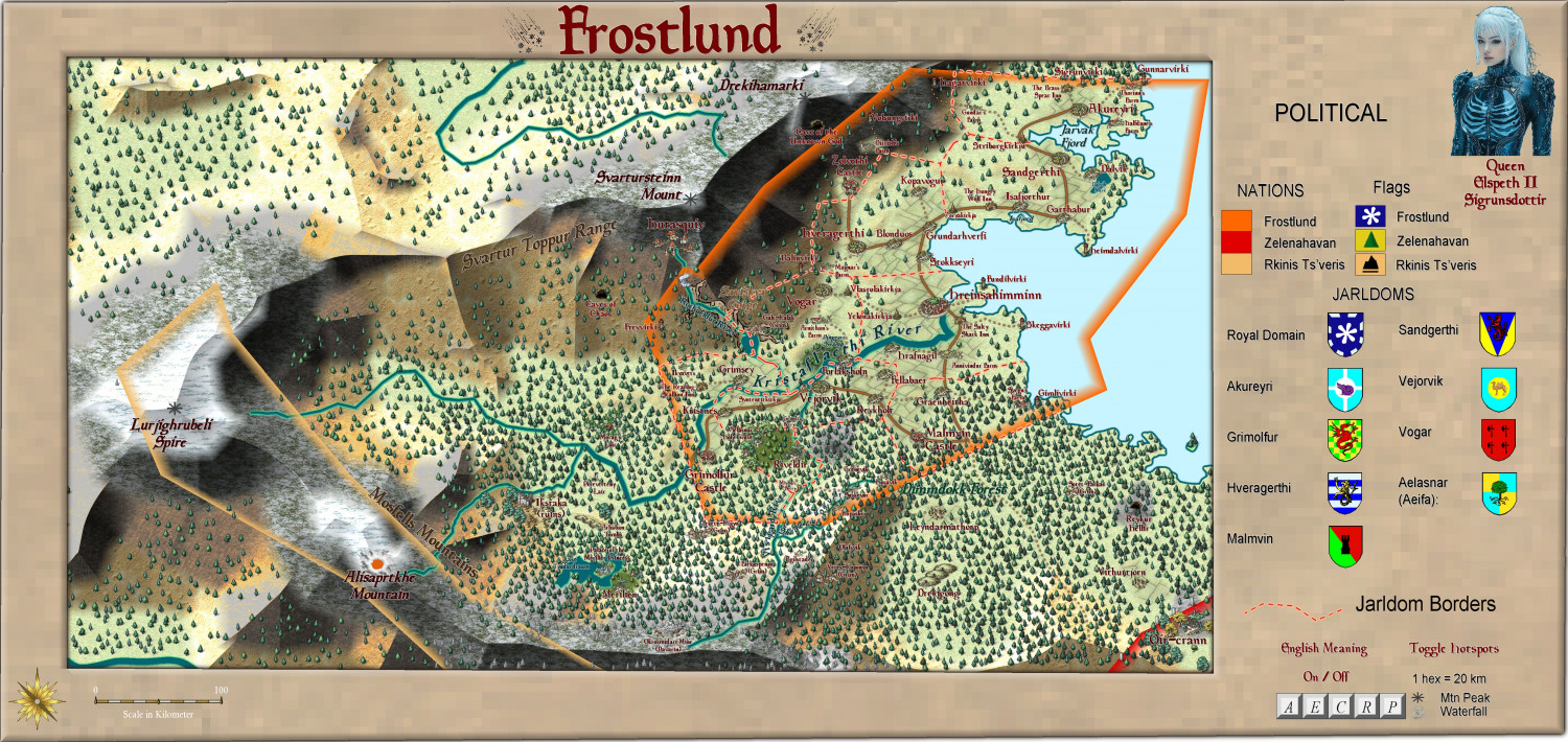
Frostlund - a land of adventure
Here is the 'nation' of Frostlund. it is primarily a Vynling (norse) federation of largely autonomous jarldoms, but with a High Queen as the bit-more-than-nominal ruler.
It is the region where the first campaign I have run will commence in 10 days time after a break from DMing for 33 years! Yes, I am nervous. The last edition of D&D I DMed was 2nd edition. Now it is 5th ed 2024. At least I have had about 6 months gaming experience in it - previously hadn't played since 2016 - and then that was 1 game after about 10 years absence.
The players come from Dalvik (in the upper right hand corner) and will start off overhearing a nasty argument between Sven, an old retired sailor, and 2-3 travellers to the town, exhibiting rather unsavoury attitudes (definitely more than a trace of Grimmir blood). [The Grimmir are the equivalent of the various orcish humanoids, but they can range from civilized Germanic types to yobbo Aussies, to southern USA rednecks. But the Vynlings do stereotype them as barbaric Philistines!]
Larger version in the Gallery:
Image Gallery: Continent of Ukadarlia — ProFantasy Community Forum
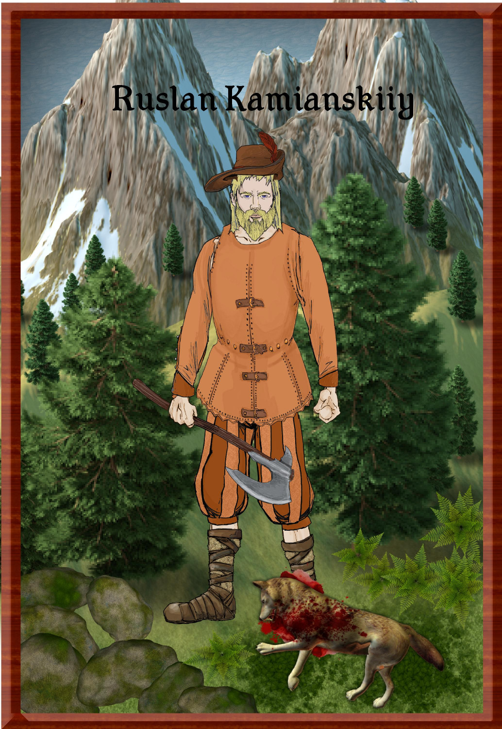
Vynlings:
And the Grimmir


-
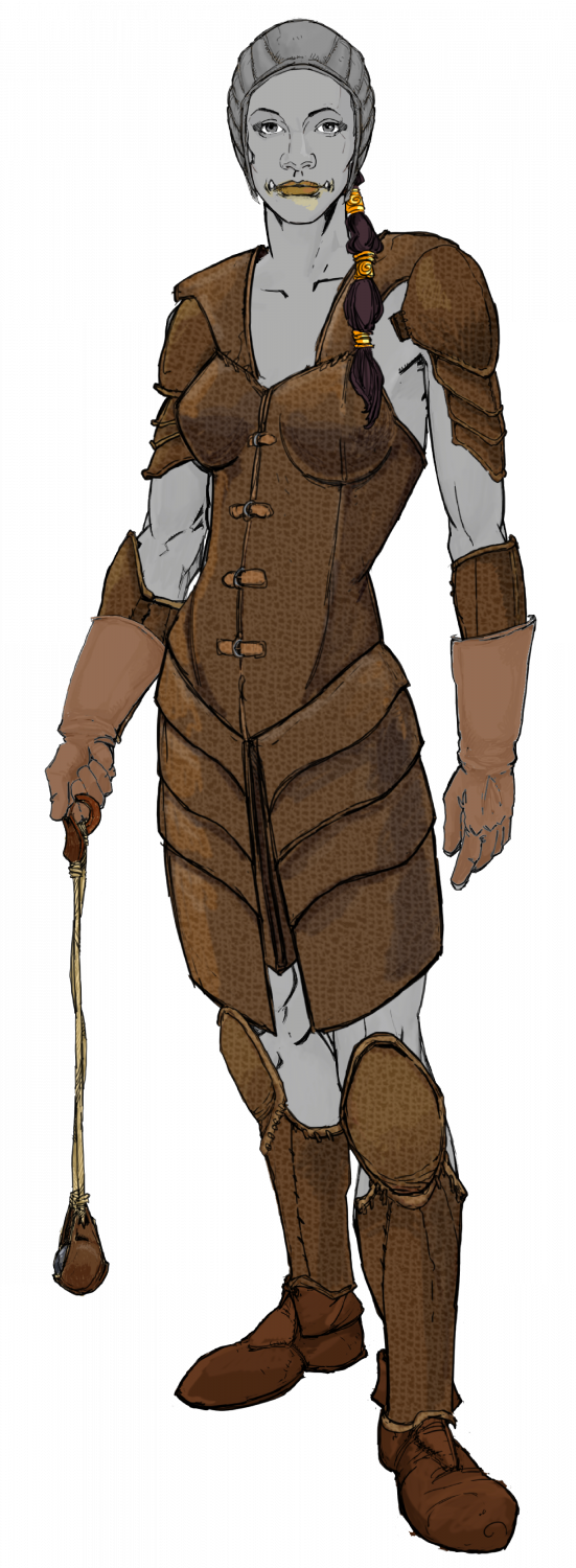
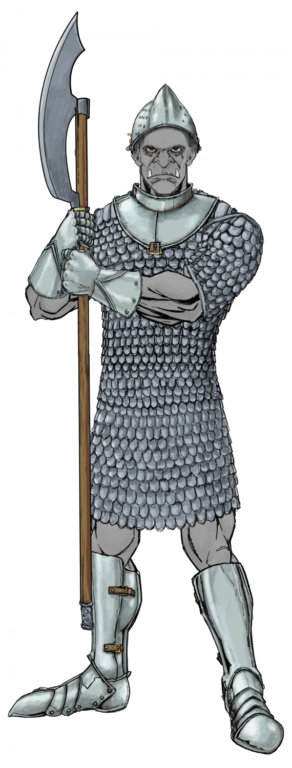
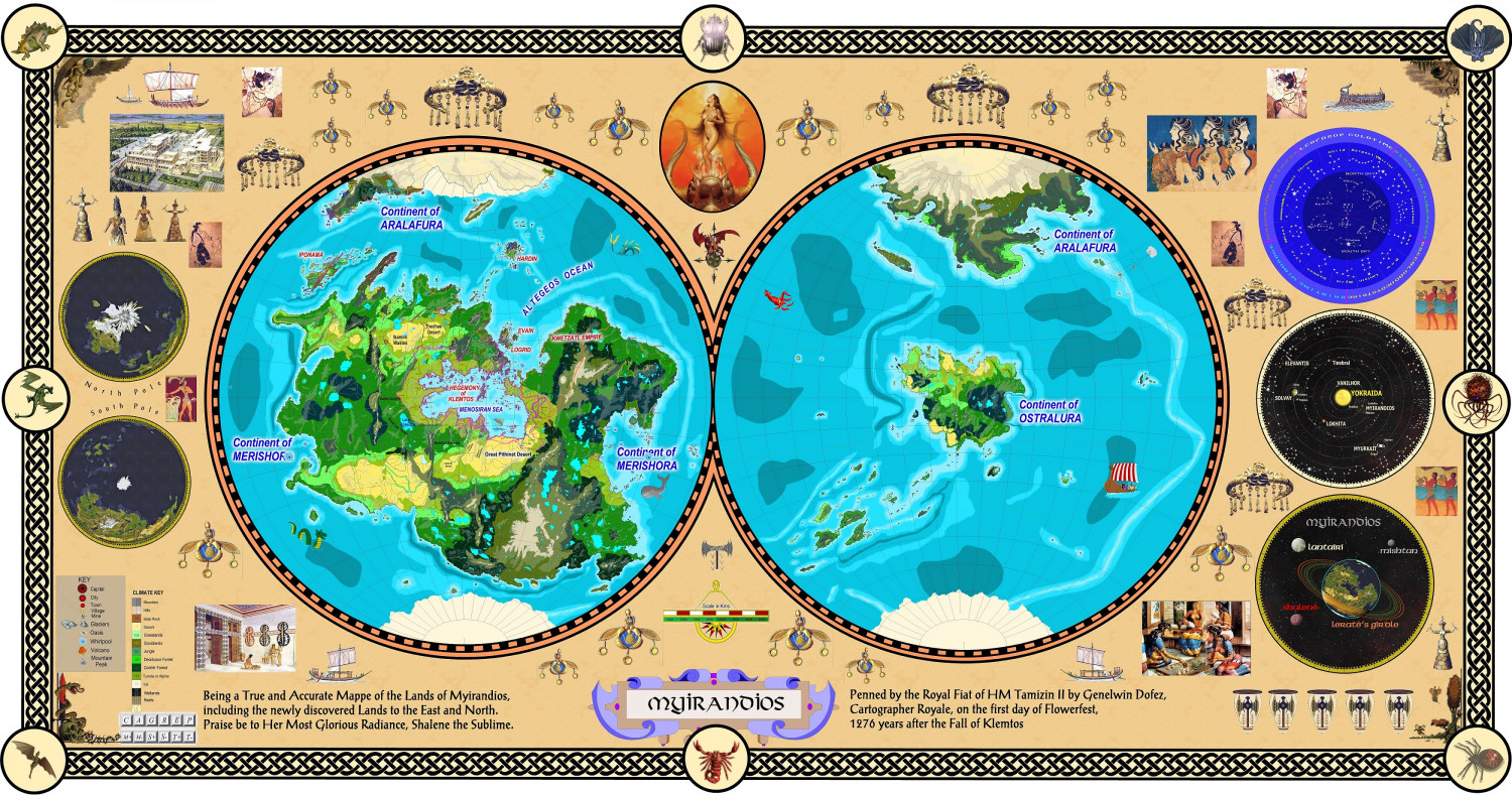
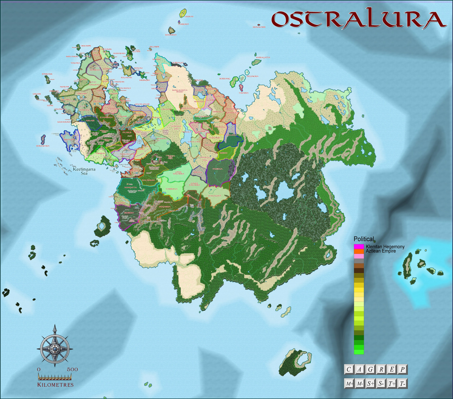
Ostralura - north-eastern region
Placement of the continent of Ostralura on the planet of Myirandios
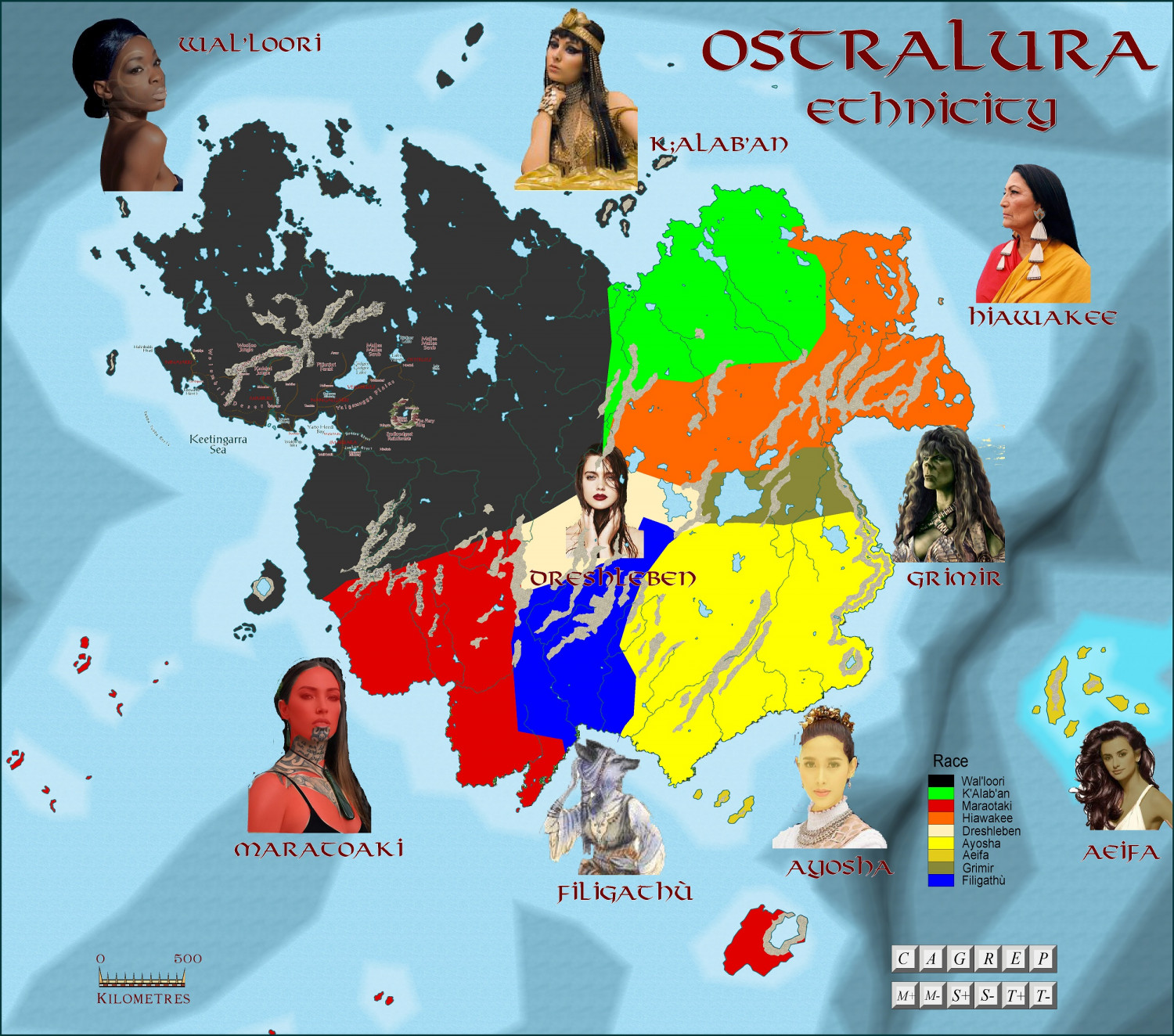
Wal'loori = Australian Aboriginal
Maratoaki = Maori
Ayosha - Thai
Dreschleben = Germanic
K'alab'an = Arab
Hiawakee = Cherokee
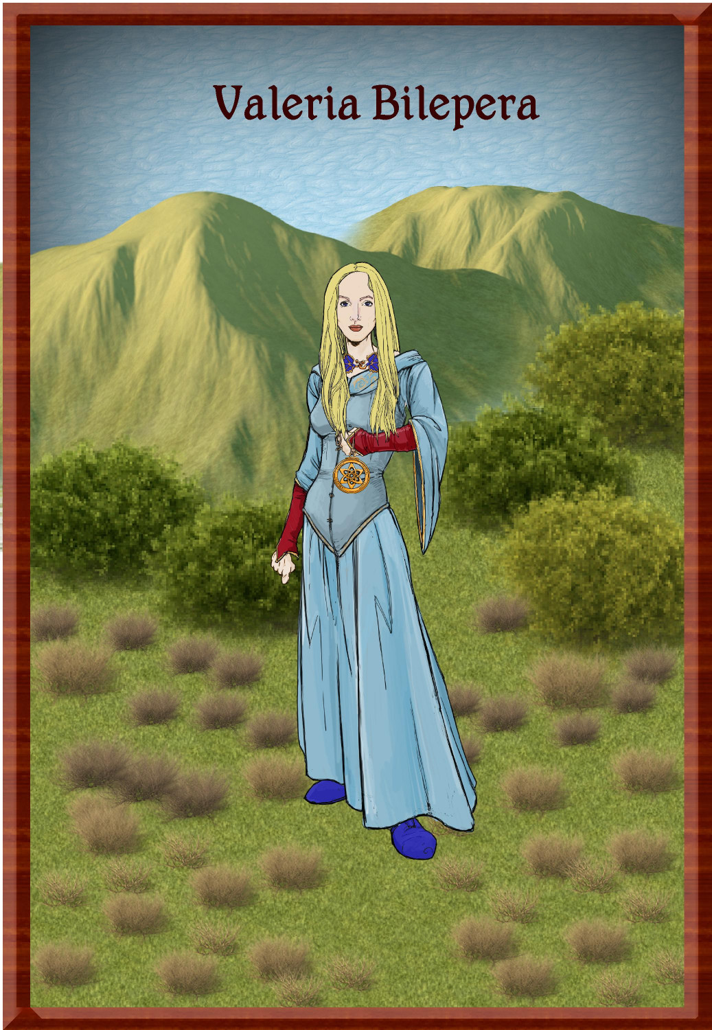
Aeifa = Elven
Grimir = Orc
Filigathu = Were
' sounded as a breathy sound break between syllables.


-
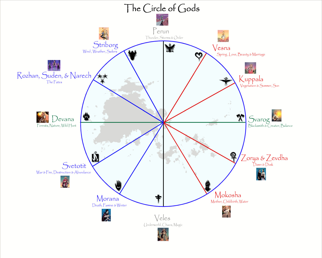
Pantheon of Gods, based on CA41 - Abstract Graphics
Here is my Pantheon of Gods, based loosely on Slavic Gods. I used the example in CA41 as a guide. The pics came from a few YouTube videos on Slavic Deities.
The landmass is the region I am using for a RPG Gaming aid.


-
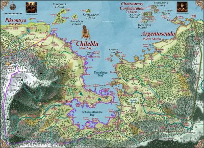
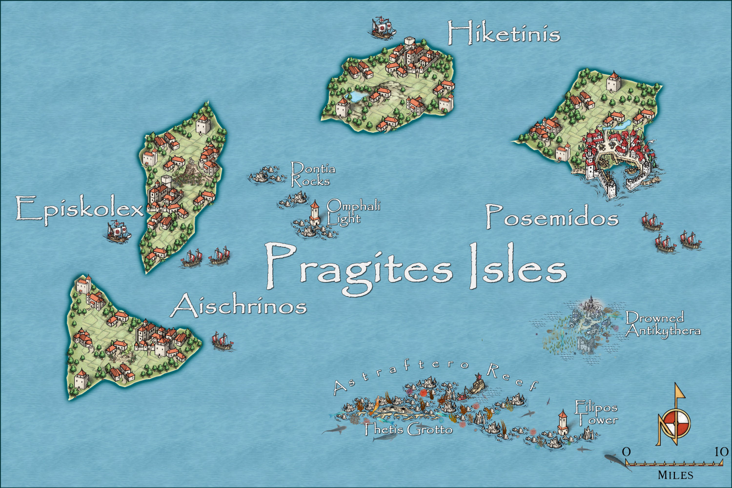
Community Atlas - Irisian City States - Pragites Isles
Halfway there. Thanks to Sue for the Marine Dungeon - for mermaid grotto and sunken city regions in the map.
Here is a region torn between the merchants of the Irisian City States, and the military Leonder Imperium. Hence the warships and fortifications on each island.
-
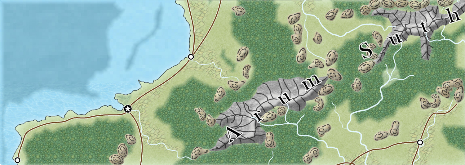
Community Atlas - Berenur - Arum Suth
This is the beginning of a map for the Atlas in the new January 2024 style.

-
Hardin region of Myirandios
The final map for the Hardin region. An archipelago with Wallori (Australian Aboriginal-type) tribes (the Wombat Tribe) in the north; the centre is occupied by a warlike collection of city-states of the Kwetzatl (Aztec-Maya type) people; and the southern island is occupied by the equally ferocious Ming (Chinese-like) who are at war with themselves and the Kwetzatl to the north - the sound separating them has many sunken warships and trade vessels.
And of course, it is a mixed up version of the Falkland Islands aka Islas Malvinas
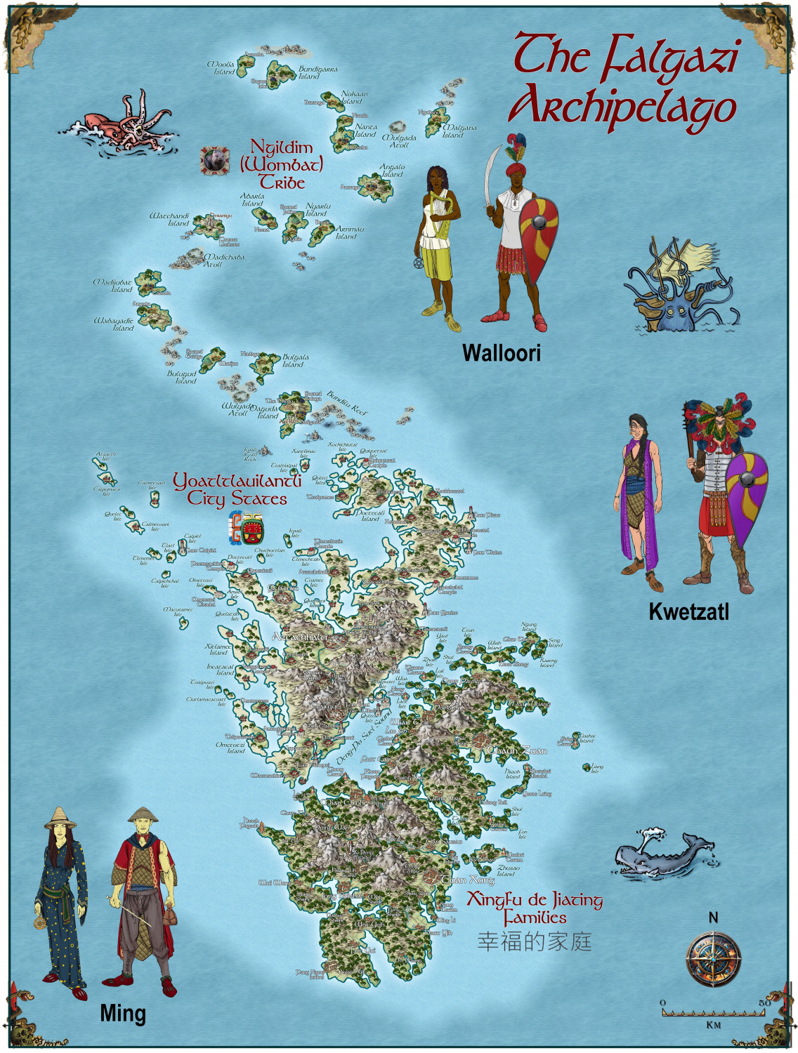
A larger version is in the Gallery:

-
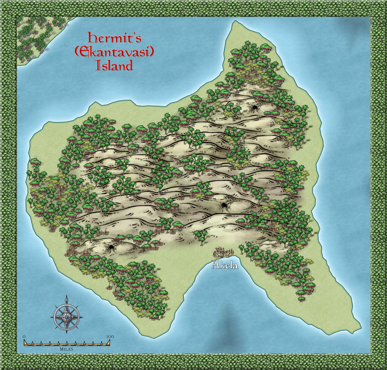
Community Atlas - Alarius - Hermit Island
This island is tropical, and shows only one settlement, a hut village symbol. However, given the actual size of Alarius, and even this island, which is roughly 350x350 miles in dimension, I am going to imagine that as a rather large settlement, albeit a hut like one. I am using Hindi based names - the alternative name is Hindi for Hermit, and Akela means alone, or Lonely.
But there will be smaller hut settlements spread around.
The Hermit will be located in a special geological feature - not sure what yet. certainly not a mountain, since no mountains were even hinted at here.
Anyway, this is the beginning of the Hermit Kingdom - now where have I heard that phrase before. hehehe

-
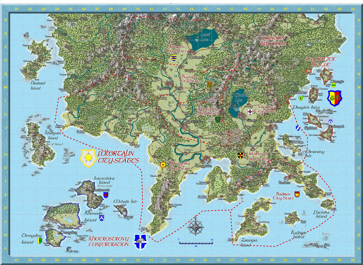
Hardin region of Myirandios
I am making great strides on my project. I have now completed making separate maps for each region on the Hardin map. This is one of the more complex - the Folortalin City States, which I have now completed to my satisfaction. (though I might add a character or two, perhaps - two opposing political figures?)
Sorry I can't give more detail on the map on the forum, it is already 9,6MB here, but I have saved it as a 10000 x 10000 map (105 Mb Jpg). I have also attached the FCW for any who are interested.

