

KertDawg
KertDawg
About
- Username
- KertDawg
- Joined
- Visits
- 4,758
- Last Active
- Roles
- Member, Administrator, ProFantasy
- Points
- 378
- Birthday
- February 16, 1978
- Location
- NC, USA
- Website
- https://playbyweb.com
- Real Name
- Kertis Henderson
- Rank
- Surveyor
- Badges
- 6
Latest Images
Reactions
-
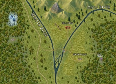
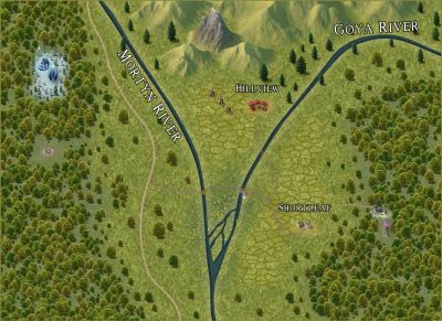
WIP Community Atlas - Mortyn-Goya Confluence
Here's an update. I added some detail. I'm stepping back to evaluate the entire map.


-
JPG Fill Different from Editor
All, much better. Thank you!


-
Selling maps?
I can only give feedback on one point. Yes, your maps are great. I think the love that you put into them is important, and it shows in the output.
However, you may be asking the wrong crowd. We're probably the least likely to want to buy maps, so maybe we don't know as much about the needs of other people. We can make our own maps!
Seriously though, you're on the right track.
-
Export lights to Foundry
Loopysue! They can "shed some light!" At least *I* got it.

-
Post-processing Map to Age It
I've been working on this off and on for a few days. I appreciate all the help and input.
I experimented with matrices, and I think a scaled unity matrix (contrast) and adding brightness is exactly what I needed.
The multiply blend mode gives the texture underneath. This is a success.
Now to actually finish the text. That's another story...
Thanks again.


-
Live Mapping: OSR Dungeons
This style brings back memories. I found a photo of a time when Ernie Gygax visited my house. He was the oldest child of Gary Gygax who was one of the main people behind Dungeons and Dragons. Ernie brought an old map to run a game with. He made it as a child to play his dad's new game. This, by some accounts, was the first player-made map for D&D. These CC3 maps capture the feeling I had when I saw that map.
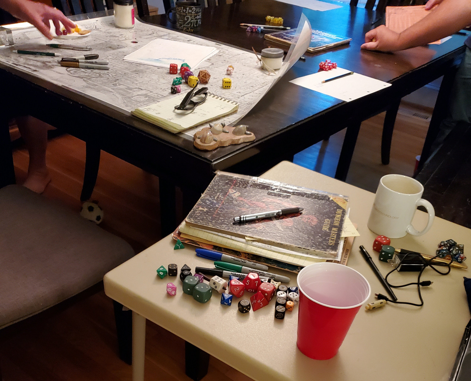
It's hard to see detail in this photo, but I assure you it looks a lot like Ralf's map. (Note the book in the foreground, which is Ernie's dad's original, hand annotated copy of the 1E Players Handbook.)
I think this style is very pure.
-
Looking to Hire a Mapper
I will leave that to Xargun, as that is the owner of the maps. I also refrained from posting them here to avoid spoilers for the players!
I was asked to do everything but the roads, settlements, and labels. That left just the basics to do. I had a lot of fun doing it.
An interesting note: We selected SS1b as the style. I used that for everything including the symbols. I eventually split some things into their own sheets, like the hills vs mountain areas. I think I made my own river style based on the existing lake style. The point is that I used only what was in that style and nothing outside of it. Rather, I tried to do that. I somehow got some Darklands hill symbols in there. I don't know how that happened. It turned out to be good because the hills went well on that map. The downside was Xargun had to buy that annual. (Though I think one can never have too many annuals.)

-
When you're lost, you need a map.
Welcome! I've used it for fiction books, both to include in the print and for my own organization. It's very useful. I'm sure somebody more knowledgeable about the servers and installation will help. Have fun!

-
Calling for Testers of VTT Export
Thanks for your replies, everyone. Sorry for the timing. I've been overcome by life events, nothing bad. My lawn tractor broke twice in different ways, auto tire trouble, a deep cleaning of the house demanded by Mrs. KertDawg, etc. Ha! I'm working on setting up the test. Stay tuned.

-
New here! Getting started with Campaign Cartographer – any tips?
Welcome, and congratulations on your first steps! I have 2 tips:
The videos linked by @Don Anderson Jr. are great. I was stumped at making anything good until @Ralf told me to watch these videos. It made a huge difference for me. I normally don't use tutorial videos, but these are really good.
This forum is the best tool to continue after the videos. The people here are friendly, helpful, and sometimes even knowledgeable. 😛
Good luck!


