


Wyvern
Wyvern
About
- Username
- Wyvern
- Joined
- Visits
- 3,238
- Last Active
- Roles
- Member
- Points
- 5,517
- Rank
- Cartographer
- Badges
- 24
Latest Images


-
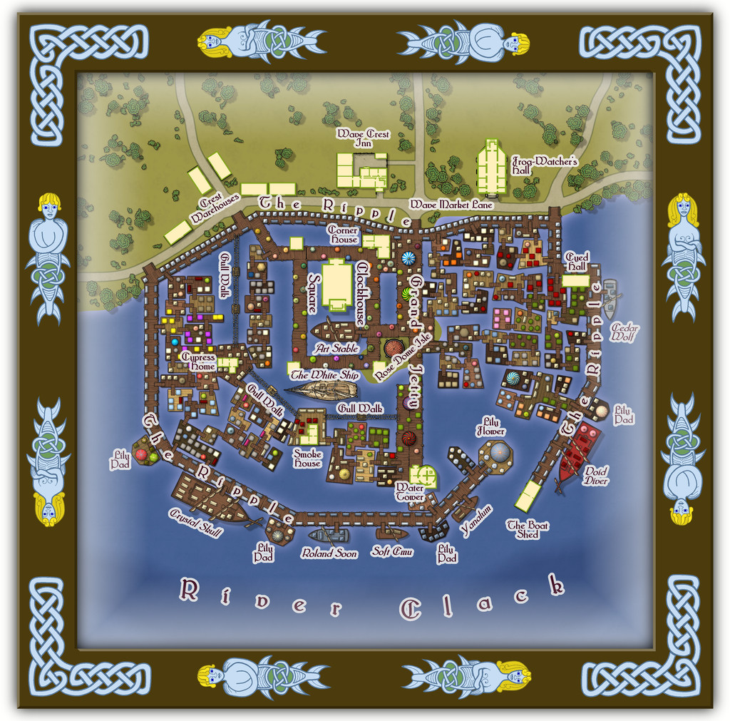
Community Atlas: Embra - Watery Places
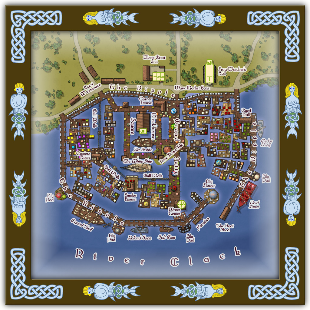
Last among the Watery Places maps is one condensing the final five streets into one drawing, the second illustration below showing just the streets for a bit better clarity at the normal Forum resolution:
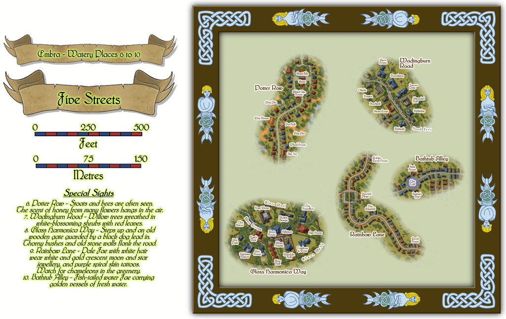
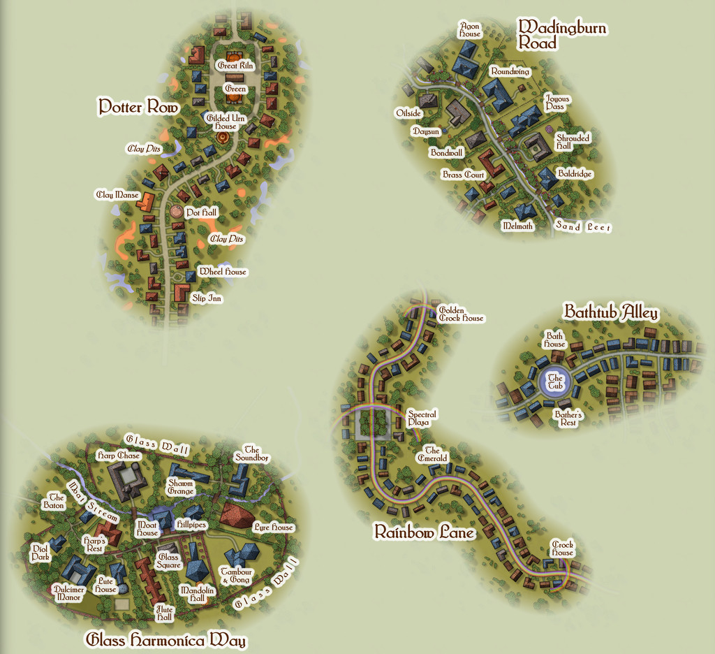
The roadways were constructed randomly, as described in the Enclosed Places Forum notes, with the final appearances and features determined sometimes by the street names, sometimes by other factors. Potter Row is of course where the great ceramic craftsfolk live and work, several in houses built of pottery - a couple even in the form of gigantic pots (this is Faerie, after all). The featured text for Wadingburn Road suggested a willow-lined stream, and fancier properties. Rainbow Lane had to have rainbows along it - even to the roadway itself - while Bathtub Alley cried out for a large pond or pool to be added for those water faeries to be in. And then we have Glass Harmonica Way...
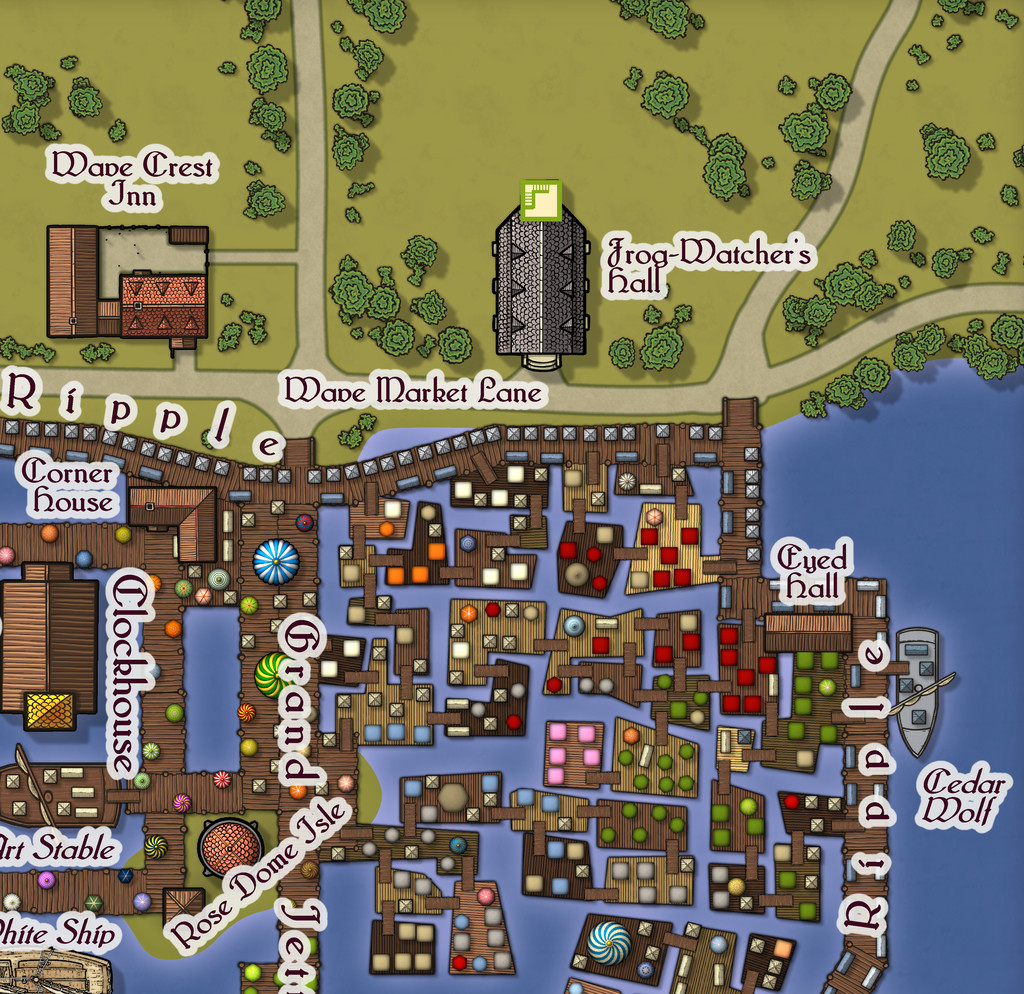
I mentioned in the introductory Embra topic that music had been one of my primary influences on how a Faerie city should be presented, and maybe one of the most "faerie" real-world instruments should be the glass harmonica, as well as being one that requires extraordinary skill and ability to play. So having come up with the street name near the start of developing Embra, it was always clear this was going to be a community of musicians, instrument makers, composers, and the like. The random nature of my street design mechanism meant the available area was smaller than I might have preferred initially, though the whole point of using random systems is to work with whatever that may throw at you, and adapt accordingly. The featured text provided an interesting adjunct, suggesting this wasn't going to be an ordinary street at all, but one closer to a gated community in the real-world, and from that everything else simply flowed (appropriately for a Watery Place, perhaps!). The one downside to the final map is that because I wanted everything clearly labelled, the small area meant the labels ended up concealing quite a lot of the area's character. However, the toggle option in the FCW Atlas file to turn off the place-names means it is possible to get a better view of the whole:
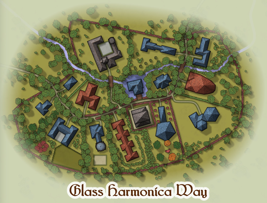
From which we can all again play "spot the red sandstone components" - and hopefully get a clearer impression of the final layout. And yes, the street was originally populated with random CD3 houses, which then got moved, adapted, redrawn and converted to their final shapes here.

![[Deleted User]](https://secure.gravatar.com/avatar/c75d9a245b74d9c59be0999ea81ca541/?default=https%3A%2F%2Fvanillicon.com%2F92add7f8c954488718110edc4896ad39_200.png&rating=g&size=200)
-
Community Atlas: Embra - Watery Places
For anyone concerned the Watery Places maps have been quite simple, easy-going, places, let us now move on to the part of the Twilight Market among this group, Wave Crest Market:
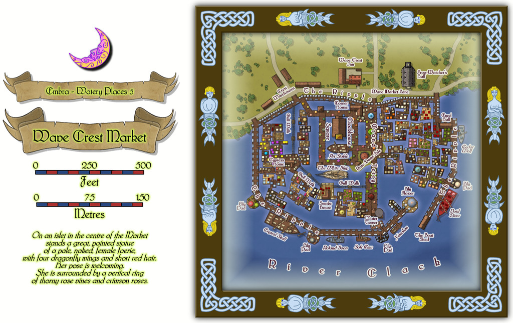
This gives the variable appearance of the River Clack another kick entirely, to the point where the far bank doesn't even make it onto the map at all! And while the shape may (correctly) suggest another, if much more substantial, castle map was at the base of this one, it's always interesting to see what can be done by using the shape, but converting the purpose to something quite different.
I always intended this part of the Twilight Market to be quite a complex mapping project, after seeing the original plan I'd be working to, though this one grew into a larger undertaking than I'd expected. Indeed it was one of the maps that took the greatest amount of time to complete, just setting-up all those floating platforms, market stalls/tents, and making sure there were walkway links to all the separate parts on the river.
There are buildings here as well, and not simply on land:
Some of which have a second storey:
One even has a further upper storey (close-up on the northeastern part of the map now):
This latter image has the advantage of giving a better view too of how the floating platforms, gangways, ramps, tents and stalls have been applied, as well as showing the great dome on the little island in the Clack, covering the statue which is mentioned in the featured text for the Market. There's a detailed set of PDF and text-file notes to go with this map, as might be anticipated.

-
Community Atlas: Embra - Watery Places
Next is another curiously isolated hamlet, this time closer to the River Clack, so it appears on the map as well, although the hamlet's existence is presumably due to the fortuitously-discovered, naturally enough magical, Crimson Rose Well:
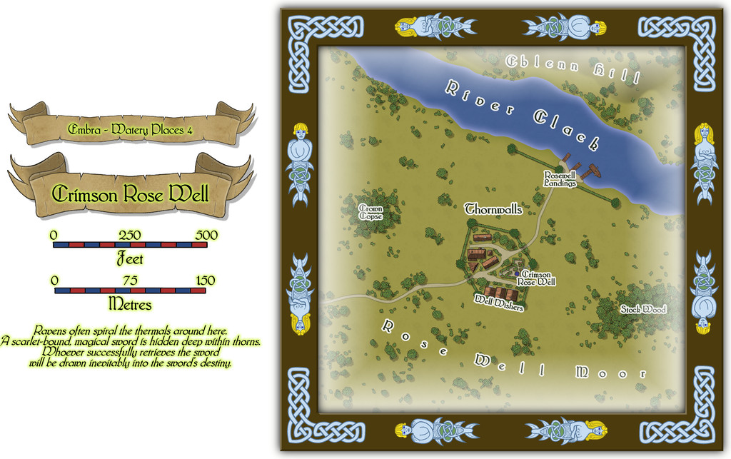
As might be guessed, the odd appearance of the settlement and its riverine landing-stages resulted from the original random base map being one showing a small castle and a defended landing on a river. This being Faerie, the defensive walls become high "walls" of thorny vegetation sporting great, heavily scented, crimson rose blooms, and the castle becomes a hamlet-sized community dedicated to looking after the Well and those who come here seeking its magical aid. The fact there could be a powerfully magical sword hidden away within the thorns somewhere (from the featured text) merely adds an extra note of interest. Plus GMs can have fun accounting for why this bit of Embra is so apparently isolated from the rest of the city it needs a substantial landing area all its own on the Clack!
Buildings on the non-streets maps means interiors, and again these are all of just the one storey:
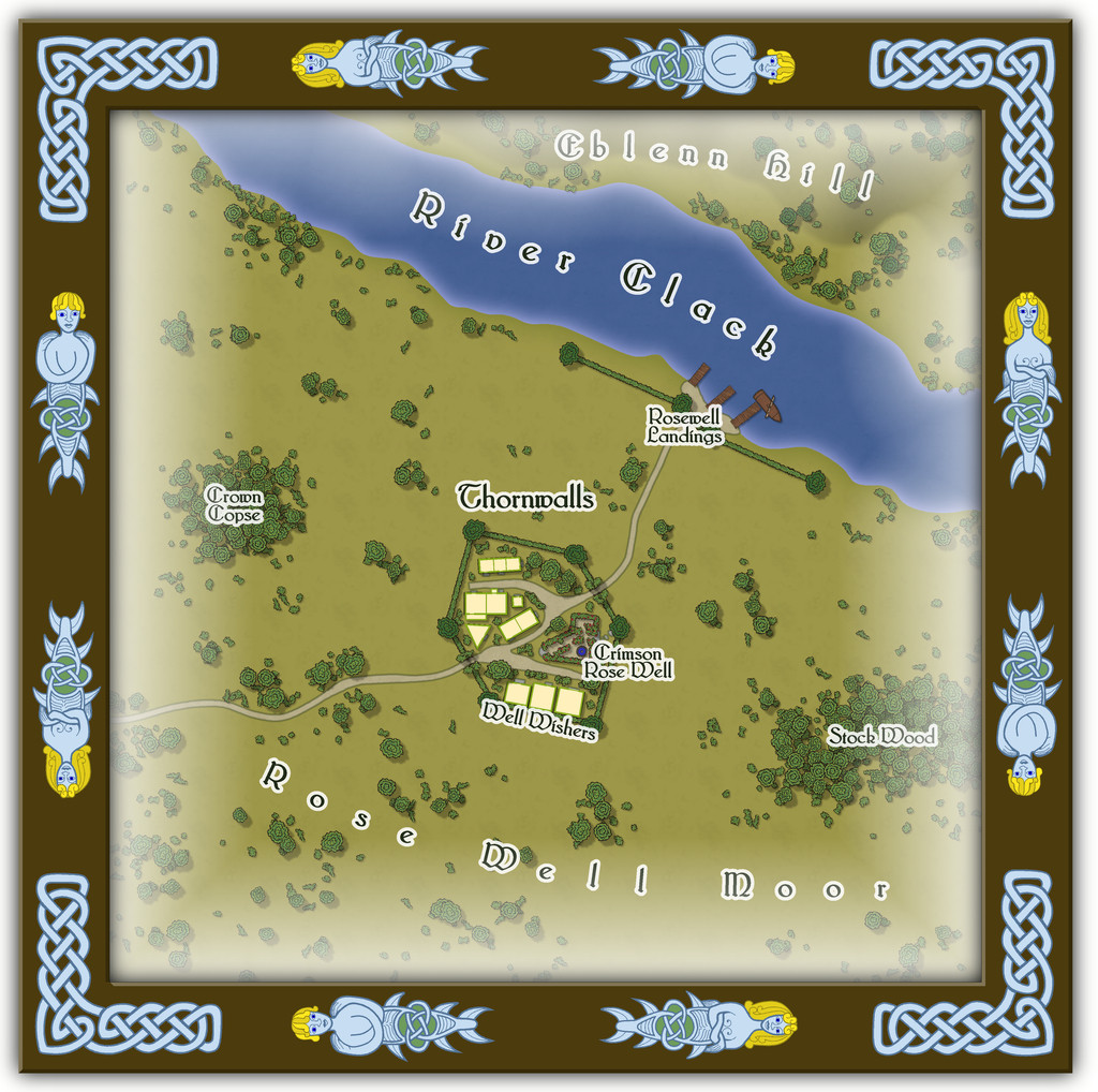
Some of you may recall Eblenn Hill has featured before among these Embra Places maps, as it's the substantial hill the first of the Enclosed Places was set upon, the Freed Haven Floral Garden. Whether the version here is the same or not, and how - or if - it may relate to the "other", is left for GMs to decide.

-
Community Atlas: Embra - Watery Places
The remainder of the maps in this Watery Places set are all of the more usual, larger, size, beginning with that for Silverburn:
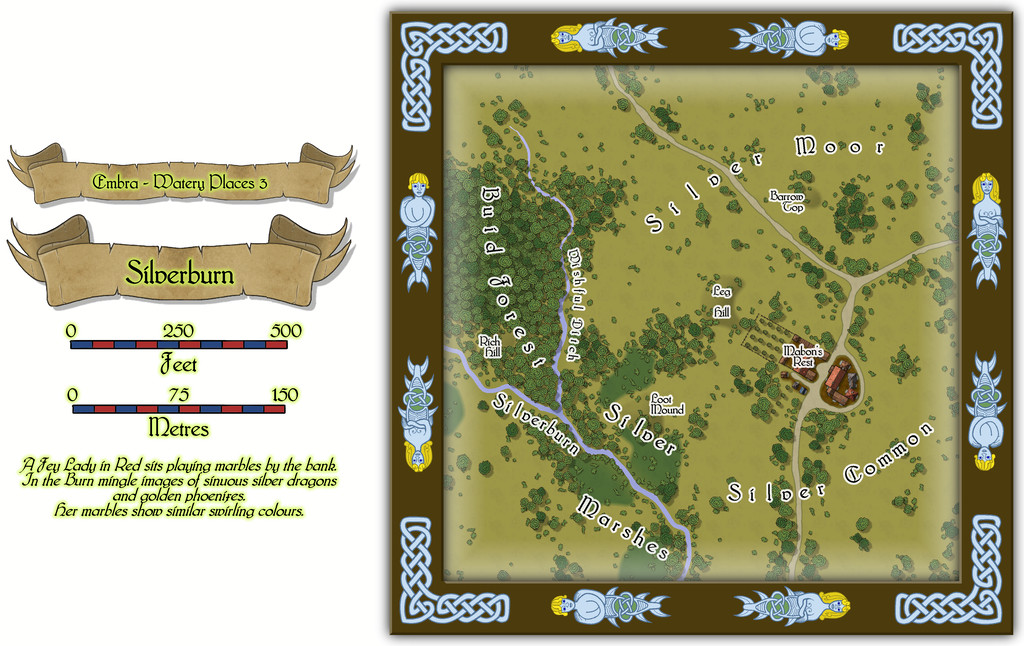
Those with a good memory may recollect that the Silverburn is one of the two main tributary streams that join the River Clack at Embra. The Silverburn comes in from the north, while the other tributary, the Wadingburn, comes in from the south. Naturally, this map isn't intended to cover the whole course of the Silverburn, but to highlight an area of the city which is known by that name, and through which the Silverburn does run. Indeed to emphasize the name more, I thought it would be interesting to interpret the featured text as meaning there could be some small amounts of metallic silver in the bed of the Burn here, more of which can be discovered by perceptive or lucky characters in the scattered Silver Marshes and parts of the adjoining Silver Common. That concept was allowed to spill out into others of the named map features here, and although the little hamlet isn't labelled as such, it is generally known as Silverburn too, although the substantial inn of Mabon's Rest is adopted as another name for the place by some. The "Mabon" name derives from Celtic folklore, if slightly reinterpreted in the map's accompanying text and PDF notes, so here Mabon is said to be a youthful god, or a young man who became a deity through his great deeds.
As there are actual buildings on this map for the first time in these Watery Places settings, naturally I wanted to add interiors for them. All are single-storeyed, so only one extra toggle is needed for the FCW Atlas version to display them:
-
Community Atlas: Embra - Watery Places
Stepping things up a little, for all the map is still a reduced-size one, Watery Place two is Bright-Eye Well:
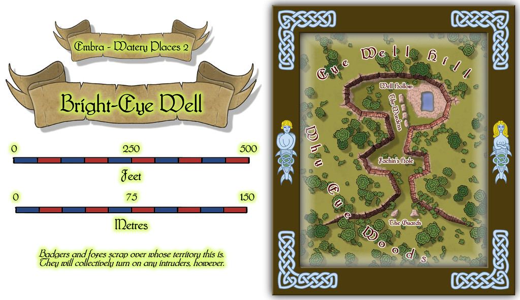
Coming up with a magical well is a bit "shooting fish in a barrel" for RPG scenario-writers, but using details from the original base-map (which was actually for a subterranean barrow tomb) meant I could add some extra interest here, along with making it an open-air feature, a partly natural, partly quarried, hollow in the edge of a hillside. Not quite sure what it is about red and pink rocks that have held a long fascination for me, but I made an early decision that one of the main rock types that was going to keep recurring at Embra was red sandstone. And as luck had it, the second of @Loopysue's excellent sets of City Cliffs symbols comes with a set of red sandstone symbols and fills! So that was an easy choice.
There's a knack to using connecting symbols effectively. Sometimes that means turning-off their ability to connect, and placing them individually. Sometimes you can just let them "have their head" as it were, and make whatever pattern they will. Usually, that latter works fine for straight, gently undulating, or long curving lines. When it comes to more intricate structures, it can be better to opt for individual symbol placement. Here though, despite the strongly curving lines in a short space, I decided to try using the connecting-symbol option, and see what happened, because this area was meant to look as if it had been straight-edge carve-quarried in places. It took a couple of tries to get something close to what I wanted, and then a lot more tinkering to get the shadow effects to work OK (don't look too closely behind a couple of strategically-placed trees, that's all!).
Those familiar with northern English dialect may appreciate a couple of the more curious map labels, although the Fachin's Hole name derives from real-world folklore, as something I'd decided from soon after the shape of the base map for this drawing had been chosen. A Fachin is a Scots' Gaelic fearsome Faerie creature, with one leg, one hand that protrudes from its chest, a single eye and rough, spiky hair. Sometimes considered of giant size, its preferred lairs are lonely gorges and lakes. That overall shape seemed to fit with the cliff-line being a loose, crude profile image of such a creature, with the Well as its eye.

