Quenten
Quenten
About
- Username
- Quenten
- Joined
- Visits
- 8,061
- Last Active
- Roles
- Member
- Points
- 3,087
- Birthday
- November 29, 1950
- Location
- Australia
- Real Name
- Quenten Walker
- Rank
- Mapmaker
- Badges
- 16
Latest Images


Reactions
-
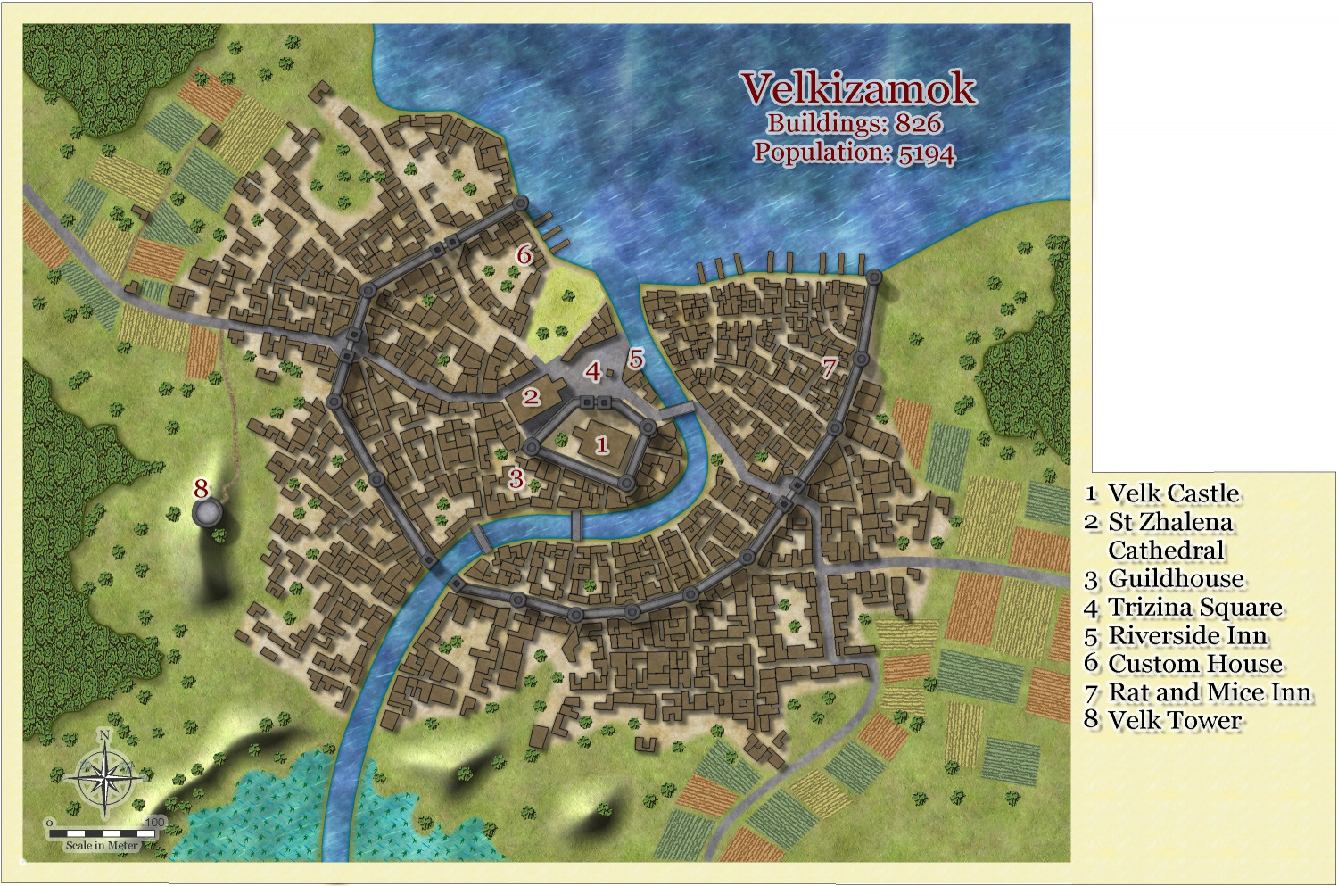
Community Atlas - Irisian City States - Giant Circle Island
Brilliant. I actually used a modified vector symbol in the end, but this method will be useful in future times - I am saving the methodology. Thanks so much Sue.
Here is the final map. Comments required before submitting to the Atlas. Especially Ralf, Remy and Wyvern.


-
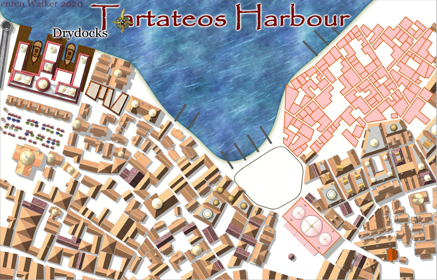
Community Atlas City of Tartateos - Shipyards District
This is also aimed at the community Atlas in the City State of Irisia on Artemisia.
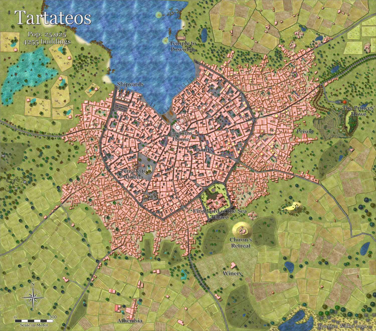
This is finished and is already in the Atlas. I used Watabou Medieval City Generator as the basis.
Here is the nearly completed Shipyards District.


-
Community Atlas - Alarius - North Central Region - Silver Spring - battlemap
I am a novice at battlemaps, so lots of help please. I am continuing on using styles I would not use in my own world, to create maps for the atlas. this time it is the turn of the Winter Trail map.
I had to install bitmaps from Ice Caverns as well as Winter village - I wonder why they were not included, especially as the example maps made use of them.
I have quite a few things I am not satisfied with, the waterfall and stream being the main ones.
But here is the beginning.
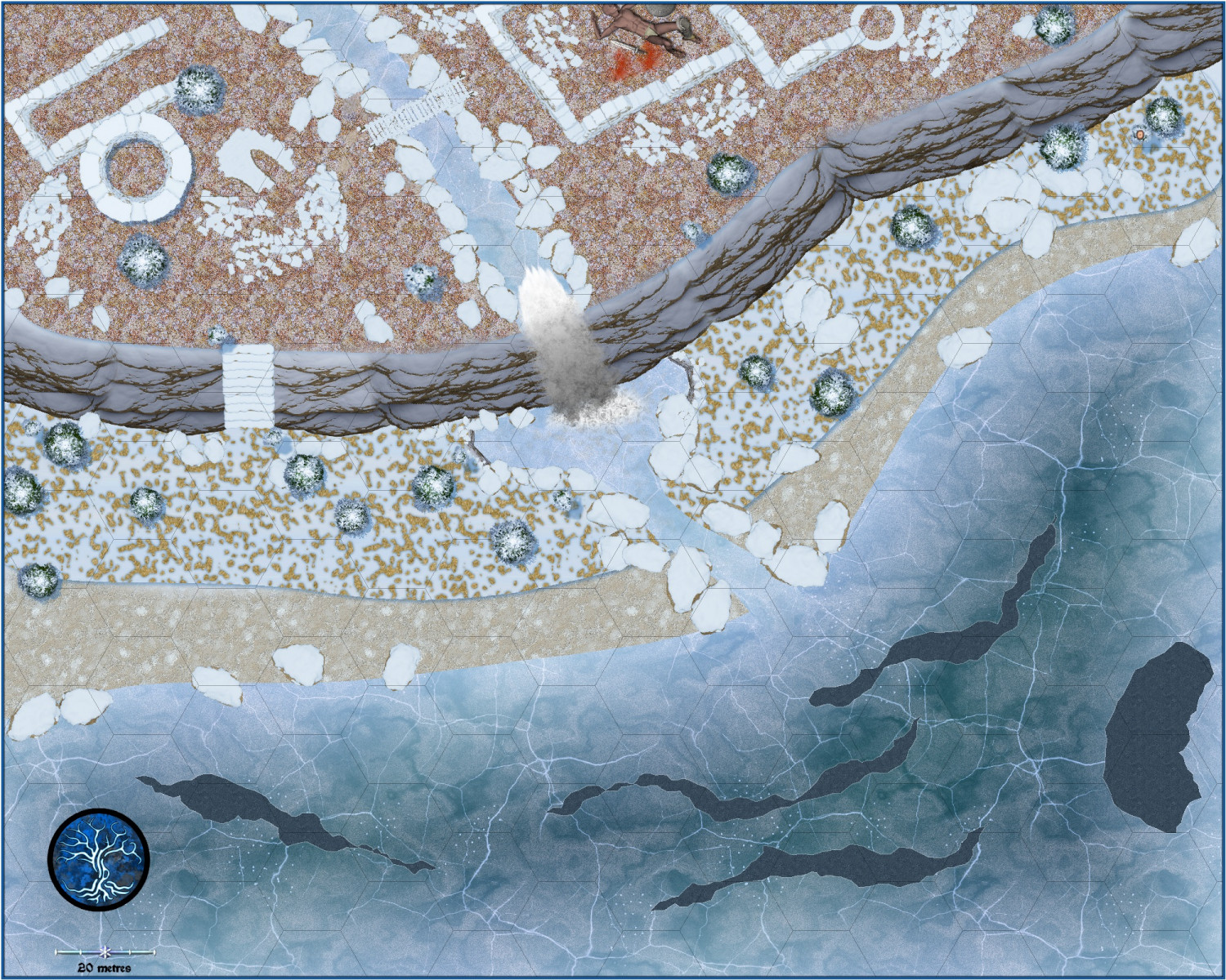
And the corpse seems a bit large for a man - perhaps a giant?


-
Ukadarlia
Some background.
The original sentient inhabitants of Tatilana were the Drakona and the Muru
The Drakona are six-limbed creatures, with a pair of wings, and a tail. Their body is segmented into three distinct parts –
a) The head, which has almost 230o rotation, and contains the organs of taste, smell and sight and hearing, along with the brain.
b) A thorax which contains 2 lungs, and a heart and electric organ responsible for creating the energy for manipulation of the electromagnetic spectrum, and another organ responsible for immune responses. The upper four limbs are attached to the thorax, and the digits have special nerve endings that enable the direct use of electromagnetic energy.
c) An abdomen, which contains
a. the alimentary canal
b. a purifying organ – combining functions of a kidney, liver and spleen.
c. various hormone producing organs,
d. the organ which produces the blood cells responsible for transporting oxygen.
e. the sexual organs which produce the gametes for reproduction, and the equivalent of a uterus for both sexes, which are both able to lay eggs.
f. a tail attached which has poison spurs on it. The toxins produced mainly causing neuro-paralysis.
g. The lower two limbs, which enable it to walk upright
h. A pair of wings, which are only useful for gliding. Their main function seems to be in sexual display. The female has fairly plain, usually shades of green, wings, while the male sports larger wings with various iridescent colours of blue, red, green and purple (rather like the colourful beetles of Earth).
Their ‘skin’ is light weight chitinous material (similar to insects on earth), which is also very hard, and acts as an exoskeleton – they do not have bones. There is a patch of leathery skin on their front abdomen, and the joints between the head, thorax and abdomen allow for flexible movement.
They live mainly in tropical and subtropical regions, as they are somewhat cold-blooded. Their blood is yellow, due to the pigment used to carry oxygen in their circulatory system. They are omnivorous, and love cooking complicated recipes.
They reproduce by egg-laying, and have a two stage life cycle – they are a larval form, which then hardens, and from that emerge fully developed Drakona, which in turn lay eggs which hatch larva. About 1 in 10,000 develop into huge dragon-like creatures, with huge wings that enable proper flight. They are thankfully sterile, but are capable of inflicting great damage.
They have a complex social system, and their language is both sibilant and harsh. They had developed to an early urban civilization by the time of the arrival of humans – see below.
The Muru are a totally marine race, inhabiting the depths of the oceans, with one subspecies adapted for shallow waters. They have a preference for colder waters, but migrate to equatorial latitudes for breeding. They have streamlined bodies, and four limbs used for grasping, and two vestigial legs. They are covered by a thin chitinous exoskeleton and have gill-like structures and an ability to extract oxygen from water. They have a semi-urbanized civilization and herd other marine animals. They are totally carnivorous, and use their electromagnetic abilities to obtain and prepare food. Their body pattern follows that of the Drakona.
From an evolutionary aspect, the Muru derived from marine genera, that also gave rise to land dwellers, and eventually the Drakona, in the same way fish gave rise to land dwelling animals on earth.
Arrival of the Davaraz
About 25,000 years ago, a colonizing spacefaring rave of Davaraz landed on Tatilana. They were an albino, radiation-resistant, race of small stature, adapted for underground dwelling. As a result, they did not compete with the Drakona or Muru, and instead hollowed out realms beneath the mountains, and had some perfunctory trade with the above land dwelling Drakona. How this underground race ever developed space travel is unknown, but may have had something to do with their fondness for working with such materials as uranium and thorium and cobalt – which evidently were in plentiful supply in their home world.
The Davaraz are about 1.2 m tall, four limbed, hairless except for beards on the males and a long ropy strand of thick hair on the females. They are a very pale white, with skin similar to humans, eyes which are large, green irises, and very well adapted to night and underground vision. They tend to be blinded by any normal lighting, and get severely debilitating pain if encountering bright light. As mentioned above, they are very radio-resistant, with their cells being surrounded by cell walls that protect the genetic material within from being subject to radiation damage.
Arrival of Humans
About 15,000 years ago, a colony ship of humans with thousands of frozen embryos, crash-landed on Tatilana, on the Ukadarlia continent. They had already used some genetic midifying techniques on various humans, and this continued after they established their first base on Ukadarlia. They were aggressive against the native Drakona, and soon a long war raged between the two races.
Towards the end of this 100 year conflict, the humans developed more modifications producing the strong war-like carnivorous and cannibalistic Grimir (orc-like), and the long-lived, somewhat self-repairing Aeifa, who could regrow limbs.
The main modifications made involved all the human races – first, an ability to metabolize sulphur better, as this planet has a higher concentration of sulphur in its make up than earth, which affected all living things. So the modifications were applied also to animals and plants that the earthlings had brought with them, though few of these survived. Only potatoes, barley, sugarcane, and cacao plants flourished, along with a few other herb-like plants (at least there was chocolate, beer and rum); and of the animals, only camels and their relatives survived in numbers enough to flourish. Thes animals have subsequently been bred to fulfill many functions – beasts of burden, war animals, pets, dairy and meat providers, wool providers, etc. Many of these functions had already been apparent in the versatile camel, but were greatly improved and enhanced, resulting in camels as big as elephants, and as small as medium dogs.
The second modification was to replicate the ability to use various wavelengths of the electromagentic spectrum in all humans. However, it seemed this ability was expressed mainly in females, as it was expressed on the X chromosome as a recessive suite of genes, requiring two X chromosomes to actually express the ability, although a few males did also have some albeit weak, ability in what came to be called etherics. This naturally led to a female-centric society, and eventually matriarchal systems of various types dominated the whole of the human races.
At the final stroke, the humans decided to cool the climate enough to destroy enough of the Drakona sufficiently to enable the humans to take over their lands with ease. But the project went awry, and the result was a cataclysmic Ice age, which almost wiped out the Drakona, and severely depopulated the humans. Most of developed technology was lost, and a rapid decline of civilization began.
After about 5000 years, the Ice Age retreated, and both humans and to a lesser extent, the Drakona, recovered and began to rebuild their civilizations.


-
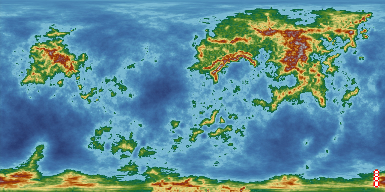
Ukadarlia
I have started on a project which I hope will get published next year. It is set on the continent of Ukadarlia on the world of Dashamargo, with the initial focus being on the NE of the continent, and the nation of Kelenahavan in particular.
These are the maps so far. In addition there will be geographical, historical, political and cultural notes, as well as notes on the various races, ethnicities, fauna and flora and unique 'monsters'. As well, I hope there will be at least 2o adventures, with a common thread to make a full campaign, as well as many other adventure hooks, and character profiles.
Anyway, here is a map of the world, as created in FT3.


-
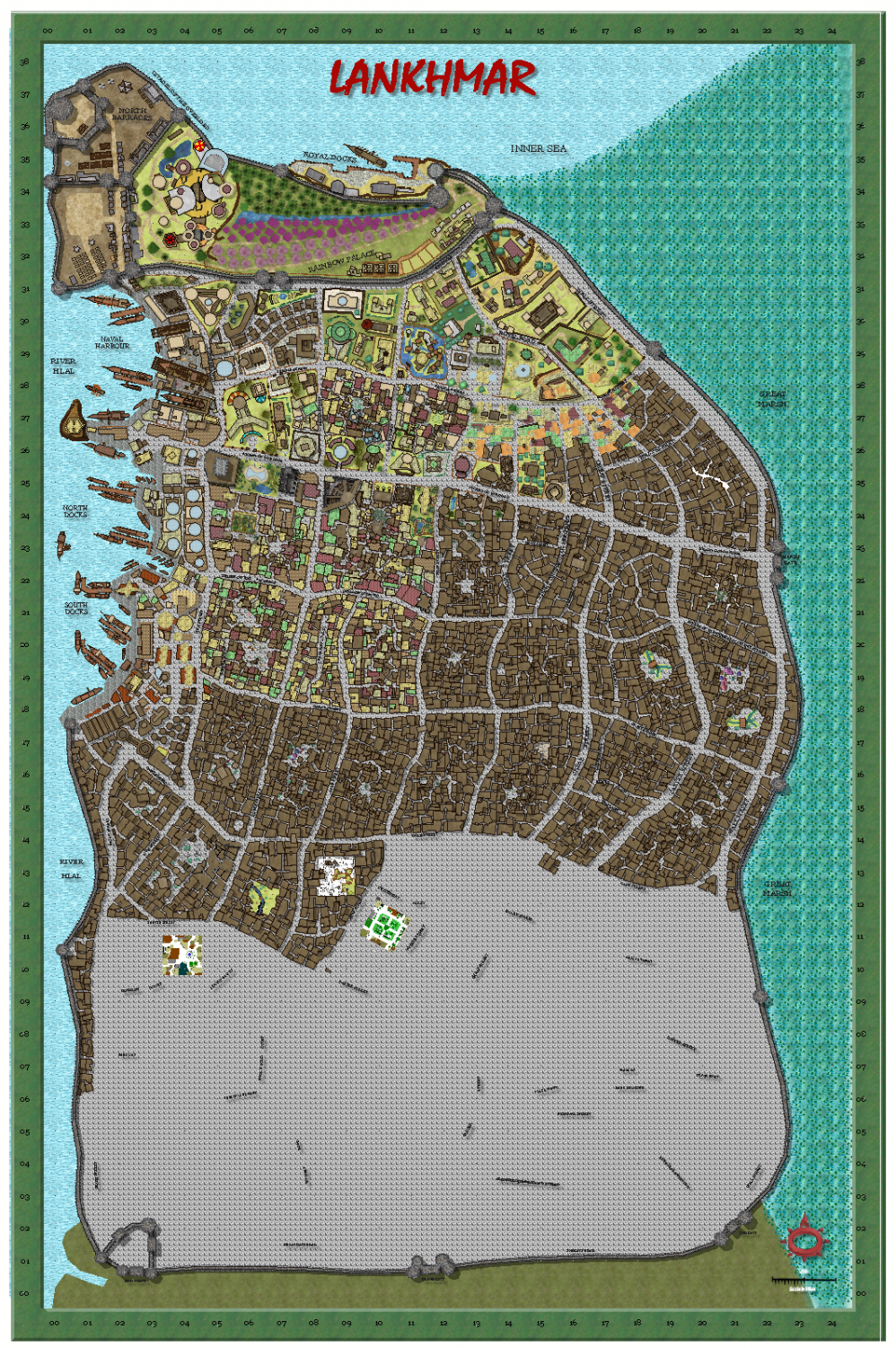
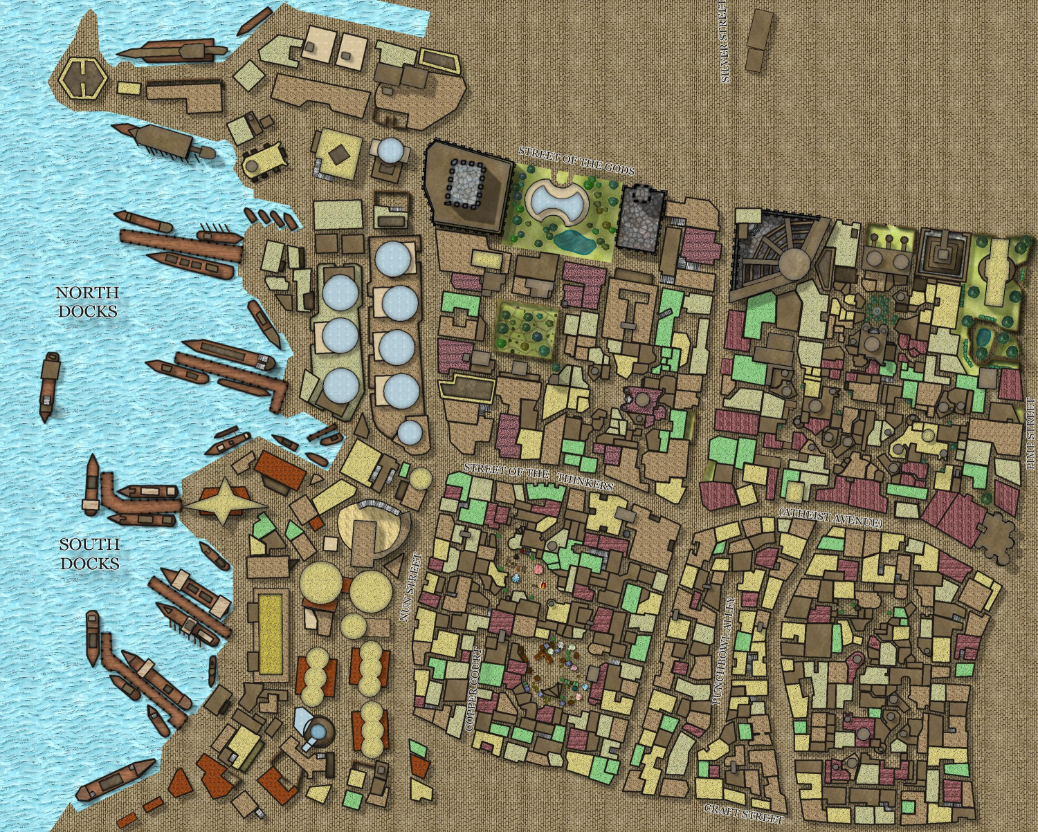
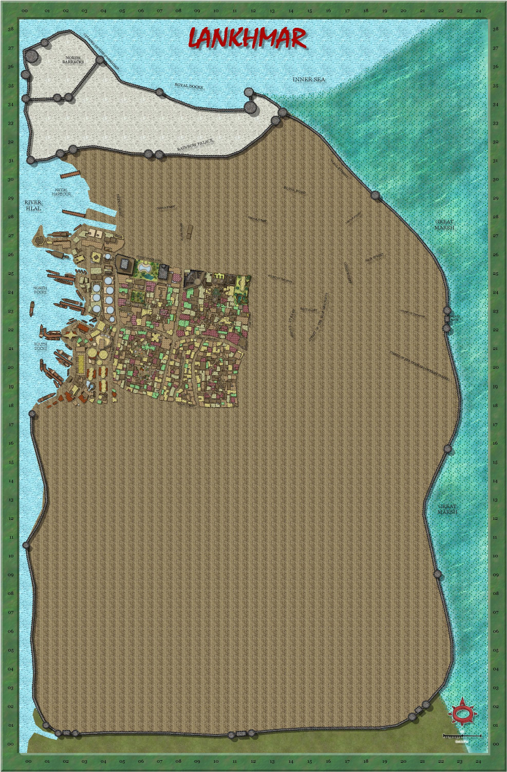
My version of Lankhmar
Some more progress - it is now my current project, aiming to finish by end of January.


-
My version of Lankhmar
Today's work - added some of the docks.

-
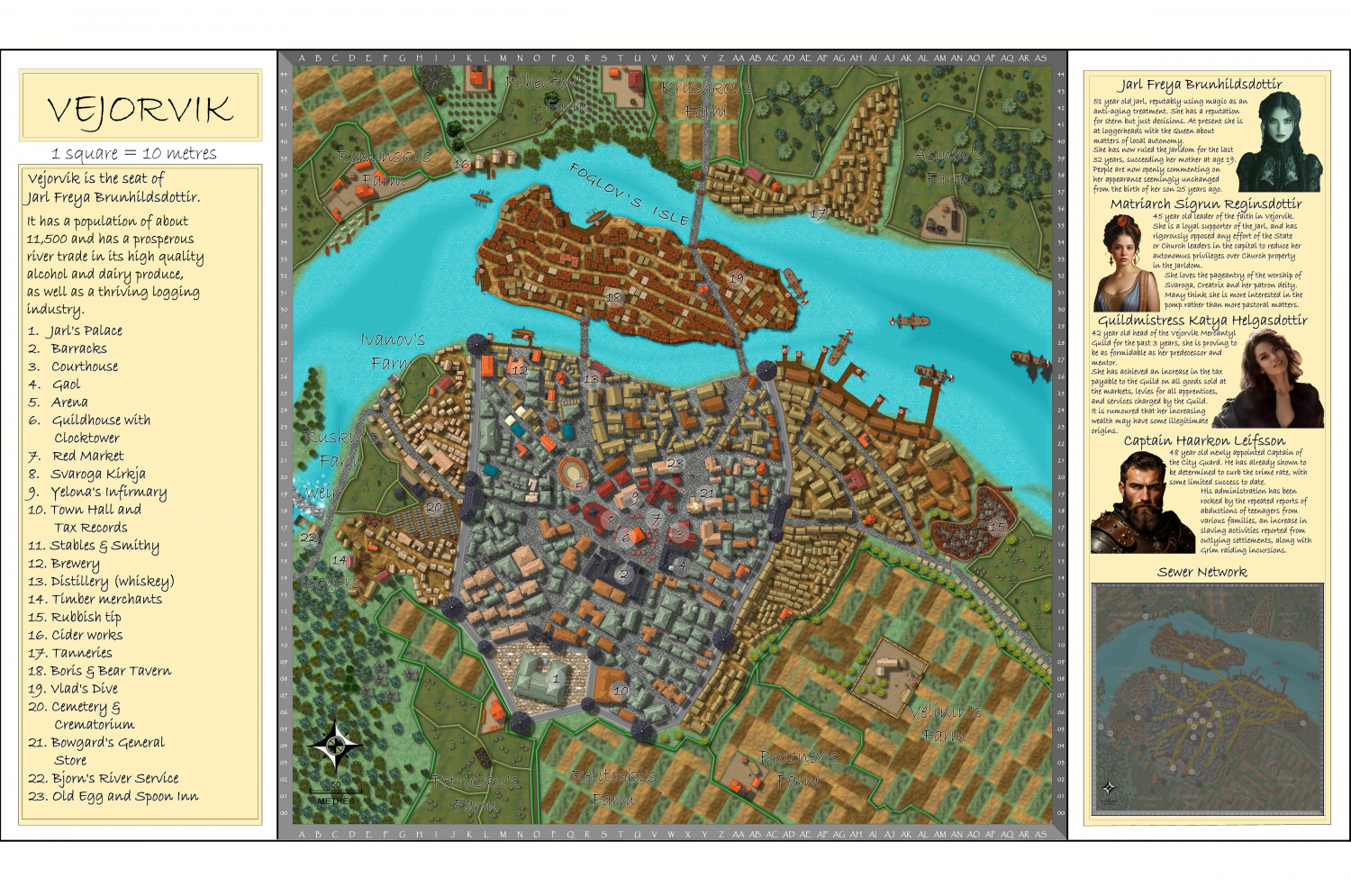
Vejorvik - Boris and Bear Tavern
I have also altered the Vertshusen map in the atlas to the city in my campaign - Vejorvik.
here is the link to the original city I did, in the Atlas.
Browse Maps - Vertshusen City - ProFantasy Community Atlas
Larger map in the gallery.
Image Gallery: Continent of Ukadarlia — ProFantasy Community Forum
-
How EXACTLY does "Fill with Symbols" work?
There is also an article by Remy Monsen as well.
Command of the Week - Fill with Symbols (Week 50) — ProFantasy Community Forum
I also make a lot of use of Symbols in area.
Command of the Week - Symbols in Area (Week 52) — ProFantasy Community Forum
This may also help in setting up your own catalogues for using Symbols in area.
And this explains how to use exclusion commands as well for Symbols in area, and Fill with symbols.
Exclusion Commands
Ever needed to fill a polygon with symbols, but exclude the area overlapping with another polygon? CC3+ now includes a couple of exclusion commands that lets you do just this; CONTOURSMX, FORESTX and SYMFILLX. These three commands all behave exactly as their normal counterpart, the only difference is that they will ask you to select entities two times. The first set of entities you select are the ones to be affected by the command, and the second set defines those entities that will be excluded from the command. Below is an example using the Fill with Symbols (FOREST) command. The first image shows three polygons (A forest area with two lakes) before filling anything. The second image shows what happens when using the regular Fill with Symbols on the forest polygon, while the third shows what happens if we use FORESTX instead and define the two lakes as excluded. Except for the fact that you are asked to select entities twice with FORESTX, it behaves the same as the regular Fill with Symbols command. (To change settings for FORESTX, go to Draw -> Fill With Symbols first to load whatever setting you wish to use, but click close instead of Run Now).

-
Watabou City REVISED (annual 157)
And here is the final version of the map - I will see if I can find a place in the Atlas for it.