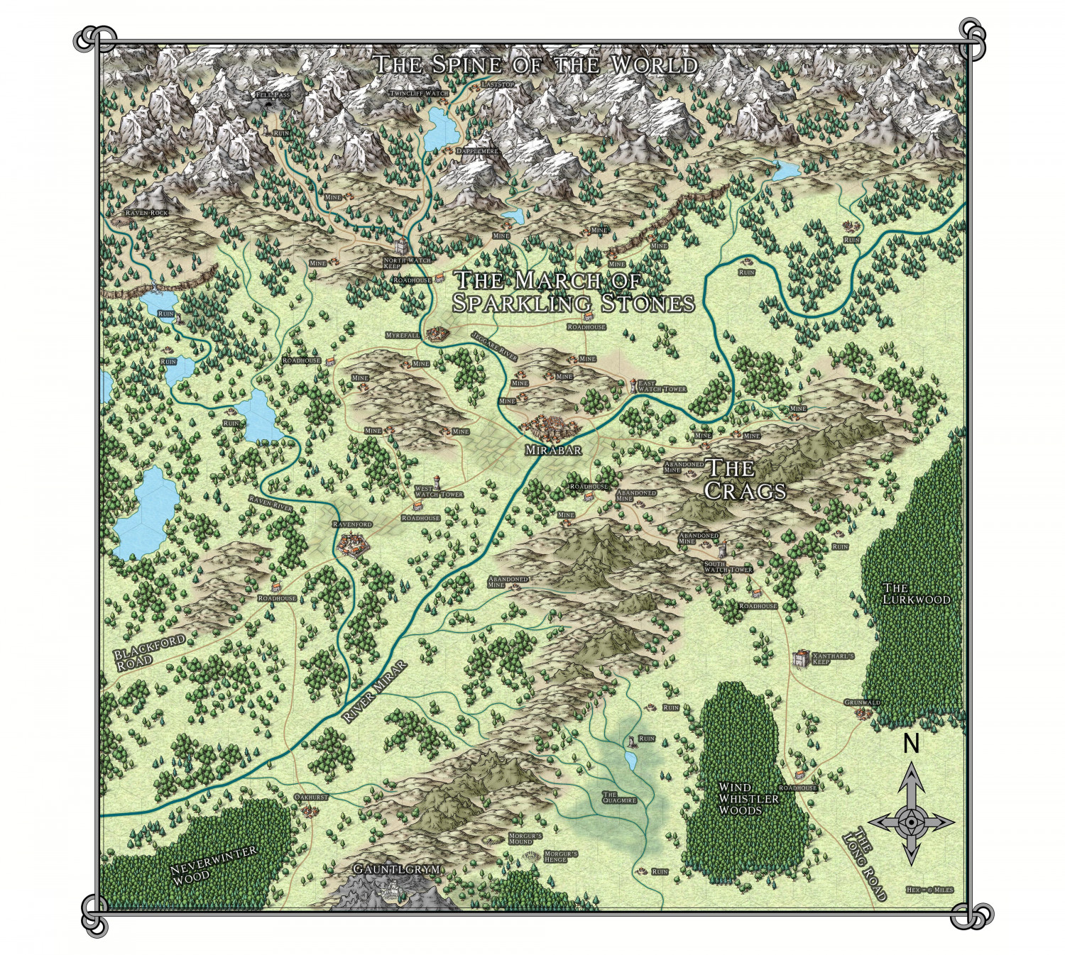
Mirabar Region Of The Forgotten Realms
Hi All - not posted for a long time but finally getting back into mapping. This is going to be a map I used for a D&D 3.5 game im planning to run in the near future. Please note this isnt canon although ive pulled from canon sources. Ive then overlaid my own things into the sandbox.


Comments
Treating the Forgotten Realms setting as a sandbox onto which you can project your own preferences and ideas is an excellent one, albeit I say this as having used exactly this same Mirabar region for starting my own 5e explorations in soon after that edition first came out! Didn't get as far as I'd have liked with it, but I might return to it one day - and this image took me right back to my first mapping in the area as well.
I might make the hex grid a little more obvious is all, if it'll be important to judge distances more exactly, and quickly, during the game.
Thanks for the advice re the hex grid its appreciated. It shows up well on the main screen but never when i transfer to jpg. As for the sandbox i never really like the canon stuff and its always put me off The Realms because there is just so much of the stuff but decided to take the setting and completely own it and boom ideas start to pool :-)
Darg any chance I could get a FCS version of the map any version? Found m
y Forgotten Realms Atlas CD yesterday but have to figure out how to even get a CD player on one of my PCs now to just take a look at what is there.
The map looks amazing! I also ran into the issue that grids didn't show clearly in the final renders, especially with large maps. Disabling sheet effects such as transparency helps. Lowering antialiasing also seems to somewhat help make grids more clearer but at the cost of image quality. If there's a way to increase the thickness of the grid lines, I haven't found it.
Grids are just entities, you can use change properties on them and make them as wide as you like (They're usually on a frozen layer, so thaw it before attempting to manipulate the grid). Other things that also usually work very nicely is to add a small glow effect to the grid.
The default line in CC3+ is a line that is as thin as possible (which usually translates to a single pixel). This works fine on screen, but can lead to nearly invisible lines on prints/exports.
Ah I see now, you're right. I thought I tried adjusting the line width before but I must've had the layer frozen then or perhaps I'm misremembering and was looking in the wrong place. >_<'
You might also simply not be increasing it enough. Keep in mind that when exporting to an image, you take a very high-detailed setup in CC3+ and tell it to squeeze it in to a limited number of pixels. This means something sometimes have to give and give up some of their pixels to other elements in the map. An line can feel plenty thick in CC3+ itself, but when competing with the rest of the map for those precious pixels, it may still be too thin for export.