

Community Atlas - Lizard Isle
 Monsen
Administrator 🖼️ 82 images Cartographer
Monsen
Administrator 🖼️ 82 images Cartographer
The community atlas has it's second anniversary this month, so I made a map for the occasion.
You guys may remember that for the first anniversary, I did a map in CC-DOS, the first generation of the Campaign Cartographer software.
This time, I stepped up a generation, and made a map in Campaign Cartographer 2. This was a much less endeavor compared to using CC-Dos, as CC2 is very similar to CC3+ in most aspects. It is missing some of the newer commands obviously, and it doesn't support raster symbols or effects, but otherwise the mapping work mostly the same. I was easily able to copy the landmass from the parent CC3+ map into CC2, clipboard copying works nicely between the two programs, both ways. The map format is also basically the same between the two programs, so you can actually load up a CC3+ map in CC2 just fine, although features it don't support simply won't show.
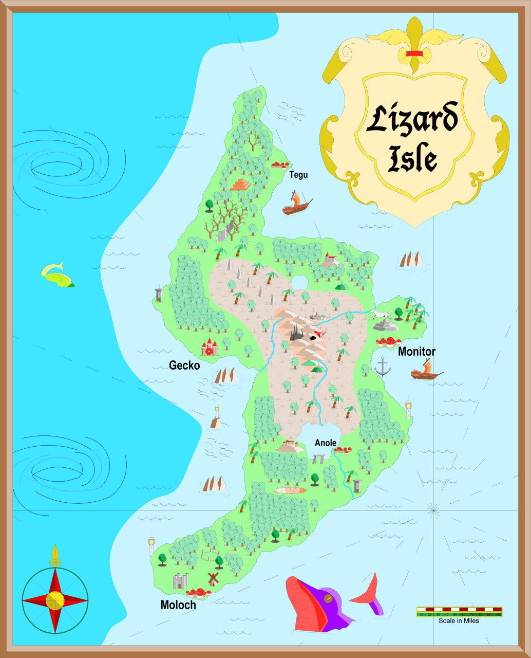
For the map, I made it in two versions. The first version uses the original CC2 symbols. If you compare this version of the map with the CC-DOS map from last year, you'll notice that these symbols are mostly just filled and colored versions of the original CC-Dos symbols.
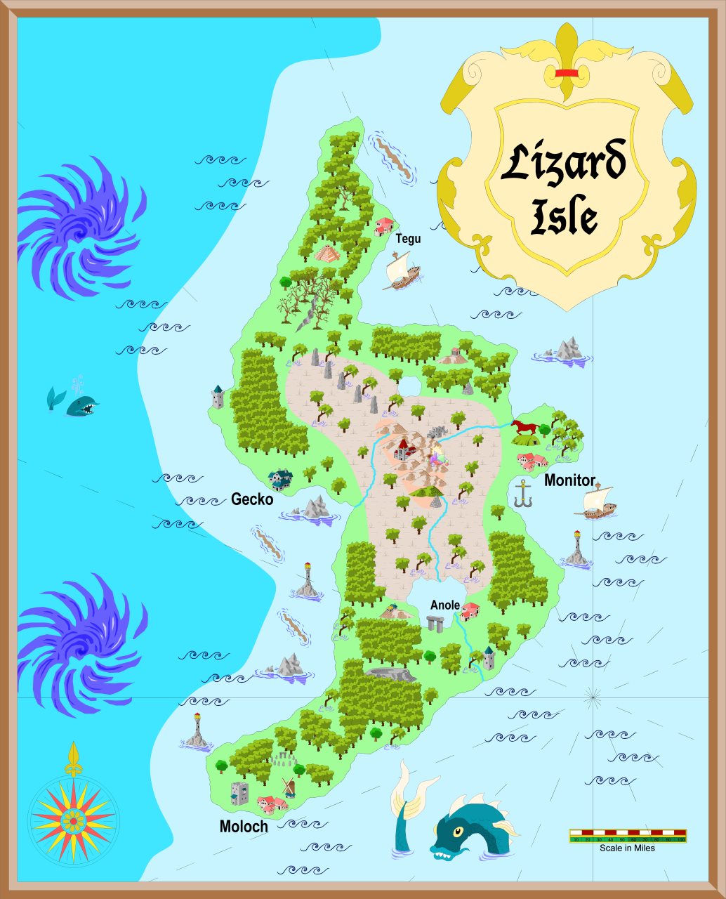
The second version uses the symbols from Symbol Set 1 (for CC2) instead. If you zoom in on these, you'll notice how much more detailed they are. Note that the second map was done by a couple of quick replacements in the symbol manager, and a few manual tweaks, but the SS1 symbols generally do have a greater variation in the symbols too, something which is not quite apparent in my version here.
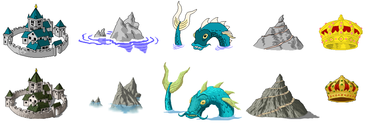
It is also quite interesting comparing these symbols with the raster symbols from the CC3 Standard Overland style, look a the image at the bottom comparing these.
Of course, as with my CC-Dos map, these maps aren't the prettiest of maps either, especially when compared to the standards of today, but they are more intended to show how CC maps looked back in the day.
This map is located on Alarius, just like my Quake Island map. You'll find the classic CC2 version here, and the CC2 version using SS1 symbols here.
Note that these maps are probably best viewed by downloading the .fcw's from the atlas site and opening them in CC3+, rather than view the exported images.
[Image_12225]
You guys may remember that for the first anniversary, I did a map in CC-DOS, the first generation of the Campaign Cartographer software.
This time, I stepped up a generation, and made a map in Campaign Cartographer 2. This was a much less endeavor compared to using CC-Dos, as CC2 is very similar to CC3+ in most aspects. It is missing some of the newer commands obviously, and it doesn't support raster symbols or effects, but otherwise the mapping work mostly the same. I was easily able to copy the landmass from the parent CC3+ map into CC2, clipboard copying works nicely between the two programs, both ways. The map format is also basically the same between the two programs, so you can actually load up a CC3+ map in CC2 just fine, although features it don't support simply won't show.
For the map, I made it in two versions. The first version uses the original CC2 symbols. If you compare this version of the map with the CC-DOS map from last year, you'll notice that these symbols are mostly just filled and colored versions of the original CC-Dos symbols.
The second version uses the symbols from Symbol Set 1 (for CC2) instead. If you zoom in on these, you'll notice how much more detailed they are. Note that the second map was done by a couple of quick replacements in the symbol manager, and a few manual tweaks, but the SS1 symbols generally do have a greater variation in the symbols too, something which is not quite apparent in my version here.
It is also quite interesting comparing these symbols with the raster symbols from the CC3 Standard Overland style, look a the image at the bottom comparing these.
Of course, as with my CC-Dos map, these maps aren't the prettiest of maps either, especially when compared to the standards of today, but they are more intended to show how CC maps looked back in the day.
This map is located on Alarius, just like my Quake Island map. You'll find the classic CC2 version here, and the CC2 version using SS1 symbols here.
Note that these maps are probably best viewed by downloading the .fcw's from the atlas site and opening them in CC3+, rather than view the exported images.
[Image_12225]
Comments
Both great maps, Remy