

Mapping Europe 1790s

Hi all,
I'm running a huge wargaming campaign for 8 players and have been using the maps from http://www.murat.ca/maps.htm
They've been a great resource, however many of the maps do not line up neatly which makes it awkward to use during play. I've purchased CC3+ in hopes of redesigning the maps in the same style and connecting them all together; as well as adding in other sections of Europe, and sea zones
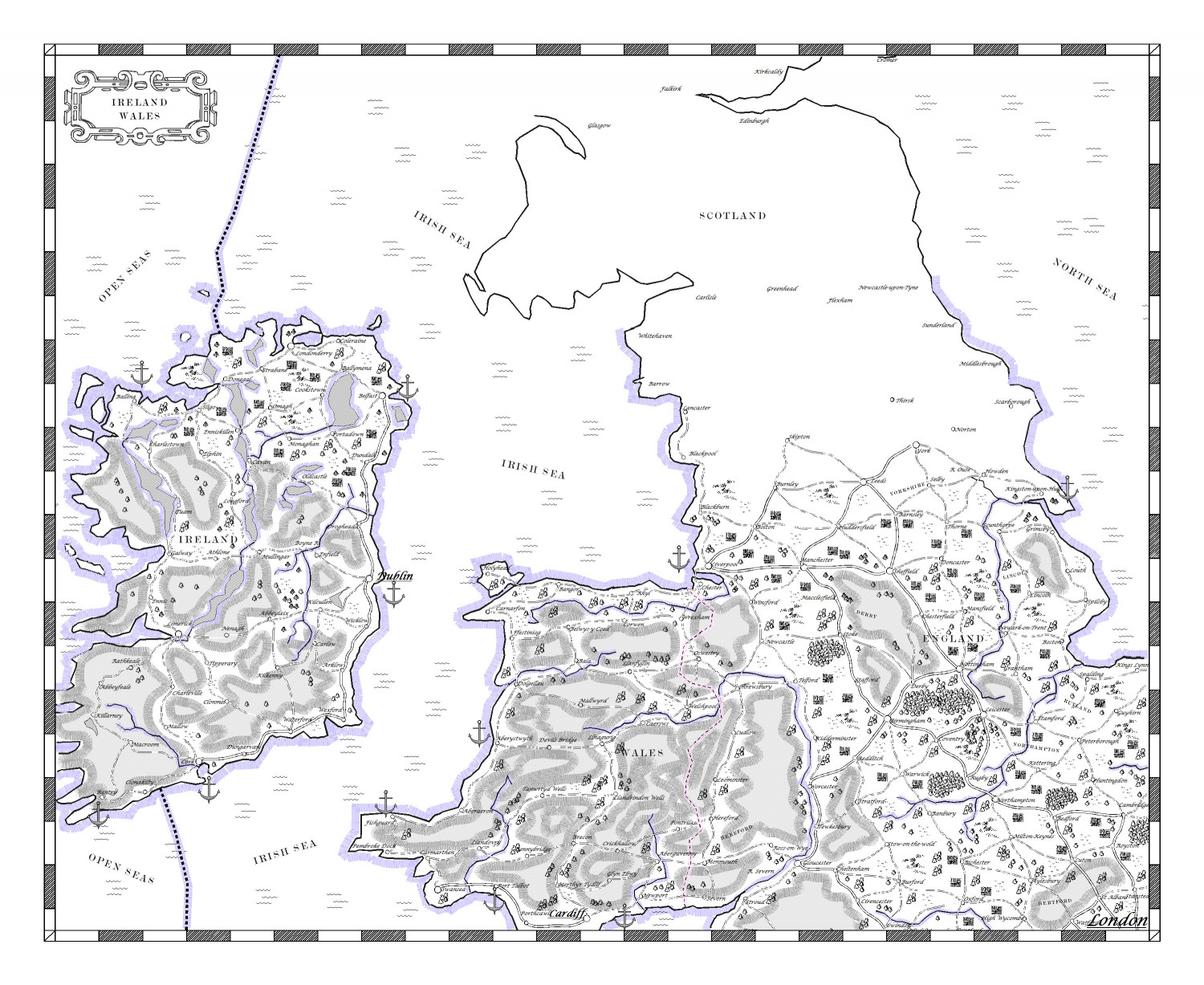
(the maps aren't all complete). I have played around with the program a little however am struggling to find map overlays in the same style as the maps above. The overall map design doesn't seem too difficult to mimic but I need to find what style has been used. I've looked through the annuals and haven't found anything yet. Any help concerning this would be greatly appreciated.
Secondly, when designing maps, how do you scale the sheet to a printable size? I.e. I want the maps to be either A0 or A1 but I don't want to start working on the them until I've set the sheet to size to avoid any major errors down the track.
Thirdly, if there are any people out there that would be open to commissioning such a map please get in touch. I'm an eager learner however time is the greatest challenge when my hobby is concerned so if I can avoid the hurdle that is drawing up the maps myself, I'd be very keen to pursue that avenue.
Cheers,
Sasha


Comments
For the second point, CC3+ scales to paper on print. The map itself should be scaled according to the actual real world size, not the print size, so if you wish to cover an are 500 by 500 miles, set the map dimensions to 500 by 500.
In the print dialog, you can then specify desired print scale when you print, or if you export to an image, set the desired pixel size as needed by your print.
For the first point - was the original a CC3 map? If it wasn't then you won't find the style ready made somewhere in our stock of styles.
However, you have accurately surmised that it wouldn't be too difficult to make something similar. That would mean picking and mixing different elements of different styles, like for instance using the tree symbols from 'CC3 Mike Schley Inks Overland' and creating drawing tools for the rest of the aspects.
The only thing you might find a bit difficult to emulate is the dotty fill. The rest is more a matter of setting up the correct line styles and making drawing tools for them.
On the final point - are these maps copyright by the artist? That's not a problem if you create your own for personal use, but paying someone else to copy them may be a problem if you haven't got permission to reproduce them from the artist.
A good resource for political boundaries over the period can be found in "The Hammond Historical Atlas". I have a hard copy, but I'm sure its content should be available online.
In my edition of the book, there are maps of France on pages H-23 through H-26 depicting the start of the revolution (disparities in application of the salt tax), through the Great Terror and the arrival of Napoleon and a map of Paris at the time of the Revolution. Interesting stuff for a campaign.
The book is an excellent view of Europe before Rome to the cold war. I've thumbed through it for hours and always learn something new.
Thanks that's a great help!
Hi, yes I was told they were. I contacted the artist when I originally found the maps and he pointed me in this direction.
The tree example you provide is great. How would you go about doing the grey shading; or is that what you mean by the dotty fill (mountainous regions)?
I don't believe they are but will check in with the artist.
The dotty fill is the grey shading. I don't think we have one like that, though I do remember showing a dotty fill on here some considerable time ago. It's not a published fill.
I found it! Wow, that really was a very long time ago. The third one here is probably a possible fill, but use it very small scale so it looks grey. https://forum.profantasy.com/discussion/7039/dotty-fills