Rendering a Megalopolis
I've been trying to create a large city and its surrounding farmland, so I've decided to render the map in sections, and in some cases, create it in sections.
I've run into two problems so far and was hoping to get some help with them. First, in order to make it easier to reassemble the sections in a photo editing program later, I was trying to the make the segments uniform in size and slightly overlap. I was trying to use the grid for this, but while drawing tools and symbols snap to the grid, the selection cursor doesn't. I'm fairly certain that it did at one point while I was making the map, but it doesn't now, even with with the "Cursor Snap" checked in the switches menu of the grid system options.
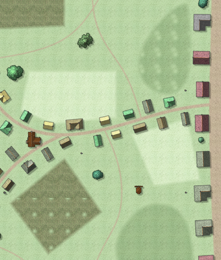
While trying to figure that out, I rendered a segment of the map, and found these small transparent spots in the fields and terrain where they overlapped the background.
I appreciate any help on this, and apologize in advance if these problems have already been covered. Searching on forums is never straightforward...


Comments
I don't think the selection box snaps, but I might be wrong.
Those dots are what we call transparency acne, which is just a term that got tagged onto the effect and not an official name for it. It's caused by the way the rendering engine works sheet by sheet from the bottom up and compares the pixels calculated for the current sheet with what already exists so far. If the current sheet pixel has an identical RGB value to the one beneath it the engine counts it as transparent - a hole in the texture. So when the sheet effect for that sheet is applied (in this case an Edge Fade, Inner) it is applied to all the edges on that sheet, including the 4 tiny edges around each hole.
The cure: Create a new sheet just underneath the sheet with the TA issue and copy all the polygons from the problem sheet to the new sheet. Hide all other sheets and turn the new polygons on the new sheet solid and colour 227 (a dark purple), then copy the Edge Fade, Inner from the problem sheet to the new sheet, and paste it there twice, or even 3 times to prevent the purple showing around the edges. If you still have problems with the purple showing slightly increase the width of the edge fade inner on at least one of the copied effects.
For large cities, I found it a good idea to map pieces of it, and then put them together on my web sites. Easier on my computer, and faster to load the individual maps.
Thanks for the quick and insightful replies! I'll try that method of fixing those blotches, and thank you for the terminology. It'll make it easier to describe going forward.
And yes, it's definitely better to do the larger cities in pieces. Since this is a huge city and is so important to the area it's in, it could easily host entire campaigns in it. I'm basically making a lower-res version for tiling together to give an overview of the city, then rendering the smaller sections in a higher resolution to zoom into in a Google Earth fashion.
I thought the selection box snapped before, but maybe it was something else I was thinking of. It would make assembling the sections easier, but as long as it overlaps, I should be able to work with it.
Oh I've just realised! Do you mean the box you draw when you export a rectangular section?
If that's what you mean then yes, it snaps to the grid, providing you have the snap switched on.
Yeah, it definitely worked before, but for some reason it wasn't working again. I'm not sure what I did, but I'll figure that out. The TA solution also worked, so I appreciate that.
Thanks for the help, and I'll catch you all on the live streams!