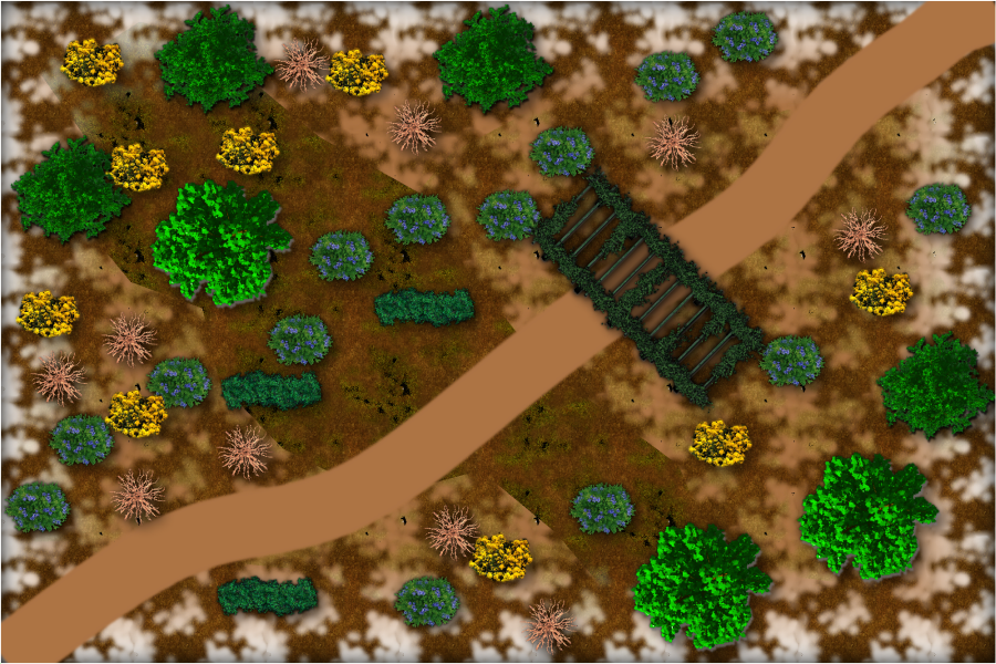
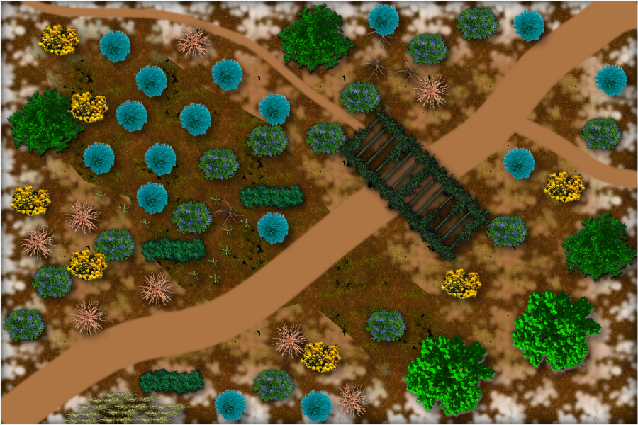
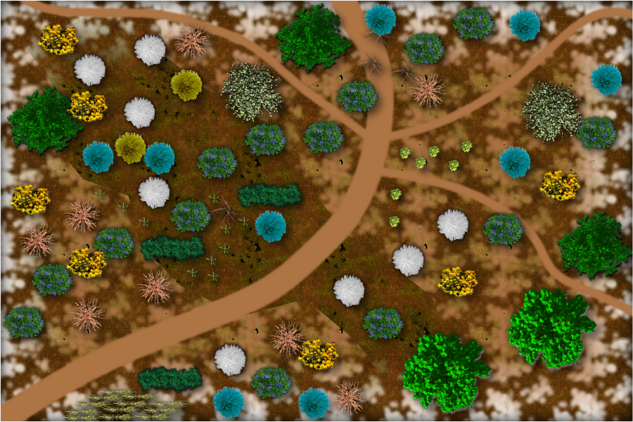
some battle maps, 75' x 50'
 JimP
🖼️ 280 images Departed Legend - Rest in Peace
I was reading another forum, and several people were talking about battle mats/maps. The ones they had found had buildings. So I was thinking of making some that are just woods areas, with different paths, different bushes and trees, different backgrounds, etc. Along with no grid, square grid, hex grid; color and B/W.
So here are several preliminary maps. Same background, with path and shrubbery differences.


Comments
Squares and B/W. Same map. Selected 'Greyscale' in Irfaview and saved. I could also make them with a gray or B/W overland map template. edit: The squares are 5 feet.
They could use some attention to the edge fade in several places, both to make the road fir more natural with the terrain, as well as get rid of the sharp edges of some of those terrain polys (they might need to be moved to a separate sheet)
There are 3 fills on the background. I'll have to work on that. Thanks.
I only redid this one. I'll have to renumber the ones on my hard drive so I don't write over the different versions. This has two background bitmap fills. They are now on different sheets. The main background one needs work.
These are now numbered so you can more easily tell me which ones have problems. Number 4, the two bit map fills have switched sheets. Number 5 has an added brick fill, probably remnants of an old wall. Most of these have a brown color 40 for a background sheet. All other background fills are on separate sheets. I also did different amounts of edge fade, inner on these. Some have 8 width, some are 4 width, or larger. Some the outer opacity is larger than zero percent. In future I hope to find time to work on connecting tiles.
Some have a pergola, some different shrubbery, some different paths. The next ones will have bigger differences.
A path. Apparently a dead soldier behind a small wall. Is he there to protect the pumpkin patch from the hog ? And who cut the tree down ? Certainly not the hog.
Different types of shrubbery on opposite sides of the path. Map 7 through 9 hasn't been started yet.
Very likely to remove the map border on this one, otherwise I don't think the geomorph would work well.
A tree, bushes, rocks, a spider, and open and closed pit. A path. I''l dig around see what other symbols I can find in a B&W style.
Here we go. Spider more hidden, and a few different symbols. Border hidden.
Instead of just making them in random fashion, I think it would work better for connecting them if I inserted each one into a larger map, and then made squares so the paths follow a larger path.
And 12 above will be 2 maps instead of one.
This is what I meant by making one large map, and inserting the battlemaps so I could see where paths go and make connecting maps match. The map in the bottom right is number 10. Screen is erased on these smaller maps, so some symbols and paths will be visible that otherwise wouldn't. I'll see if the 2000 pixel wide map will go on the gallery. Otherwise I probably should put this up on my web site so it is clearer.
Not all numbers have maps currently.
edit: The 2000 pixel jpg fit in my gallery.
Well. I was trying to figure out how to map a small map, add it to the larger map, that is the easy bit.
But, if I make changes, how to get them to the smaller map ?
I finally remembered how I did it.
I made the small pieces on the larger map, then copied out all the bits for one of the small maps, the paths already matched doing it this way.
Also, the above map had some mistakes in sheet order. I think I have that fixed now. And Map 4 was incorrectly located on this map, that is also fixed.
Next step.
900 pixel jpg. I forgot to label all of them. I'll take care of that later on.
Okaaay. That is a painful way to do this.
Calling Dr. Memory !
Anyway, I think a better method would be to draw each small map on the larger map. Then copy them individually over to smaller templates.
Good thing I have earlier versions I can go back to.
Retry. The table symbols are to mark off 75' x 50' areas.
900 pixel wide jpg. Two rectangles.
Now 4 parts. 900 pixel jpg. 2000 pixel jpg in my gallery.
Added two more parts. I realized I had left shadows off the trees and shrubberies. Added that in.
900 pixel jpg
The pathway at the right has a gap in the join - it looks a bit awkward to me.
I am also not sure why the paths don't go to the edges, but I think there must be a reason for that, as you are getting them all to join together quite nicely
Each 75' x 50' piece is a separate map. That is what the tables are marking off.
I may not have the tables in correct locations.
After I make the entire sheet I'll break them up into individual maps, put the pngs in a zip file, and add them to my download page on Crestar as generic cross country travel/adventure maps.
I also intend a set of B&W maps for gamers that prefer those.
Whew. Neglected this bit. Anyway, here are 3 more sections added. Each table is a break line. When I get these done, no idea when, I'll put them up on my Crestofastar downloads page.
900 pixel jpg, 2000 in my gallery.
I decided to post one without the grid. And the part lower right of this jpg has no path. Sooner or later the path has to disappear.
edit: I am using trees and shrubbery from CSUAC.
900 pixel jpg. 2000 in gallery.
I was working on some new bits, desert areas. I couldn't find mesquite trees, prickly pear cacti, saguaro cacti, nor cedar trees.
Anyway, here is the entire map so far. I'll also do a zoom in of just the desert areas. I'll look for a different desert/sandy area for the next parts.
900 pixel, 2000 in gallery.
desert bits 900 pixel, 2000 in gallery.
And here they are without the grid.
same sizes.
Made it back home with no problems. Rather tired. So no mapping until later.
Hundreds more cyclists than in years before. Distance race.
5 x 4 smaller maps. Blank area upper right does have 4 bushes in it. Not all 75' x 50' areas block movement.
Couldn't find a 'jungle floor' bitmap fill, so I just used water.
edit: Oops. It has 5 bushes.
Two new sections. With and without a 5' grid.
Two water sections, this fills up the top row of the total map area.
The right hand part isn't finished, trying to put the grass areas slightly underwater. I just have transparency on them so far.
Here is the map file if anyone would like to look at it. CSUAC2 is in use.
Another row completed. With and without a grid. larger in gallery.
Two more rows done. with and without 5' square grid. Larger in gallery.
That leaves 2 rows to complete, and one row to start.
All done except for the one row I haven't started yet. A few statues, a ruined mausoleum, etc.
with and without 5' squares. Larger in gallery.
And, completed. Here is the 900 pixel version, larger in gallery.
I'll cut it up into smaller jpg and png pieces for download from my web site. With and without grid. But I want to game in Everquest 2 for now, its an in-game version of Halloween.