Community Atlas, Forlorn Archipelago, Fisher Island, Moroni Range, local maps
 JimP
🖼️ 280 images Departed Legend - Rest in Peace
New thread. I asked Remy about this last night and he said it was up to me.
I am doing this because it has become harder for me to keep track of maps in the other thread. It isn't actually closed, I don't have that ability, but please post over here, not in the other thread. Thanks.
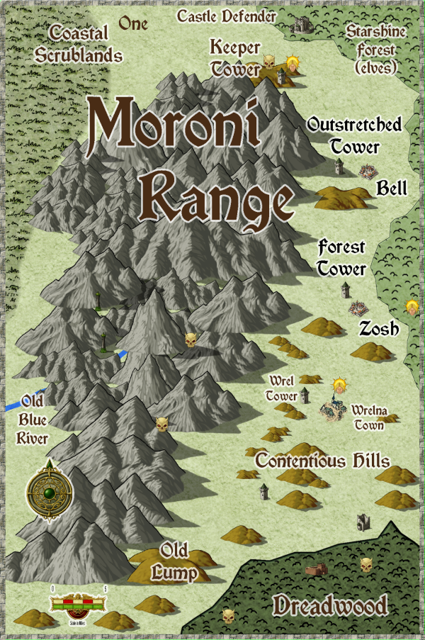
Map 1: Moroni Range, South.
Several places have been moved. Ignore the size of the symbols for the towers, castles, and towns. They are just location markers. The sizes are in the detail drawings, not the symbols.
Map 2: There is no map 2.
Map 3: Area around Keeper Tower.
Crows fly distances.
2811 feet between Shoro Town and Stout Tower.
2325 feet between Stout Tower and Moo.
775 feet from Stout Tower to the hills.
1552 feet from Stout Tower to Keeper Tower.
less than 300 feet to the dungeon city entrances from Keeper Tower.
140 feet from the evil head to the human dungeon city entrance.
400 feet from the second evil head to the kobold dungeon city entrance.
105,000 square feet, the Desolate Fens. Not very big, but they can bog down travelers.
about 3 miles from Shoro Town to Starshine Forest.
Yes, they are close. For support.
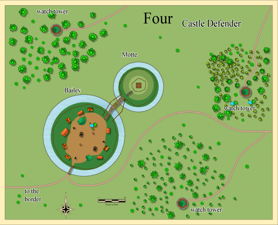
Map 4: Castle Defender, a Motte and Bailey
Defends roads going into the interior of Starshine Forest. The towers are to help defend this area and backup Castle Defender.


Comments
Map 5: Wrel Tower.
Bill's Store doesn't have a detail map.
Map 6: Bell town. This map has detail maps.
Map 25: Bell shop
Maps 26 and 27: storage building.
Looks like the text effects need work.
Map 28: bread and cheese shop.
Map 7: Moo
no building detail maps.
Map 38: Outstretched Tower and Bell area map
Yeah, symbols can be any size you like, providing they're only meant as markers to show the approximate location of the place, but they should always be at least as large as the place they're representing according to the ground scale of the map, otherwise - well, you've seen what confusion that can cause!
Are you thinking of maps like the ones the US Coast and Geodetic Survey makes ? I don't make those.
Other locations, like the Outstretched Tower and Bell I just posted, they are over a mile away from each other.
edit: Would it work better if I moved everything between Keeper Tower and Starshine Forest further down Map 1 ?
Map 8: Outstretched Tower.
No detail maps for this tower.
Map 9: Shoro Town
No detail maps for this tower.
Map 10: Stout Town
No detail maps for this tower.
No detail maps for this town.
Map 39: Forest Tower and Zosh area Need to fix effects.
No detail maps for this tower.
Map 12: Zosh
No detail maps for this tower.
No detail maps for this tower.
Next two are the ruins maps. Should I give them names ?
Map 13: ruins south of Yonder Spring
Map 14: ruins west of Yonder Spring.
Map 15: Ost
Map 16: Sud
Map 18: general General Store
14 more maps to go.
map 19: ground level. or first level ( refers to different naming between US and Europe. )
Map 20: first or second level.
Map 21: second or third floor
Map 22: Third or fourth level.
Map 23: Top floor.
Map 24: basement
No detail maps for this area.
Scale on this map, doesn't match the area covered by these fens on Map 1. This maps they are much larger. No idea what to do.
Map 30: Dungeon City human entrance.
No details for this area.
map 31: Kobold entrance.
No details for this area.
Obviously, you can set up the places as you wish, but where the area maps don't show the settlements in their true relation to one another, that can create problems all-round. For instance, at the scale of Map 3, because of the size Shoro and Stout Tower are, it would make more sense to draw their walls to-scale onto that map, and not use symbols for them at all. Or replace the symbols with something like a filled polygon which has the exact shape and correct size of the outline of the walls at the size they are on the Map 3 scaling.
I think too that places as substantial as Shoro and Stout Tower should perhaps be on Map 1 as well.
Didn't want to put them on Map 1 in the open area between Keeper Tower and Starshine Forest as I felt it would be too crowded there.
with and without fog.
Map 33: Dungeon City The Deep, a city.
Map 35: ruins area of Dungeon City.
Map 36: the small lake, in the center of the area.
I'll have to come up with room descriptions for the numbered areas.
The other option would be to show maybe just Shoro Town, but not Keeper Tower, on Map 1?
I could add a training area near Shoro Town, for replacement troops going to Keeper Tower.
Lunch for me, and I may be back later today.
Shoro seems big for just a stopover place, and it has huge stone walls too, however, as also with Stout Tower, while Keeper Tower is really small by comparison, and just a single structure. Shoro also seems to have plenty of space inside its walls for training areas, if necessary.
(I really should try and pay more attention to the other places as well, I know...)
I can do large area maps, and local town maps. It is the maps in between those that give me headaches.
Currently moving Shoro and Stout to south of the Contentious Hills.
I'll work on redo of Map 3.
Map 3: Moo is 3600 feet from Keeper Tower.
Next I'll be making Map 40 for the area around Shoro and Stout.
Map 40. Maybe put a road that stops before it reaches the ruins off to the south east.
I'll have to sit down and try and remember the ideas I had for the background of this area. So submitting these maps will be somewhat more delayed.
On my cell
A general comment to most of your maps, you do place the scale bar and compass rose a bit haphazardly. It looks much better when these are in a corner, edge, even if they overlap something (not something important obvisouly)
40 is missing a scale bar
32, 36: Edges of those lakes look a bit harsh. Tried using an edge fade on it?
36: The numbers 6 and 7 are behind the symbols. Guess the symbols are on the wrong sheet. Guess it is the bars, I can see a tiny overlap with the bars on 34 too.
1: Now with most towns moved to this map, perhaps some roads?
Map 40... well, it isn't there, I thought I put one on it.
I'll have to check maps 32 and 36. Likely I made it too strong.
I'll try to fix all of that.
I have checked some of the local area maps, for roads. I'll start down the list to see if the roads need fixing, and the other things you mentioned Remy and Wyvern.
Map 3, roads updated. I think I need to make the Dungeon City entrances text larger. What do you think ?
Map 4: Defender Castle, no changes.
Map 5: Wrel Tower, no changes.
Map 6: Bell, added a compass rose