


MarkOlsen
MarkOlsen
About
- Username
- MarkOlsen
- Joined
- Visits
- 113
- Last Active
- Roles
- Member
- Points
- 81
- Location
- Chicago-adjacent
- Real Name
- Mark Olsen
- Rank
- Traveler
- Badges
- 1
Latest Images
Reactions
-
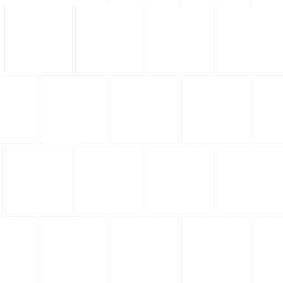
Offset square grid.
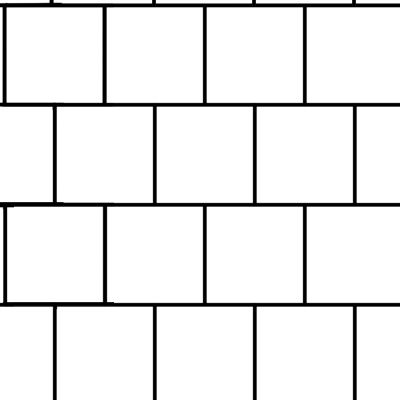
I can't edit my comment above because I haven't posted enough to the forum so sorry for the two posts, but I played with this some more and I really think that using a custom fill might be a good solution for what you want to do (minus the issue of labeling the boxes).
Here is a better example using a slightly revised version of the fill I made above (I didn't make the map itself, this is one of the example maps from a recent annual). In this example I used a polygon to draw the fill so that it only covers certain areas, which fulfills your desire to not have the grid overlap the land... you can just draw it on the water.
Revised tile I used for this grid:

-
Fractal Terrains' Overlays
Since the problem as identified by @jslayton is the anti-aliasing, I wonder if redoing your overlay image with much thicker lines would solve the issue?

-
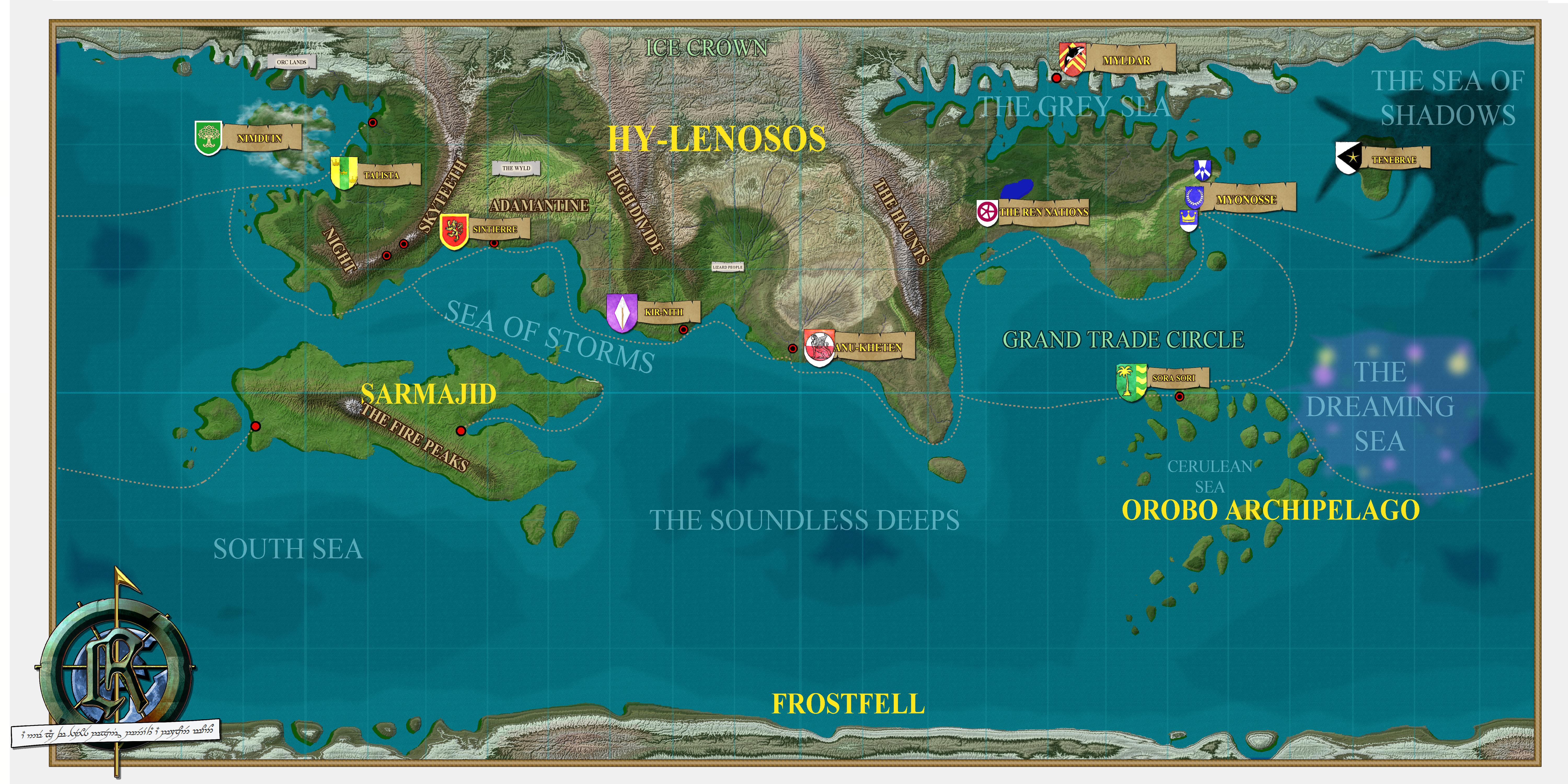
[WIP] The World of Runimar
I've been continuing to tinker with this world and after a long time of trial and error have settled on a style I really like and thought I'd share an update!
I recreated my map in Fractal Terrains and used Wilbur to add some more realistic erosion following the tutorials in The One Day World Builder from the 2019 Annual. After playing around a bit more with the climates I have been exporting it back to CC3+ where I have come up with my own style using a bunch of assets from CC3+ and various annuals and some heavily customized sheets and layers.
The compass rose and the mists covering the island-nation of Nimduin were made in Photoshop then imported to CC3+ as PNGs. The banner on the compass reads (more or less) in one of Tolkien's Elvish scripts "Under a broken moon, a new age of heroes begins" which is sort of the mission statement for the setting. The shields for the various nations were made in CC3+ and a paint filter was applied to them in Photoshop then they were brought back to CC3+ as PNGs.
This is the full world of Runimar as it currently stands:
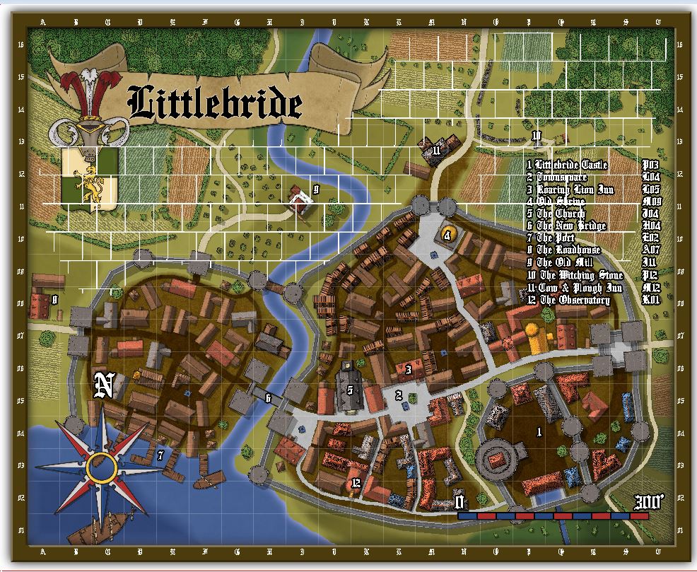
This is the nation of Talista, the main region of my D&D campaign:
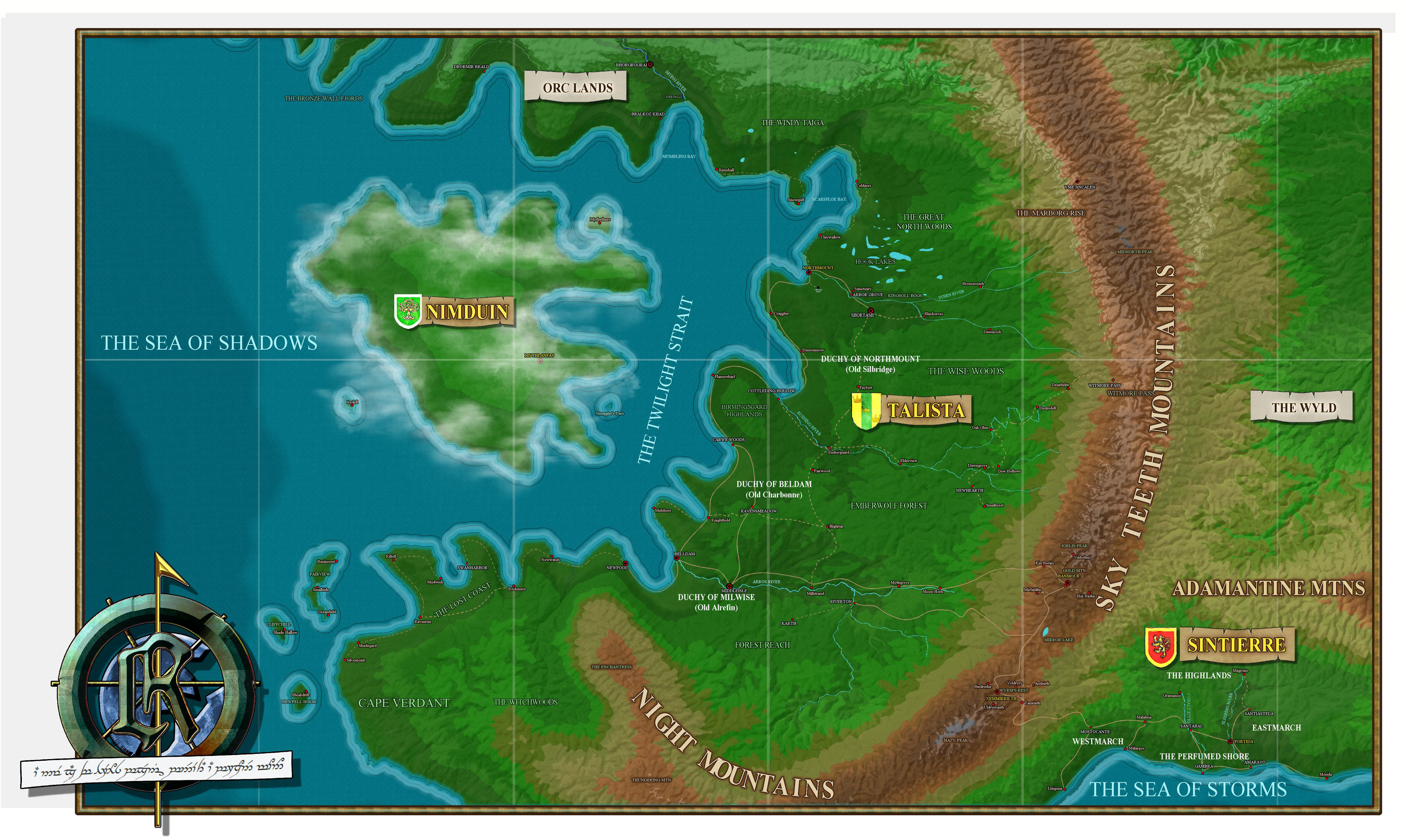
You can see how dramatically they have both evolved from my early maps in the first post of this thread!
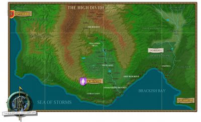
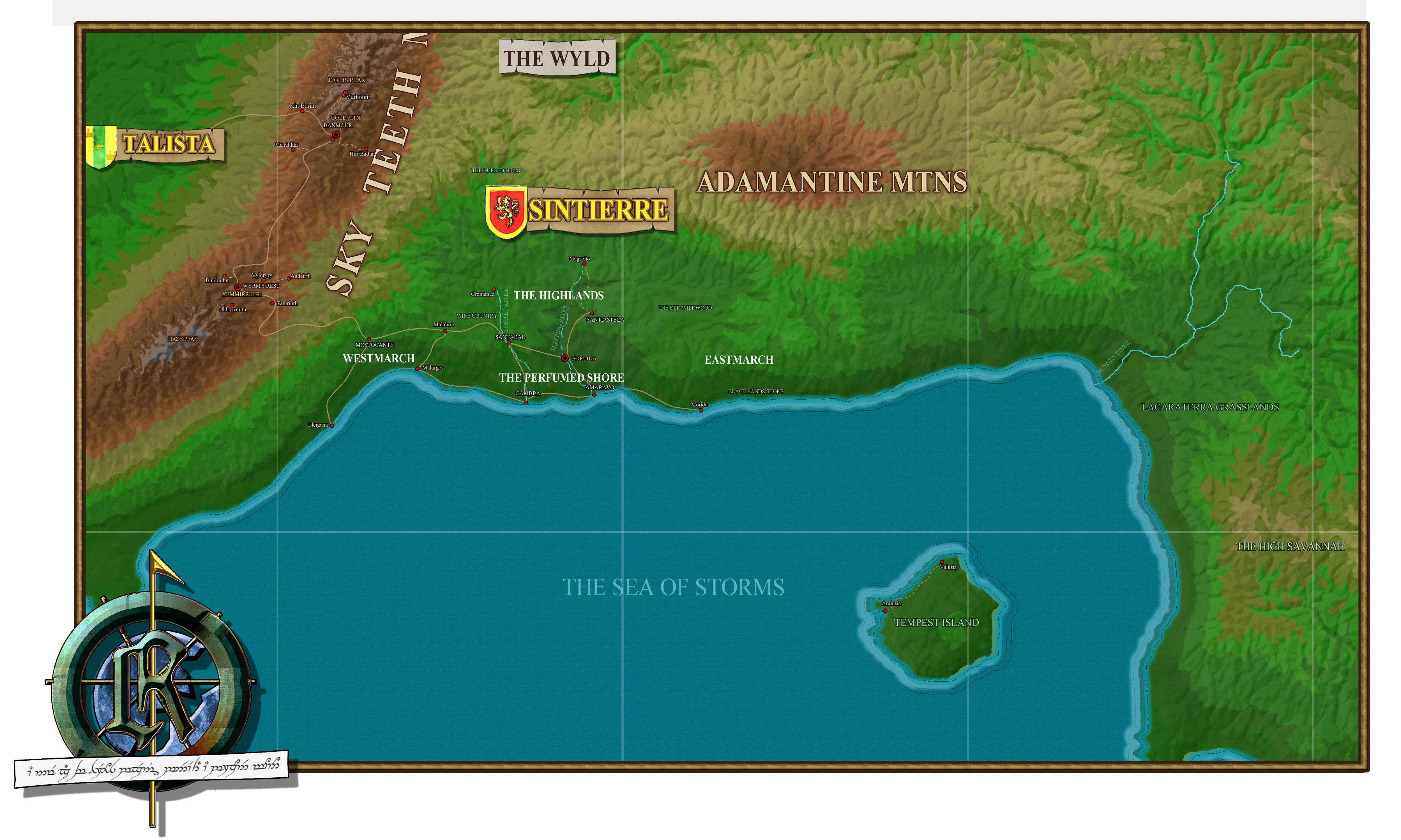
This is the small nation of Sintierre, Talista's closest neighbor and ally:
And the latest addition, the nation of Kir-Nith. This one is a WIP; if you look at the larger version you will likely notice that many of the towns are just named "Market Town" and there are spots labeled "Geo Feature" and rivers that are just alled "Water." ?


