HelenAA
HelenAA
About
- Username
- HelenAA
- Joined
- Visits
- 1,230
- Last Active
- Roles
- Member
- Points
- 564
- Rank
- Mapmaker
- Badges
- 7
Latest Images

Reactions
-
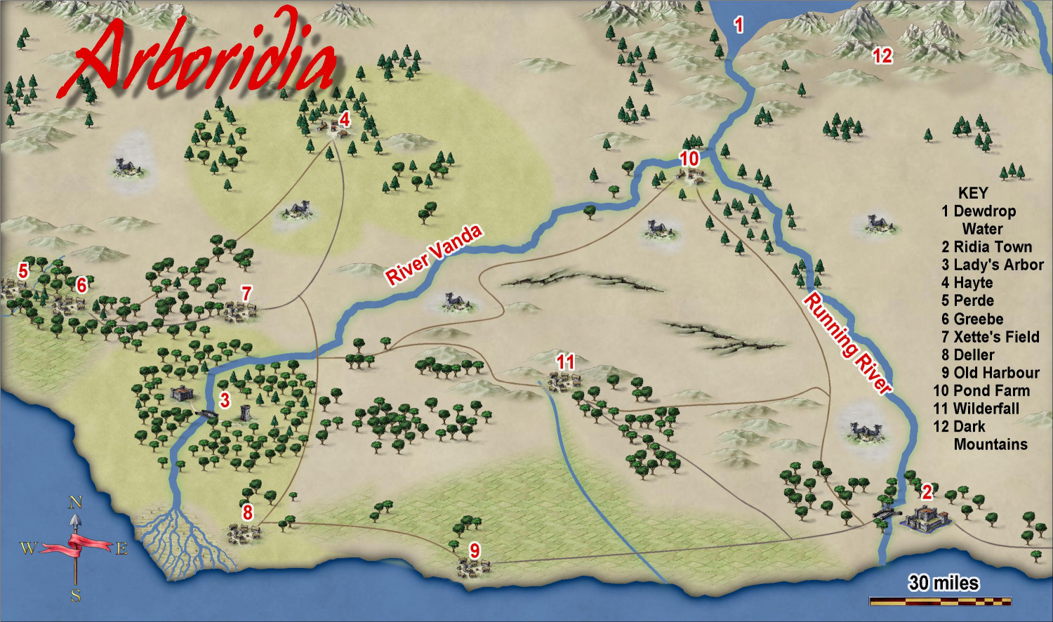
WIP Arboridia (Mercia) for Community Atlas
Ah, that’s why it was way out. I did wonder,, however numbers and me don’t really work. Thanks for setting me straight.
Anyway here’s the final .jpg


-
WIP Arboridia (Mercia) for Community Atlas
Almost finished! Noticed I’d not put river names in after I’d exported this. And a few trees that must be uprooted....
Anything else?


-
WIP Arboridia (Mercia) for Community Atlas
Thanks for the tip about editing the tree fill, @Don Anderson Jr. I had great fun doing the delta -- zooming in, I used a fractal line and started with two main stems, then went down .2 and then after i’d put in enough lines, I went down another .2 and filled in some gaps. I could have gone on but you probably wouldn't be able to see them on such a small map so decided not to gild the lily. Instead I got all 12th century and put structures for Heloise and Abelard to live in, one each side of the river! Had fun trying to get the structures large enough to see and not too densely hemmed in.
-
WIP Arboridia (Mercia) for Community Atlas
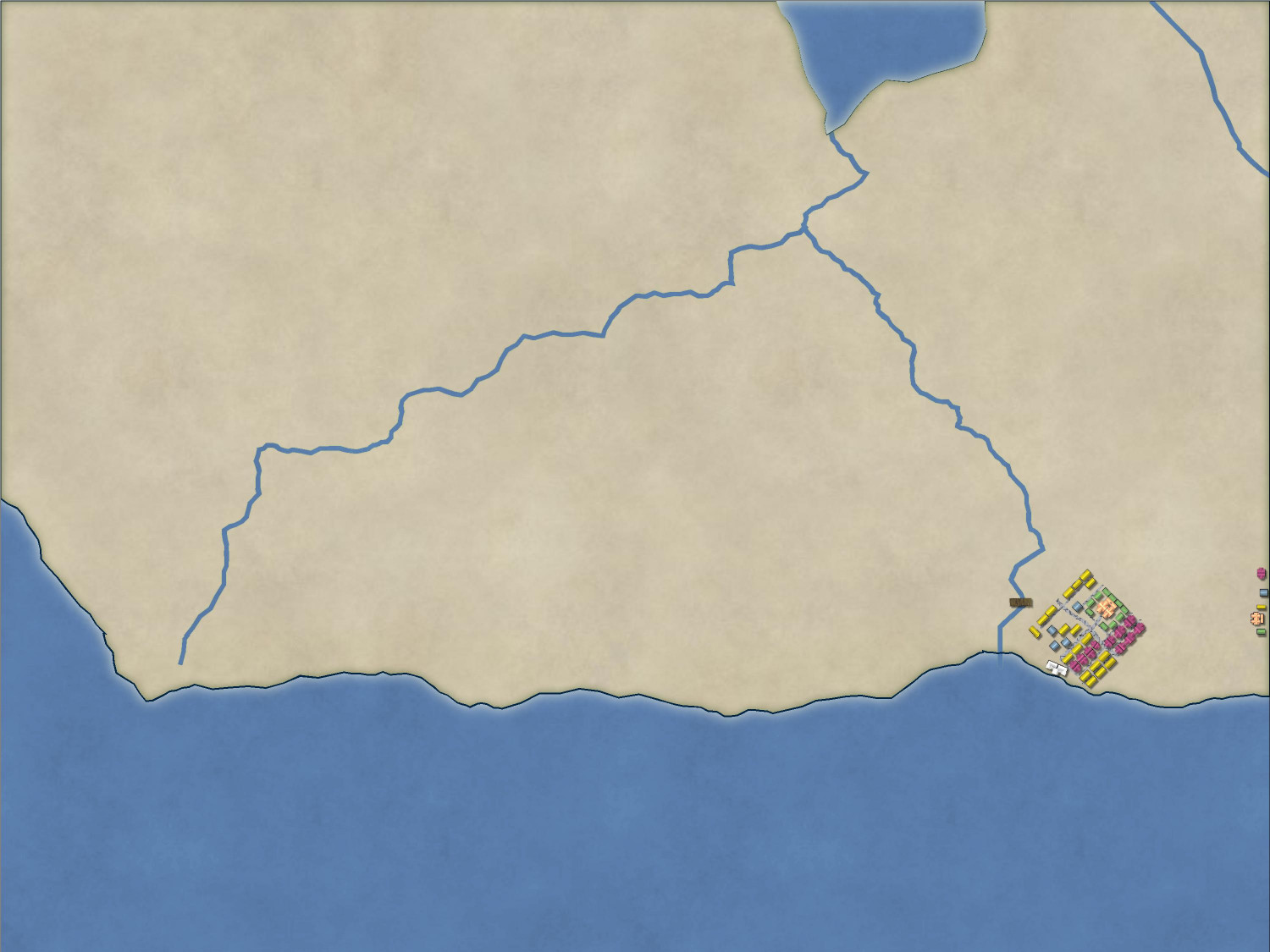
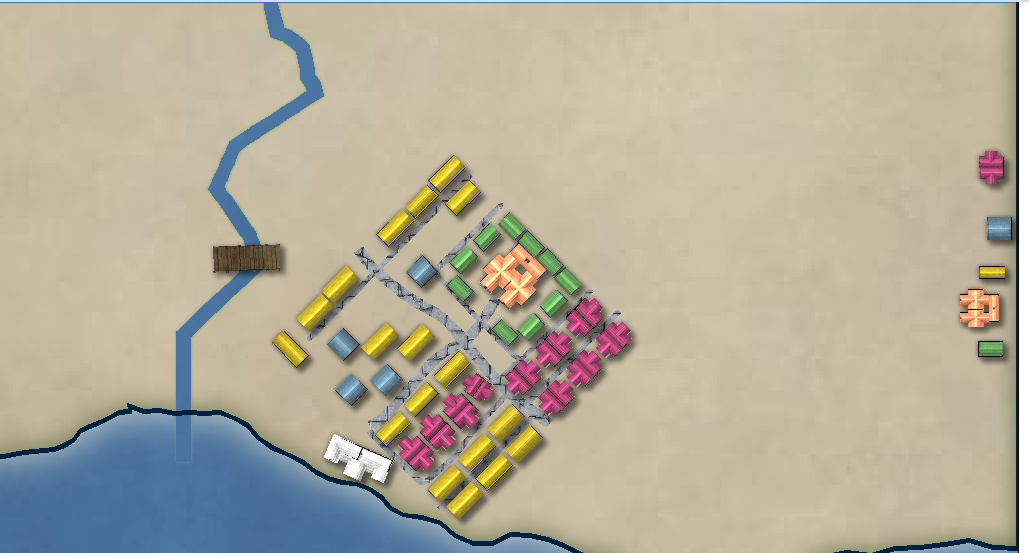
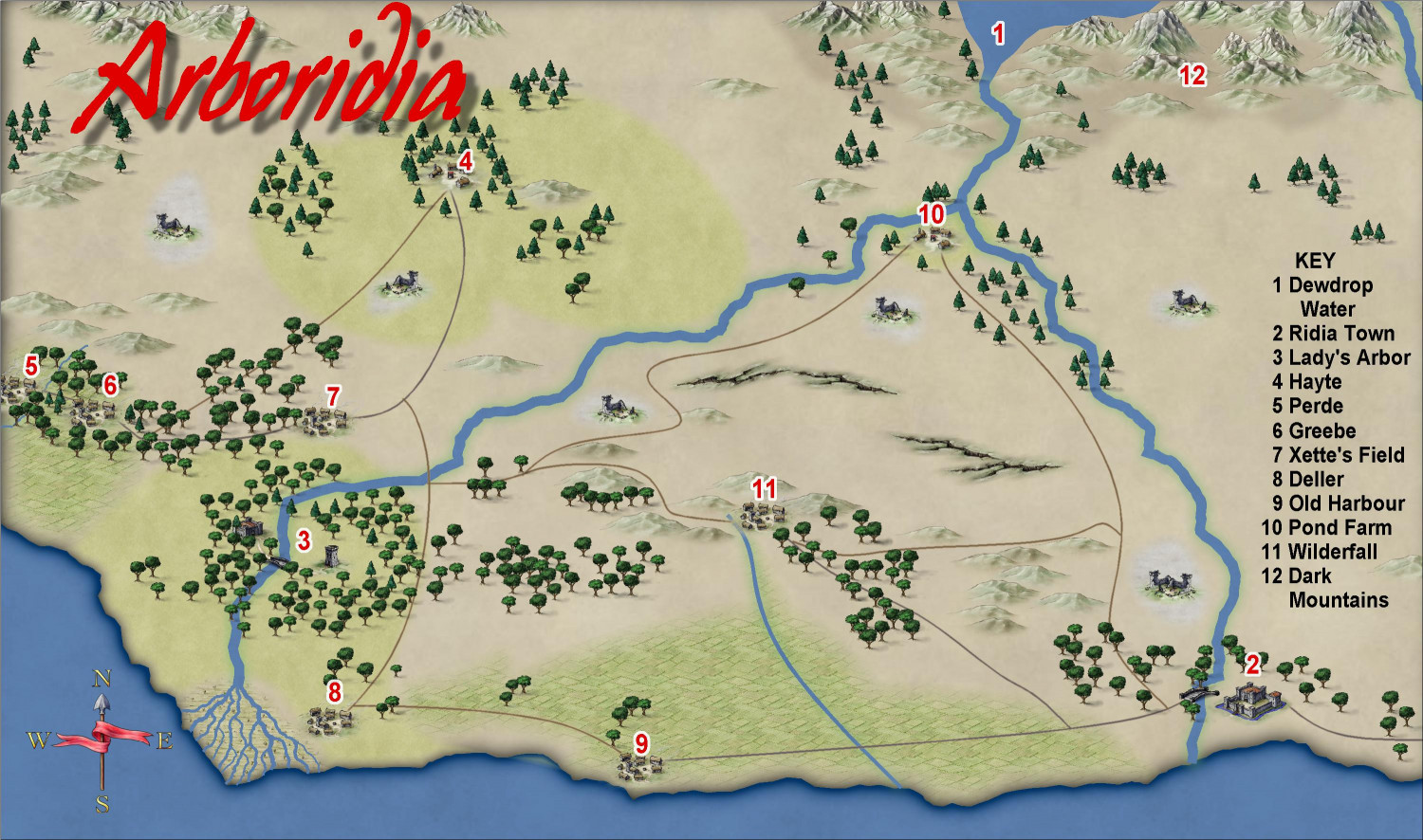
Here’s my most recent export of Arboridia, it’s not complete by any means.
I’m aware of the need to darken the roads - hadn’t realised how much too light the lines are until I printed the thing out - and I need to do something about the text. I’m going to put more trees in, but I don’t like the Forest fill tool - way too dark for this map in my view - so it's going to be manually placing each tree.
All comments welcome.
-
WIP Arboridia (Mercia) for Community Atlas
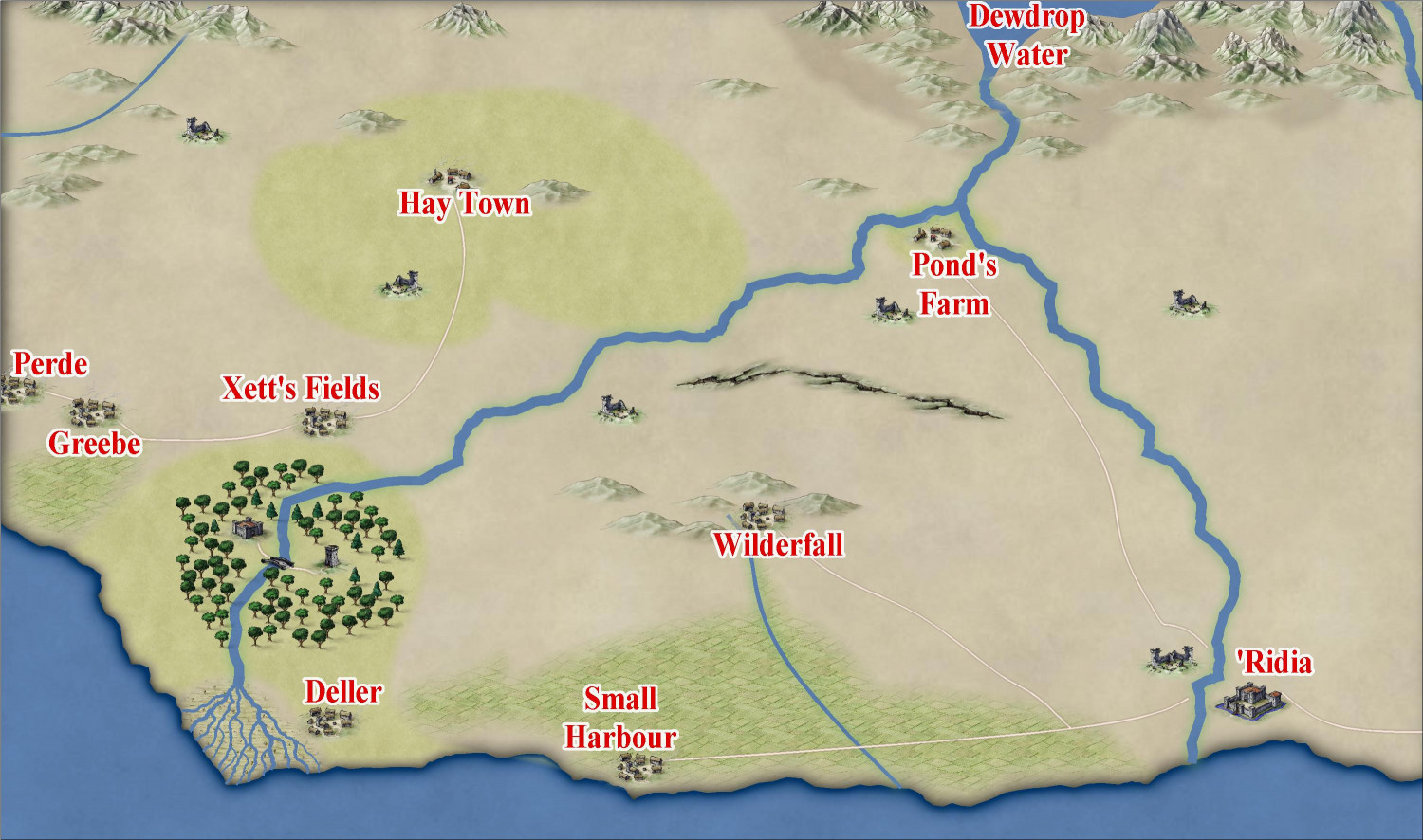
I need suggestions - I’ve been rebuilding ’Ridia over and over and although it looks fine when zoomed in, I either have it large enough to see when zoomed to extents which means that it swamps the entire bottom right corner of the map, or small enough that its in keeping with the visual scale of the map as a whole which means that nobody (not even me!) can see what’s where. The symbols down the left of the map are in preparation for a key, by the way.