


Monsen
Monsen
About
- Username
- Monsen
- Joined
- Visits
- 723
- Last Active
- Roles
- Administrator
- Points
- 9,029
- Birthday
- May 14, 1976
- Location
- Bergen, Norway
- Website
- https://atlas.monsen.cc
- Real Name
- Remy Monsen
- Rank
- Cartographer
- Badges
- 27
Latest Images


-
Welcome to the Updated Forum
Doesn't the browser save that per subdomain? Looked at my saved passwords, and I have one for www.profantasy.com, and one for forum.profantasy.com.

-
September Annual: City Cliffs
These looks great. Can't wait to find a good time and opportunity to play with them.

-
WIP Novaregna
I might have a chance in the wits category, but the steel is going to get me every time.
Great map, but I did wonder a bit where the large lake in the middle of the largest island was getting it' water from.
![[Deleted User]](https://secure.gravatar.com/avatar/c75d9a245b74d9c59be0999ea81ca541/?default=https%3A%2F%2Fvanillicon.com%2F92add7f8c954488718110edc4896ad39_200.png&rating=g&size=200)

-
Guide: Posting Maps & Images
Example - Post with gallery link, embedded image and attachment
This post includes an inline image, and a link to show a larger version from the gallery, as well as the same image uploaded as an attachment. There is also a link to the community atlas at the bottom showing how the forum automatically creates "rich" links just by pasting the URL on a line of it's own (the site you link to must support this to get the best result).
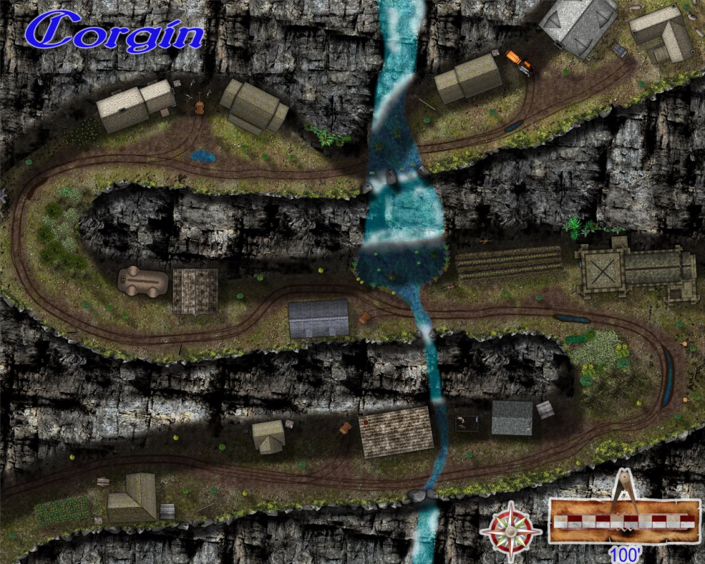
Full Size image here (Warning; large file)
The rich link below was created automatically by the editor by pasting "https://atlas.monsen.cc/Maps/Corgin" on it's own line and hitting enter.


-
Input a scanned map
You can easily import one or more scanned map into CC3+.
Do note that it will only be a flat background element, it won't be converted to actual CC3+ symbols and entities, and won't be modifiable inside CC3+, as CC3+ isn't an image editor. What most people do is to import a scanned map and keep it as a background image to trace over inside CC3+, to basically recreate the map in CC3+, using the scanned map as a guide.
You can also keep the scanned map as a background element and place things on top of it, but that might look a bit weird, depending on the map, since the style of the background probably won't match the style of the CC3+ symbols.


