


Monsen
Monsen
About
- Username
- Monsen
- Joined
- Visits
- 725
- Last Active
- Roles
- Administrator
- Points
- 9,029
- Birthday
- May 14, 1976
- Location
- Bergen, Norway
- Website
- https://atlas.monsen.cc
- Real Name
- Remy Monsen
- Rank
- Cartographer
- Badges
- 27
Latest Images


-
Live Mapping - City Floorplans
Updated versions


![[Deleted User]](https://secure.gravatar.com/avatar/c75d9a245b74d9c59be0999ea81ca541/?default=https%3A%2F%2Fvanillicon.com%2F92add7f8c954488718110edc4896ad39_200.png&rating=g&size=200)

-
Live Mapping - City Floorplans
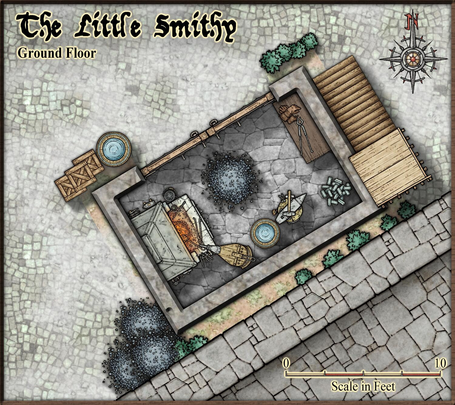
The chimney is already in my head and planned. The doors are closed out of lazyness, because then I don't have to deal with the transition between the floor and the street.
But yea, I should really move that coal heap, shouldn't I. Maybe the blacksmith is lazy like me... "Yea... Just dump it there... I am going to have burned through it soon enough anyway...."
-
August Mapping Competition - Building Floorplans - Win Prizes
Still about a week left of the competition, which means it is still enough time to pick and map a building (plenty of small ones available if you want to do something quick).
I'll also point out one thing to everyone planning to submit their map to the atlas too (hopefully most of you). The atlas has it's own navigation bar off the side of the map, so I do not need that little navigation box CC3+ makes for multi-floor maps in the lower right corner. Because I usually need to rename the map files when putting them into the atlas, the links in that box will be broken anyway, so I'll just have to delete it. So I would be pleased if you just remove the entire box (including the hidden hyperlinks (view -> Show Hyperlinks to show them)) before you hand in the map or at least keep in mind how the map will look when I remove it. Thanks.

-
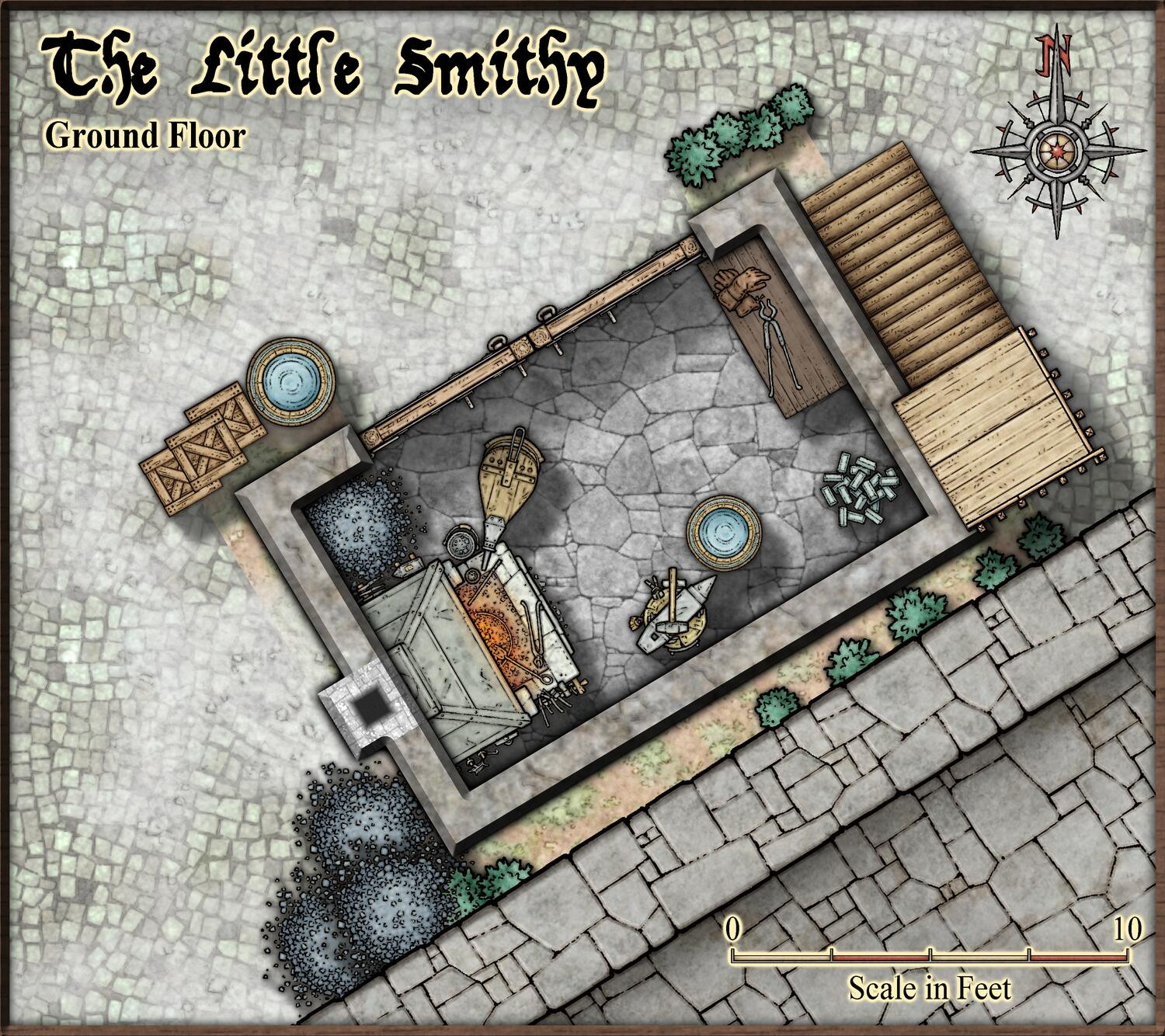
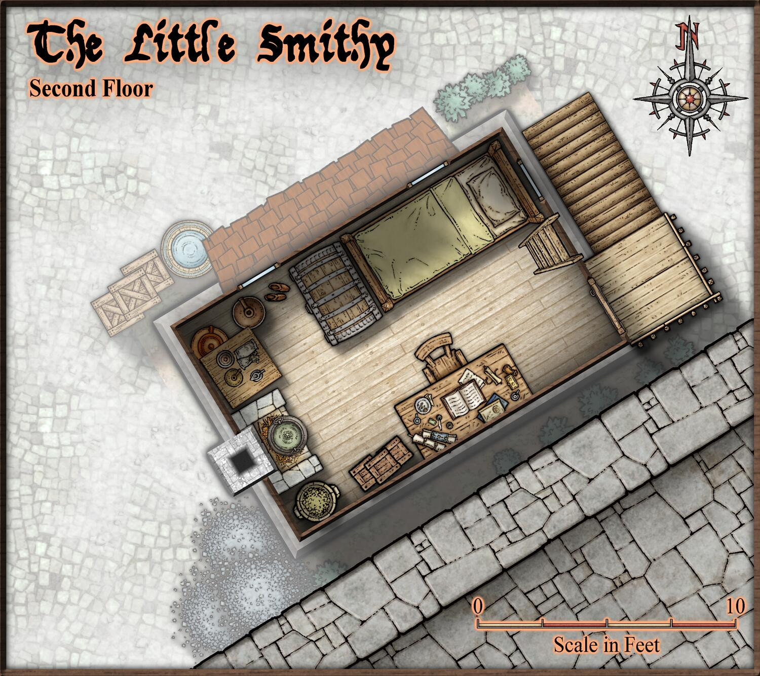
Live Mapping - City Floorplans
So, I have spent some more time finishing up my tiny little smithy from the video, so here are the current state of the maps.
-
Monthly Content Installed But Can't Find
You should find them by just clicking the :CC2SYMICOND: button and look for the "Monthly" catalogs in the list.

