


Monsen
Monsen
About
- Username
- Monsen
- Joined
- Visits
- 723
- Last Active
- Roles
- Administrator
- Points
- 9,029
- Birthday
- May 14, 1976
- Location
- Bergen, Norway
- Website
- https://atlas.monsen.cc
- Real Name
- Remy Monsen
- Rank
- Cartographer
- Badges
- 27
Latest Images


-
Creating Symbol Catalog issue.
You can just rename it. The maps doesn't refer back to the .fsc file even if you've inserted symbols from it. As long as you don't rename any of the underlying art (png) files, or the folder/path they're in, you're fine.


-
Creating Symbol Catalog issue.
What Sue says about using the PNG instead of the symbol id right, but you don't need to go around hunting for the png, simply place the symbol you are going to modify, then :CC2EXPLODE: it, that will turn it back into it's individual parts, for most png symbols that will be the image it is made from and nothing more.
But, you also said something about sheets. Do note that symbols DO NOT contain any sheets. When you define a symbol, sheet information is lost. So when creating a symbol, you should always place everything on the same sheet and just rearrange things with the front/back buttons. This ensures that ordering is proper.
(A symbol CAN go to different sheets if you use the line style to sheet options, but this splits it into several symbols on placement.)
-
Is there a runic font?
@Royal Scribe asked:
If there's a font that's not on the approved list but is available for use, are we allowed to explode them and use them as symbols for Atlas submissions, or would you feel safer only using fonts on that approved list?
Commercial fonts, assuming you actually own the license to said font, allows you to produce documents using it, so exploding it should be completely fine, as you are not making the font available to others in any way by doing that. So I have no problem with that.
(Moot question if the answer above is "no.") If there's a font that's not on the approved list but is available for use only, does the Atlas count as noncommercial use that would allow permit that font to be used as an exploded symbol?
Well, the atlas is absolutely non-commercial, neither me, nor the contributors earn anything from it. The big problem with non-commercial though is that it is poorly defined, and a lot of licenses have a slightly different take on what that actually means. Technically, this forum IS a commercial entity, because it is connected to ProFantasy's business, but most licenses are still happy with end users posting things made with non-commercial usage licenses in such forums to show off their own work as long as they don't personally earn money from it. But for that atlas itself, I don't seeany problem with using such fonts as long as their license doesn't explicitly forbid it.
-
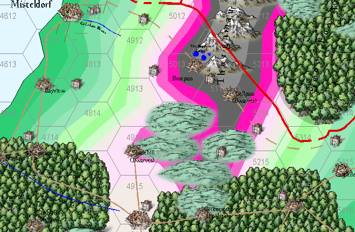
Building a world from scratch
Nice work so far.
I was looking at your .fcw files, and I noticed that some of the colors around your mountain regions were a very bright pink. I am suspecting this is not intentional and is due to you having an non-default palette installed. If this is the case, I recommend attaching the palette to the drawing so it follows the file instead of having it in your CC3+ data directory as a separate file affecting all maps. You can attach the palette from the :CC2PRESETS: dialog.

-
unsure what I've done to the border
Whenever you have issues like this, it is almost always something on the wrong sheet.
Sometimes the easiest way is to go through the sheets one by one.
If you issue the command
SAUTOHIDEONyou put CC3+ into only displaying one sheet at a time mode. You can then go to the next sheet with theSNEXTcommand or previous one usingSPREVcommand, or to a specified sheet by using theSSET SheetNamecommand.There is a small bug where the sheet indicator in the status bar says Common Sheet even if that is not the active sheet. Issuing a REDRAW command (or Ctrl +R) updates this to show the proper sheet.
Once you have identified what is wrong, which should be obvious when you work through the sheets like that, you can turn normal sheet display back on and show all sheets with
SHOWSHTF *.
