Quenten
Quenten
About
- Username
- Quenten
- Joined
- Visits
- 8,146
- Last Active
- Roles
- Member
- Points
- 3,110
- Birthday
- November 29, 1950
- Location
- Australia
- Real Name
- Quenten Walker
- Rank
- Mapmaker
- Badges
- 16
Latest Images


Reactions
-
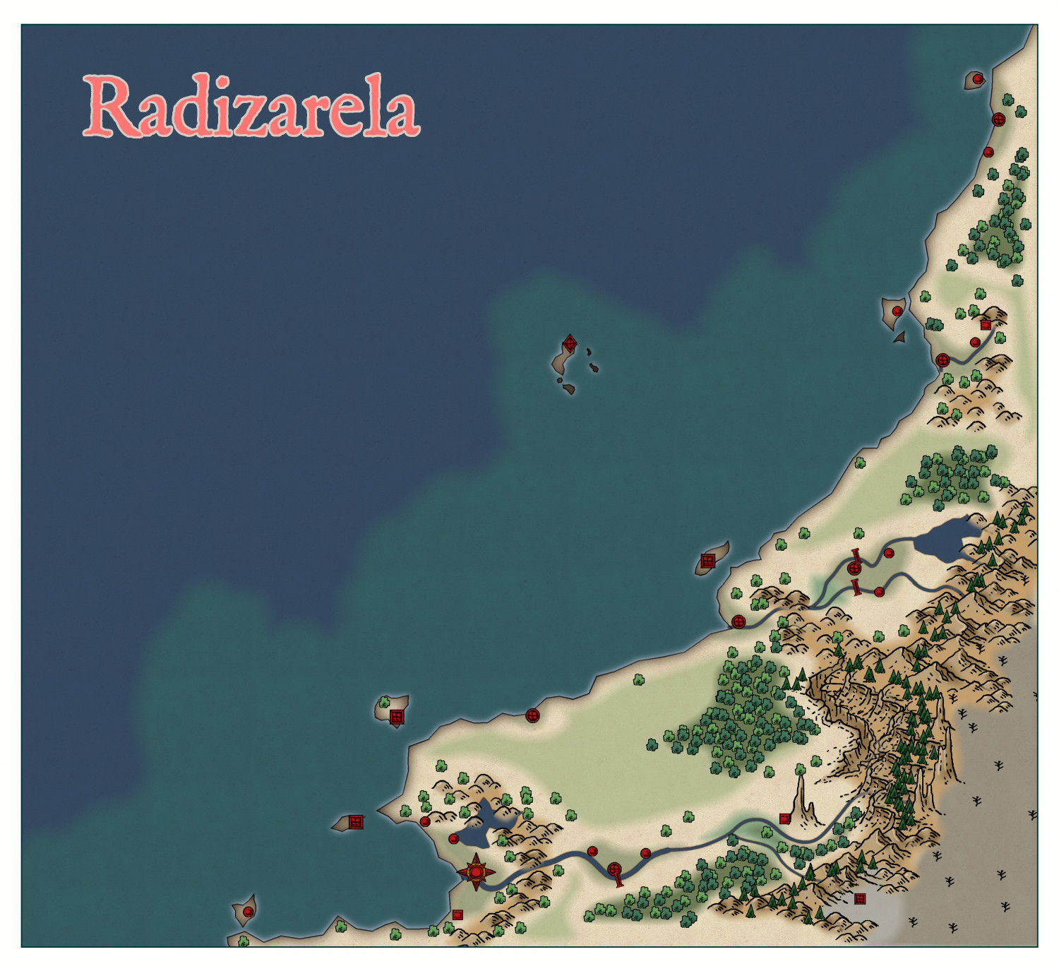
Community Atlas - Doriant - Radizarela
Intentional - it is EEEVVVIILLLLLL

-
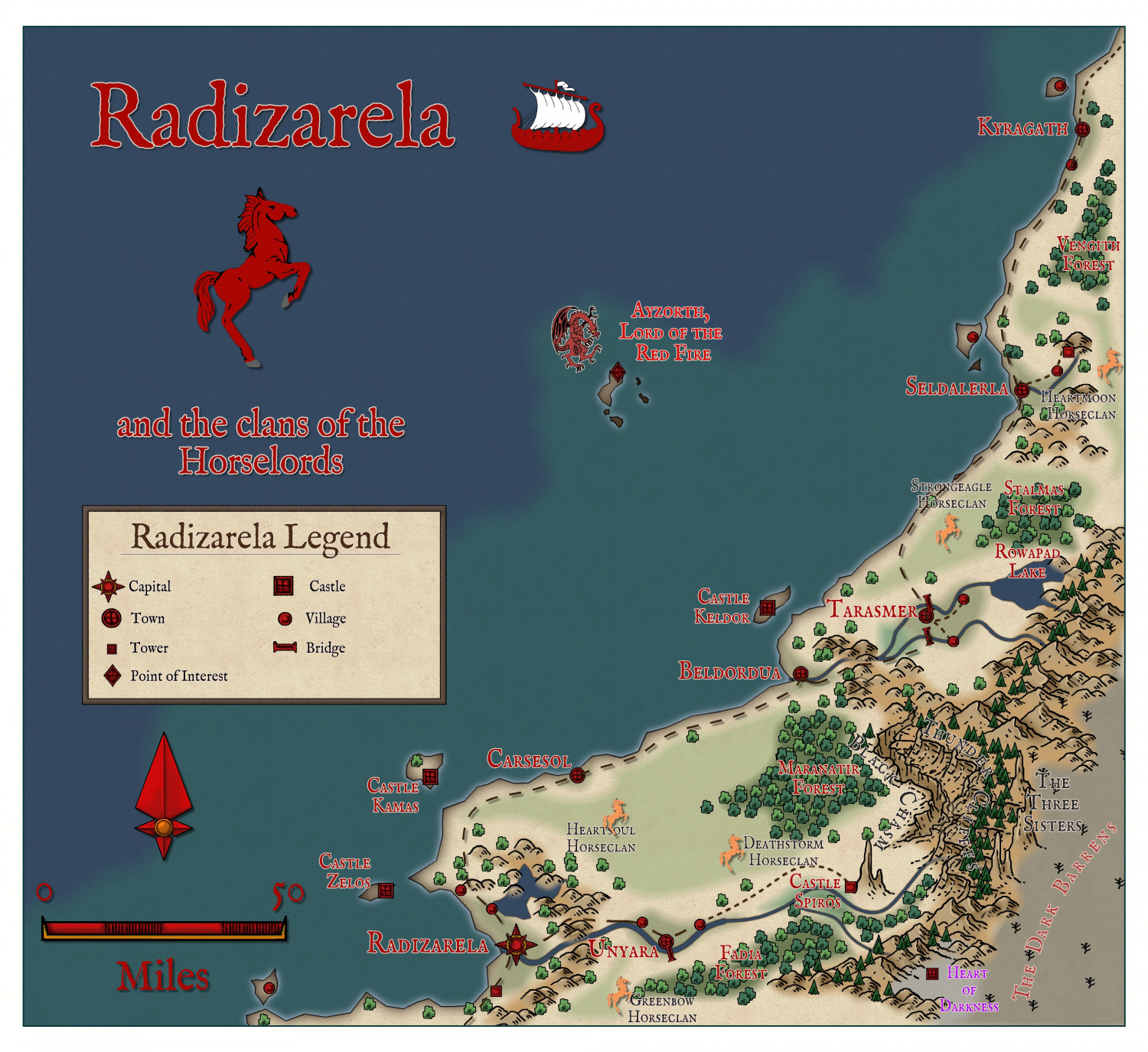
Community Atlas - Doriant - Radizarela
The finished map, ready for submission to Remy when he returns.

-
Community Atlas - Doriant - Radizarela
I have taken this bit of Doriant which would otherwise be overlooked in the larger scheme of things. I am using a style I have not used before, from the 2016 annual - Realms of Legend.
Here is my beginning.

-
Hardin region of Myirandios
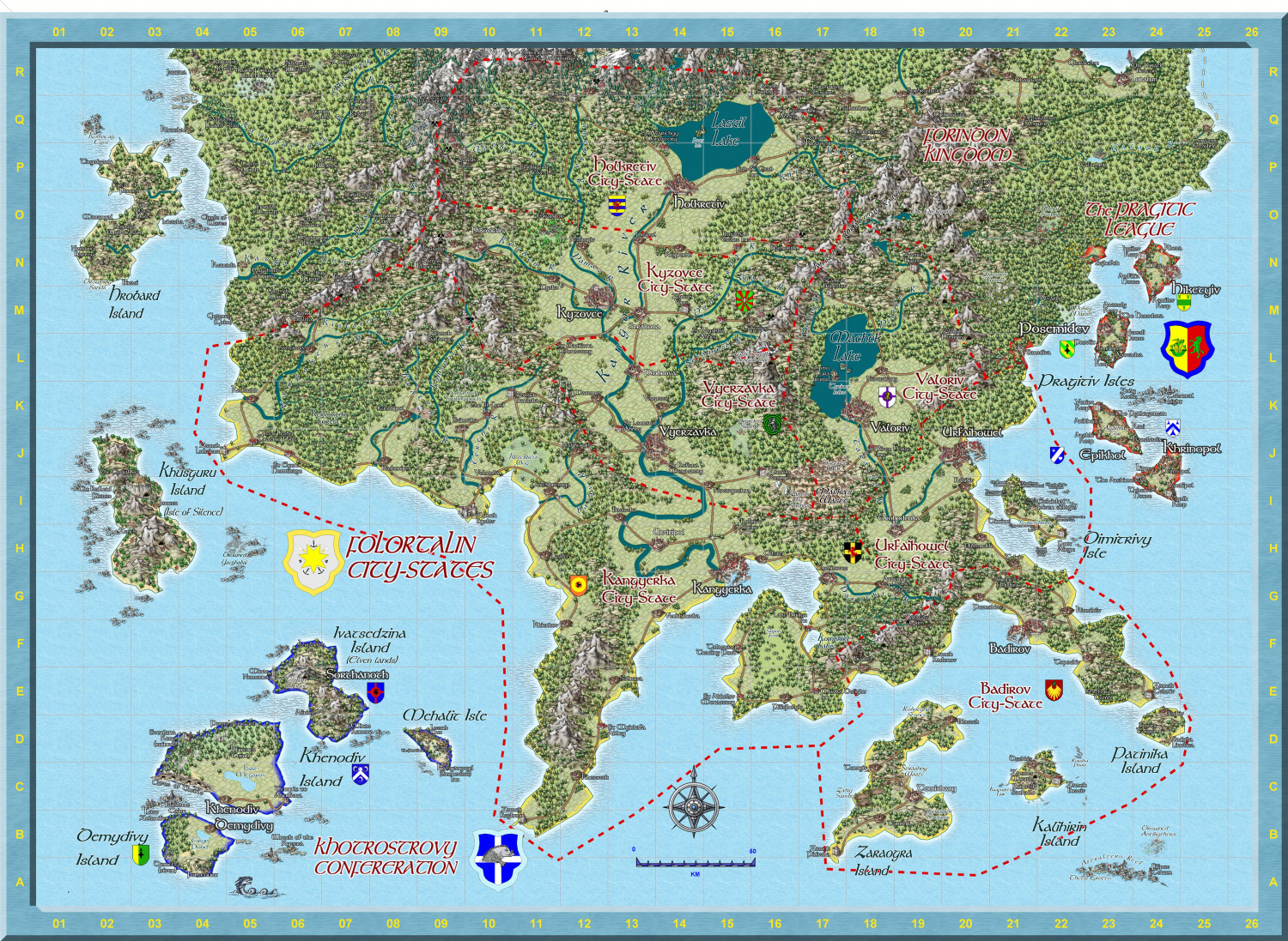
BTW, 16,001 tree symbols, in the Folortalin map, nearly all added by hand in the end. Not anywhere near Ricko's record, though! 😄
-
Hardin region of Myirandios
I am making great strides on my project. I have now completed making separate maps for each region on the Hardin map. This is one of the more complex - the Folortalin City States, which I have now completed to my satisfaction. (though I might add a character or two, perhaps - two opposing political figures?)
Sorry I can't give more detail on the map on the forum, it is already 9,6MB here, but I have saved it as a 10000 x 10000 map (105 Mb Jpg). I have also attached the FCW for any who are interested.