


Traveller
Traveller
About
- Username
- Traveller
- Joined
- Visits
- 1,578
- Last Active
- Roles
- Member
- Points
- 77
- Birthday
- June 19, 1969
- Location
- Haifa, Israel
- Real Name
- Avi Hecht
- Rank
- Traveler
- Badges
- 1
Latest Images
Reactions
-
WIP "Old Glory" - A Home Brew World
The main map was cut up, following the very good tutorial in the Tome of Ultimate Mapping (P.56) and the cut tools in CA068 (August 2012), and mapped in "Modern style" CA034 (October 2009)


-
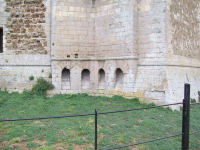
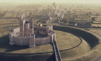
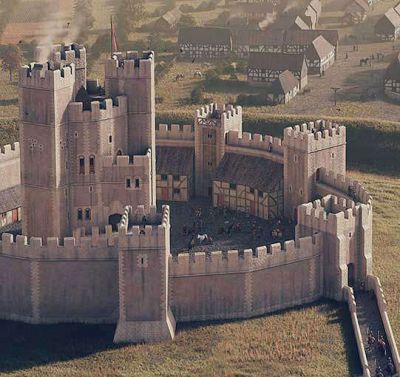
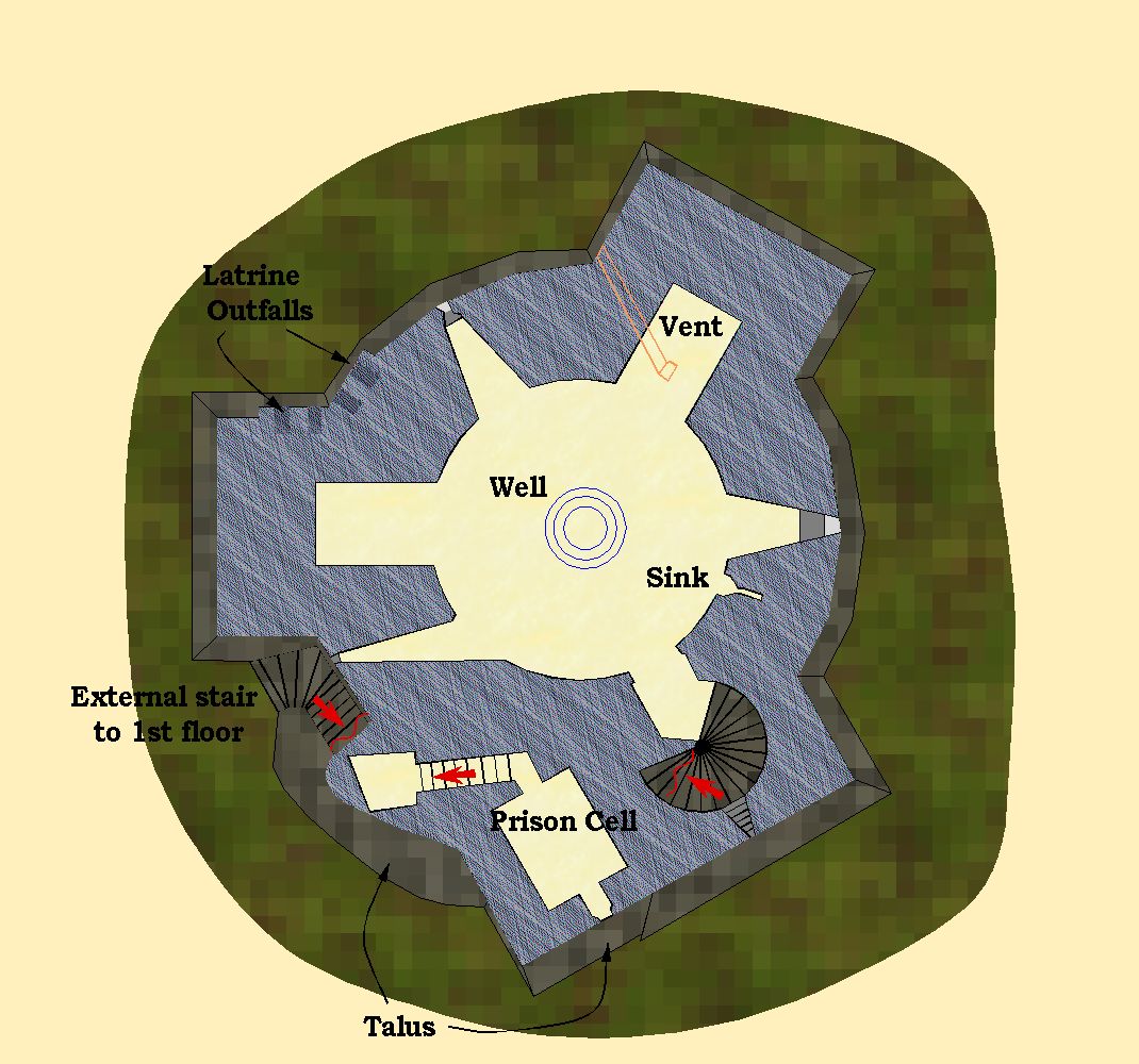
Orford Castle - England
Basement
...

-
WIP "Old Glory" - A Home Brew World
Work... Corona... Life... and here we are 2 months later, posting my regional map.
A) Learned not to save a JPG in 100 percent, 80% really gives sufficient details and much smaller files.
B) Promised myself I will not over-plan, well, one new year resolution down the drain...
First, marked Regional areas on world map:
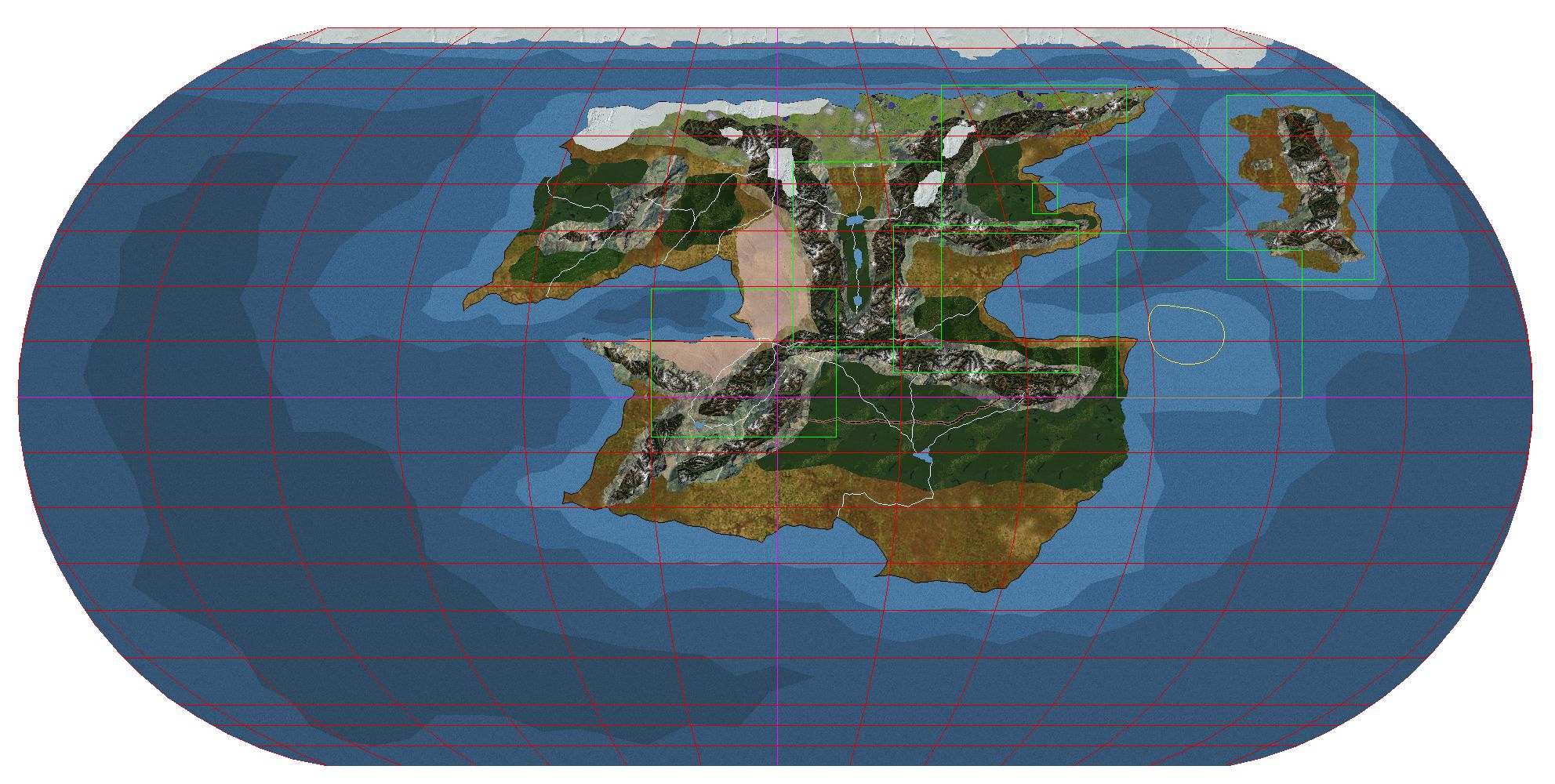
I am detailing the upper
leftright corner of the main continent -
Why should I buy CC3+?
It is "to the point" in the most medieval warfare sense !!!
As in cutting the points that hold the others armour in place and laying him bare for the killing....
![[Deleted User]](https://secure.gravatar.com/avatar/c75d9a245b74d9c59be0999ea81ca541/?default=https%3A%2F%2Fvanillicon.com%2F92add7f8c954488718110edc4896ad39_200.png&rating=g&size=200)
-
Show All Text Insertion Points
It might be worth checking if all the text is on the same layer (being an old map I guess there are no sheets).
Hide all but that layer and it will be easier to select.
And/or select by type

-
Watabou City REVISED (annual 157)
-
WIP "Old Glory" - A Home Brew World
When you right click the "smooth path" you have an option of adding arrow heads "curve with Arrow". The only less intuitive (for me) was that you start from the Arrow head and go "back"
-
WIP "Old Glory" - A Home Brew World
Hi all,
Has been great fun coming back to mapping after long time lurking... Used CC2 in the past especially during the transition to CC2+ (Realms Work Mapping Project), and recently restarted with CC3+. The newer iteration is much easier to use, especially for new users, and "returnees" ;-)
The presented maps are my home brew campaign, which up till recently operated in an empty void of disconnected adventures. Now with a regular troop consisting of my Wife, Son and the occasional friend, I decided to ground the geography and build a world atlas. Learning from past mistakes, of over planning and burn out, the plan is to map just what is needed. We live in a metric area so maps will be metric and designed to fit comfortably into an A4 printed page (with nice white borders)
The project will consist of:
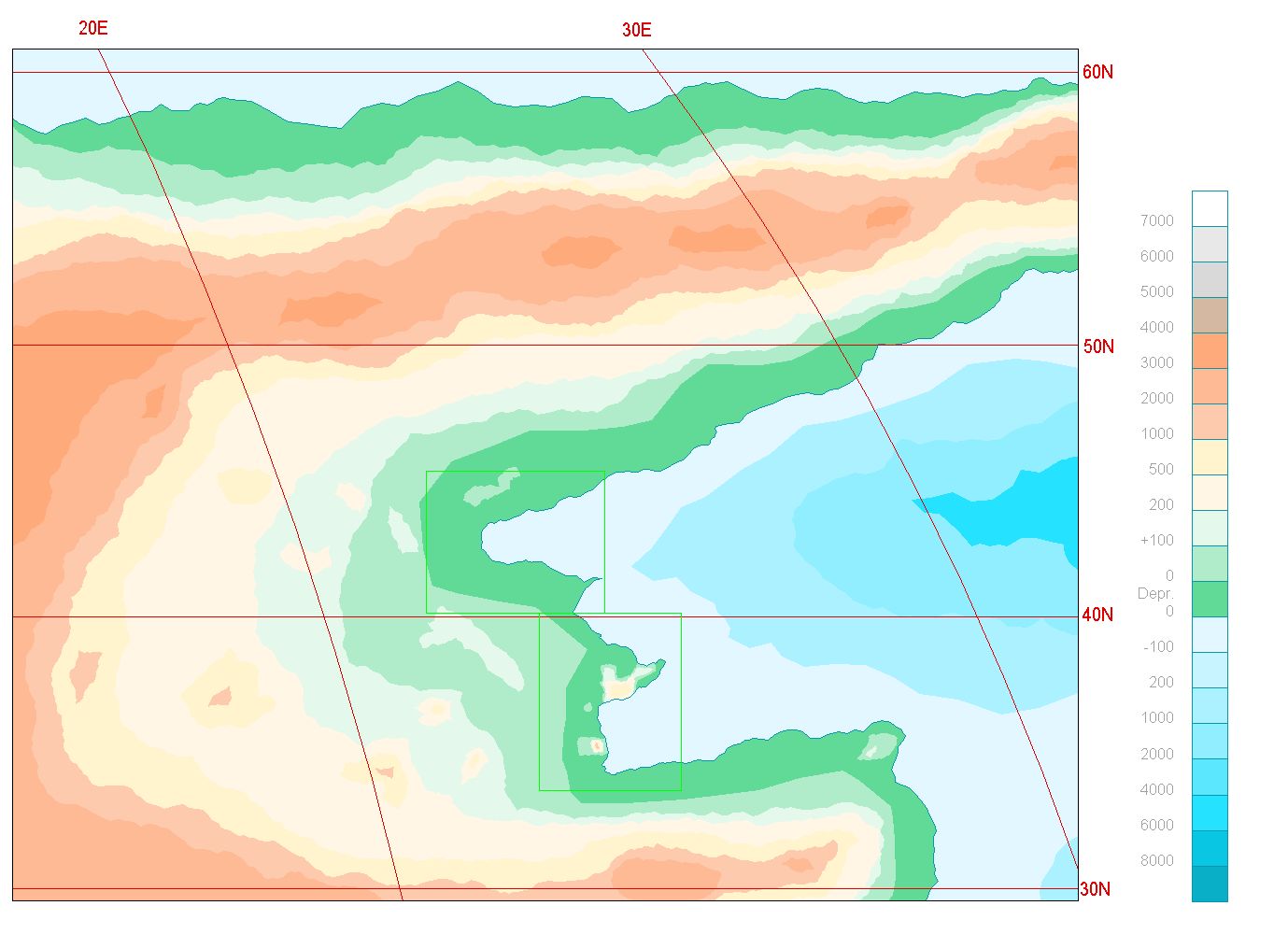
a) World map - a full world map, done using CA062 (February 2012), in "Equal Earth Projection". The size of the globe is earth like - which will make my head hurt less when trying to understand distances and their implications.
b) Regional Maps - 3000*2000 KM sections cut from the world using CA068 (August 2012), and mapped in "Modern style" CA034 (October 2009), with a smattering of selected symbols from other catalogues.
c) Local Maps - 500*400 KM (6 * 6 fit in regional map), that should be cut out of the Regional maps. Although the one I did first was, well done first, before the regional and world map, so the reqional map needed some manual fixing to match up. These will be using the classic overland template (Mike Schely).
d) Local B&W Maps - Copied from above and simplified with a selection of B&W symbols, that look more hand-drawn. I put white overlay sections on these, to hide unknown areas, then print them out for my players.
e) Detailed maps - as needed using 80*100 KM. Sections from (c) that need further expansion.
There is one city in the local region, but currently, no time line to mapp it.
So next, posting some samples...
-
Community Atlas - Forlorn Archipelago - Marine map
Landlubber heresy!!! 😋
Of-course deep water is white and the shallows are dark... We should stay clear of the shallows and keep to the high seas.
The land is light coloured, Yellow or White, not as interesting apart from navigational points. This also gives us high contrast between Land and sea.
-
Searching for symbols for WW2 and modern military vehicles, artillery etc.
Maybe look for "Squad Leader" or "Panzer Leader" sites. their counters are top down representation of vagarious WWII weapons and vehicles


