

Lillhans
Lillhans
About
- Username
- Lillhans
- Joined
- Visits
- 2,008
- Last Active
- Roles
- Member
- Points
- 2,066
- Location
- Sweden
- Rank
- Surveyor
- Badges
- 13
Latest Images

Reactions
-
Panzer sample thread
Save for colours, perhaps, mixing should be no problem. We can finally get the T34 turret/Cromwell chassi combo we always wanted!

![[Deleted User]](https://secure.gravatar.com/avatar/c75d9a245b74d9c59be0999ea81ca541/?default=https%3A%2F%2Fvanillicon.com%2F92add7f8c954488718110edc4896ad39_200.png&rating=g&size=200)
-
First Completed Map, looking for feedback
With regards to composition, I don't find it too busy; with no colours there is only so much you can convey without placing a symbol, after all.
I am looking for symbol slip-ups but you seem to be on top of the back-to-front way of doing things. So, yeah; fantastic first regional map, says I!

-
Inbetween failed video takes distraction
There is that, of course. But these would fall into the planetary-defence-grid-just-kicked-in-and-lit-up-the-sky-category. 😆

-
Festive Winter Card Challenge WIP: Ensamheten
Since the map itself is more or less done with I thought I'd spend some time on embellishments.
8 triangular shapes and a circle (colour coded for ease of acquiring when tracing the contour). I think some sort of stereotypical norse/dwarf wood carving will make up the frame of the design. Perhaps the bottom right corner featuring a figurine of some kind with a serpentine pattern for the sides - partially wreathed in a ribbon/holly combo.
Colour scheme probably needs sorting out there; going dark to bright with the cut-out effect seems more appropriate somehow - but that would depend on the tree one was pretending to paint being carved upon.
The colouring pattern kind of works, other than that, I think.

-
Festive Winter Card Challenge WIP: Frosty Village
See, here's the thing I know: it's difficult to play music "wrong" once you know how to play proper. So..what I am definately reading into this is...well...you be the trained visual artist! 😂

-
Inbetween failed video takes distraction
Got around to starting a map. Did not finish it, of course, but the video is getting uploaded once I figure out how to set up timestamps.
-
Canvas map development
Oil on canvas! Fantastic, obviously :)
"The map is not the territory" kind of has stuck with me and I tend to read a whole lot of terrain into the general area of where there is a mountain symbol - similar to how the ocean just doesn't go straight to plains (even if that's what maps tend to show us). And then, there's of course places like that location in New Zealand where they shot Edoras for The Two Towers - where the mountains go from 0 to 100 in no distance at all.
Ecotones are forever a menace :)
With foothills I see lower and perhaps slightly flatter than the usual suspects mountain proper symbols. The scope/scale of map in which foothills would be the "biggest" geological feature sort of barrs proper mountain symbols (as shown in the above example) from play simply on account of their peaky qualities.
Or not: as @jslayton points out, it isn't set in stone (puns!) and whether it's mountains or hills or foothills kind of depends on what you put next to it.
With regards to my first remark, distinguishing between mountains proper and the intermediary foothills in the same map, to me, suggests a level of landscape detail which closes in on the diorama/map as illustration of actual terrain.
-
Canvas map development
...essentially cancel all plans and do a 500 symbols mountain catalogue, yes.
-
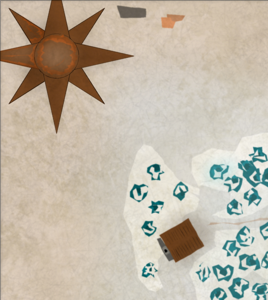
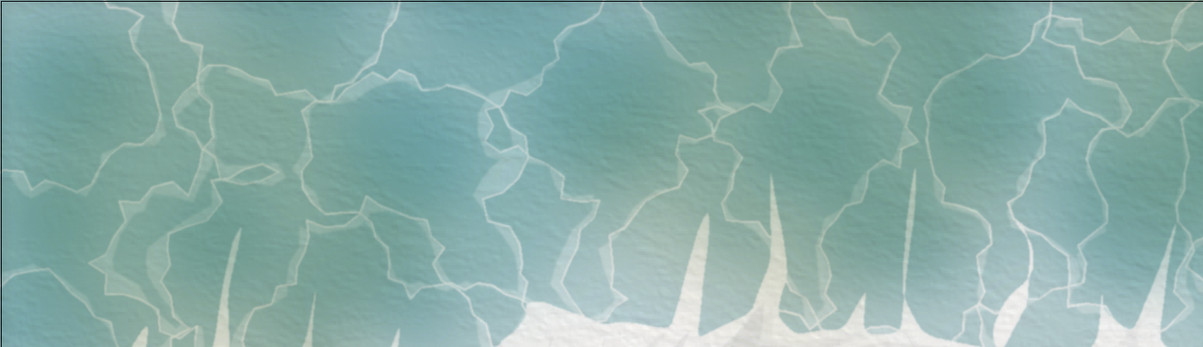
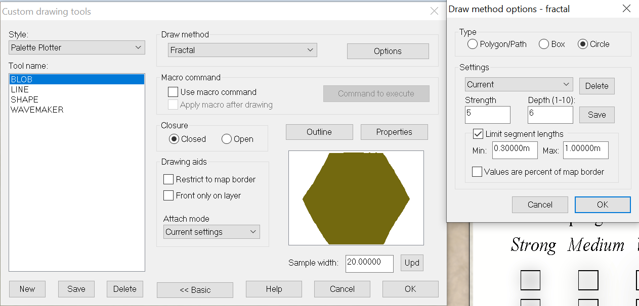
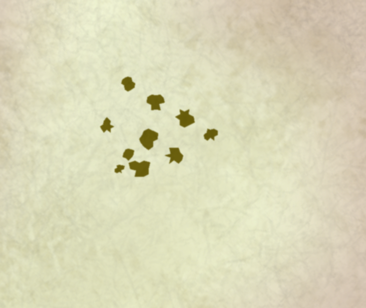
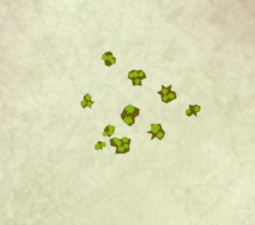
Looking for a style to match Paizo
I'd start off with Fractal Circles of a darker tone. Once you have cranked up the fractal count you can stamp random iterations real quick, Ctrl+Scrolling for size adjustments as you go:
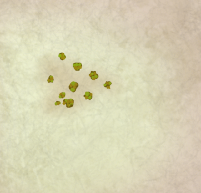
I'd then dot them, similarly, with a brighter green:
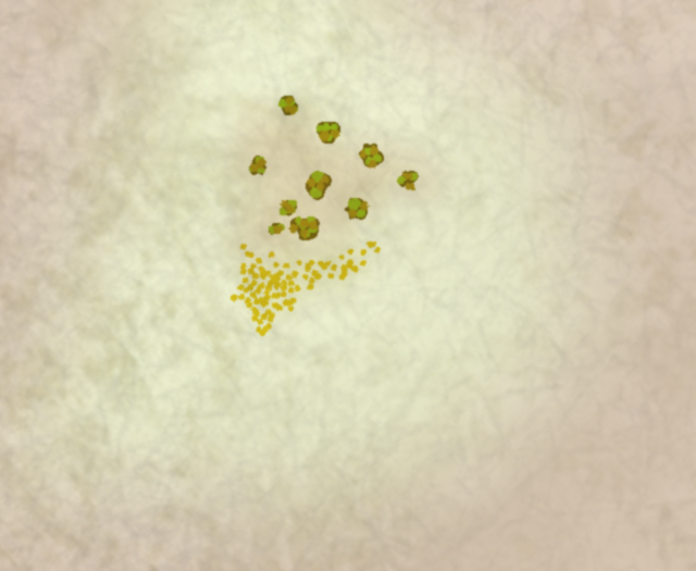
...and perhaps run Straight-To-Smooth and throw in a third colour for the foliage, also adding a brown patch on the ground, just because:
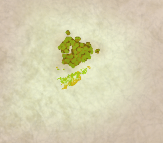
The undergrowth admittedly makes for a bit of an effort, if done similarly, but there you may opt to simply have individual dots towards the edge of the patch - as opposed to make the entire patch out of individual dots, like the below example.
Patches of trees could, of course, be done that way too: one polygon for the bulk of the body and then individuals for the edge/canopies.
-
Looking for a style to match Paizo
Walls I would probably do myself using circle and box tools.

So the bright gray here is the circle and box, respectively, which I gave a polygon contor and a splash of darker gray for variations. Easy enough to multiply strips of the same width for the wall and then the same with towers.
