

Calibre
Calibre
About
- Username
- Calibre
- Joined
- Visits
- 1,746
- Last Active
- Roles
- Member
- Points
- 1,327
- Rank
- Mapmaker
- Badges
- 10
Latest Images
Reactions
-
WIP: My version of Royal Scribe's Most Excellent Wizard Tower
And so you shall, RS---running it tomorrow and calling the adventure: A Wizard in Amber.
Will let you know how it goes.
😁
Cal


-
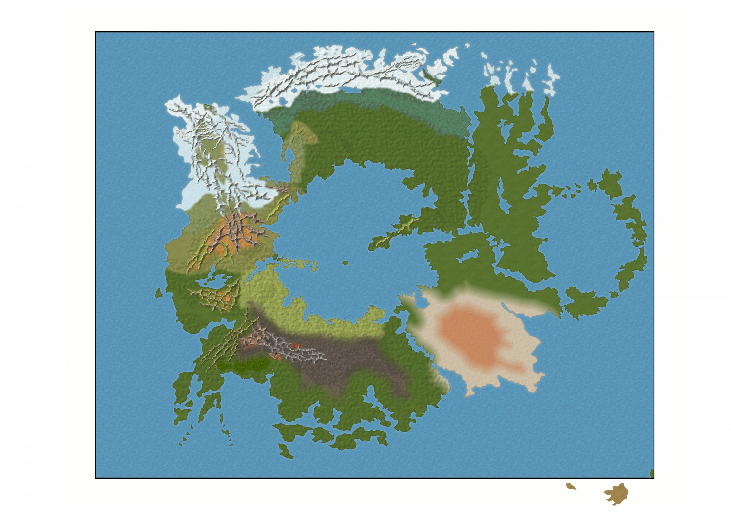
WIP: Dominion of Ostia
Ok, my fellow artists, I am progressing!

Bear with me on Font and Text colours, please. Can't make up my mind. Need to study it a bit.
Quenten: the opposing elemental force is personified in the Fane of Terranos, Earth Elemental God who keeps the ice of Immros at bay, so to speak.
Cal


-
WIP: Galaxy Map and Template...
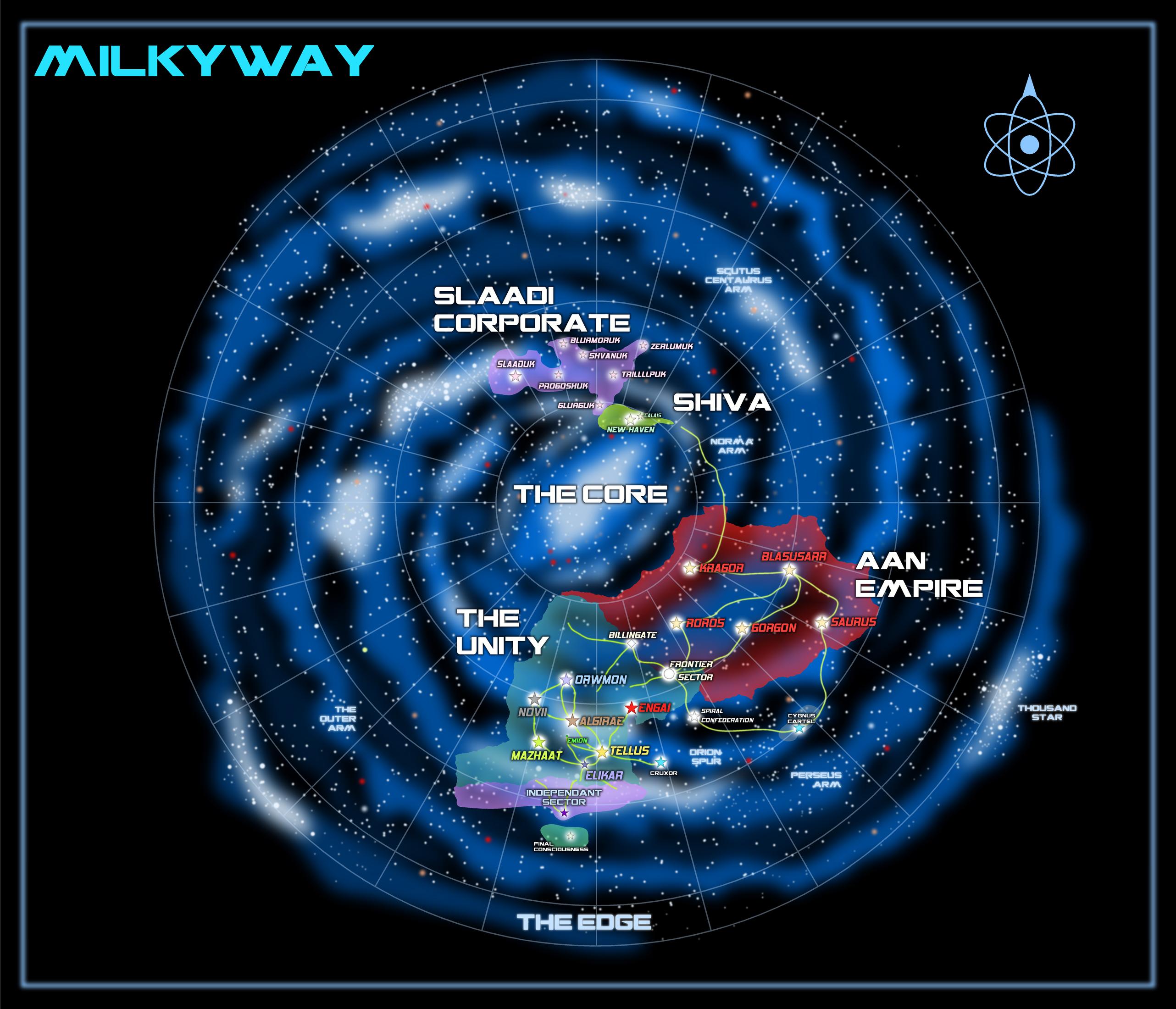
Final Version.


-
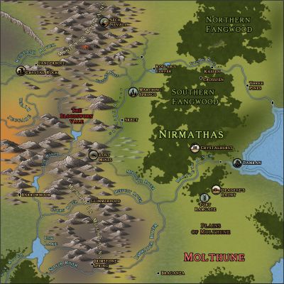
WIP: Nirmathas on Golarion
Greets!
I do not know if the following information is wanted; but I will reveal how I did this map.
First: I opened the map in Darklands overland. I inserted Spectrum Overland and Watabou Cities. These provided me with the Fills I knew I would need.
Then, draw your Land.
Then, once I had the Land to my liking, I went to the drawing tools on the right side of the screen, chose the various tools there to draw blobs of various colors. I put these on individual sheets, each color to a specific sheet. Now, add effects: blur, blend and edge fade till they 'look right to you'. WARNING: this will slow down everything. Turn off effects to help you draw out what you need.
Again: turn off effects to draw what you need. 😁
I draw what I know what I need or want. Sometimes, it takes many times to draw 'what looks right'. I can't describe this process any clearer than to say this: think outside the box.
Think outside the box.
Cal
PS: I hasten to add: You can do this with any style you have in CC3+. You don't have to have the ones I have listed here.

-
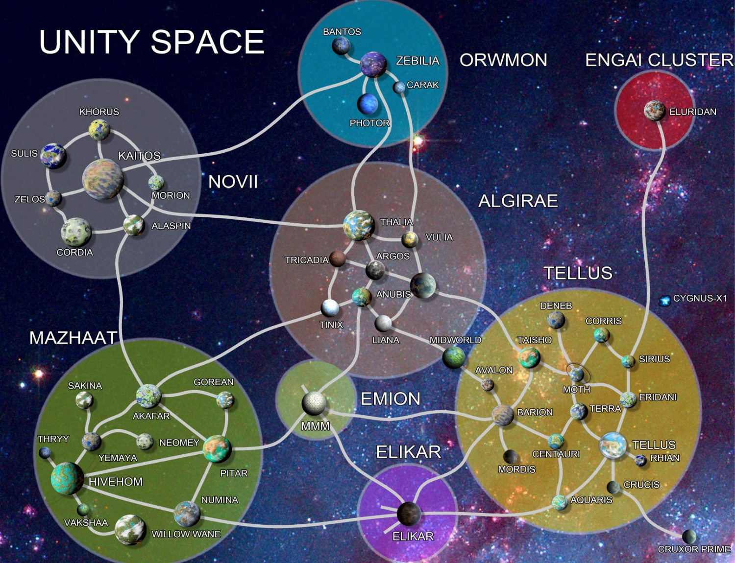
WIP: Galaxy Map and Template...
Thanks, all. For a look at Unity Space:

-
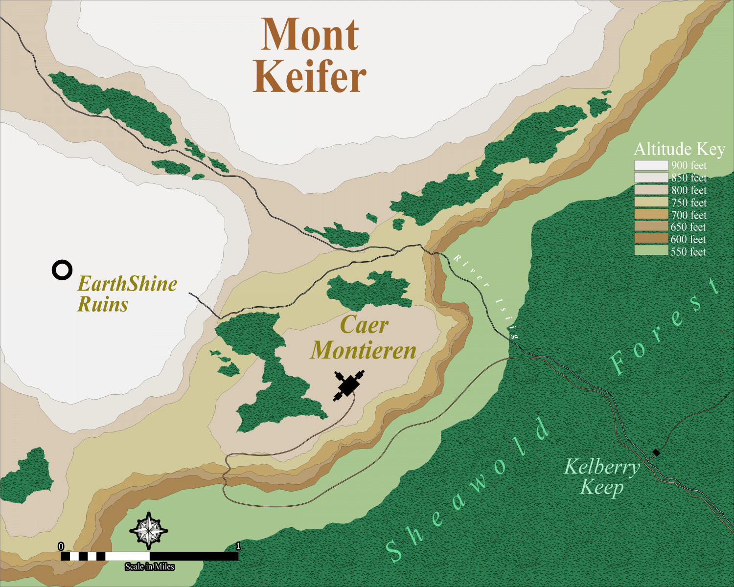
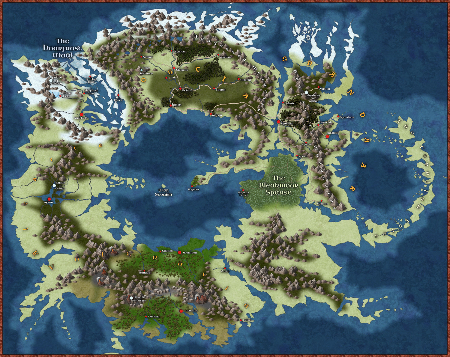
WIP: Caer Montieren: Ostia
Here's the latest version

![[Deleted User]](https://secure.gravatar.com/avatar/c75d9a245b74d9c59be0999ea81ca541/?default=https%3A%2F%2Fvanillicon.com%2F92add7f8c954488718110edc4896ad39_200.png&rating=g&size=200)

-
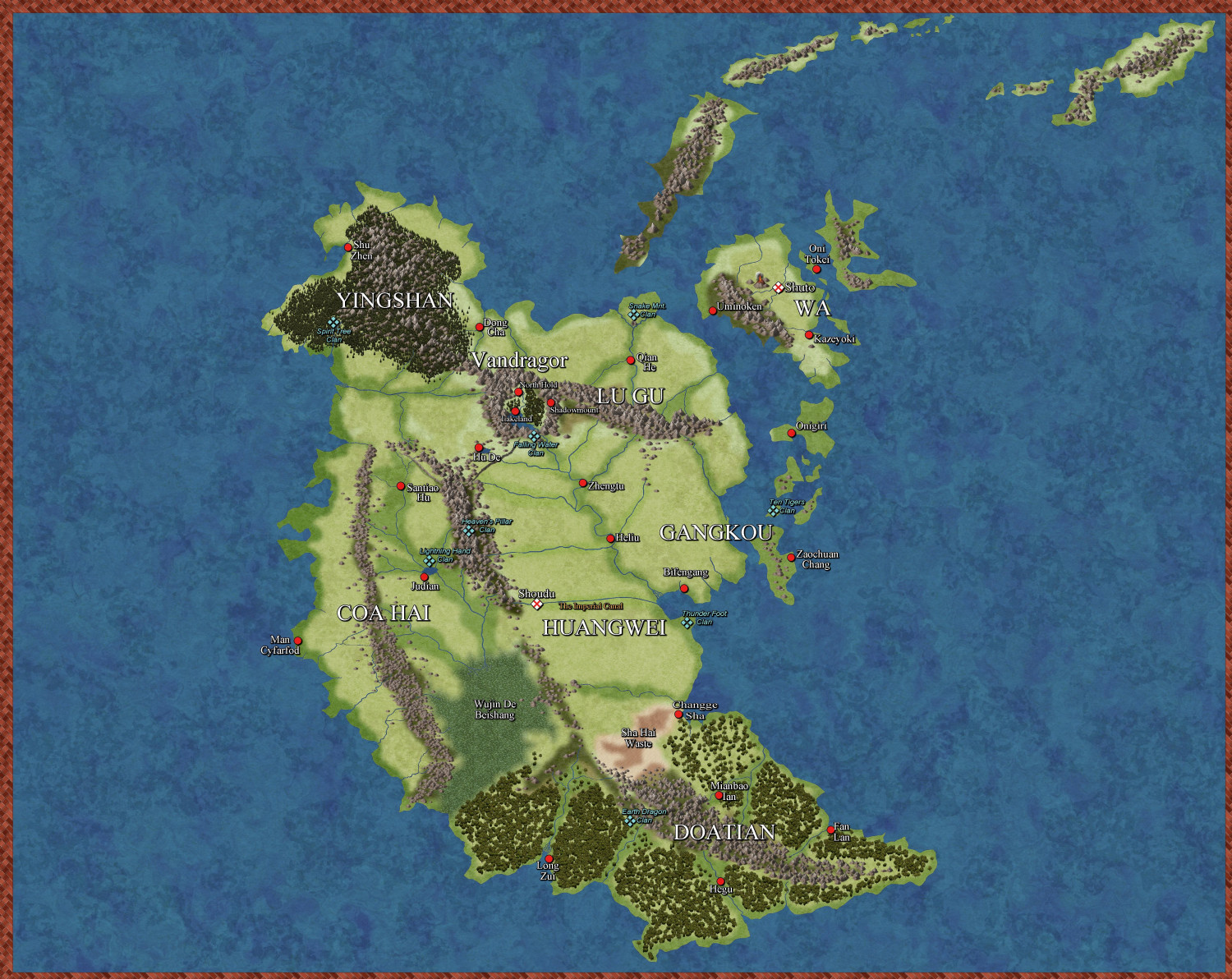
WIP: New Map, New Issues...
Nearly complete:

-
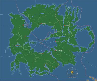
WIP: ESTONISCH CONTINENT BIRDSEYE
Ok, last update for awhile...
Still working on mountains.
Cal

-
WIP: Now, for something completely different...
Hey all,
I'm starting to wonder if this is too busy looking. The continent is 1785 miles N-S and 2255 E-W at the widest points. That's rather small for a continent. I was also envisioning it being probably twice that size. I suppose I could fudge the scale bar when I add it. I only have a couple more 'nations' to do, but I'd really like some feedback please. Too much? Not enough? ETC.
Thanks
-
Tutorial - Between hills, rivers and trees
Greets!
Great info, Ricko!
For the river attaching to the coast, I have 2 other ways of 'getting it right' 😁
1: Use the Node Edit tool on the left; grab the node of the river closest to the coast and manipulate it so that the river aligns as you wish to the coast.
2: Edit>Reshape>Stretch: to pull the end of the river to the desired location.
You could, also, BREAK the river further up from the river end, then STRETCH it to the coast as you desire. Or, BREAK it and redraw the portion that is not aligning, making sure to use F5 to attach the new river line and then F9 to ON it to the coast again.
Cal

