


JimP
JimP
About
- Username
- JimP
- Joined
- Visits
- 4,082
- Last Active
- Roles
- Member
- Points
- 3,637
- Location
- Earth or Alpha Centauri A-B system
- Website
- https://jimp.monsen.cc/
- Real Name
- Jim
- Rank
- Departed Legend - Rest in Peace
- Badges
- 18
Latest Images
Reactions
-
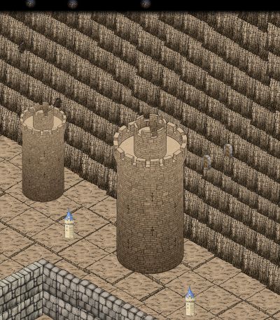
[wip] d&d Basic/Expert set of maps
Added The Cave. Adventure location.


-
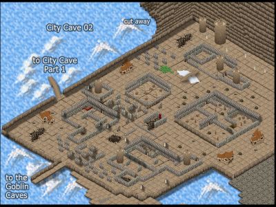
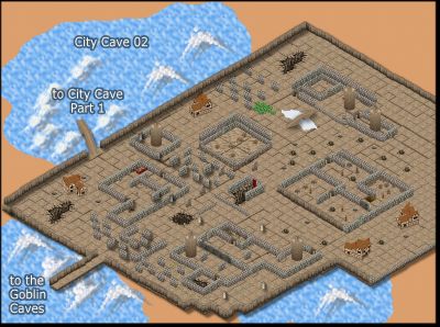
Community Atlas - Forlorn Archipelago - Fisher Isle, several villages and surrounding areas
Orc camp Chul left to do. It will also have the moonlight effect. Busy, the town, needs more work,.
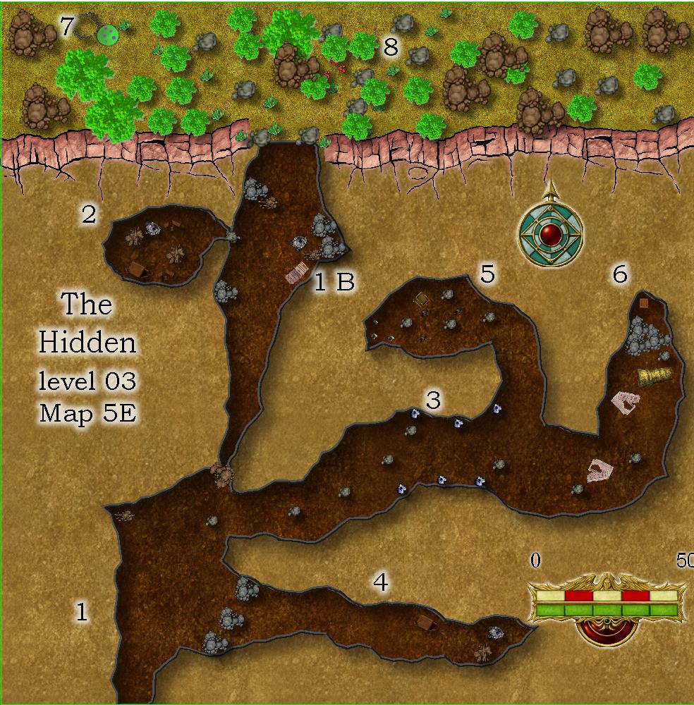
Here is an update on the 5e exit for The Hidden Level 03.
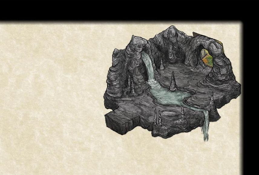
1) continous cave area. A skeleton under debris.
1 B) a rock fall on a human skeleton, a campfire and cut wood nearby.
2) old guard room. Some signs of recent habitation.
3) more cave; the blue mushrooms glow on pixie holidays. The orcs have learned to not touch nor destroy them.
4) a cave with a campfire and a pile of wood. Defensive rocks at the entrance.
5) 3 rattlesnakes, an open treasure chest.
6) Wood debris, a painted pillar debris looks like it might have been dragged here. A treasure chest, view of it blocked by a pile of rocks. This could have been a retreat area, with a treasure. Why not behind the rocks in area 4 ?
7) pixie dance ring, not used due to the orcs
8) an area of some cover, could be used for ambushes.


-
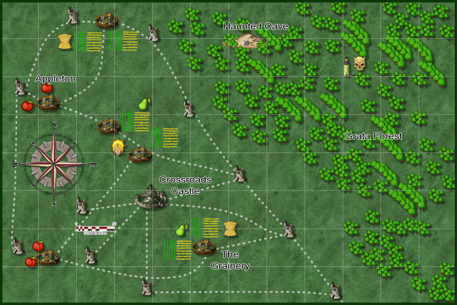
Community Atlas - Forlorn - Bleakness - The Craig dungeons and environs
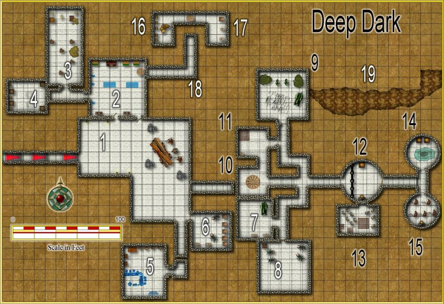
I think Deep Dark map is done. If not, please post what I need to fix.
Maps left to do are: 3 outside maps, and the connecting cave so these three areas can connect via secret door hidden passageways.
Deep Dark 900 pixel, 2000 in gallery.
![[Deleted User]](https://secure.gravatar.com/avatar/c75d9a245b74d9c59be0999ea81ca541/?default=https%3A%2F%2Fvanillicon.com%2F92add7f8c954488718110edc4896ad39_200.png&rating=g&size=200)

-
Community Atlas - Forlorn Archipelago - Fisher Isle, several villages and surrounding areas
That should be it. I had two maps I was looking at for reference, the original Fisher Island one being one of them. So 21 maps.
If I made a mistake, please let me know, but as far as I can tell, I am done with these maps.
And my car's air conditioner and engine are working great.

-
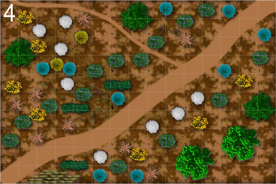
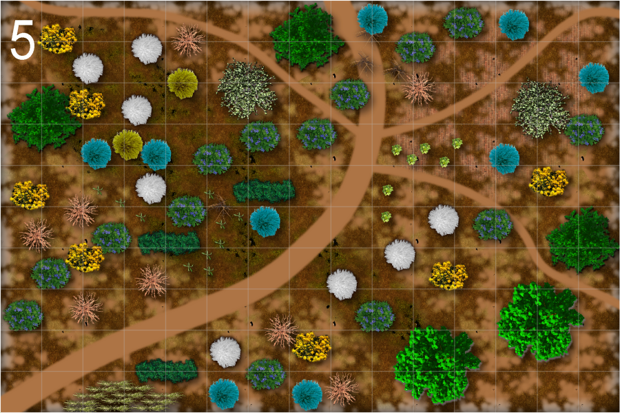
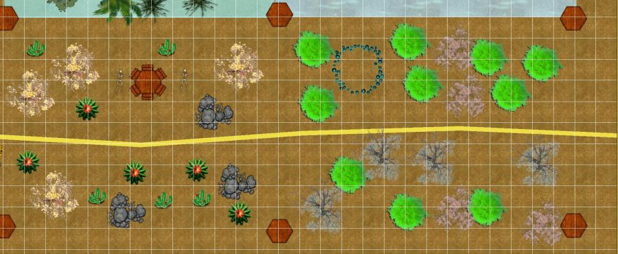
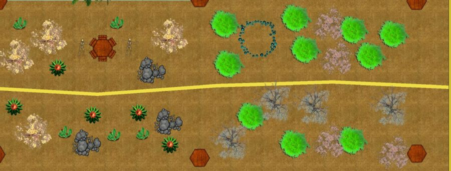
some battle maps, 75' x 50'
These are now numbered so you can more easily tell me which ones have problems. Number 4, the two bit map fills have switched sheets. Number 5 has an added brick fill, probably remnants of an old wall. Most of these have a brown color 40 for a background sheet. All other background fills are on separate sheets. I also did different amounts of edge fade, inner on these. Some have 8 width, some are 4 width, or larger. Some the outer opacity is larger than zero percent. In future I hope to find time to work on connecting tiles.
Some have a pergola, some different shrubbery, some different paths. The next ones will have bigger differences.


-
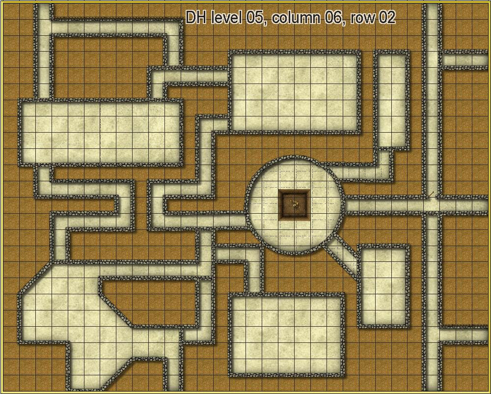
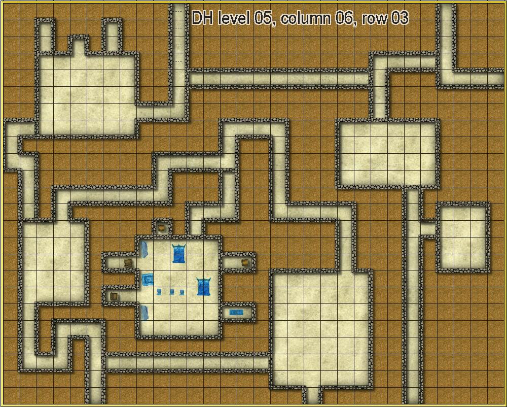
Crestar, Southern Hemisphere, Dwarf Home, take 2
Not going to post the entire level here, but I thought you might like to see the next two parts. CSUAC is where I got the ghostly furniture in the row 3 map.

-
an experiment in iso/perspectives
Upper right, needs work. I have some things to do today. So I'll probably work on this tomorrow or Monday.
Leaves bitmap fill on the floor, and a yellow color upper right. Transparency of 50% on both.

-
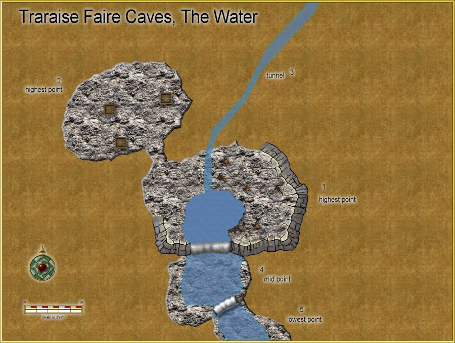
Community Atlas - Elen Daelarion - Thrarasie Faire Cave, 14 & Western Hill Fort, 16
Added 3 pits. In room 1 highest point are now bugbears and goblins. I have no idea how they got there. I suppose the water tunnel number 3.
My guess is there are here trying to figure out how to get up into the cavern and attack.
900 pixel jpg, 2000 in my gallery.
-
some battle maps, 75' x 50'
Another row completed. With and without a grid. larger in gallery.


-
YAWIP: Sea Star, a Dark city seaport
The 6 maps together in a html page.
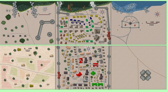
15,000 feet by 8,000 feet. Or 4.3 square miles, or 11.15 square kilometers.
I intend to make two more rows of maps, the main part of the city, where most adventurers will live and sally forth from.

