


Monsen
Monsen
About
- Username
- Monsen
- Joined
- Visits
- 723
- Last Active
- Roles
- Administrator
- Points
- 9,029
- Birthday
- May 14, 1976
- Location
- Bergen, Norway
- Website
- https://atlas.monsen.cc
- Real Name
- Remy Monsen
- Rank
- Cartographer
- Badges
- 27
Latest Images


-
Blending with background not working as (I expect?) it should
What you are experiencing here is an issue nicknamed 'Transparancy Acne (TA)'.
What happens is that as CC3+ stacks sheets on top of each other to generate the final drawing, it needs a way to figure out the Edges of the entities on the sheet just added, so it can apply edge effects. It does this by looking at the difference of the stack of sheets up to an including the prior sheet with the stack of sheets up to and including the current, and then computes the differences.
Unfortunately, when the new sheet have parts that are new, but identical (like you are using the same parchment here, although one is a bit modified, it is still the same parchment) the effects will see those parts (can be as small as a pixel) as holes with edges around and thus apply edge effects.
One way of handling this is to simply stick a sheet with a copy of your entity in between the two sheets with the parchment, and apply the same edge fade to it (maybe even a bit more). Another option which may work in your case is to change the color of your custom fill a little bit, that might be enough to avoid the issue.
Unrelated to this, you'll want to make sure to use relative paths for your fills styles, will save you issues in the future.


-
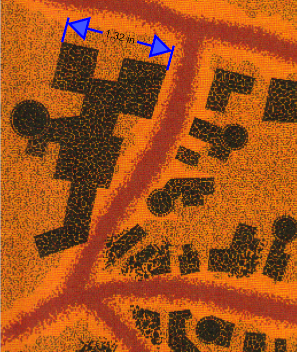
FRIA - Myth Drannor's scale
This is probably something that needs to be taken up with the original designer of the map. The FR Atlas map is just a faithful reproduction of an actual product map
The scale are from the original Myth Drannor maps from TSR.
The original Ruins of Myth Drannor Map specified 1 inch = 100 '. The non-ruin map that the one you posted is based on doesn't specify a scale as far as I can see, but it makes sense it is in the same scale as the ruins map, since it is the same place.
I looked at the original maps, and made some clips from the area around the building in the bottom left of your clip. Based on how the artist drew them, it certainly seems looks like they were drawing them like individual, to-scale buildings. But I do agree with you, the sizes is a bit large. So I'll probably chalk this down to a bit of a poor quality control with the original design. Lots of maps from those days played a bit loose with scale.

-
Live Mapping: Villages of Schley (revived)
Note that there is no reason to go around remembering the EDITSHADING command from step 3, simply using :CC2EDIT: on the shaded entity will do the same job.


-
I Can't Buy Campaign Cartographer And Other Such Products
The currency of sale will always be either UK Pounds or US dollars, no matter the country picked, we don't have pricing available in other currencies.
This shouldn't normally be a problem though. When you pay with your credit (or debit) card, your bank will automatically convert to the local currency, cards can be used to pay in any currency without actually having that currency in your account. This is exactly as it is for me, being Norwegian, my local currency is NOK, but I still use my regular cards to pay in all kinds of various currencies all over the world. Most stores only offer their local currencies, and maybe a few more, only the largest stores have the infrastructure to handle payments in the user's local currency.


-
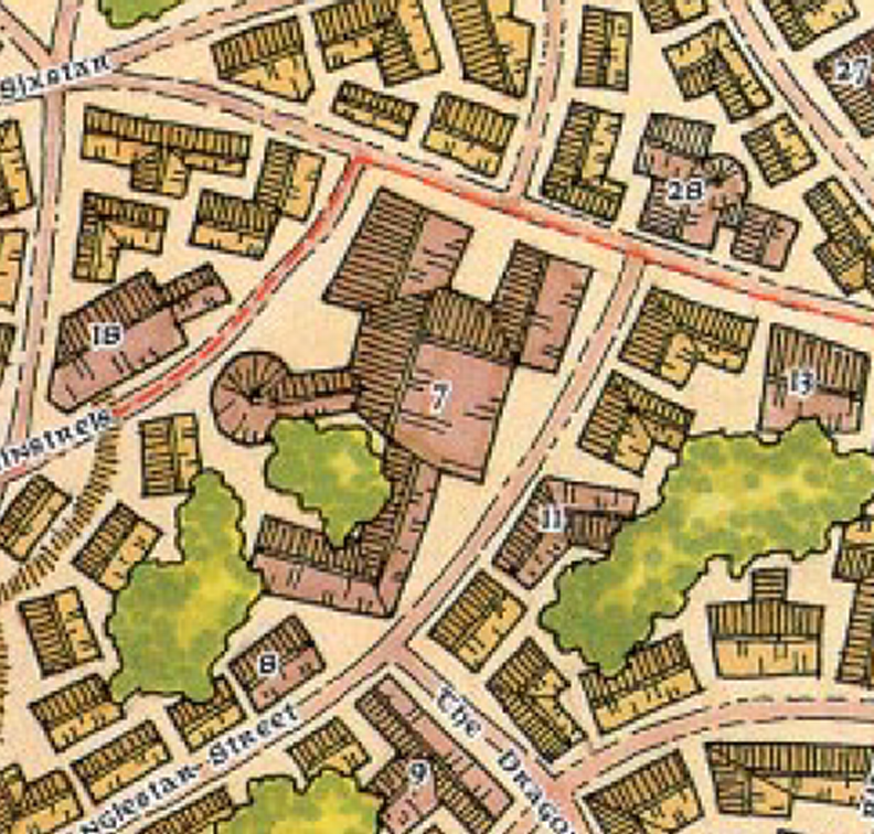
Community Atlas: Embra - Villages
To make zoom-friendly glows for text, use the Percentage of View Width effect scaling option. This means the width will be relative to the current view, instead of the map. Of course, this also requires a very different size setting for the range of the glow.
![[Deleted User]](https://secure.gravatar.com/avatar/c75d9a245b74d9c59be0999ea81ca541/?default=https%3A%2F%2Fvanillicon.com%2F92add7f8c954488718110edc4896ad39_200.png&rating=g&size=200)
-
Drawings cant be set on a specific sheet
This can only be changed by editing the drawing tool (Or better, make a copy, and edit the copy).
But, the best way to do it is to utilize a proper sheet naming scheme.
Almost all drawing tools look for sheets that STARTS with something in particular, for example, a drawing tool for the outside sheet will be set to draw on OUTSIDE*. That * is a wildcard, and means anything that starts with the text preceding it.
So, if the drawing tool is set to draw on OUTSIDE*, if your current sheet is called OUTSIDE VEGETATION for example, it will happily use that sheet instead of the default outside sheet. On the other hand, if your current sheet do NOT start with OUTSIDE, it will allways go to the default OUTSIDE sheet even if you have others starting with the word.
This same behavior applies to symbols as well.


-
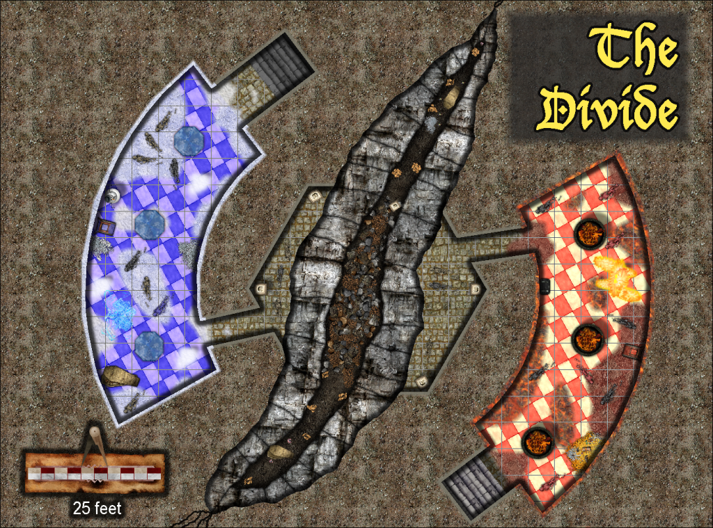
Atlas Competition - The Divide
Something like this?


-
Community Atlas 500th map and 4 year anniversary competition with prizes.
What Wyvern states is correct. That time is to allow it to become March 1st in every time zone.


-
Forgotten Realms Interactive Atlas repairs.
That's just how copyrights works unfortunately. It's still their material to do what they want with even if the products isn't available anymore.
Even if WOTC doesn't keep the patches on their site any more, they're still available using archive.org though. I just tested the links, and they work fine.
-
[Atlas Submission] - Doriant - Gold Coast - Eknapata Desert - Sakherma Ruins
These maps are now in the atlas. Thanks @Royal Scribe


