


Monsen
Monsen
About
- Username
- Monsen
- Joined
- Visits
- 723
- Last Active
- Roles
- Administrator
- Points
- 9,029
- Birthday
- May 14, 1976
- Location
- Bergen, Norway
- Website
- https://atlas.monsen.cc
- Real Name
- Remy Monsen
- Rank
- Cartographer
- Badges
- 27
Latest Images


-
Accidentally Deleted Sheet Effects Preset
You don't have to reinstall the software. That preset is embedded in the map template, and can be regenerated from it. The preset is only needed if you need to re-apply it to the map for some reason.
To recreate the preset, start a new map using the right style, the CC3 Mike Schley Overland in this case using default settings in the new map dialog, then enter the :CC2SHEETS: dialog, make sure effects is turned on (otherwise the options are greyed out), simply hit the "New" button to create a new setting based on the current map, and name it CC3 Mike Schley.


-
Friendless necromancer tower
He's used the standard Mike Schley overland style (in a nice creative way), which comes with CC3+. The building on top is one of the monthly freebies.


-
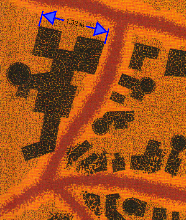
FRIA - Myth Drannor's scale
This is probably something that needs to be taken up with the original designer of the map. The FR Atlas map is just a faithful reproduction of an actual product map
The scale are from the original Myth Drannor maps from TSR.
The original Ruins of Myth Drannor Map specified 1 inch = 100 '. The non-ruin map that the one you posted is based on doesn't specify a scale as far as I can see, but it makes sense it is in the same scale as the ruins map, since it is the same place.
I looked at the original maps, and made some clips from the area around the building in the bottom left of your clip. Based on how the artist drew them, it certainly seems looks like they were drawing them like individual, to-scale buildings. But I do agree with you, the sizes is a bit large. So I'll probably chalk this down to a bit of a poor quality control with the original design. Lots of maps from those days played a bit loose with scale.

-
Is there a way to import a bunch of symbols at once?
This is true, but remember that if you do it this way, you are giving up a couple of the advantages of symbol catalogs:
- When not importing them, you don't automatically get the 4 resolutions created either. This means CC3+ will use the highest (and only) quality available for your symbols regardless of zoom level. This can impact performance
- You don't get to set useful properties like which sheet they should go on or things like symbol groups or smart symbols.
-
Drawings cant be set on a specific sheet
This can only be changed by editing the drawing tool (Or better, make a copy, and edit the copy).
But, the best way to do it is to utilize a proper sheet naming scheme.
Almost all drawing tools look for sheets that STARTS with something in particular, for example, a drawing tool for the outside sheet will be set to draw on OUTSIDE*. That * is a wildcard, and means anything that starts with the text preceding it.
So, if the drawing tool is set to draw on OUTSIDE*, if your current sheet is called OUTSIDE VEGETATION for example, it will happily use that sheet instead of the default outside sheet. On the other hand, if your current sheet do NOT start with OUTSIDE, it will allways go to the default OUTSIDE sheet even if you have others starting with the word.
This same behavior applies to symbols as well.


-
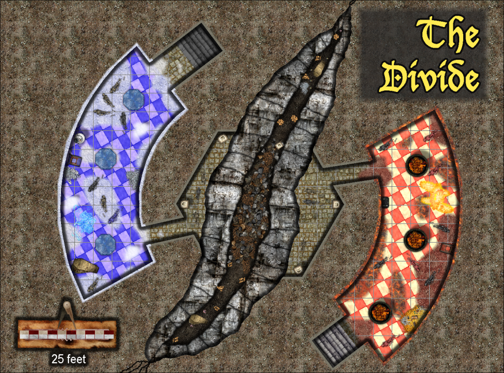
Atlas Competition - The Divide
Something like this?


-
Community Atlas 500th map and 4 year anniversary competition with prizes.
What Wyvern states is correct. That time is to allow it to become March 1st in every time zone.


-
Live Mapping: Villages of Schley (revived)
Note that there is no reason to go around remembering the EDITSHADING command from step 3, simply using :CC2EDIT: on the shaded entity will do the same job.

-
I Can't Buy Campaign Cartographer And Other Such Products
The currency of sale will always be either UK Pounds or US dollars, no matter the country picked, we don't have pricing available in other currencies.
This shouldn't normally be a problem though. When you pay with your credit (or debit) card, your bank will automatically convert to the local currency, cards can be used to pay in any currency without actually having that currency in your account. This is exactly as it is for me, being Norwegian, my local currency is NOK, but I still use my regular cards to pay in all kinds of various currencies all over the world. Most stores only offer their local currencies, and maybe a few more, only the largest stores have the infrastructure to handle payments in the user's local currency.

-
Possible map for roll20 game
I find going with my own world so much more rewarding than those published worlds. It's more work on one side, but oh so much more flexibility on the other side, and the opportunities for a place the players can truly explore rather than read all about in a book.
Map looks quite fine to me. If anything, I think it might need some more settlements, but that can be a thing for detail maps. Since it had land et every edge, you can bet that the players will soon enough want to travel there and see what is beyond, so I hope you are prepared for that.


