


Monsen
Monsen
About
- Username
- Monsen
- Joined
- Visits
- 723
- Last Active
- Roles
- Administrator
- Points
- 9,029
- Birthday
- May 14, 1976
- Location
- Bergen, Norway
- Website
- https://atlas.monsen.cc
- Real Name
- Remy Monsen
- Rank
- Cartographer
- Badges
- 27
Latest Images


-
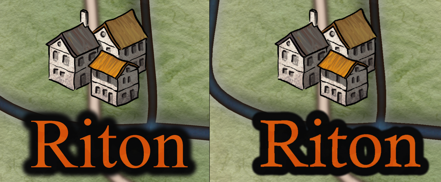
Community Atlas: The Vale, Panaur
Looks fine now. The font is still being replaced (By Times New Roman it looks like) but the difference between that and Calisto MT are miniscule anyway, so it doesn't really matter IMHO.

-
Community Atlas: The Vale, Panaur
They are, it's just less noticeable because they are broken up into individual letters.
-
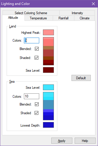
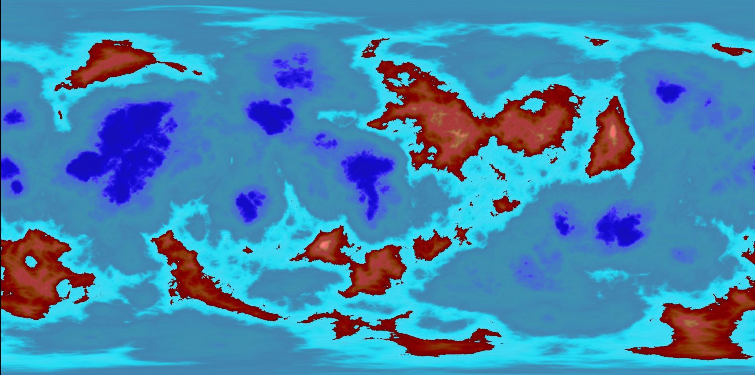
FT3: a Mars-like world, but with blue oceans ?
First, load and apply the Mars color setting
Then, go to the Altitude tab of the Lighting and Color dialog, here you can set blue colors for the sea. Just set the sea level and lowest depth color, FT3 will calculate those in between, and you'll probably want to bump up the value for number of colors too.

-
Importing a PNG File
Use Draw -> Insert file to insert it. This allow you to specify the size as part of the insertion procedure.
Or simply use :CC2SCALE: after inserting it.

-
Too early for a CC4 wishlist thread, or is it timely?
@Shessar exclaimed:
I am not fond of the dark theme that many modern software packages use, but then, I'm old and my eyes just don't see dark on dark like younger eyes might.
Good to know I'm not the only one who take issues with this dark trend. Fortunately most software lets you change, those that don't annoy me.

-
WIP - Quay thing
If you aren't doing it already, remember that relative coordinates are your friend when pasting with regular intervals. Since the next paste is relative to the previous one, one can mass paste by using the exact same relative coordinates multiple times in a row.

-
How to "blend" different terrain fills
Drawing tools select their own sheet by default, so users won't have to manually set the sheet before using a tool (Nor needing to know which sheet to pick).
You can manually change the sheet of any entity using either :CC2MCHANGE: or Move to Sheet (right click :CC2SHEETS:)
-
WIP: Fane of the Swamp People...
If you have the crop image to aspect ratio option on when exporting, you shouldn't get those white bars on the top/bottom.
The dungeon I started with is actually a below ground level, rather than an above ground but hey, what can you do?
It gets a bit more interesting when using the dungeon walls, since a regular floor mask would cover up all the unevenness of the stonework. But I am wondering if you could use TRACED to generate a polygon made up from the total area of both the floors and walls here, perhaps with a distance of -0.5 or something like that to make the mask "hole" for the dungeon to give that below ground feeling. Probably need to do something with the path to the entrance too though, to make it look like it is sloping downward towards the entrance.
-
Help adding the monthly content to existing map!
They are cumulative, you only need to install the latest one.
-
Joint work with a colleague architect and the results are stunning!
Looking great. Very nice work there.
The fill in the street in the second one looks a bit repetitive though.

