Quenten
Quenten
About
- Username
- Quenten
- Joined
- Visits
- 8,148
- Last Active
- Roles
- Member
- Points
- 3,110
- Birthday
- November 29, 1950
- Location
- Australia
- Real Name
- Quenten Walker
- Rank
- Mapmaker
- Badges
- 16
Latest Images


Reactions
-
MY MUNDI IS READY!
@Ricko Hasche I have to disagree with taustinoc - I think the land does look above the ocean.


-
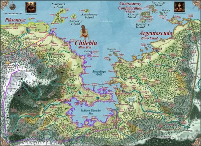
Ukadarlia
And the map with the English meanings.
Vynlings = Icelandic; Kratirim = Ukrainian; Aeifa (elves) = Irish Gaelic
-
Sinister Sewers - Style Development Thread (CA207)
Don't forget the advanced plumbing of the Minoans - they had flushing toilets, not reinvented till the 19th century. Don't know about their sewer system, but it would have been fairly advanced I think.

-
Sinister Sewers - Style Development Thread (CA207)
I want sickly vomit yellow!!!
-
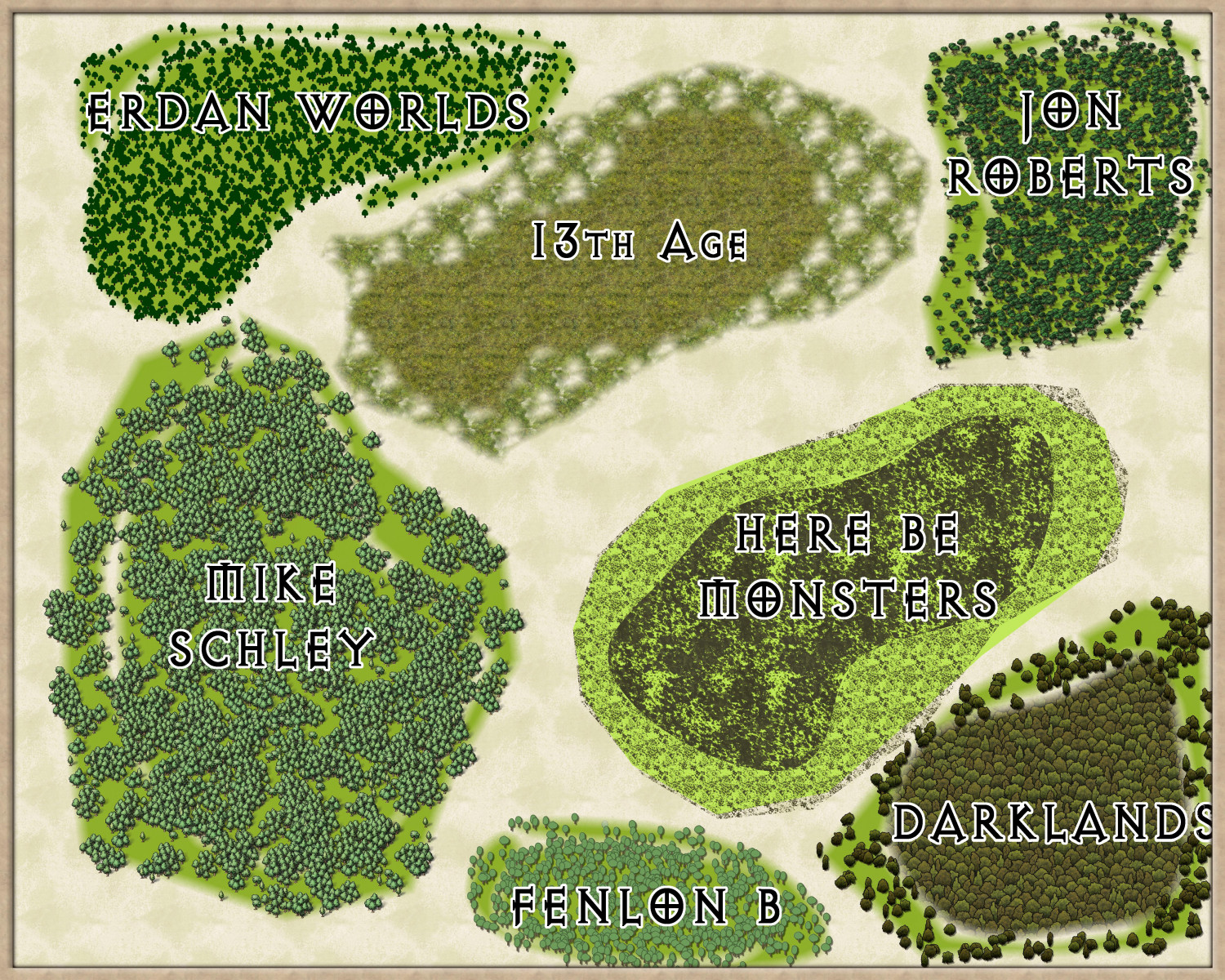
Forest depictions for large overland map.
Here are seven different depictions of forest that I would like your opinions on as to which is best. It is for a commission I have, and also will be used in my own Ukadarlia project.
If you have other thoughts, that is also welcome, but i really want to know which one you like best, and also the one you like least, even if you don't like any of them.
Each has dense forest in the centre, and woodland at the periphery.
-
CC4 Overland Development Thread
Love the mountain. For me, the snow is still a little bit too blue (though I can always fix that with Alter Hue effect if need be).

-
[WIP] Marine Dungeons Lighthouse (more May Annual Stairs & Steps)
And mangroves - needed for overland in Mike Schley style (which sadly neglects tropical regions), as well as dungeon maps.

-
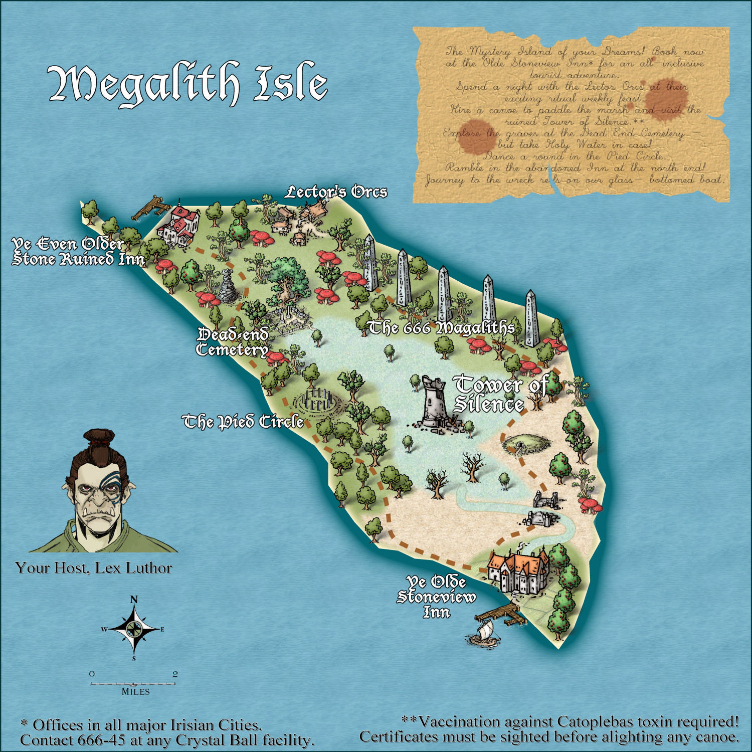
Community Atlas - Irisian City States - Megalith island
Here is another version. Comments desired.

-
What's your favourite overland style?
The other top dowm ones are 13th Age, and Sue's birdseye.
-
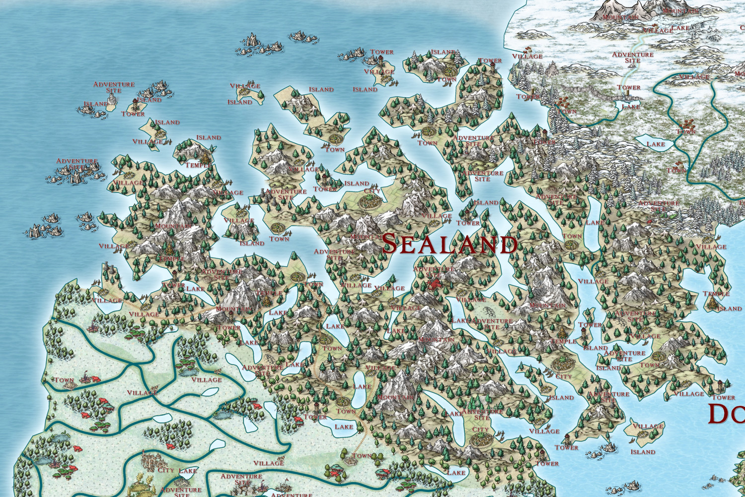
The Ten Kingdoms
Sealand Kingdom.