Quenten
Quenten
About
- Username
- Quenten
- Joined
- Visits
- 8,145
- Last Active
- Roles
- Member
- Points
- 3,110
- Birthday
- November 29, 1950
- Location
- Australia
- Real Name
- Quenten Walker
- Rank
- Mapmaker
- Badges
- 16
Latest Images


Reactions
-
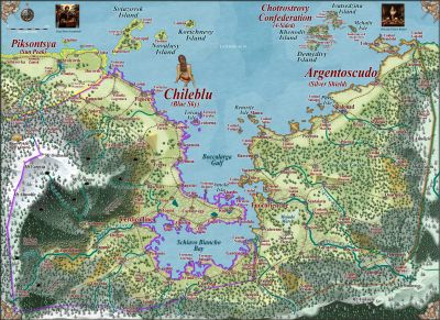
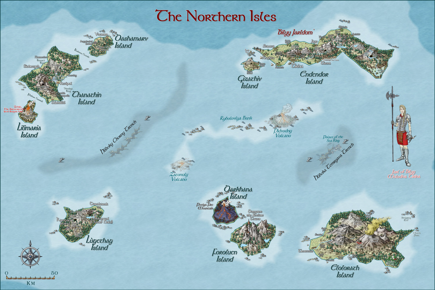
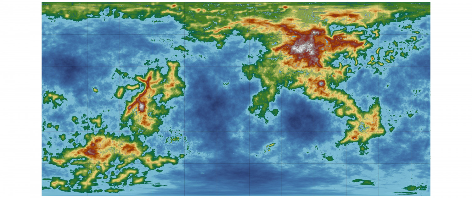
Hardin region of Myirandios
Here is the region of the northern Isles, with each island detailed. The uppermost left island is the closest to there being a 'nation', mainly due to the efforts of Melodiva Tirina, the charismatic female leader of this hardy folk. I am going to do a sketch using Character Artist of both the Sea king and Melodiva Tirina (as she is an important person in this fantasy world). And also try to use it to do the sea creatures, the Muru.


-
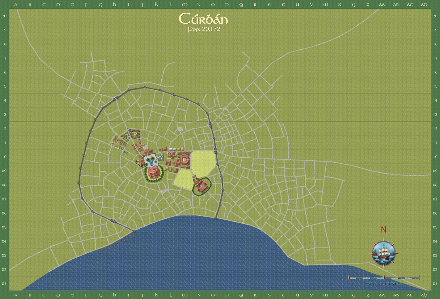
Curban - an Elven City WIP
I am now doing another city (my favourite type of map) - the capital city of the Elven Queendom of Aillte-Lonrach. I will show it as I progress - almost finished the city centre.
The street layout i got by using the Watabou city layout, and The style I am using is a mix of SS5 and Watabou revised. And Shessar's magnificent compass and scales.
Here is the total city.
Here is a close up of the city centre. The text is deliberately small at this stage - more a reminder to me of the sort of buildings I need to put in.
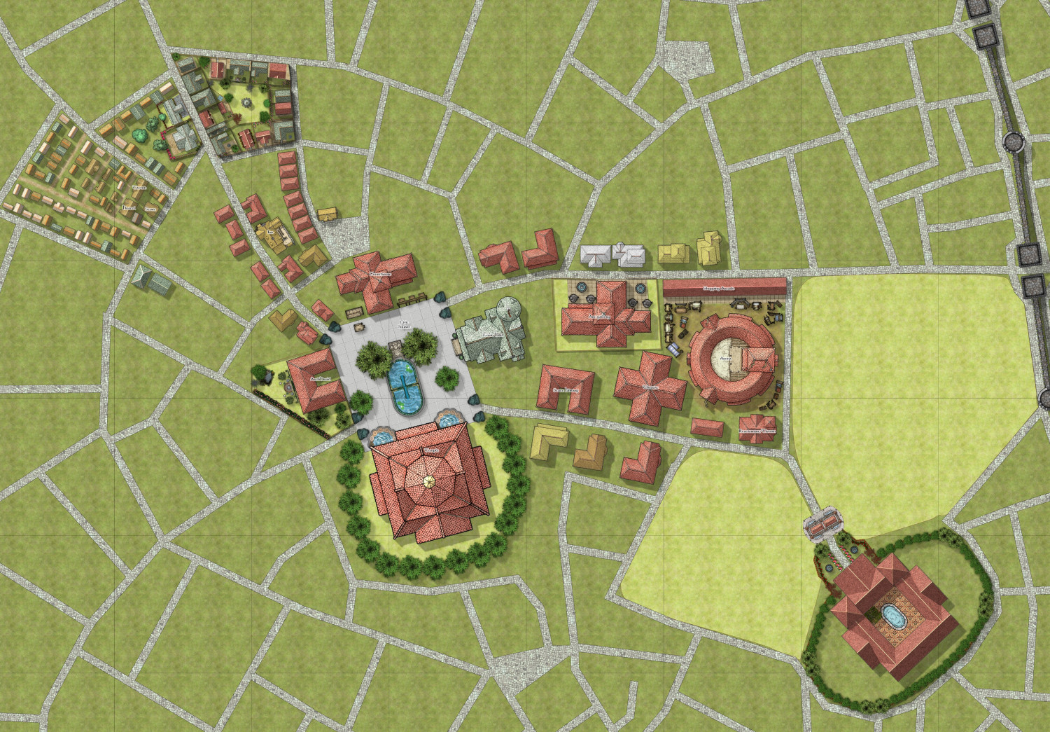
After I finish the centre, I am going to concentrate on the dockside area.


-
Hardin region of Myirandios
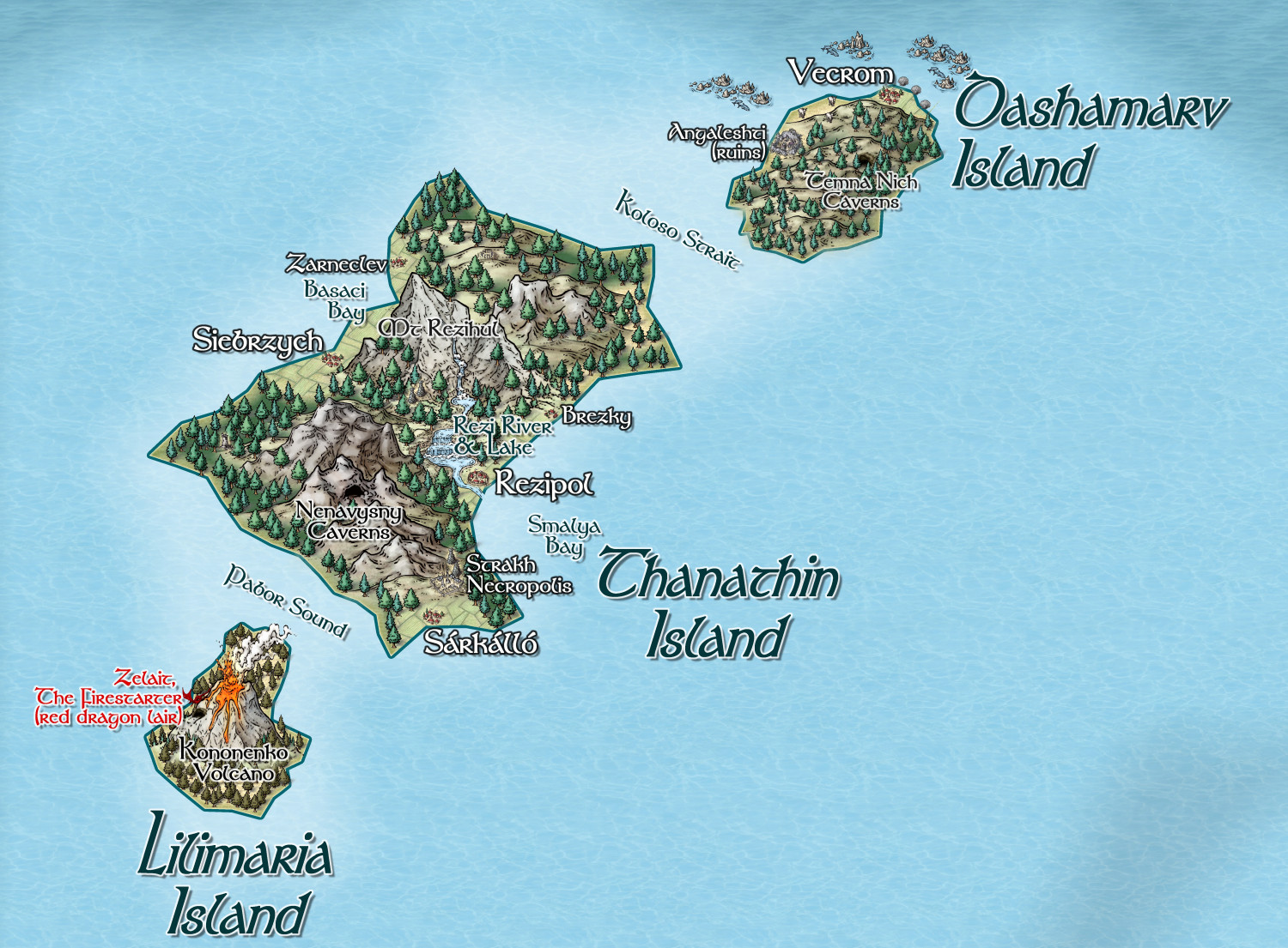
Another group made up of self-sufficient settlements, but with closer development towards forming a cohesive 'nation', with regular meetings of leaders of each settlement and farmstead in something like the ancient Icelandic Althing. This has largely been motivated by the increasing threat posed by an ancient red dragon, Zelait.

-
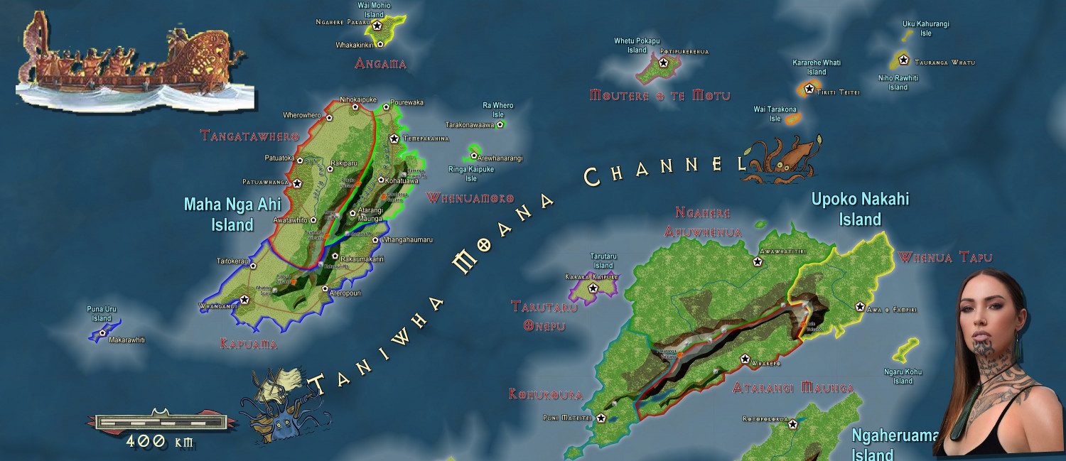
Developing new Overland bird's eye view Overland style for my world maps
The map so far - much to be done, or course. Comments and advice VERY welcome.


-
[WIP] Tatilana, a new world
Tatiana and I have decided to collaborate on creating a new world, using this map I have created using FT3. (just got to get it into Wilbur and back again).
It is named Tatilana after Tatiana, and our adopted daughter, Ruslana.
We aim to produce many regional maps, and also details of cultures, physical characteristics, histories and also adventures, to turn into a Game Aid for Roleplaying games, hopefully to publish, with illustrations done by Tatiana (who is very artistic).
Here is the final FT3 map to be 'Wilburized'. I have added lakes, but they are not on the MDR. As you can see it readily divides itself into East and West continents.
I am not going to bother with tectonics - just assume they are appropriate for the geological formations as is. There will be a 'Ring of Fire', earthquake zones, as well as wind and ocean current details, so I can work out the biomes. I hope our resident experts can guide me with this after I post the first maps showing them.

-
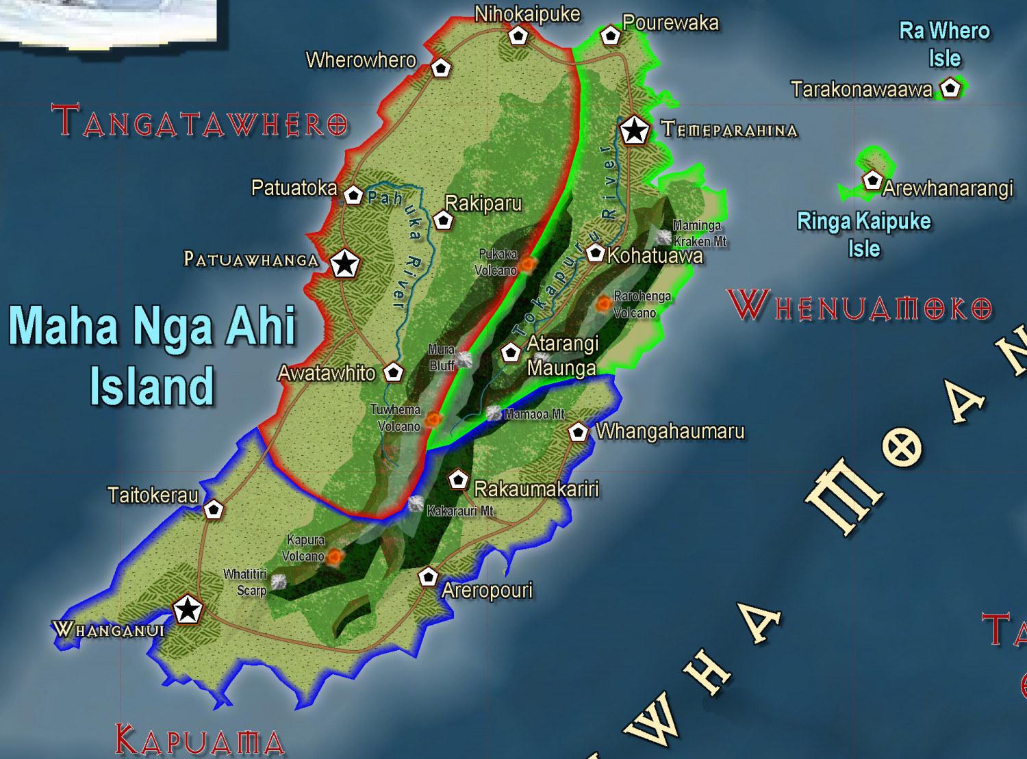
[WIP] Tatilana, a new world
I have made a start on the focus area which Tatiana has chosen. An Andean type range, I see. Obviously some contour alteration will take place, to fit the rivers that were generated in FT3. Each grid square is 500 km.
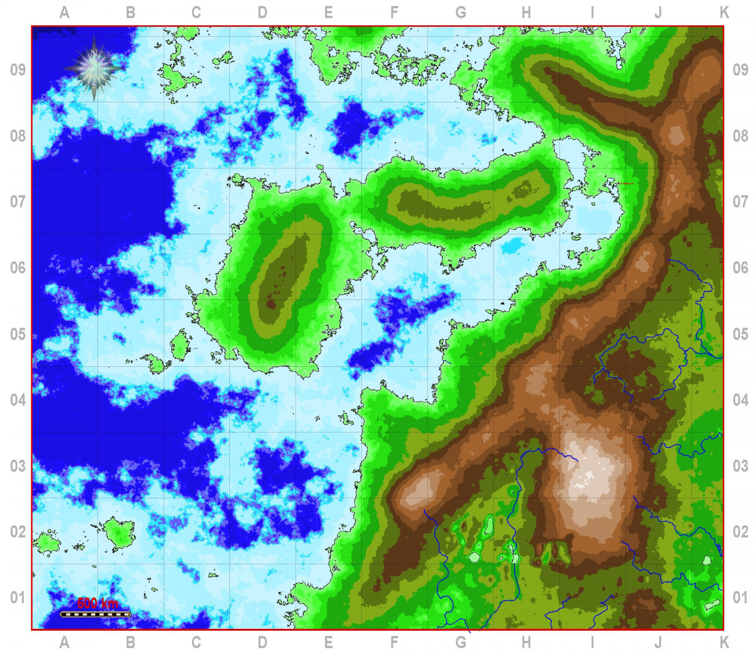
We will have fun working out the histories and cultures - to be shown in map form as well, of course.
-
Hardin region of Myirandios
Here is each island close up.
Two rather 'evil' islands, and a major reason why the region hasn't consolidated into a nation state.
-
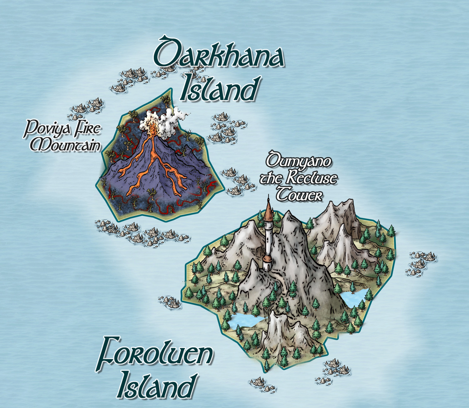
World of Tatilana - Free Towns of Chervonyahuar (Red Jaguar)
Thanks. It is going to be the focus of what I hope will be a pdf I can sell on Drivethrough RPG, and will include stuff about the world as a whole, as well as detailed stuff on this area in particular. So far I have 18 linked dungeons and 12 settlements to this map, which I have begun work on.
Tatilana is named in honour of Tatiana and her adopted daughter, Ruslana.
-
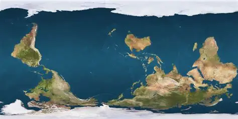
Interesting Political Take on the Mercator Projection
OK, Aussie here. We need a far more radical revision. Not only a map reflecting true land size (good bye England), but the South pole in its rightful position at the top of the page!!!!!

-
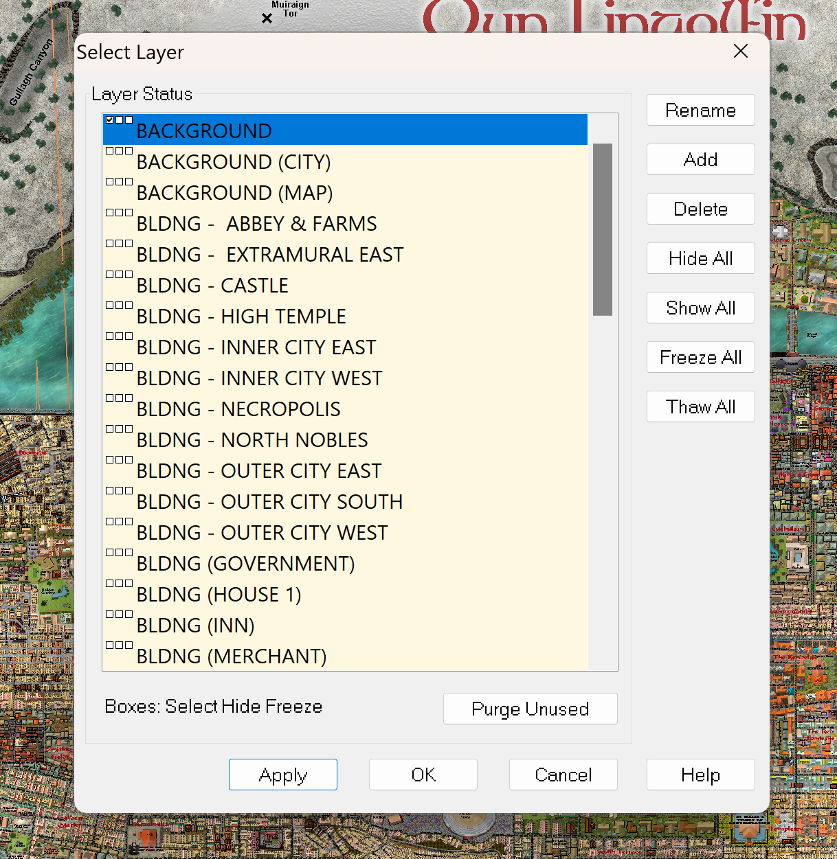
Creating large cities without crashing
And here are the Layers that I used to do each district separately.