


Quenten
Quenten
About
- Username
- Quenten
- Joined
- Visits
- 8,145
- Last Active
- Roles
- Member
- Points
- 3,110
- Birthday
- November 29, 1950
- Location
- Australia
- Real Name
- Quenten Walker
- Rank
- Mapmaker
- Badges
- 16
Latest Images


Reactions
-
[WIP] Isometric city
This is the very first time I have done anything perspectives or isometric. But I was inspired by Ralf's recent video, and the current Annual issue, so I decided to give a big city a go.
Here is my initial layout - cliffs, main roads, coast and walls done.
One observation - the walls look a bit artificial with the straight parts and only 4 directions. But I hope that will not be so obvious once I add vegetation and buildings.
Comments, as always, welcome - you can only help me get better.


-
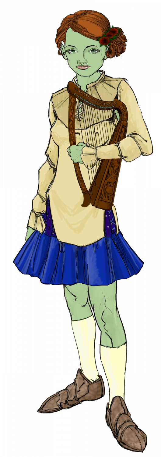
Ukadarlia
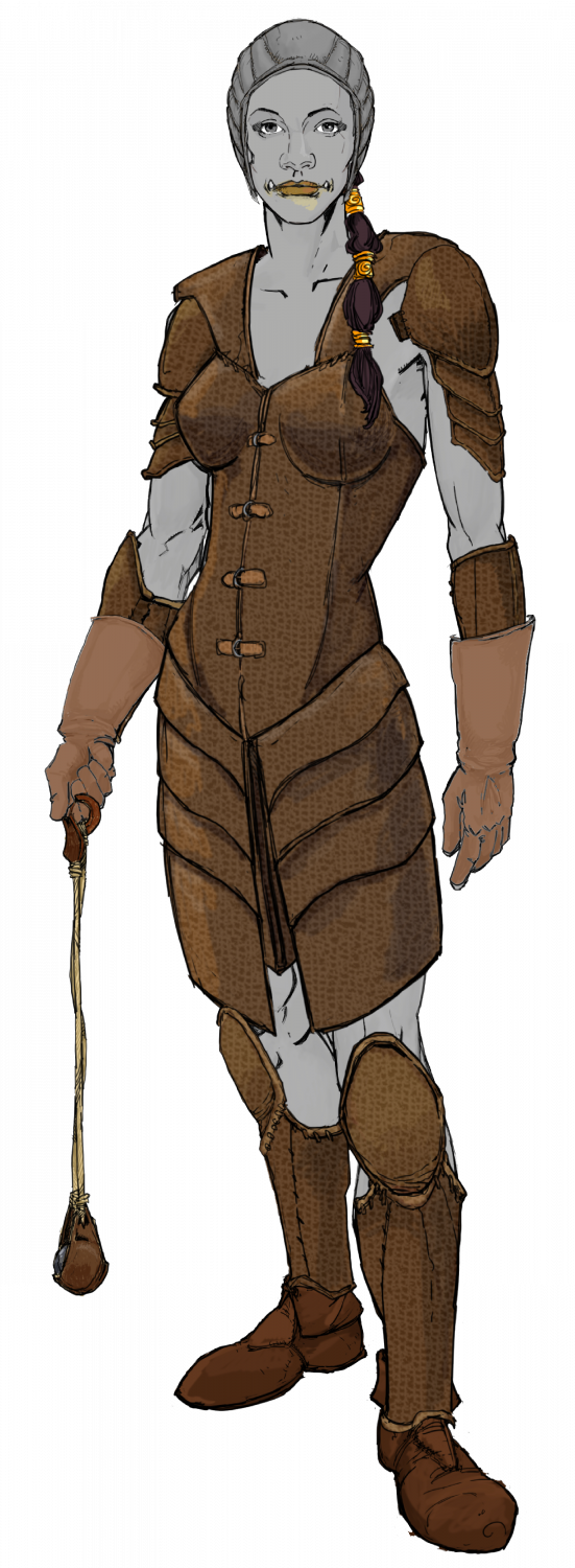
The male and female Norvians - rather pale green-olive skin, mediterranean types.

-
Ukadarlia
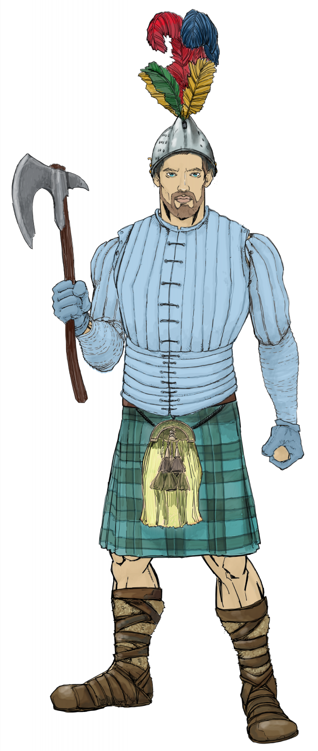
The Kratirim - a Slavic -like people


-
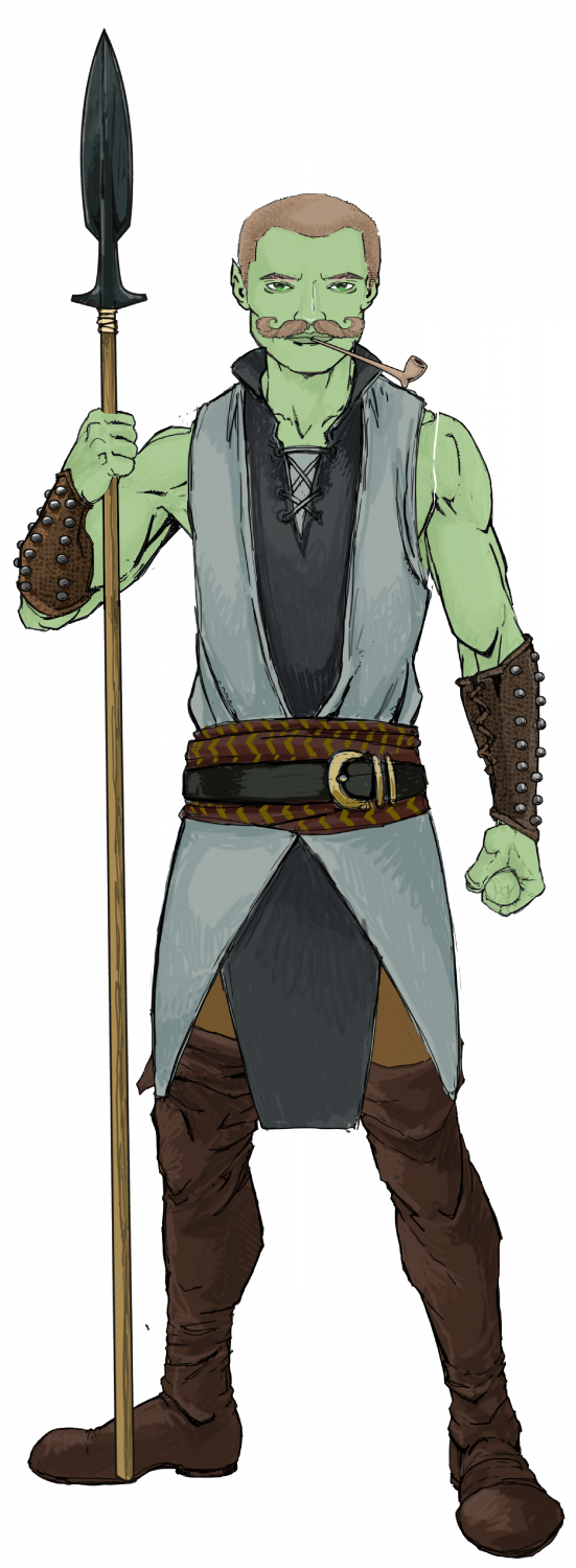
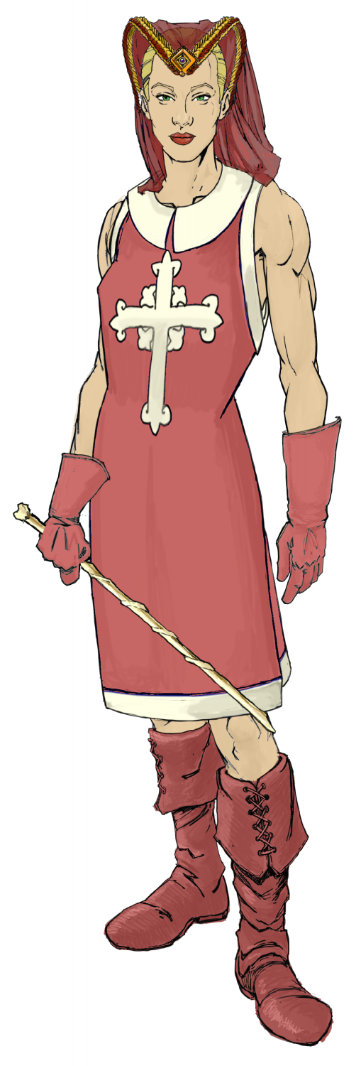
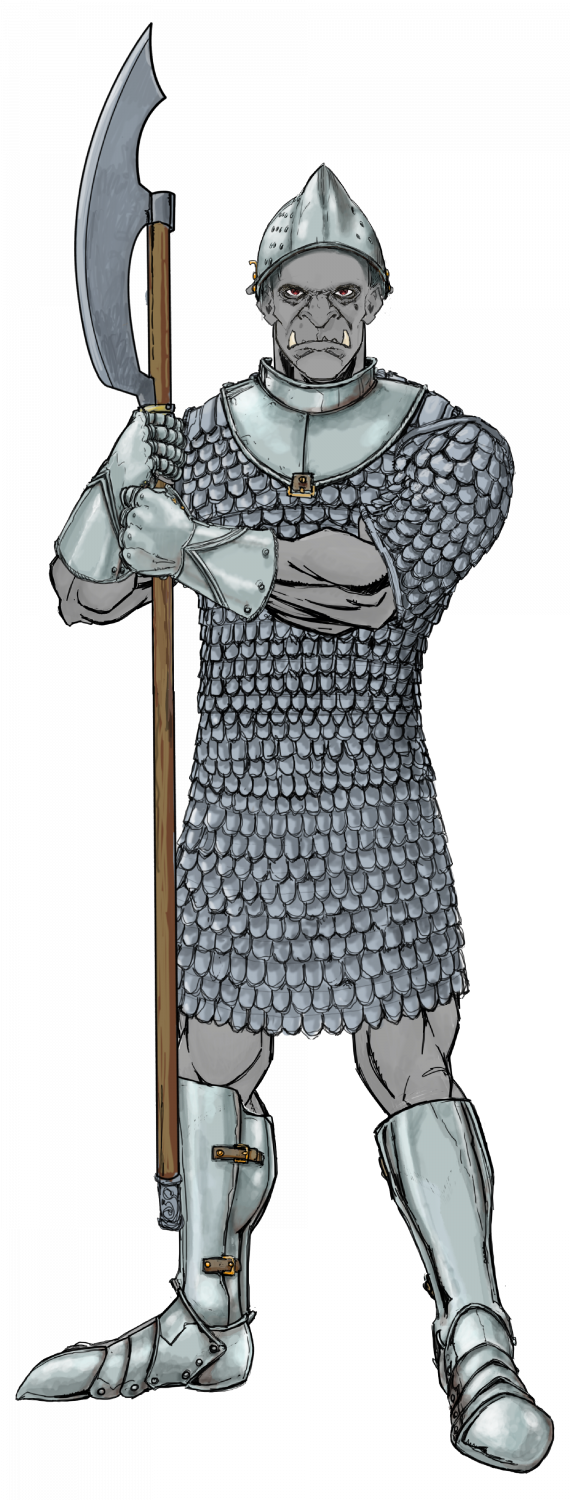
Ukadarlia
Finally, the Grimir - the 'orcs' of Ukadarlia. They have grey skin and protruding lower canines. They are otherwise another human variant. Both the Aeifa and Grimir can interbreed with each other and the other human ethnicities; however, the pregnancies are likely to miscarry about 50% of the time, and the progeny have about a 20% chance of a genetic flaw - eg cleft lip, club foot, extra digit, accessory nipples, large birthmarks, etc.
-
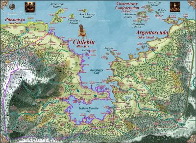
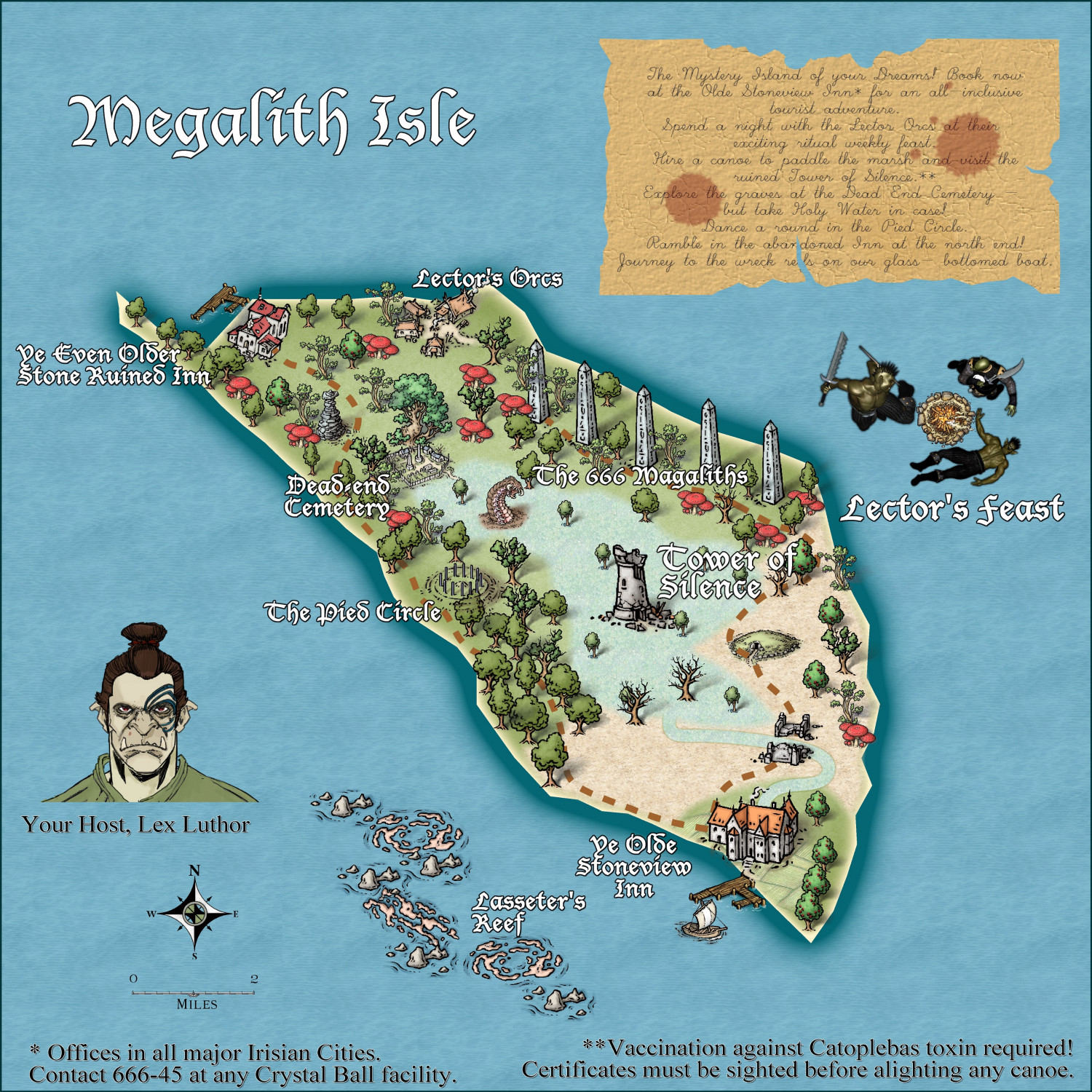
Community Atlas - Irisian City States - Megalith island
Most recent update. I think this is ready for the Atlas. Again, thanks to @Ricko Hasche for his very helpful suggestions in a private message.


-
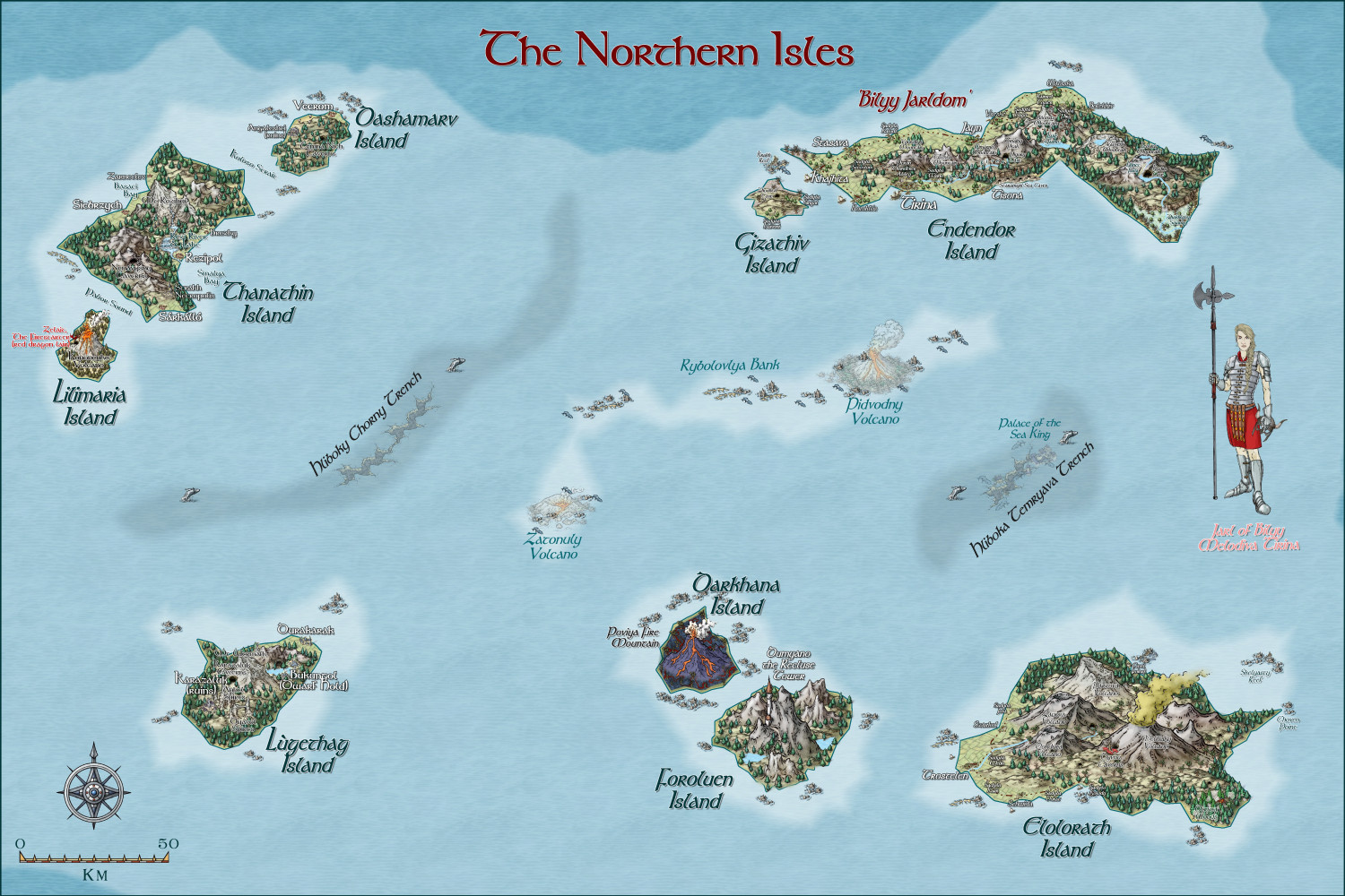
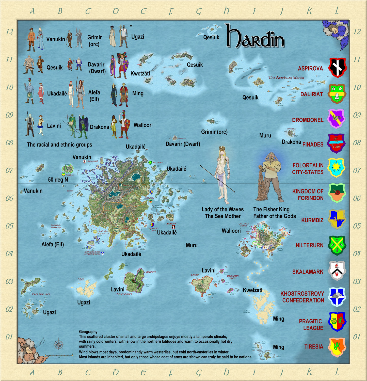
Hardin region of Myirandios
Here is the region of the northern Isles, with each island detailed. The uppermost left island is the closest to there being a 'nation', mainly due to the efforts of Melodiva Tirina, the charismatic female leader of this hardy folk. I am going to do a sketch using Character Artist of both the Sea king and Melodiva Tirina (as she is an important person in this fantasy world). And also try to use it to do the sea creatures, the Muru.


-
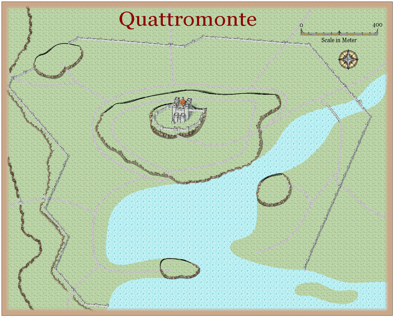
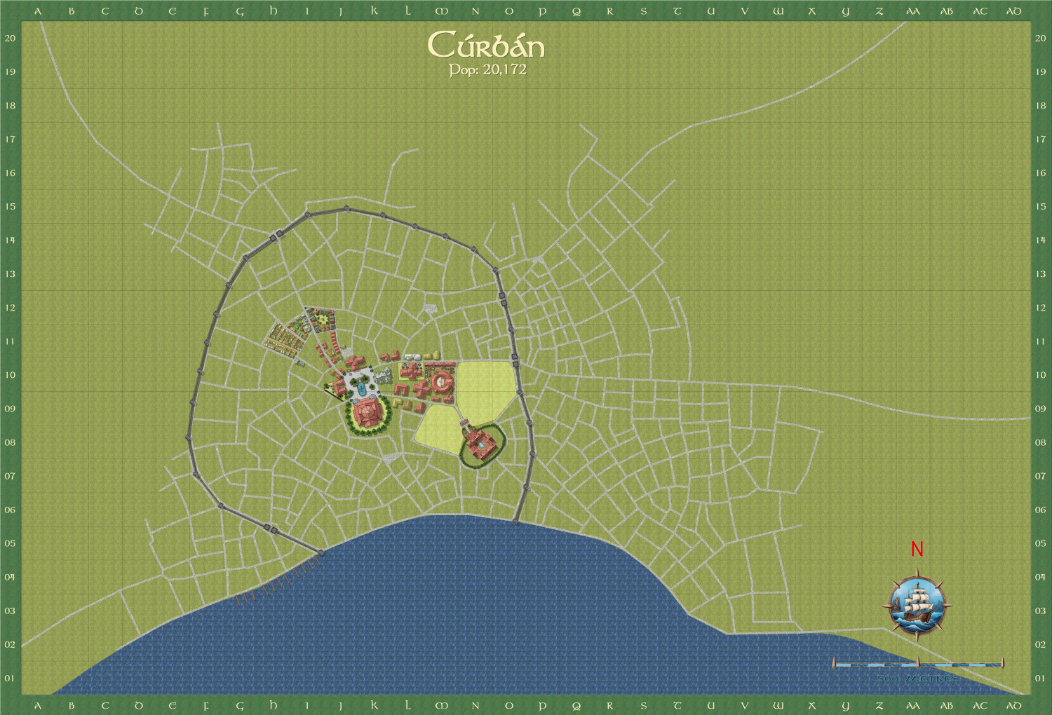
Curban - an Elven City WIP
I am now doing another city (my favourite type of map) - the capital city of the Elven Queendom of Aillte-Lonrach. I will show it as I progress - almost finished the city centre.
The street layout i got by using the Watabou city layout, and The style I am using is a mix of SS5 and Watabou revised. And Shessar's magnificent compass and scales.
Here is the total city.
Here is a close up of the city centre. The text is deliberately small at this stage - more a reminder to me of the sort of buildings I need to put in.
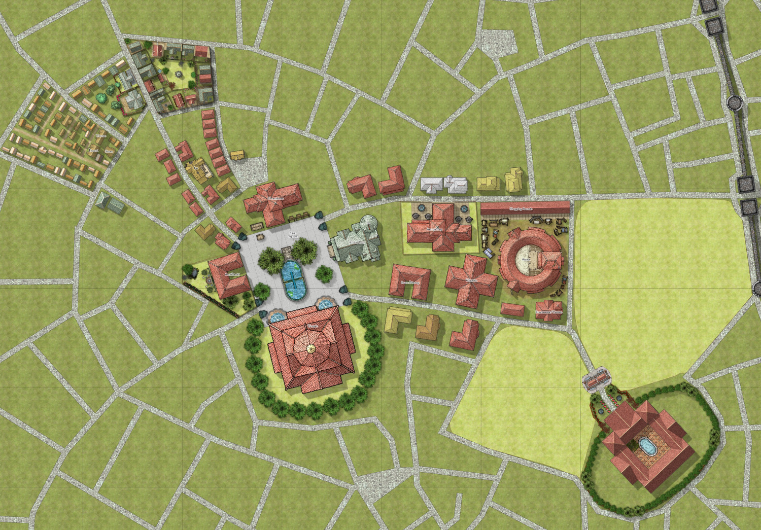
After I finish the centre, I am going to concentrate on the dockside area.


-
Hardin region of Myirandios
Here is a revised map of the whole Hardin region - not fully complete yet. Ranges from subarctic to subtropical.
-
Hardin region of Myirandios
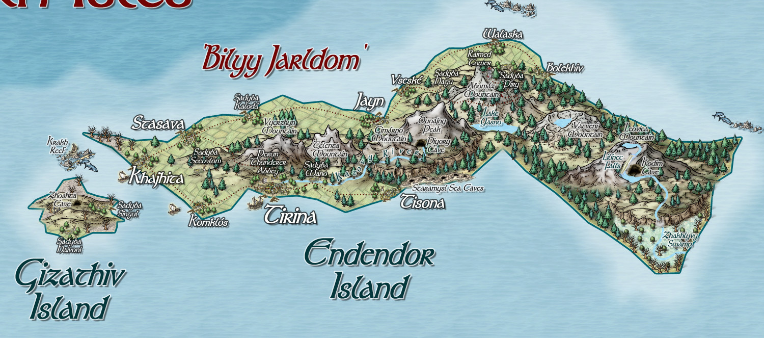
Finally, the one island that has seemingly got its act together, and formed the nascent Jarldom of Bilyy (White), under the charismatic leadership of Melodiva Tirina, who also has her eyes on uniting the whole island archipelago. Unfortunately, not only does she have to deal with the fierce independence of each individual settlement, but also agents of evil chaos from the Dumyano Recluse Tower; and the general trouble-making of the sea-people.

-
Community Atlas Project - Download information - Contributions Welcome
I am having real internet problems, and can't get my internet to work well at all. So I am going to ask @Monsen to add this map to the Atlas - in southern berenur.
