Loopysue
Loopysue
About
- Username
- Loopysue
- Joined
- Visits
- 9,965
- Last Active
- Roles
- Member, ProFantasy
- Points
- 9,852
- Birthday
- June 29, 1966
- Location
- Dorset, England, UK
- Real Name
- Sue Daniel (aka 'Mouse')
- Rank
- Cartographer
- Badges
- 27
Latest Images


-
Lost fills
That might be this post:
Paragraph 4 gives you a general all-around fix for the problem.

-
Numbering/Labeling Conventions thread
I was taught (several decades ago now) that you numbered the municipal buildings and churches first, then the features of interest like parks and historic sites and finally the local landmarks - waterfalls, etc. However, given the same map two different cartographers would probably number it quite differently according to their personal opinion on which of the features or which of those groups is more important than the others. So in the end it boils down to what Wyvern said:
As long as your labelling is clear and unambiguous, and makes sense to you, I'm not sure anything beyond that is altogether important.


-
Live Mapping: Dracula Dossier Floorplan
This week in Live Mapping, Ralf will be taking a look at, and starting a modern floorplan using the Dracula Dossier style from the 2015 Cartographer's Annual (Volume 9).
Come along and join in the fun and the chat with us here on Youtube:
https://www.youtube.com/watch?v=UglZYeAeHlA
Or you can watch it right here on the forum if you prefer*
*This thread is not monitored during the show, but is the place you can discuss it or ask further questions if you have any after the show.

-
How Can I Draw Real-World Places in Campaign Cartographer?
It sounds like you need a hex style where the hexes are ready-built to be placed on a snapping grid, though that might mean the coastlines, rivers, and boundaries, etc. are more hex shaped than you would probably like them to be.
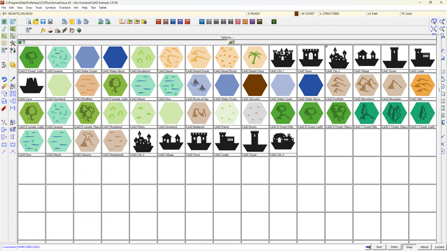
Perhaps something like Hex Overland? It's in the same Cartographer's Annual as the last example I showed you - the 2010 annual, or "Volume 4".
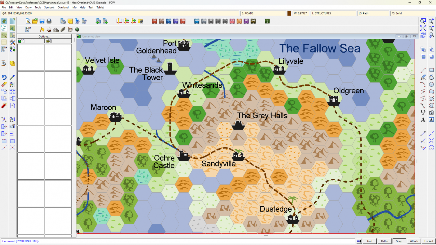
These are the symbols from that style.

-
How Can I Draw Real-World Places in Campaign Cartographer?
There are a number of hex mapping styles that might suit, but do you need to limit yourself to actual hexes or will a hex grid do? CC3+ can add a numbered hex grid to any map, like this (the map below is one of the example maps from the style Modern Political in the 2010 Cartographer's Annual).
Original map (no grid)
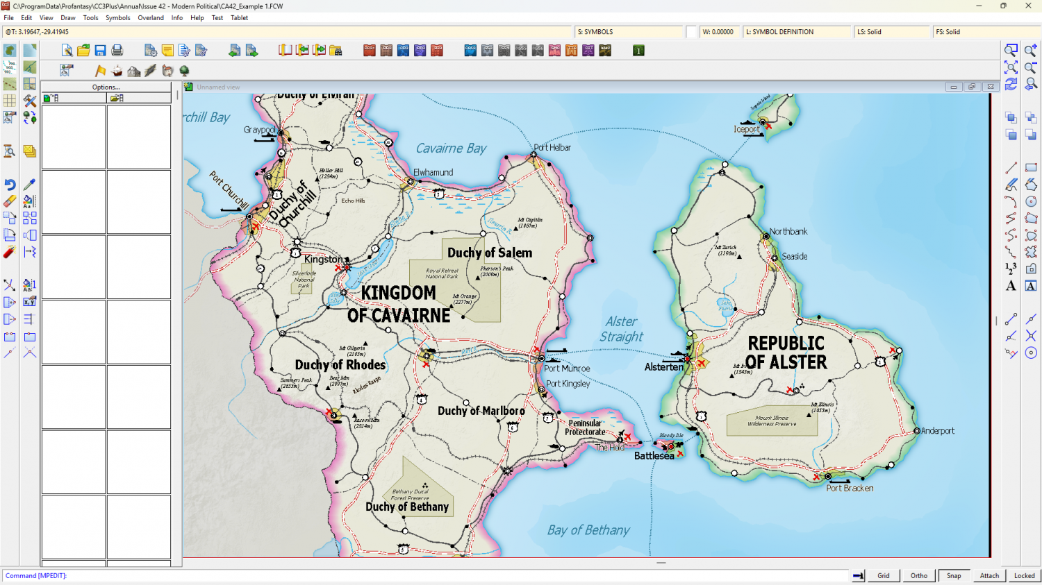
The same map with a grid I just added.

As I said above, you could use any style you liked if a hex grid was an acceptable alternative to hex components, or even make your own style as Mike has done.
If you want to have a look at other styles available there's a page of links here.
As for the actual drawing of the map - the coastline etc, you can import image files of these types into CC3+ and trace the shapes as you wish.