Loopysue
Loopysue
About
- Username
- Loopysue
- Joined
- Visits
- 9,969
- Last Active
- Roles
- Member, ProFantasy
- Points
- 9,853
- Birthday
- June 29, 1966
- Location
- Dorset, England, UK
- Real Name
- Sue Daniel (aka 'Mouse')
- Rank
- Cartographer
- Badges
- 27
Latest Images


-
Advice on what looks better, please, on a completed map
Hi Simon :)
Both are good looking maps, though I recommend getting rid of the drop shadow on the text on the first top view map for the sake of clarity.
If this is an ebook you should really check what they both look like when they are reduced to the correct resolution for publication. Check in particular if the labels are legible.
If they are for a printed book (and unless the book is going to be printed in full colour), I recommend printing both of them the correct size in black and white to see what they look like. You might find that a black and white style is more appropriate in that case.


-
New user from the Netherlands, nice to meet you all!
Hello and welcome, Yskonyn :)
The 'Tome', as we often call it, does contain practically everything there is to know about Fractal Terrains, CC3 and all the add ons, but it's probably easier to use that as a rather large all-in-one reference manual.
I recommend starting with the CC3+ User Manual and working through the excercise contained in it. That will give you a reasonable understanding of most of the basic tools. Similarly, when using the add-ons they often have their own user manuals (or 'Mapping Guides' in the case of the Cartographer's Annuals.)
However, if you are more of a visual learner we have collectively created a lot of tutorial videos and live mapping streams, most of which are available on YouTube and indexed on this thread here.
But sometimes the quickest way to solve a problem is just to start a thread here on the forum and ask how to do it or what went wrong.

-
Live Mapping: Parchment City (CANCELLED)
Yes, we all rushed straight back here to let you know, so you didn't get all worried about us :)
As you can see, that created a race to be the first to tell you.

-
Help with FT3 to CC3+ exported maps
Thanks :)
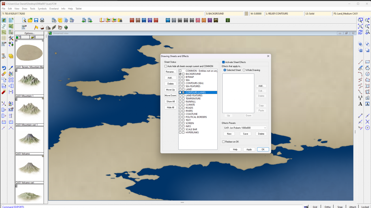
The first thing I did was to hide all the sheets except the BACKGROUND and used List in the Info menu to find out a bit more about the entity I could see on that sheet. This is what I got.
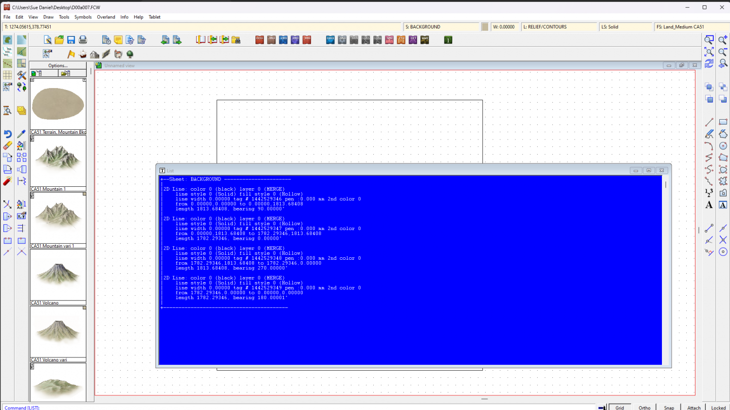
The first problem is that the 'polygon' isn't a polygon but 4 separate lines on the BACKGROUND sheet. The second problem is that they are on the MERGE layer, which is definitely wrong. Things on the MERGE layer cause all kinds of problems, so we need to put both those things right.
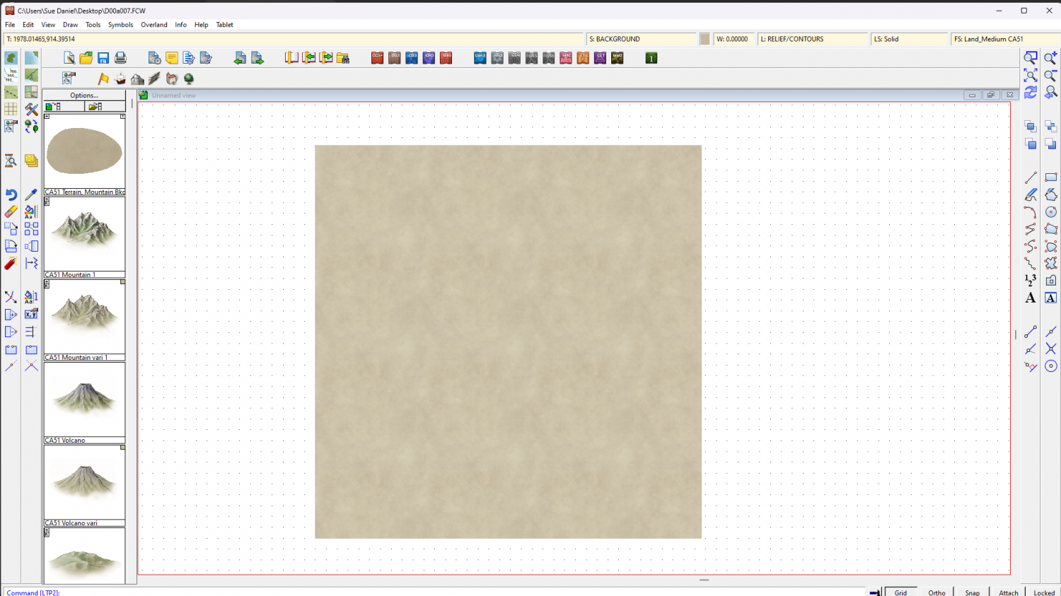
I right-clicked the Fractalise button on the left and picked "Line to Path", then picked all the lines and hit D for do it. The accidental effect of doing this with a set of lines that are perfectly alined at the corners is that they automatically become a polygon, even though that wasn't the intention of the command. It's really convenient, though, so no one complains about it.
This is what I got
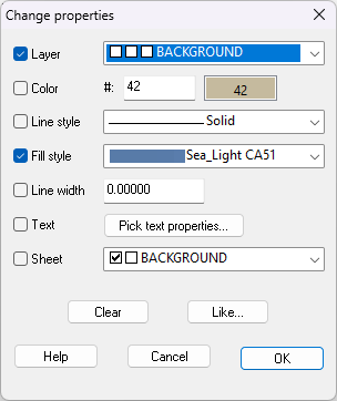
I used Change Properties (top paint can button on the left toolbars) on the visible polygon to put the new polygon on an appropriate layer (BACKGROUND), and to change the fill to "Sea_Light CA51".
Then I unhid the rest of the sheets.
(In this example I changed the fill to Sea_Medium)
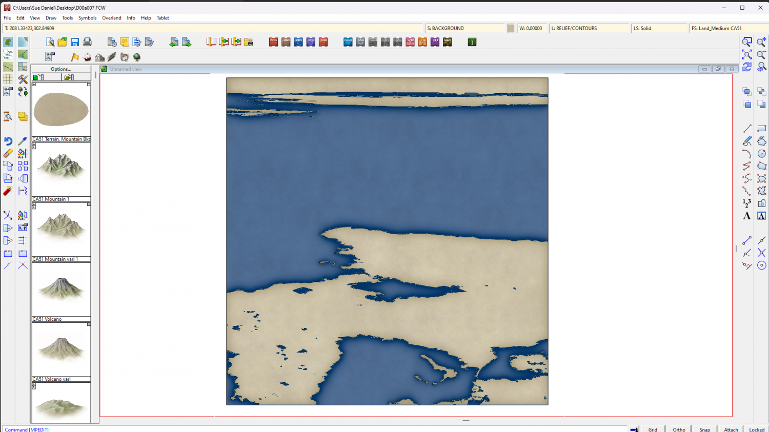
Here is the modified FCW for you.
In it, I have also hidden the CONTOURS LAND sheet to simplify the appearance.
This is a fairly complex map with a lot of very tiny islands and lakes. Please ask if you have any further issues with it.


-
Mixing curves and straight lines?
If you use the smooth polygon tool you can add as many corners (and therefore straight sections) as you like by pressing C before you click for each corner.