


Wyvern
Wyvern
About
- Username
- Wyvern
- Joined
- Visits
- 3,237
- Last Active
- Roles
- Member
- Points
- 5,515
- Rank
- Cartographer
- Badges
- 24
Latest Images


-
Live Mapping: Random City
Just time to generate a quick sample random city map before the stream (it may not take anything like that long, depending how long you take adjusting the parameters first)!

-
Community Atlas: Temple of Nidag, Stormwatch, Emerald Crown Forest, Alarius
While tinkering along the northern, east-street area, I'd started wondering how viable those narrow strips of grass might be along the southeastern side, and even if I should remove the bushes and thin grass verges on the other. Currently, I've opted to maintain the bushy verges (makes sneaking around the front of the inn easier for nefarious purposes, after all!), but have "paved" the other side's verges with a fresh area of dirt trackway.
To make up for the loss of vegetation cover, some new garden plots have been set up (not all with their vegetation added at this stage), together with a battered, earthen area between the curving road and the back gate of the inn's yard, which seemed a natural addition, using the same dirt fill as the gardens, with much less vegetation cover. The perceptive may notice I've also now added a lot more small, low-growing, "dots" of meant-to-be weeds in numerous places, helping break-up the textures and some of the harder pathway edges in places.
Now the rest of the garden plots northwest of the inn street have been finished, it's perhaps a little easier to see that vague, not-yet-pathway from the road to the back of the inn:
Which leaves just one last row of buildings to design internally, and a few more garden plots to add. This was as far as I got in my most recent session:
The non-spiral staircases have been a little bit of a battle all the way through. The initial trio all had the same orientation, so could be easily copied from one place to the next and still have their effects look correct, although even then, the second one had to have its staircase symbol adjusted for size (which luckily meant it fitted better to the third house as well).
Those in the two houses west of the main road though were in an opposite orientation, and needed to be added to a new sheet with altered effects to stop their shadows protruding through the solid wall they're inside. With those alternatives in-place, the two new staircases on the inn street were less of a problem in that way, for all adjustments to the shade angle have been necessary for nearly all the "landing" floor pieces, to get them to work with their lower floor planking as well.
One other thing was corrected. For some reason, all the doors and windows in the northwesternmost property of the "temple square" section (closest to the south corner of the first house on the south side of the inn street), had ended-up on the wrong sheet, and were casting wall-level shadows. That was spotted because I normally use the "eye-dropper", :CC2KEEP:, to set-up for whatever items I'm next drawing in a map like this, which provides a quick means to do so (especially for Layers, which aren't always automatically associated with symbols, for instance), and a check for mistakes - as here.
Nearly done now, at least for this first mapped level...


-
Change Default Sea Colour
If you're wanting to darken the entire map, it may be possible to achieve something approximating your second image by setting up the effects as Sue was showing, but using the "Whole drawing" radio button, instead of just for one selected sheet. This can have unwanted consequences, depending on what your original map was like, but it is probably experimenting with at this early stage.

-
Node Spikes
You're not alone in battering away at unwanted nodes to get rid of them! I usually end up hiding or freezing any overlapping entities (like the LAND sheet here), and then just clicking to remove a node or two nearby more or less at random till something useful happens (and using "Undo" if it makes things worse!). Of course, the trick is then to unhide the LAND sheet and lose the same nodes in that, otherwise, as Sue said, the outline may no longer match the landmass...
-
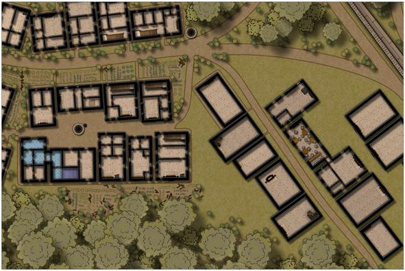
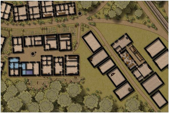
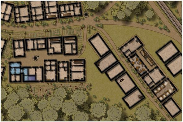
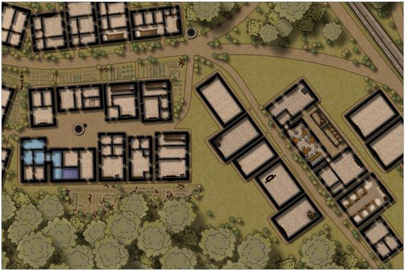
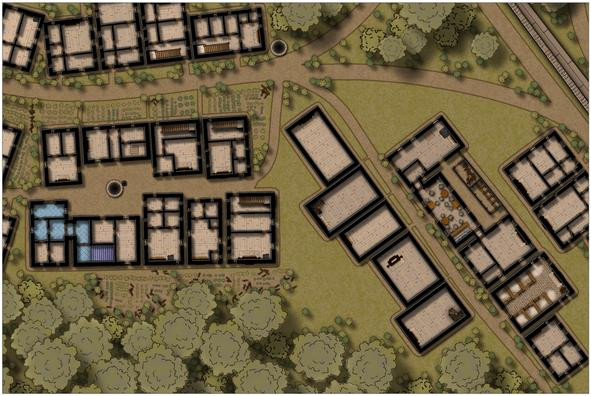
Community Atlas: Temple of Nidag, Stormwatch, Emerald Crown Forest, Alarius
The next step was to add fireplaces to the remaining properties, as their placement determines where the doors, windows and interior walls can go:
The first exterior pathways have been added too, and though it may not be obvious at this resolution, there's a spiral staircase in one corner of the second "under development" house on the left of the street, which will go into the dungeon level below eventually. That mid-building fireplace in the fourth left-side property is going to be interesting to work around!
After adding another descending spiral stair to the fifth left-side structure, I started developing the main bar feature of the series of inn buildings on the street's right side. This also connects with the adjacent property to its northeast, though I haven't finalised exactly what this property will be yet; perhaps another bar-room, or an entertainments room:
The range of fitments in the bar-room are there so I don't later forget what I was meant to be doing here, of course.
And then the inn started to develop in an unexpected direction...
Aside from connecting it to the kitchen-house (first building on the street's right), which was always intended, now there's a fence-enclosed narrow yard, with a latrine block and woodstore, together with a gate nearest the curving road off to the northwest (probably hard to spot at this res).
After which, the pathways around all these right-side buildings were drawn, and some bushes added:
Oh yes, and we now have a stable block for the inn! While it may be hard to tell here, this has been provided with a cobblestone floor, instead of the usual wood planking, and those hay piles look somewhat less strident on higher-res images (I hope!).
Followed swiftly by more external paths, a little more vegetation cover, and a staff house at the east end of the "inn-side" of the street:
Lastly for today's update, are the outer wall and internal fittings for the two northern map-edge properties:
More shortly, with luck!


