Ricko Hasche
Ricko Hasche
About
- Username
- Ricko Hasche
- Joined
- Visits
- 4,077
- Last Active
- Roles
- Member
- Points
- 8,039
- Birthday
- February 7, 1977
- Location
- merlo san luis argentina
- Rank
- Mapmaker
- Badges
- 20
-
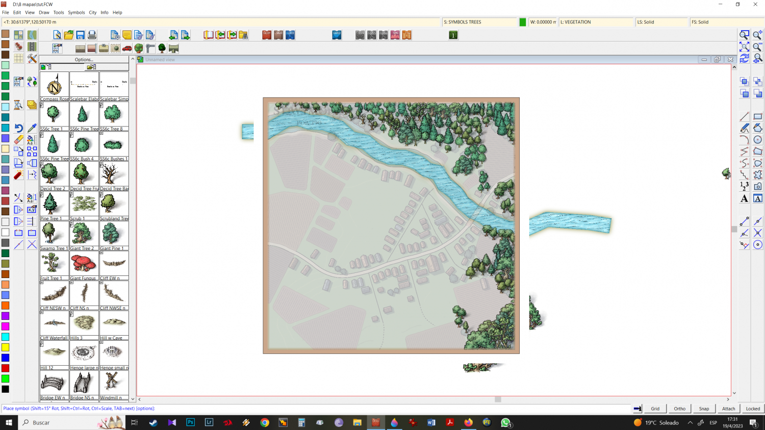
Mixing Mike Schley isometric city + Mike Schley Overland symbols
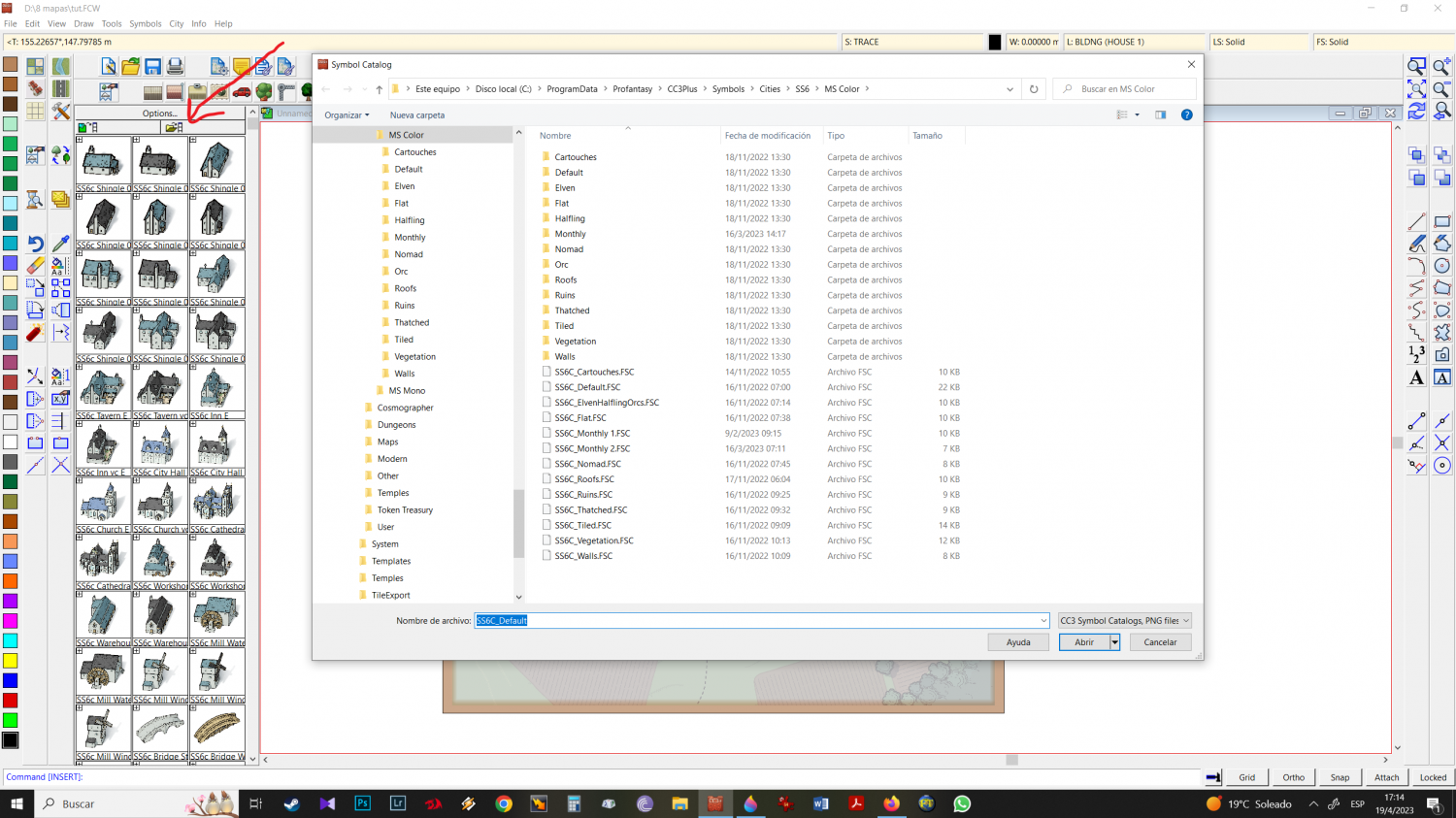
11 - to import, right-click and CC3 navigation will open (I don't know the correct term for that part)
12 - Back to symbols, from there MAPS (overland) > MIKE SCHLEY COLOR
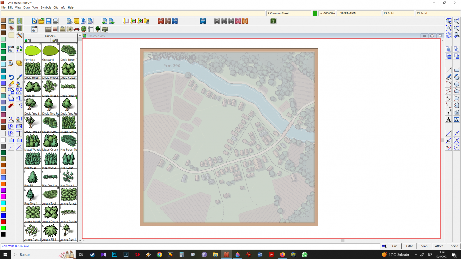
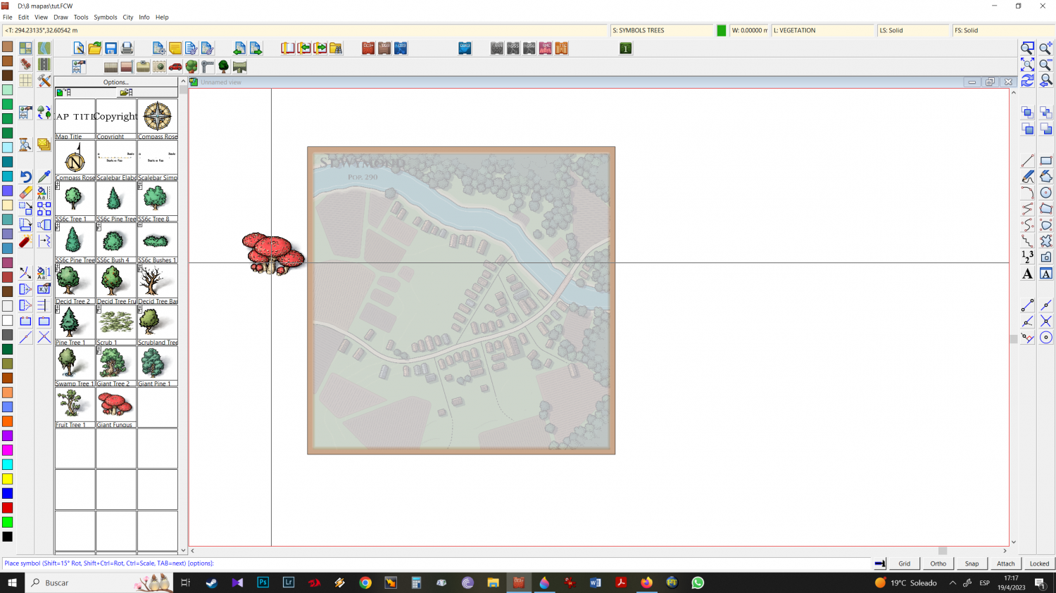
13 - In the mike schley color folder (overland) I go, subfolder by subfolder choosing the icons that I like the most. Detail here: I prefer to start with the trees, I import all the trees I want to work with, and then I go to the city's vegetation and also click on all the trees I want. In order for the program to record all the multi options (when they exist) in the icon groups, at this point I hit TAB so that they all appear, then I move to the next icon. I select all the trees I want and group them.
14 - I keep choosing icons from other folders (preferably all together - Mountains and hills, structures, natural etc. Folder by Folder.
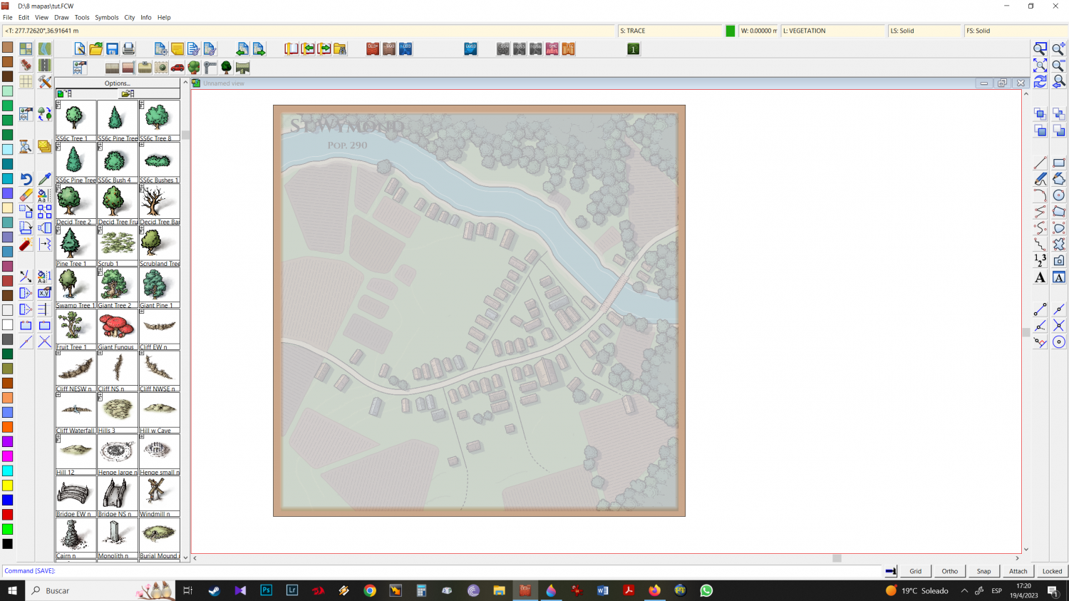
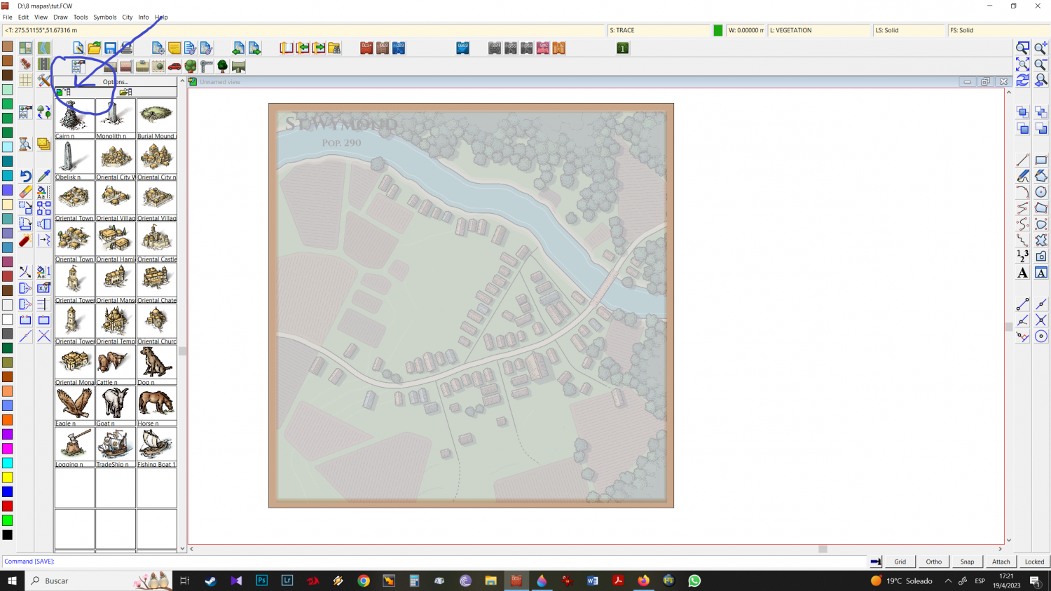
Once I've imported everything I want, clicking on that part will show you all the imported items (save your work now). Earlier I mentioned that I like to import in sets (whether it's just overland or in the example of trees, overland + isometric trees) and the reason for this is to facilitate the workflow, since things will be in that part, grouped in similar: trees, buildings, mountains and hills, structures, etc.I start with the river
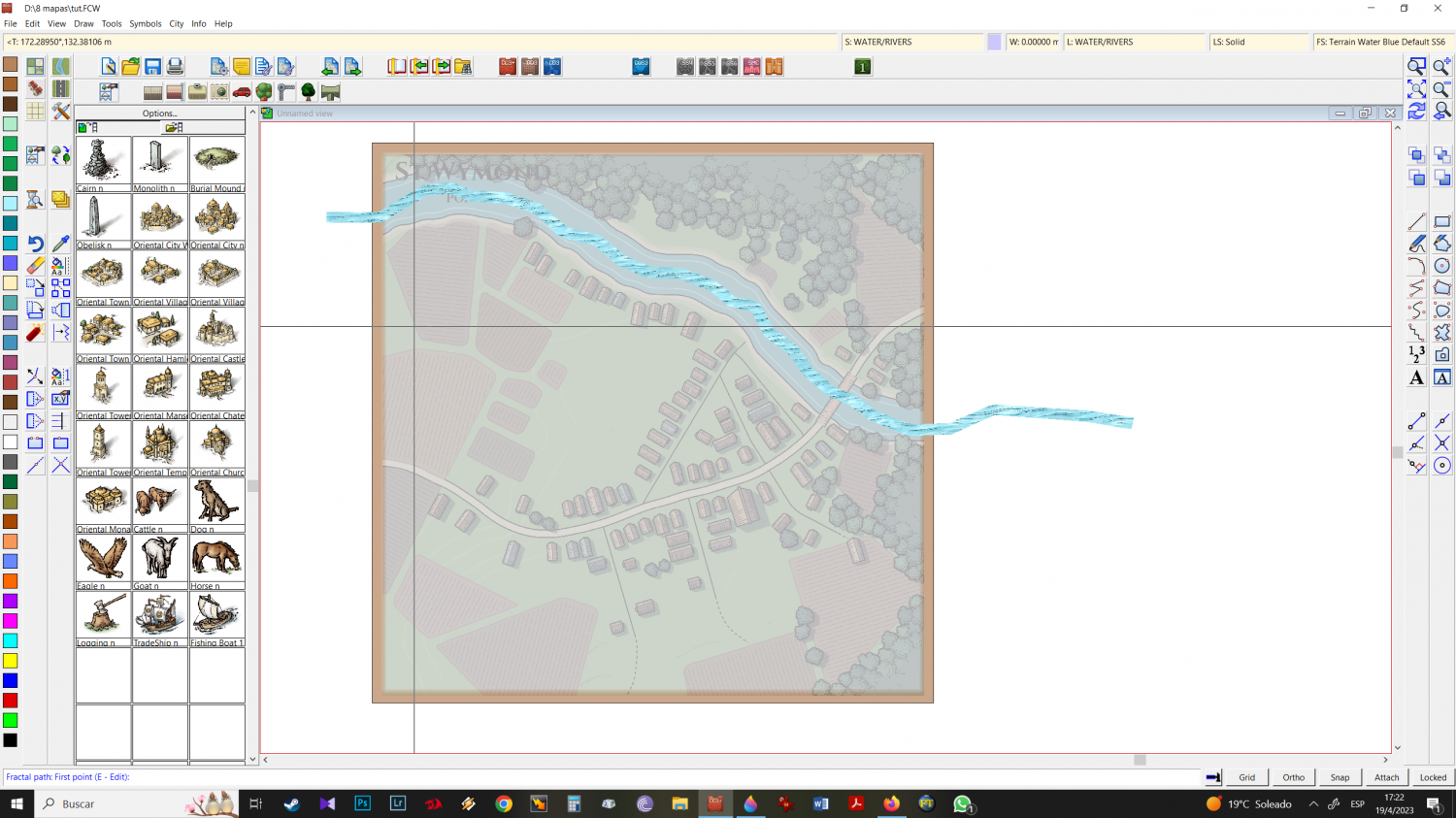
15 - I start with the river
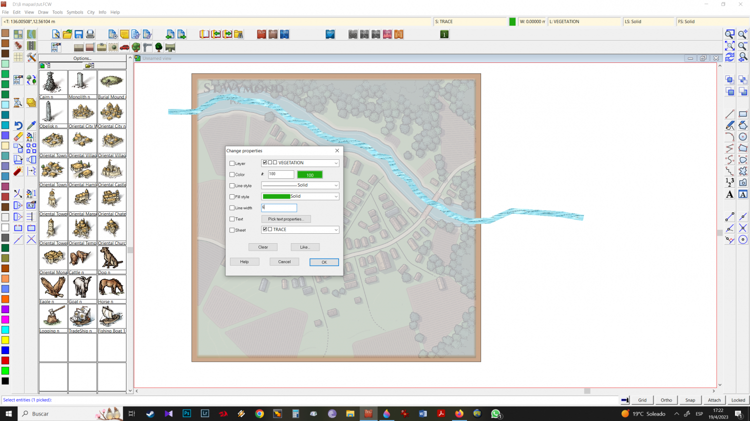
16 - I notice that it is too thin and I want it to be bigger (its measurement is in 2)
change properties and put size 6 (3 times the original)
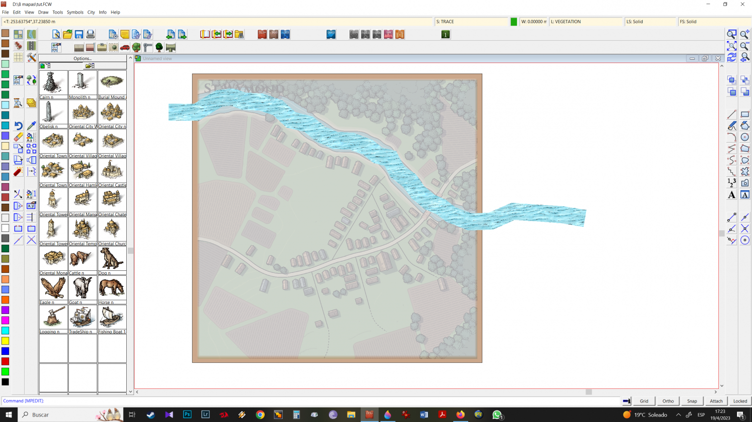
17 - refresh and seems ok to me, lets go
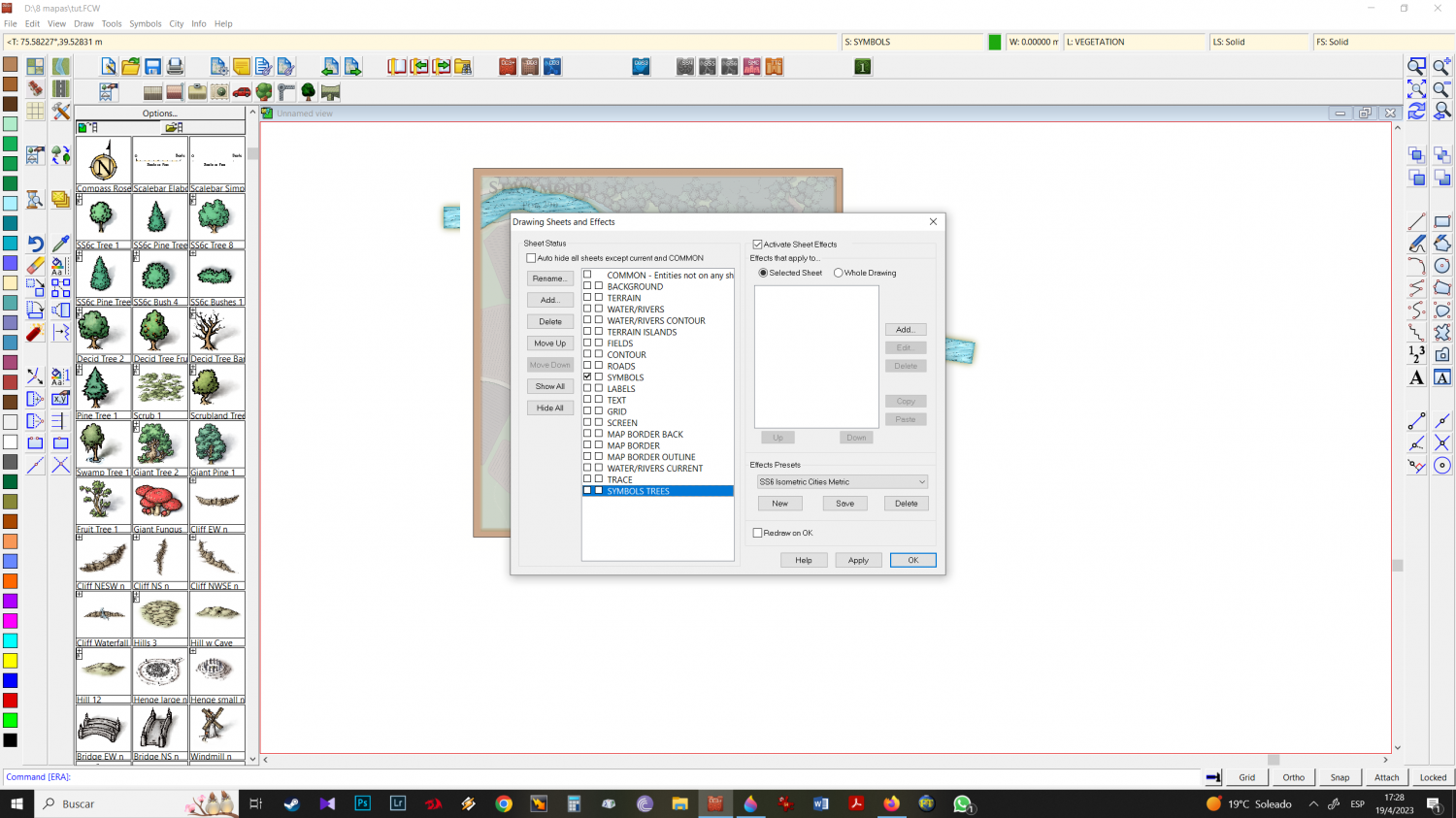
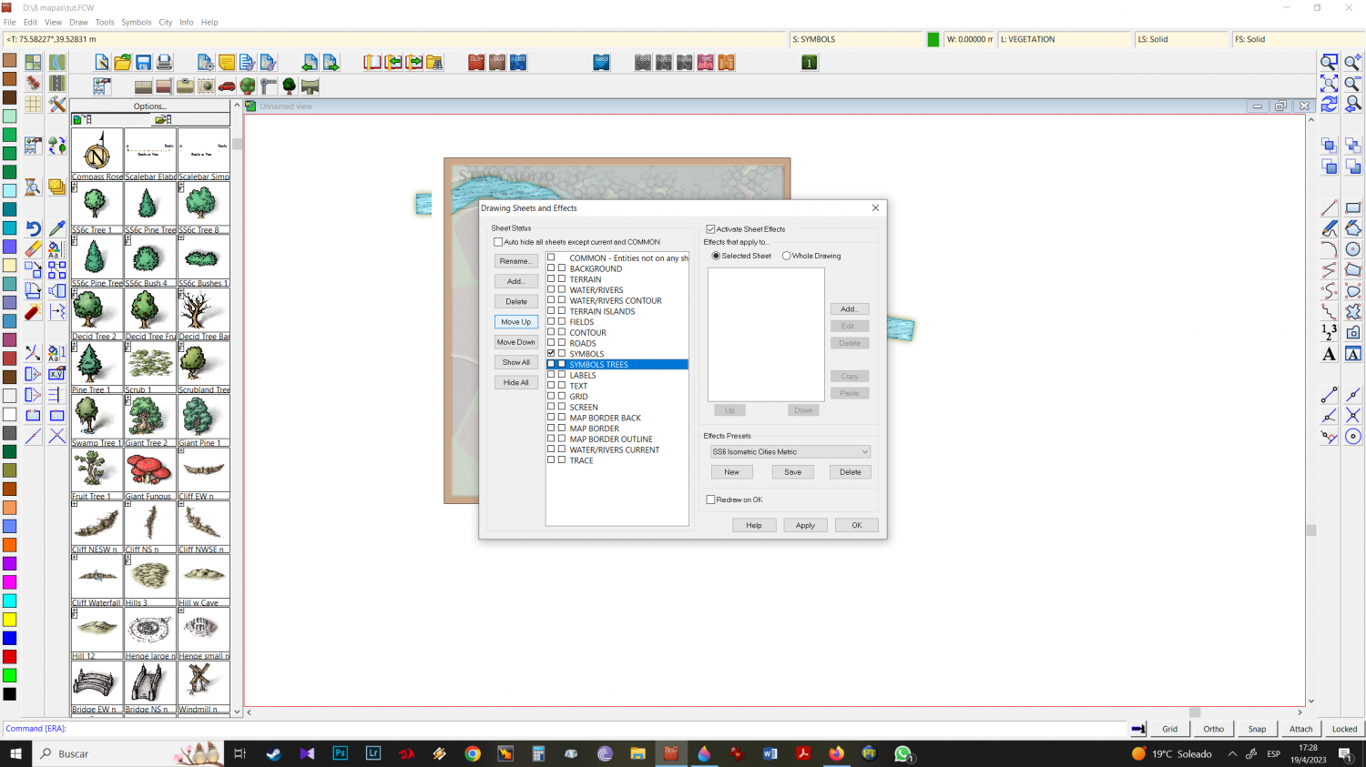
18 - Note that the isometric city recognizes mike schley overland trees as when you work with overland. as SYMBOLS TREES and, as it did not exist before - the program creates a new sheet with that name by itself. Move it under (on top) of the sheet symbols.
SYMBOLS TREES new sheet is in correct place now..
19 - Having the tree symbols you want all together helps especially when you're looking for "vegetation diversity" making work much faster. Choose the trees you want but keep in mind that some of the icons come in "different size scales" be aware of this difference and solve it by pressing CTRL and moving the mouse up or down. As a tip, also vary your sizes intentionally, so you have a greater variety of looks.
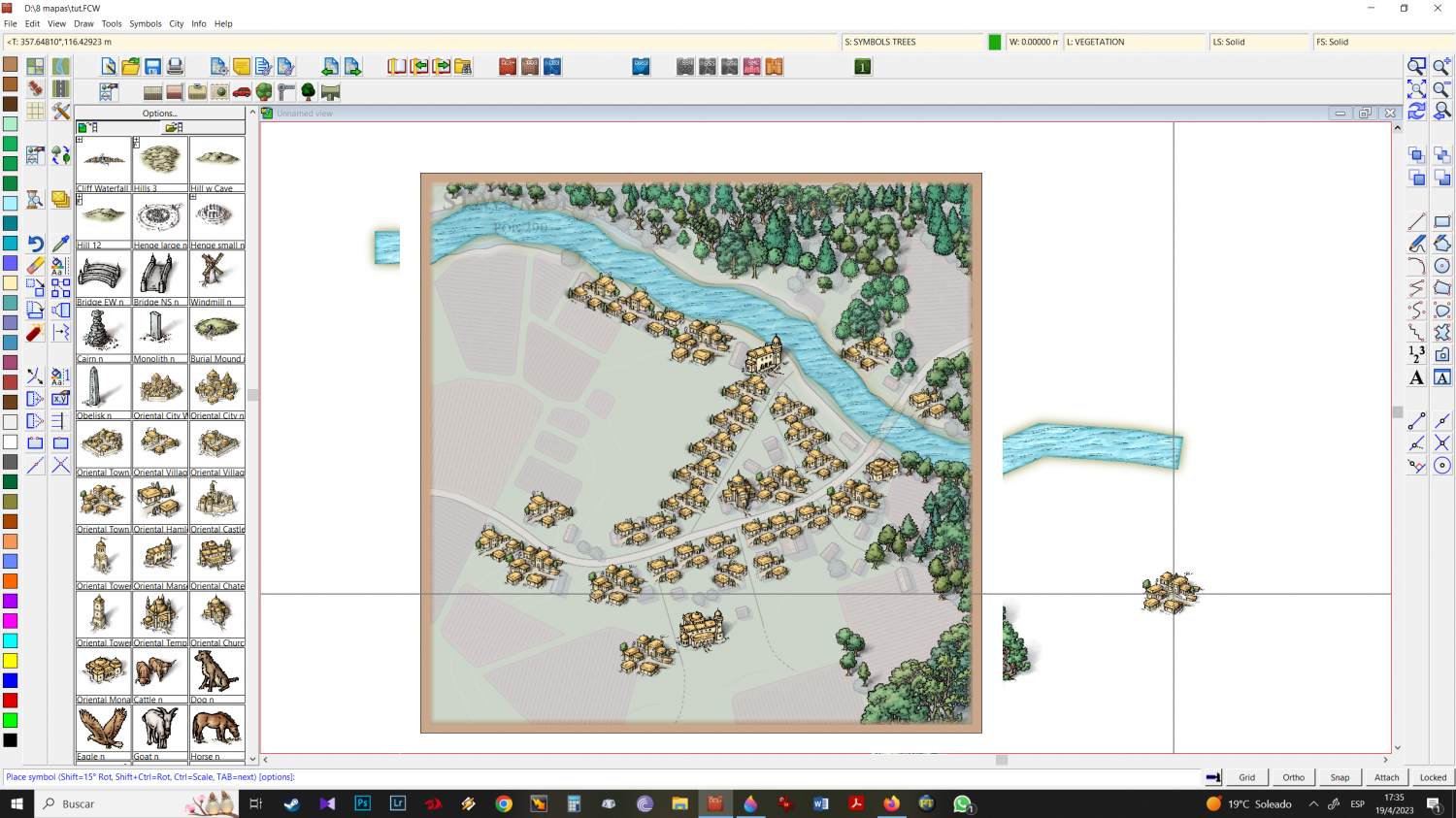
20 - once the trees are in place, I go to the buildings. Note that I will stick to the SYMBOLS TREES sheet because at this point if I go back to the symbols sheet, the images I will use will be behind the trees.
with all the icons, trees, structures etc, sometimes I use the mirror function: I select an icon, left-click and click mirror. Doing this allows for variety, especially in the most interesting constructions, and will have a less monotonous final result.
-
Elven City
-
Rattenzwinge am Königsdamm - a denser SS6 town
I normally use the lightroom image processor as cc3 exports my final file in jpg or bmp format.
In my experience, the possibilities for changing contrasts, vignettes, shadows, colors, etc... in a lightroom or photoshop are much greater (and easier to implement) than those that the program makes possible.
I love sepia + grains ... made all Karkaroff maps in this style
Cheers
-
Which style for... Post apocaliptic meshup
https://forum.profantasy.com/discussion/13042/annual-2023#latest
Make Chorus
I believe the valley with the poisoned forest can be done with mike schley overland. Changing colours ....carnivorous plants, dry trees and bleeding trees next to green/red/purple geysers might be a good idea.
the other needs there is nothing that comes to my mind that would be a good idea.
Cheers
-
Community Atlas - Berenur - Urtrah Desert
Thanks @Glitch .
When I'm about to start making a zone map for our atlas, I always imagine myself as a cartographer hired by the head of the area or just a traveling tourist.
So before starting, I create a tourist itinerary where I describe the main points of my trip. You never finish knowing every place you travel to so there's always something missing for the next traveling cartographer.
Unfortunately I live many years far away from my group that we have been playing with for over 30 years. In this rpgistic solitude I only have the maps to ease my creativity and create stories for when we meet next time.
Karkaroff region and Shrimp Tony are the last 2 brand new little sagas. (i make the adventures now in tv series format, more easy. we meet... i master around 6 chapters and finish a season with a conexion to the next one)


