Ricko Hasche
Ricko Hasche
About
- Username
- Ricko Hasche
- Joined
- Visits
- 4,070
- Last Active
- Roles
- Member
- Points
- 8,029
- Birthday
- February 7, 1977
- Location
- merlo san luis argentina
- Rank
- Mapmaker
- Badges
- 20
-
[WIP] Spectrum Overland Waterfalls x 2
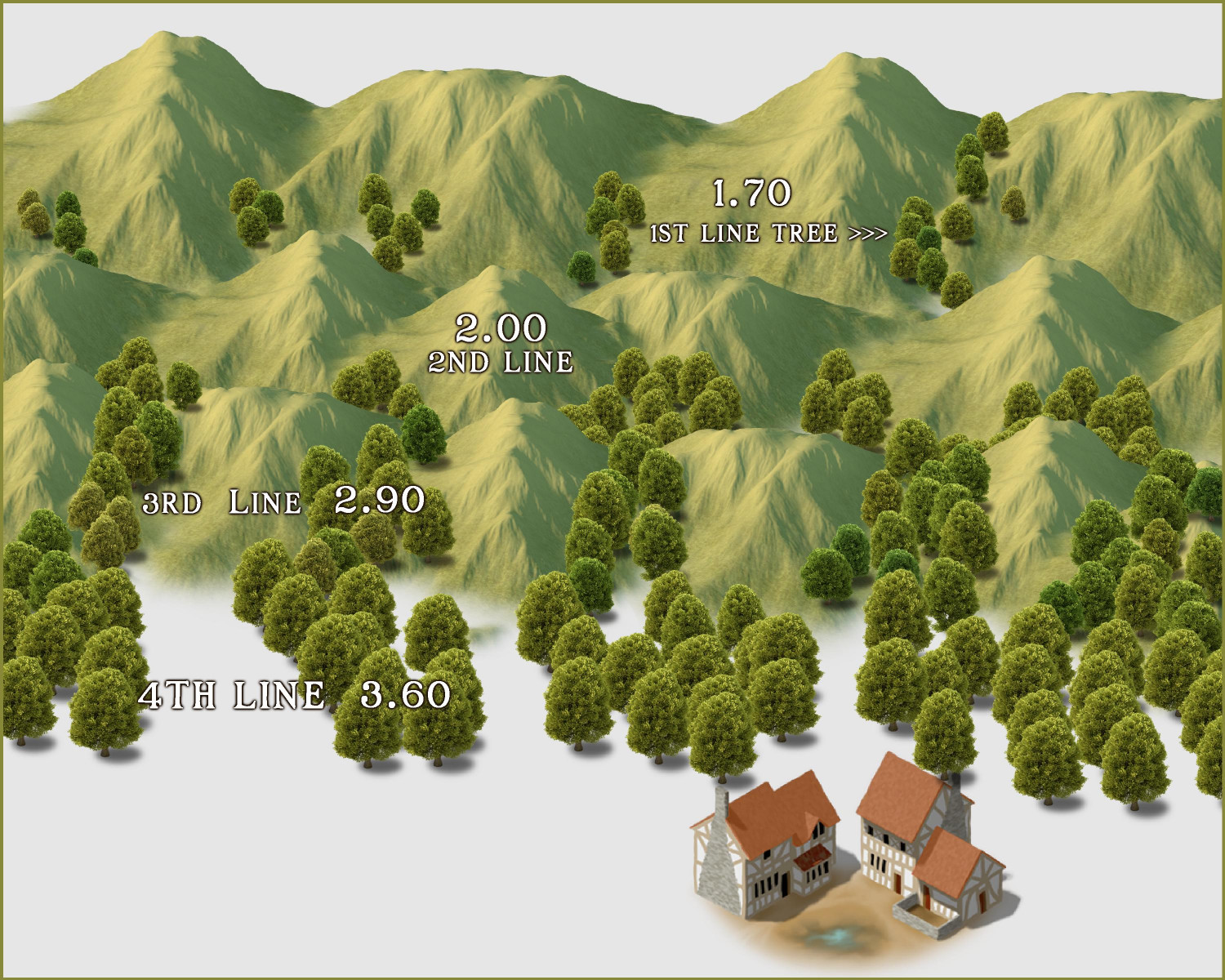
Hy Royal! Achieving depth of field with assets designed for a longer view can be tricky. One of the techniques I usually use to try to achieve this effect is to "strip by strip" progressively increase the size of some - but not all - icons.
In this example, while I use smaller and smaller hills as they get closer to the observer, the trees instead gradually grow larger to create a greater sense of proximity and distance. In the case of this style, all the images go to the default Symbols, since there is no specific sheet for trees, like Mike Schley for example.
In this case, as sometimes with Mike Schley, I have to put "everything on the same sheet" (in the case of Mike Schley I use all or most of the drawing on the TREES sheet) and go drawing layer by layer. It is always advisable to have a draft or sheet trace image with a very clear base transparency before starting, so as not to waste time and to make the task easier.
If you want to add even more realism to these scenes, gently vary the size and types between trees "in the same tree range". I usually do this visually with the controller, checking every so often to see if it is within the acceptable size range for that location.
-
Geospatial Network Model Of Roman Empire.
Recently a friend recommended this page to me in order to study travel times during the time of the Roman Empire.
I found the idea very interesting because the site has several analysis options such as seasons and travel style (expensive, cheap, on foot, by boat, cart, etc...)
I hope it is useful to someone.
Cheers
-
Tutorial - Between hills, rivers and trees
-
Tutorial - Between hills, rivers and trees
-
Tutorial - Between hills, rivers and trees


