Royal Scribe
Royal Scribe
About
- Username
- Royal Scribe
- Joined
- Visits
- 9,539
- Last Active
- Roles
- Member
- Points
- 3,353
- Birthday
- February 5, 1968
- Location
- San Francisco, California
- Website
- https://legacy.drivethrurpg.com/browse/pub/31814/Royal-Scribe-Imaginarium
- Real Name
- Kevin
- Rank
- Mapmaker
- Badges
- 16
Latest Images


Reactions
-
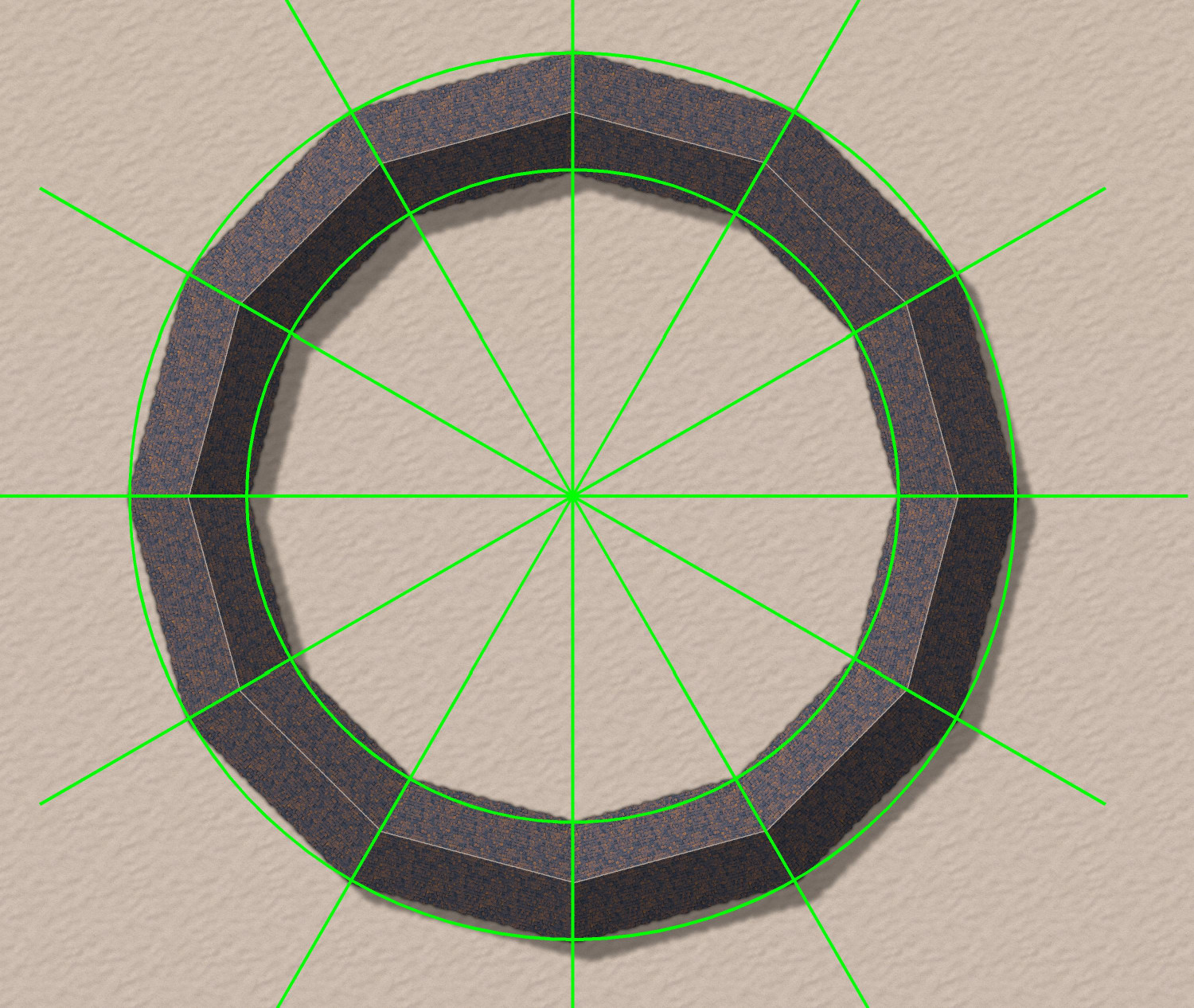
Donut-shaped buildings?
Oh, fantastic! I will try that.
As soon as I posted it, I had an idea for how to do a semi-circular one using drawing lines to draw an irregular building that was 1/12th of a circle, and then copying 12 in a circular array. But yours will allow me to do an oval-shaped stadium. Thank you!


-
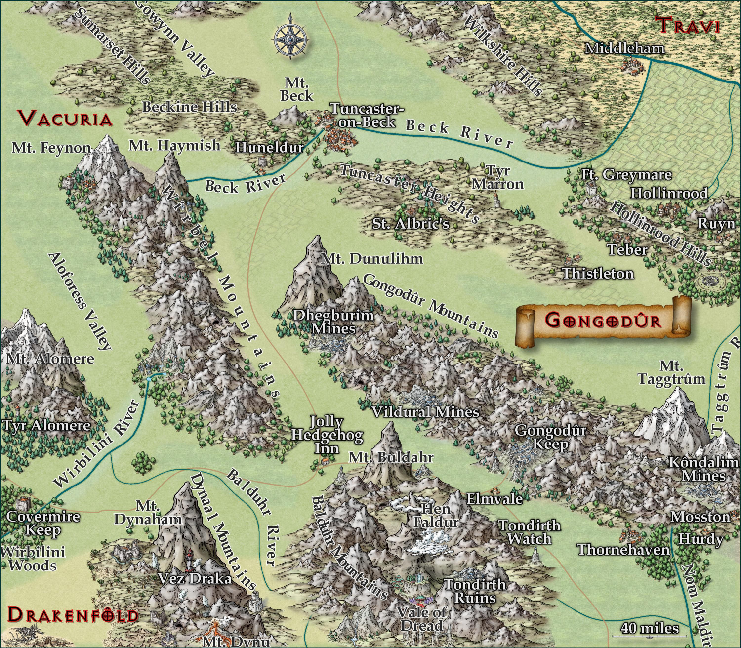
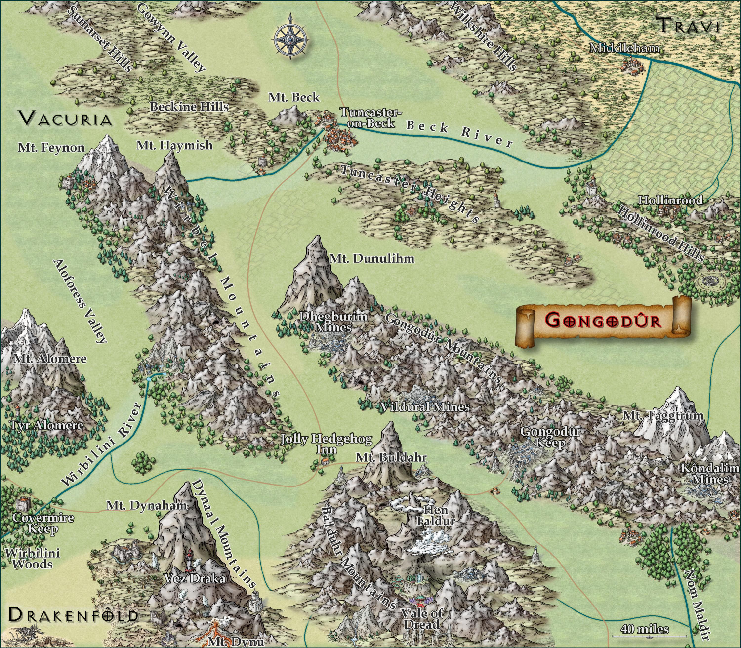
[WIP] Kingdom of Gongodûr
Still working on this. Text is slightly larger, and the glow is as well. Added more names, though I still have a few more rivers and settlements to do. Should I be naming the roads, too?
I am think about putting country names, settlement names, and geographic names each on a separate layer so that end users can toggle them on and off as desired. They're already on separate sheets, though, so maybe that's sufficient for toggling individually, and a single layer for all of them to toggle all names on/off simultaneously?

-
Aspidochelone
Today would have been my grandmother's 105th birthday (she passed away six years ago). She was fond of turtles, so in her memory, I designed this silly little map of an aspidochelone, a giant turtle.
In mythology, the Aspidochelone was a sea creature portrayed as either a giant whale or giant turtle -- a creature so large that it would be mistaken for an island covered with sand dunes and vegetation. Sailors would camp out on the "island," but when the heat from their campfires awakened the creature, it would plunge beneath the waves, killing the intruders.
In my campaign world, one of my religions is loosely inspired by astrology. There are twelve gods depicted as mythological creatures who are shown in the heavens as constellations of stars. They each consecutively take precedence for one-twelfth of the year, when their constellation is most prominent. Each is assigned to one of the four elements, as well as one of three qualities. Chelys, the Aspidochelone, is one of these gods. He represents Water Resolute, "the great sea depths in their untamed but passive state." (The other water gods are: Tuthose, the kraken, Water Ascendant: water in its wildest, untamed form, like hurricanes at sea; and Melquart, the hippocampus, Water Adaptive: water tamed for use in drinking, cleaning, powering watermills, and the like. Chelys' month is the eleventh month of the Common Calendar at the second month of Autumn. (The calendar begins on the Winter Solstice.)
Anyway, here is an aspidochelone.
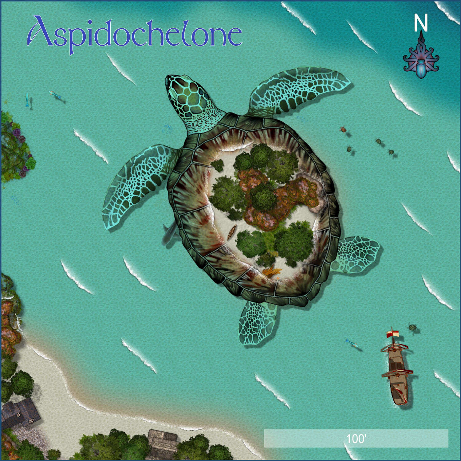
This isn't intended for the Atlas or the village competition, it's just for fun.


 and 4 others.
 -
[WIP] Kingdom of Gongodûr
I changed the two labels to near-white for settlements and near-black for geographical names. (Let me know if you think I should reverse that, with dark names for settlements and light ones for geography.) Playing with text-along-a-curve for some mountain ranges and rivers, and moved some to the side to make them easier to read. (For a few of them, I had to explode the text and ungroup temporarily to adjust the kerning.) Made some effects changes to the political borders but I need to redraw them to reflect the river changes. Oh, and I embiggened the compass and moved it. It also has an inner glow to make it stand out a little.
May not have more time today to work on this -- about to head out to a family function for the day. Hoping to finish it this weekend.

-
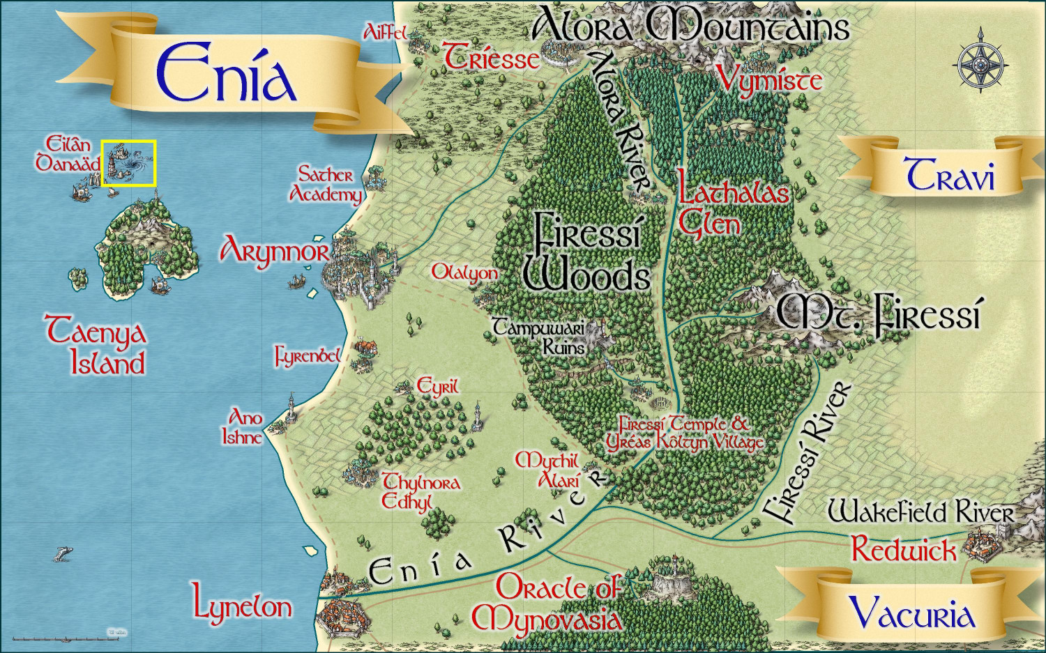
Community Atlas 1000th map Competition - with Prizes [August/September]
I am also ready to submit Eilân Danaäd, my sea elf village and harbor.
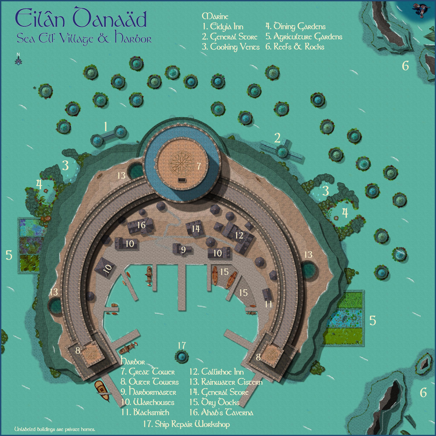
Primary Style: Marine Dungeons
Toggles: "Lighthouse Glow" layer turns on/off a glow indicating where light from the lighthouse emits.
It's located just north of an island off the coast of Enia, the elven kingdom on the north coast of the Gold Coast region previously submitted in this thread, in the area marked with the yellow box.