Royal Scribe
Royal Scribe
About
- Username
- Royal Scribe
- Joined
- Visits
- 9,534
- Last Active
- Roles
- Member
- Points
- 3,353
- Birthday
- February 5, 1968
- Location
- San Francisco, California
- Website
- https://legacy.drivethrurpg.com/browse/pub/31814/Royal-Scribe-Imaginarium
- Real Name
- Kevin
- Rank
- Mapmaker
- Badges
- 16
Reactions
-
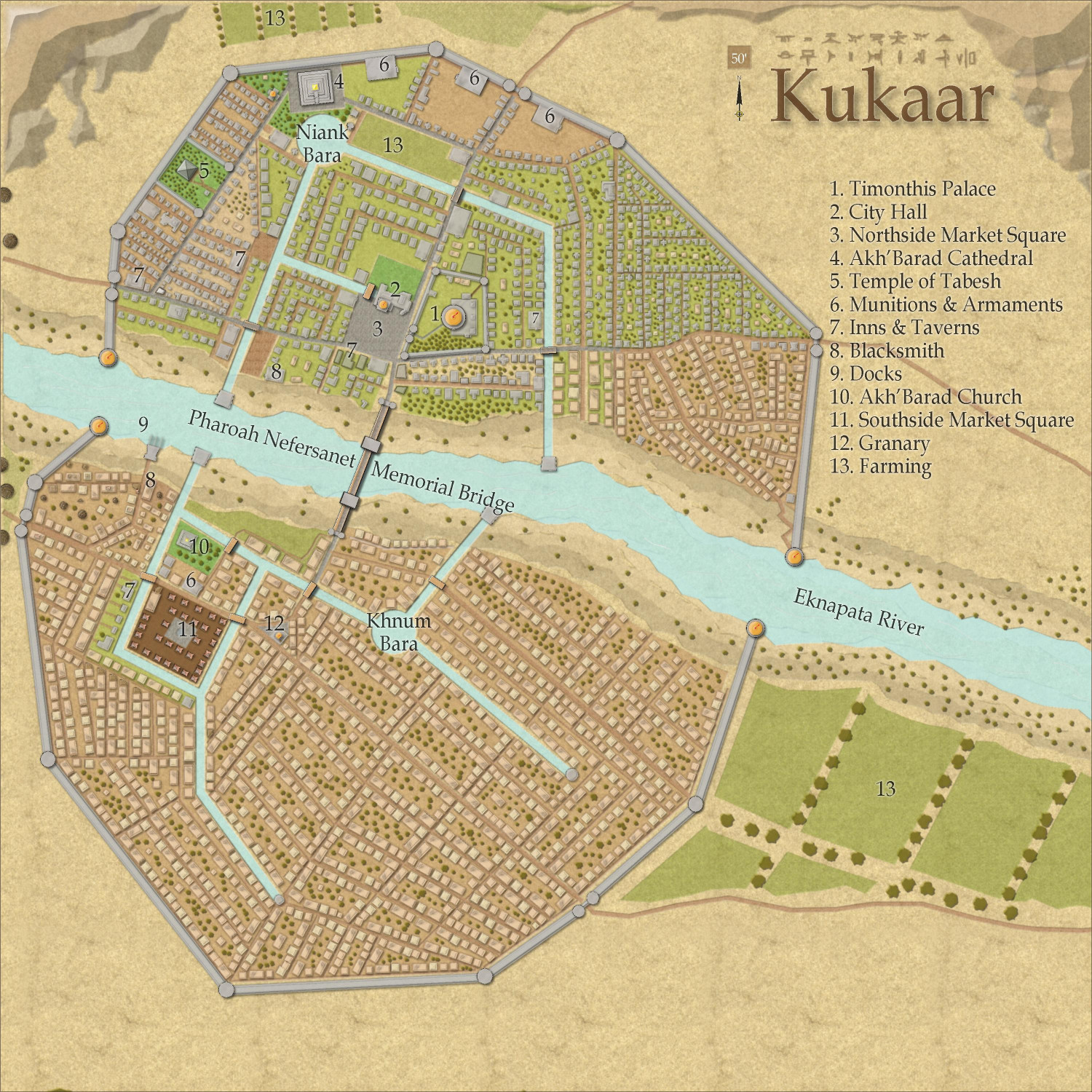
[Atlas Submission] - Doriant - Gold Coast - Eknapata Desert - Kukaar
Hi Remy @Monsen!
I have discovered an Atlas submission for the city of Kukaar that I either failed to tag you in or quite possibly failed to submit at all. My Apologies! This is ready to be added at your leisure.
This is for Doriant - Gold Coast - Eknapata Desert - Kukaar. You'll find Kukaar in pretty much the center of the Eknapata Desert map. It does not have an unusual toggles.
Thank you!
-
Community Atlas Project - Download information - Contributions Welcome
I don't think I have formally reserved anything (please let me know if I have!), but if I may, can I take the opportunity to reserve the following, all in varying degrees of progress (albeit mostly mental plotting for several of these)?
- Doriant - Gold Coast - Redwick/Fort Wakefield (in between the Kingdom of Enia and the Eknapata Desert)
- Doriant - Gold Coast - Caltanna (across the mountain ridge from Fort Wakefield)
- Doriant - Gold Coast - Gongadur - Vale of Dread
- Doriant - Gold Coast - Gongadur - Vez Draka
- Doriant - Gold Coast - Súil Island & the Vortex
-
[WIP] Research Saucer Shuttle
-
[WIP] The Wizard of Schley
Here are the dungeons -- er, basements.
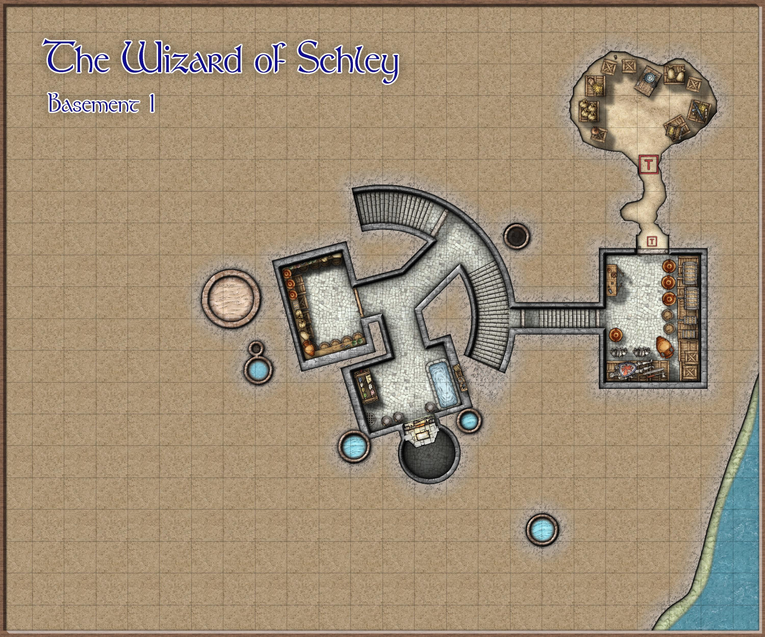
Basement 1
Halfway down the spiral staircase, there's a secret door that leads to a secret passageway with stairs that descend into a hidden treasure chamber. This chamber also has a secret door that leads to a double-trapped secret tunnel that in turn leads into a secret cavern with more secret treasure.
The non-secret areas of this basement include a larder, laundry room with furnace, and stairs locked with a sturdy stone door* that descend to the sewers.
* I have discovered that Mike Schley's dungeons do not have metal doors.
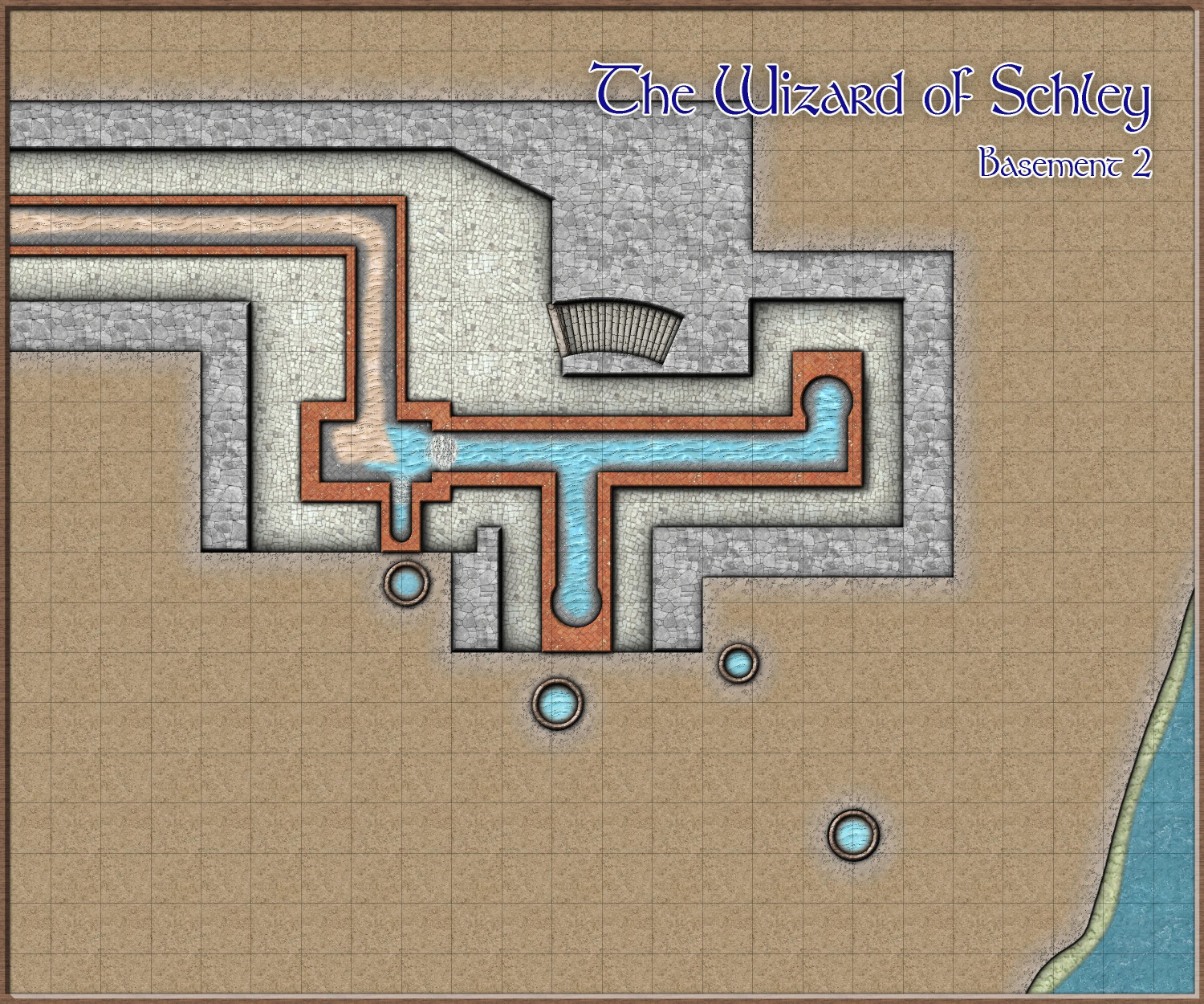
Basement 2
The second basement is really just access to the municipal sewers. I love the idea of adventurers using the sewers for heists, escapes, or other shenanigans.
-
[WIP] Research Saucer Shuttle
I intended to have three decks, but ended up pushing it to four because it was hard to squeeze medical and living quarters into a single deck. And even then, I had to make compromises (like bunk beds, and deciding to have a standard crew of six rather than eight).
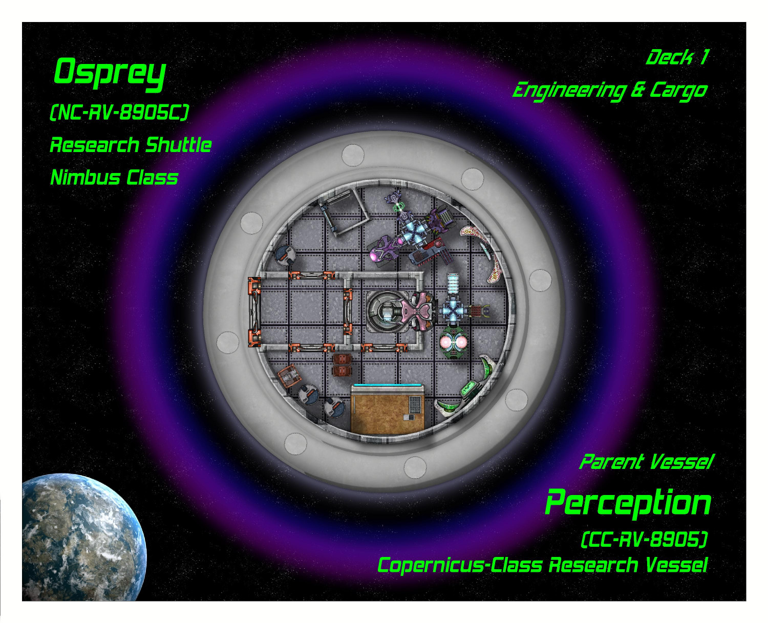
Deck 1: Engineering & Cargo
This is the lowest deck. On the left side is an airlock door with an (unseen) retractable ramp, for planet surface landings. The center has a ring hatch for connecting with other space craft. A tractor beam can also pull objects into the craft from here. The ship's main computers and engineering systems are here, including life support, artificial gravity generators, shield deflectors, the cloaking device, propulsion systems, sensors, weapons, communications, and more.
Cargo (mostly specimens collected from the planet) can also be stored here wherever there's a little spare space.
Deck 2: Medical & Cryo
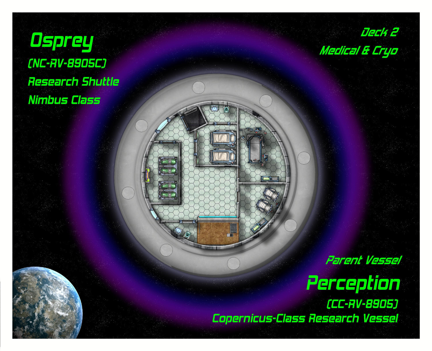
This floor is dedicated to medical care and biological research (including a lab table where local fauna can be...examined). There are four cryogenic tanks here for emergencies -- not enough for the entire crew because this is not an interstellar space craft and the cryo tanks are for emergencies. Usually that means keeping an injured crew member on life support until the ship can return to the parent vessel or space station. Sometimes if a shuttle is stranded, it can keep the crew alive (in rotating shifts) until help can arrive.
Deck 3: Habitat
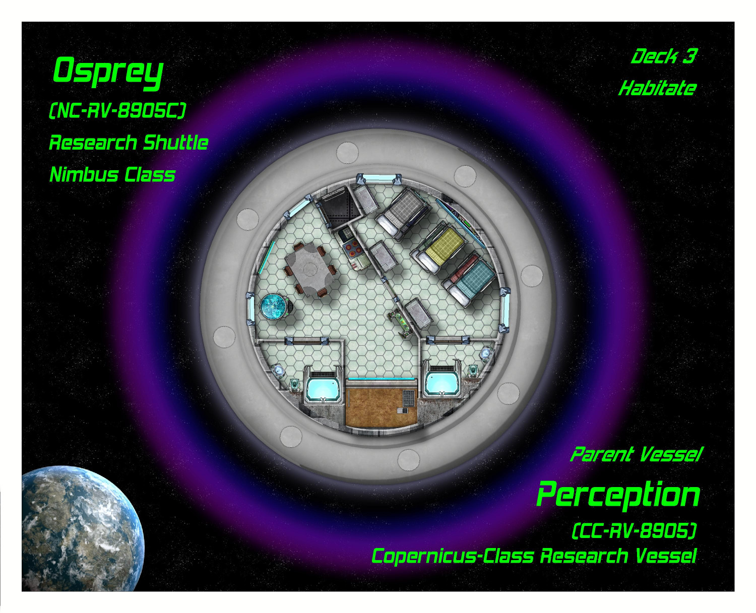
This is where the crew lives when they aren't on duty. As this ship is only intended for short missions of a day or so, sometimes a week, the living quarters can be more cramped than on their parent ship. The crew even has to sleep in bunk beds in a shared room. There are two bathrooms with showers.
The other floors were already posted and haven't changed. I'll see if there's any feedback and then post the final set.


