Royal Scribe
Royal Scribe
About
- Username
- Royal Scribe
- Joined
- Visits
- 9,534
- Last Active
- Roles
- Member
- Points
- 3,353
- Birthday
- February 5, 1968
- Location
- San Francisco, California
- Website
- https://legacy.drivethrurpg.com/browse/pub/31814/Royal-Scribe-Imaginarium
- Real Name
- Kevin
- Rank
- Mapmaker
- Badges
- 16
Latest Images


Reactions
-
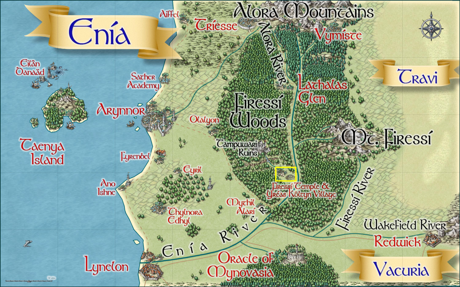
Community Atlas submissions: the Gold Coast (Doriant) and areas within it
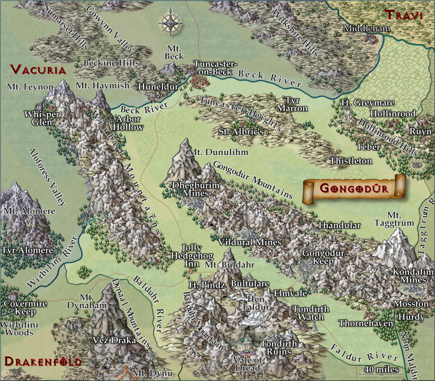
I am ready to submit the Kingdom of Gongadûr area map for the Atlas. At least one village that I will be submitting to the contest will be within this region. (I have active plans for two others in this area but we'll see if time permits.)
The parent map is the Gold Coast map at the top of this thread.
Primary Style: Mike Schley Overland
Toggles: "Borders/Political" layer to turn on/off the political borders


-
Community Atlas 1000th map Competition - with Prizes [August/September]
I am ready to submit Yréas Kóltyn Village for the contest.

Primary Style: Forest Trail
Toggles: "Tree Canopy & Treehouses" to hide/unhide the trees to create a battlemap
It is located in the yellow boxed area here (the parent map was previously submitted in this thread):


-
[WIP] Atlas Contest - Yréas Kóltyn Village (Kingdom of Enía, Gold Coast region of Dóriant)
Making some final adjustments while writing up the description to submit this. Moved some of the treehouses around to make it slightly less grid-rectilinear, though I can't do too much without essentially starting from scratch. Even though the bridge symbols are short sections, it doesn't have curved sections, so my options for winding elevated walkways is limited. I do have ideas for how to do that next time, but it's another thing I'm not sure I can implement in this map without starting over. I also added some more trees and bushes below some of the longer walkways and around the neighborhoods, but not too much -- didn't want to totally hide the village. I agree that the typical wood elf village would be concealed enough that most non-elves walking by probably wouldn't notice it, but since this village is a major destination for pilgrims because of the temple, it's probably less concealed than most. I also added more to the upper canopy to hide the chimneys of the treehouses where lighting fires wouldn't be advised.
Here's how it now stands:
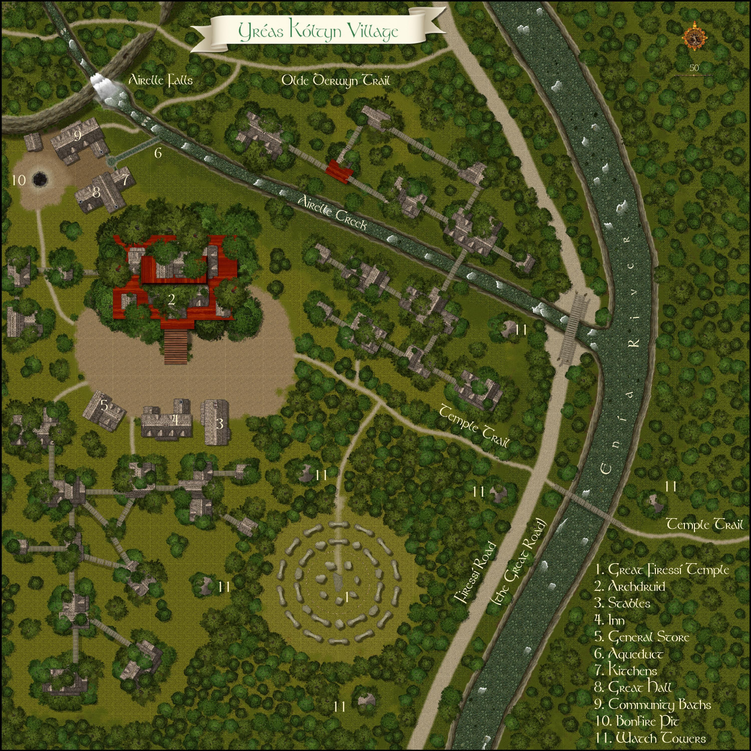
And here's a battlemap with the "Tree Canopy & Treehouses" layer hidden:


-
[WIP] Kingdom of Gongodûr
Tweaked the text for the ones I saw that were too close to the border. I will have the borders set to be on, but the political borders and names of the other countries are all on the same layer, so they can toggle on and off at the same time.


-
[WIP] Kingdom of Gongodûr
Okay, the first thing I did was back another backup of the FCW in case I didn't like the fractalization and couldn't undo it. ;-)
The fractal command isn't something I've used that much, and when I tried it on this map earlier, I wasn't sure of which settings to play with. While I think the smoother map works for a map of this scale, I rather like the Depth 2, Strength 40, smooth result on the rivers. Fractalized a few of the roads but not all -- there were some where it just made the road look overly-caffeinated.
With the place names: I added names for the settlements and rivers that were missing them (let me know if I missed anything important). I've played with the Glow settings a bit. I'll post the FCW, too, if anything has adjustments to recommend.
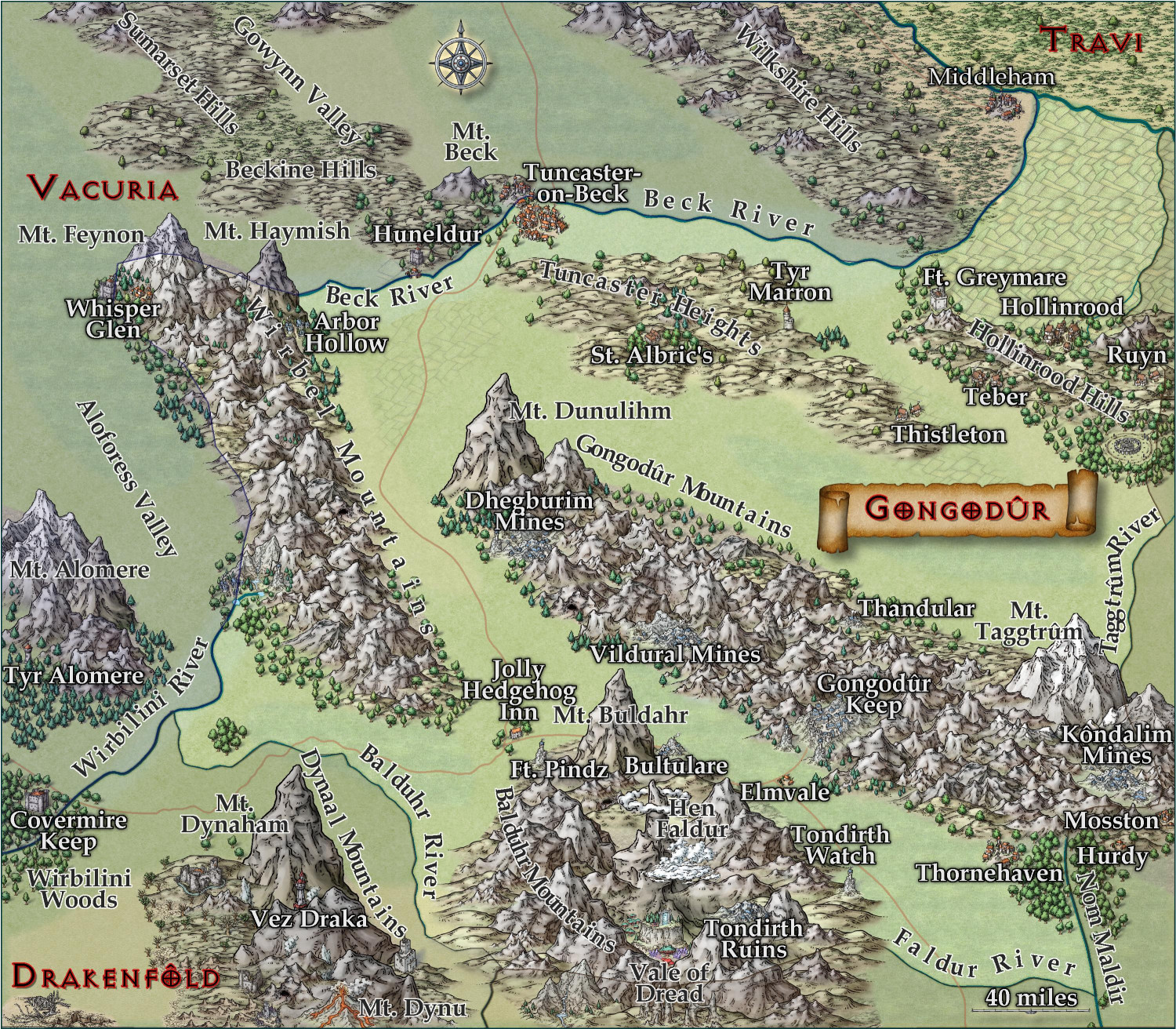
Here it is without the borders:
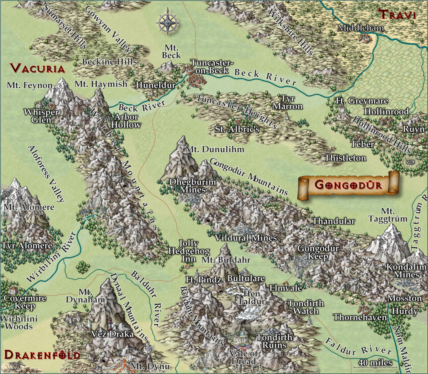
And again with the redrawn borders: