


Loopysue
Loopysue
About
- Username
- Loopysue
- Joined
- Visits
- 9,978
- Last Active
- Roles
- Member, ProFantasy
- Points
- 9,861
- Birthday
- June 29, 1966
- Location
- Dorset, England, UK
- Real Name
- Sue Daniel (aka 'Mouse')
- Rank
- Cartographer
- Badges
- 27
Latest Images


-
[WIP] August Competition - House within city
Hello galik, and welcome to the competition :)
To align the fill of a polygon with one of the edges first hide all the other sheets so that you only have the one with the floor on it showing. Then right click the Polygon tool |CC2POLY| and pick the "Shaded Polygon (Angle by Edge)" menu option. Use the little box on your cursor to pick the edge of the floor where you want the fill aligned.
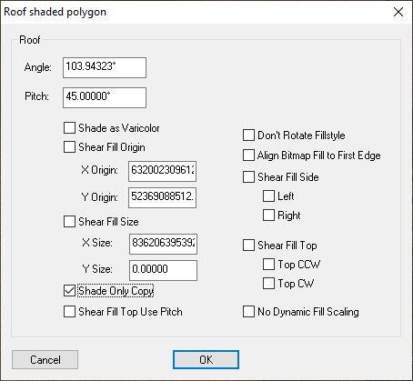
This will align the fill, but it will also shade the polygon as if it is a roof part, so we need to correct that by typing EDITSHADING on the keyboard and pressing the Enter key. Pick the floor again. The dialog that appears then will look quite complicated, but the only thing you need to do is check the little box called "Shade only copy", and then OK.
It is worth noting here that once a polygon is aligned this way you can still use the change properties tool to change the fill and its other properties, but the shape of the polygon cannot be edited. To do that you will have to undo the alignment by using the Explode tool |CC2EXPLODE| on it just the once, and then re-align the fill when you have finished. So it is a good idea to make sure you have the shape of the floor just right before you align the fill.


-
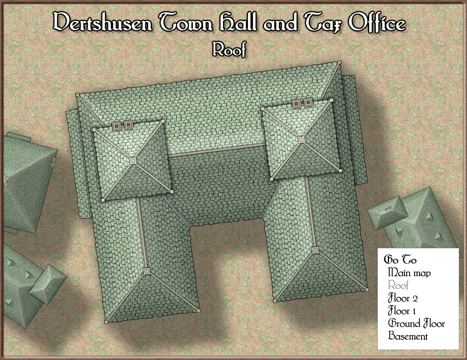
[WIP] August Competition - Vertshusen Town Hall and Tax Office
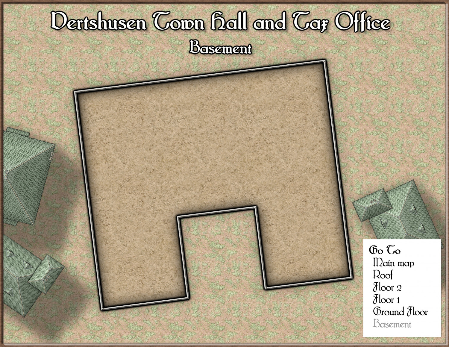
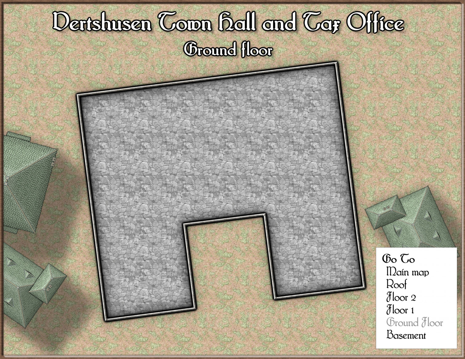
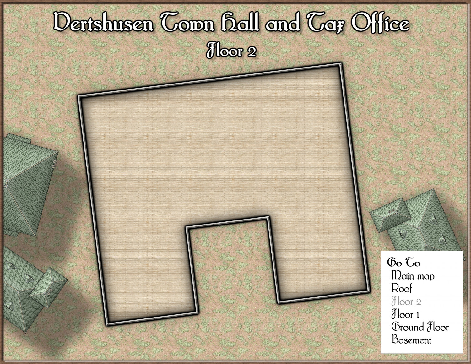
I used the Floorplan tool, and then spent the first hour cropping and arranging the maps with the building itself as close to centre as possible, while trimming as much as I could from the edge - leaving just about enough room for the key and title. No real mapping as yet. I haven't even put the city wall in (adjacent to the back wall of the town hall), or decided what to put on each floor.


-
August Mapping Competition - Building Floorplans - Win Prizes
@Wyvern LOL! Whoever is doing building number 1 is in for a bad deal.
![[Deleted User]](https://secure.gravatar.com/avatar/c75d9a245b74d9c59be0999ea81ca541/?default=https%3A%2F%2Fvanillicon.com%2F92add7f8c954488718110edc4896ad39_200.png&rating=g&size=200)
-
How can you quickly restore missing symbols?
I believe, though I don't know for sure, that you may need to download and install the free third party assets from Vintyri. The reason I'm not sure is because I have red Xs also in those maps, and I have all the Profantasy sets. What I don't have is the CSUAC, the Dundjinni archives, and the Vintyri Cartographic Collection.
You can get hold of these sets through links on this page. Installation can be a bit tricky, so be sure to read the installation guides very carefully and do exactly as described.
If I am wrong I do apologize, but I can't think that there would be another reason for it. At the very least you will gain a whole load of new stuff to use.
I didn't mention Bogies Mapping Collection because I do have that one installed, but still have mostly red Xs in those maps.


-
How do I break an entity (trying to seperate a single landmass into an island and mainland)
There are several ways of varying complexity - each has a 'best use' scenario. In this situation, since the outline is clear of anything else in the vicinity and relatively simple, I would use the Extract Properties tool |CC2KEEP| to set the active properties to match the land, and then break that polygon open by snipping a small piece out of each side of that neck using the break tool |CC2BREAK|. Then I would right click the Fractalise tool |CC2FRX| and use "Path to Polygon" from the menu to convert both the resulting bits of polygon back into separate polygons - one at a time.

-
The Swamp Rat - Playing around with Lighting
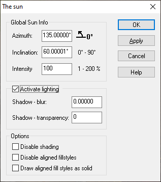
Right click the hourglass and pick Global Sun from the menu. The two settings that affect the way lighting works are in the Activate lighting panel. You can adjust the blur on the shadows cast by your lights, and how intense the shadows themselves are.
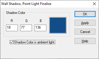
In the 'Wall shadow, Point Light Finalize' sheet effect there is also an option to make the shadows a colour other than black, called 'Shadow Color is ambient light' Have a play with that as well. You will need to change the colour in the Shadow Color panel to see any difference. The default is black.

-
[WIP] Continent Map using CC3+ MS Overland and other resources
It's a little small for me to see all the details, but it looks like a lovely map :)
The level of detail you can have on a map is always dictated by its finished size, and for the same piece of land it varies depending on how large you export it or how closely you zoom into it when you are using it. If the size of the map you use is limited by the VTT in a way that means the map looks too crowded even at maximum zoom, I recommend splitting the detailed map into a series of regional maps in a two-tiered system and drawing a more simplified version to show the full continent with the country names and so on. Think of how little detail a map of the world really contains compared to a map of the county, state or region where you live.

-
My First Floorplan: Cybperpunk Club
Nice map :)
I'm not familiar with either Cosmographer or with using SS3, but if you can switch the lighter grey floor for the darker grey floor that will make the club look darker than outside for a start. Then if you want to go even darker use a Hue/Saturation Lightness sheet effect on the floor.

-
And another small map, this time in SS2 / CSUAC2
You're making some really pretty maps, Daniel :)

-
Map with x signs
If that is where the FCW file started out, then you will be fine as long as you never move the map from your desktop. To use your symbols more freely and be able to move your maps around without worrying about red Xs you really need to store all your symbols in subfolders of the Symbols folder.
These videos by Remy Monsen explain a lot of things about importing third party symbols if you are interested.
https://www.youtube.com/playlist?list=PLulP-cGMLxw4qTpXfilRHgbDUg8WvrEX2
If you need to upload an FCW again you can do that right here on the forum. Just click the attachment paperclip. Or you can do the same in a private message to one of us if you prefer.

