Loopysue
Loopysue
About
- Username
- Loopysue
- Joined
- Visits
- 9,968
- Last Active
- Roles
- Member, ProFantasy
- Points
- 9,853
- Birthday
- June 29, 1966
- Location
- Dorset, England, UK
- Real Name
- Sue Daniel (aka 'Mouse')
- Rank
- Cartographer
- Badges
- 27
Latest Images


-
Railroads
Ok.
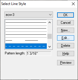
You start by opening the drawing tools. Click the Advanced button at the bottom...
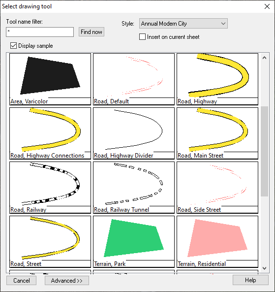
...and then highlight the tool you wish to copy and modify. I'm guessing this will be the Road, Railway, so I will use that one in this example.
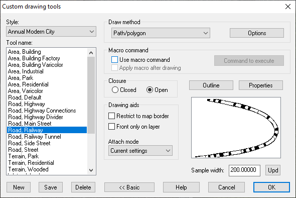
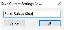
Now click the New button and give your new custom made tool a name, like Road, Railway (mike) or Sue in my case.
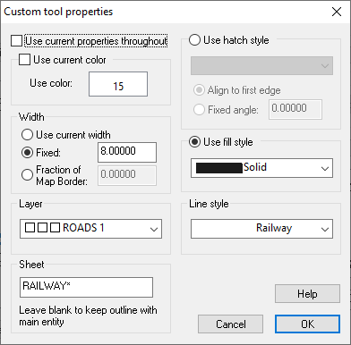
Click the Properties button above the thumbnail image, and you will see the settings for the main unbroken black line that underlies the white dashed one.
Leave this as you find it, since it is the background colour of your railway. Click OK and then click the Outline button next to the Properties button.
Initially this calls up a much smaller dialog with the options set to Extra entity. This extra entity is the second dashed line of white drawn on top of the black line on it's own sheet.
You can see the properties of this extra entity by clicking the Properties button in this much smaller dialog.
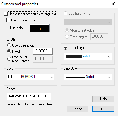
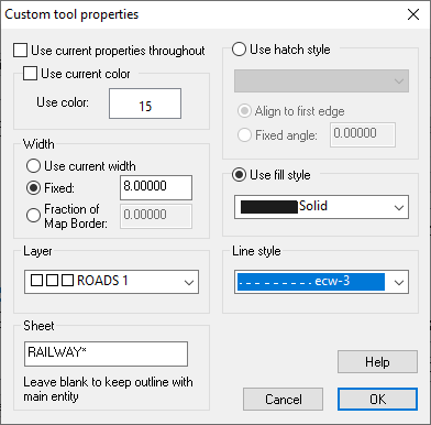
This is the only really confusing bit of the process, because this properties box looks just like the first one at first glance, though it contains the properties of the extra entity, and not the properties of the main part of the drawing tool (the black line). If you compare the two of them you will see the differences. This one has a Use color: set to white instead of black, a width of 8 map units, and a Line style has been set to Railway instead of solid.
Change that Line style to the shortest dash line you can find. I picked ecw-3
Then ok, ok, and save the drawing tool, then try it out. I'm working on something completely different here, so please excuse the background.
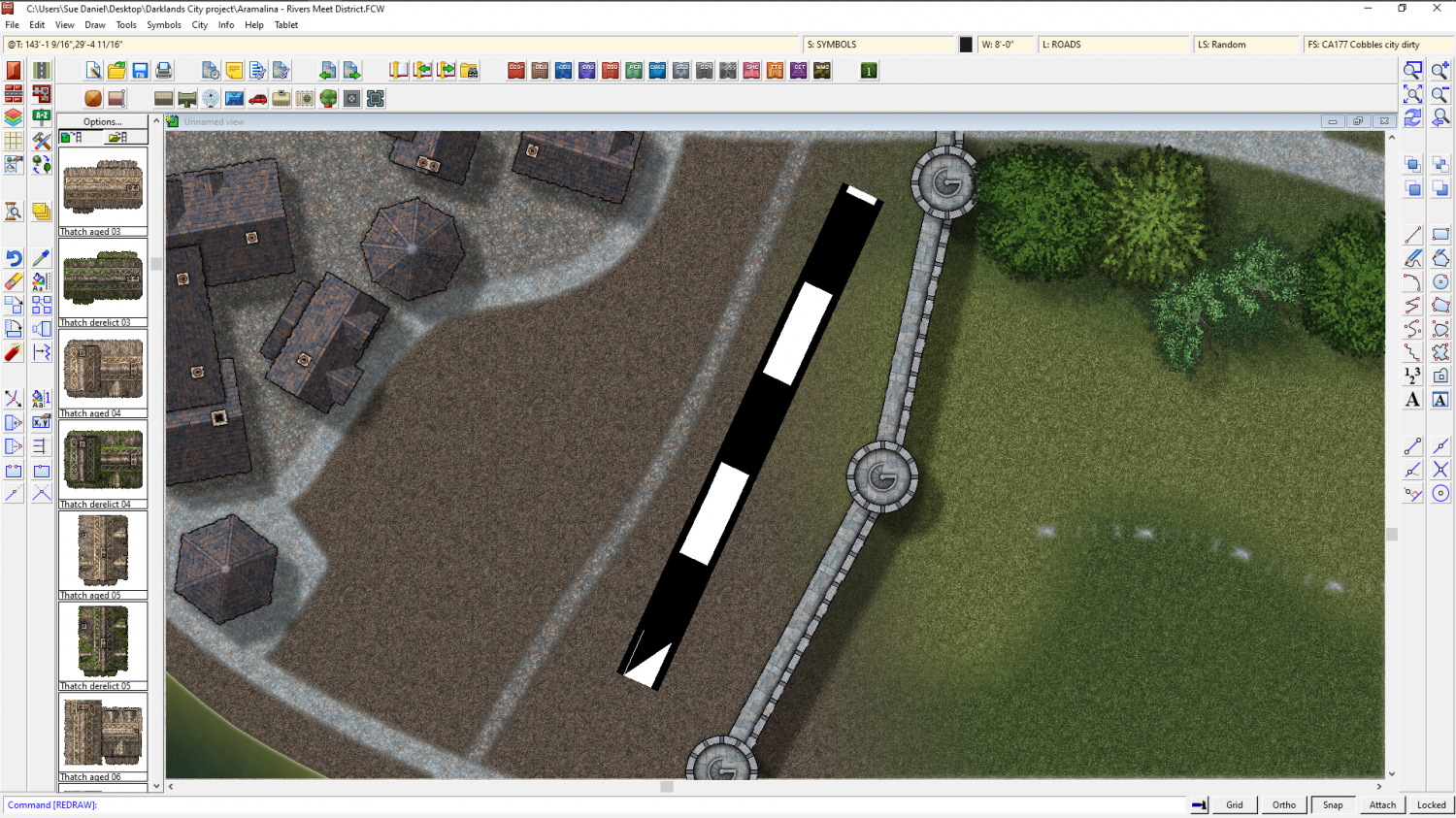
If you need to make both the lines thinner now is the time to do it. Go to both the properties dialogs I showed you above and alter the line width accordingly. I will leave mine super-large so you can see what I do next a bit better.
To make the dashes into lines instead of dashes all we need to do is alter the scale of the line style.
Click the LS: box at the top and find ecw-3.
Then edit the line style and reduce the scale of the line in the bottom text box.
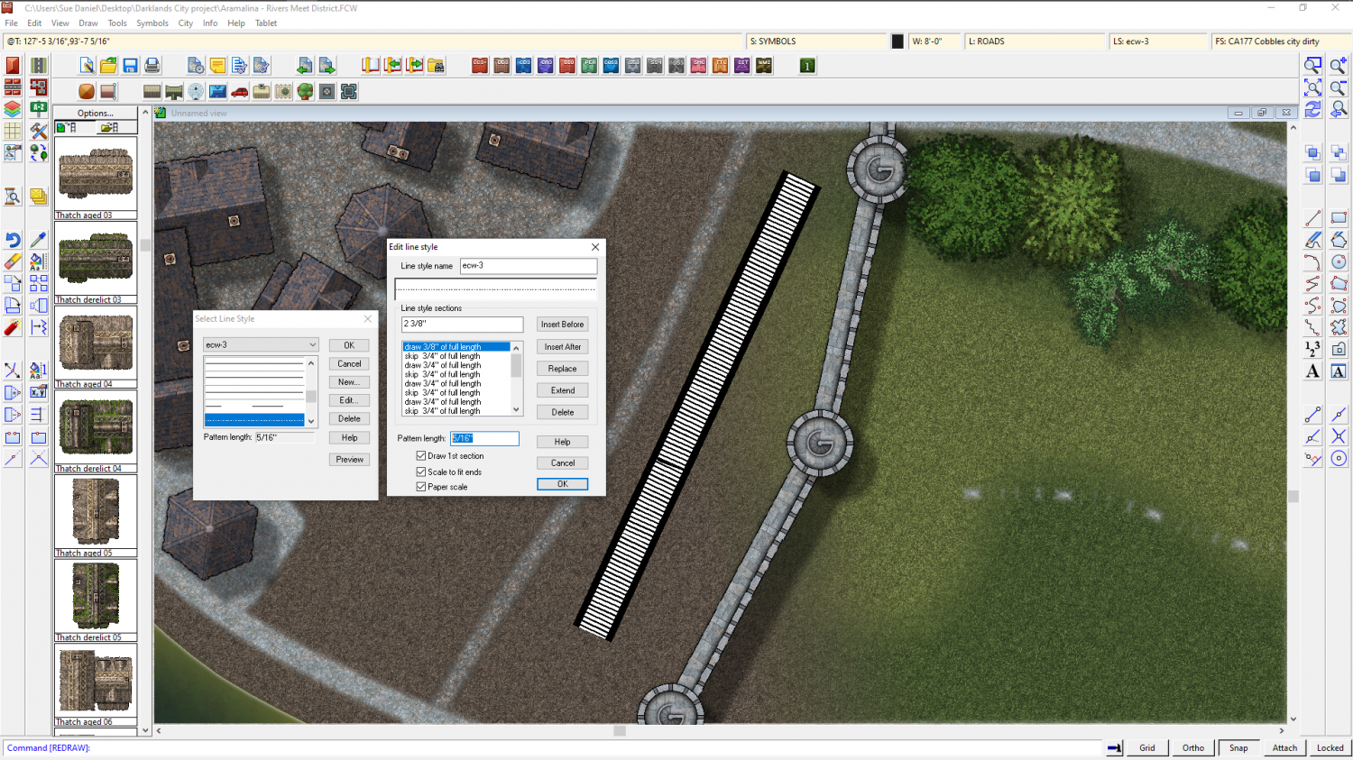
This might take a few tries, but you should be able to set it to something short enough that the result looks something like this.
![[Deleted User]](https://secure.gravatar.com/avatar/c75d9a245b74d9c59be0999ea81ca541/?default=https%3A%2F%2Fvanillicon.com%2F92add7f8c954488718110edc4896ad39_200.png&rating=g&size=200)

-
How do I fill an area?
You can convert the line to a polygon using 'Path to Poly' in the right click menu of the Fractalise tool. It looks like you might have a line width greater than zero, which will form an open polygon. Use Change properties to set the line to zero width and pick your fill, sheet, and layer.


-
Inn/Tavern battlemap (WIP)
That's a really good map elezriata - and "Hi" from Sue Daniel ;)
Have you heard about the Vintyri Collections? These are huge collections of free third party art assets that might help with things like more variation of rugs and furniture.
The links for all the assets can be found here:
Where the Vintyri collections in particular are concerned please read the installation instructions really carefully.


-
August Mapping Competition - Building Floorplans - Win Prizes
I'm late! Oh dear.
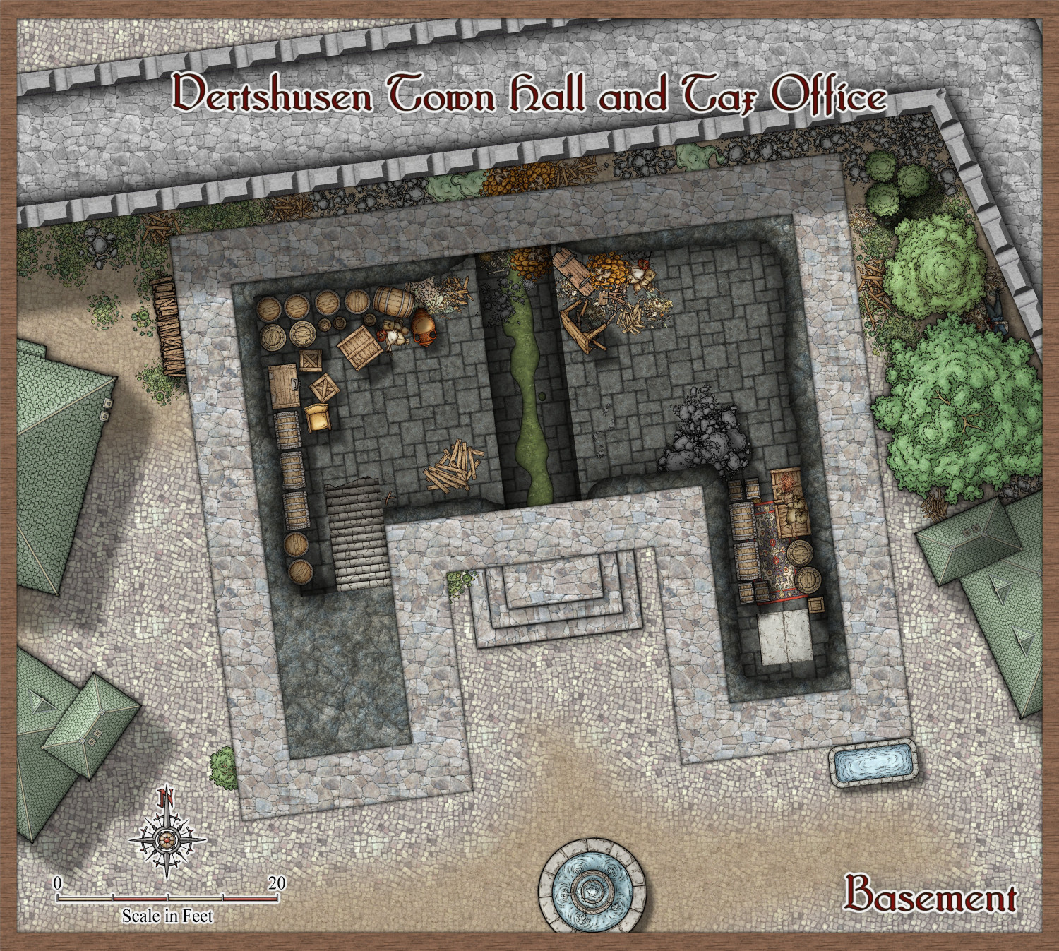
I'm also pretty crazy, so I've picked one of the largest remaining buildings - the Town Hall and Tax Office.
-
[WIP] August Competition - Vertshusen Town Hall and Tax Office
If this one looks different to all the others, that's because it is.
I had to start again.


-
Objects completely invisible while being moved/rotated
Try hitting the TAB key while you are moving/rotating/copying the objects. It toggles their visibility on and off.

-
WIP Commission, Ancient Tombs
On that last point, Raiko, I think there might be an issue if Jim is using the app for commercial purposes. The license is quite specific about it in the first paragraph under "DESCRIPTION OF RIGHTS AND LIMITATIONS".
However, it is not Profantasy's intention to be obstructive to the enjoyment of their software, so it is probably worth making polite enquiries via Tech Support to find out exactly how this rule applies to your particular circumstances and the issues you are having, @jmabbott


-
The Lakes of Michigami (Jerry's Map) - WIP thread
I've roughed out the rest of the map and added a new title from Jerry. There have been a few name changes. I'm still working on the rivers - tapering them and tidying the ends.
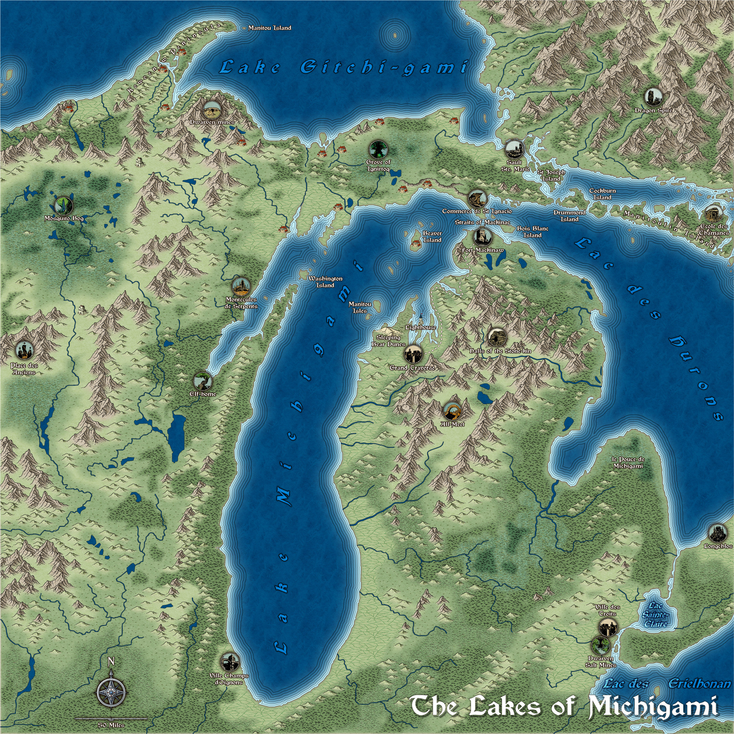
@GThiel - Jerry, please let me know if I have forgotten anything, or if you want anything changed from the way I've done it? Thanks :)

-
Creating greater depth
I think you are doing well with the contouring. It does take some time and patience to get it right. Roads are a tricky one. I did a city a long time ago and cheated a little bit by using 6 or 7 tiers a bit like a disorganised wedding cake. That way each tier cast a shadow where necessary over the roads and houses on the tiers below.


-
No matching draw tool for "Wall*"
Ok. Taking a random example...
If I have created a map in DD3, and I want to use SS4 (Dungeons of Schley) in it, I would get the drawing tools as described above, and then I would open a second instance of CC3 by right clicking the desk icon and picking CC3, or New, or whatever your system provides for a new instance of an app, and then I would use that instance to create a new SS4 map. I would then save that temporary map with nothing drawn in it as "TEMP SS4" and Pick that as the file to Insert into the DD3 file I was actually working on. I would insert it, but then immediately delete or undo the action because I don't want the dummy SS4 map or any part of it. I just want to fool CC3 into importing all the relevant fills for SS4. It doesn't matter that the dummy map is instantly deleted. The fills are imported in that instant and they stay, even though the SS4 map is gone as fast as it arrived.
Once that is done all the SS4 drawing tools will work as if this was an SS4 map.