


Wyvern
Wyvern
About
- Username
- Wyvern
- Joined
- Visits
- 3,238
- Last Active
- Roles
- Member
- Points
- 5,517
- Rank
- Cartographer
- Badges
- 24
Latest Images


-
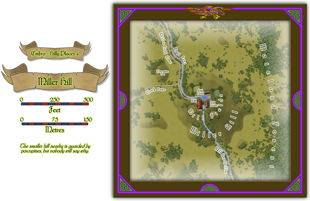
Community Atlas: Embra - Hilly Places
Miller Hill as Place 4 seemed an obvious choice for a Hilly site. However, as stated already, y'know, Embra. So this is a water mill at the top of a hill, with a stream that runs uphill to the mill pond on the summit, runs the water wheel, and then descends down the other side of the hill again! Naturally, no one here thinks this is anything unusual - how could the mill run without a water source, is the primary response to those who might seek to question the setting:
There are some buildings on this map too, for once in the "Hilly" selection, which have interiors that can be viewed using the toggle in the FCW file in the Atlas, all being well:
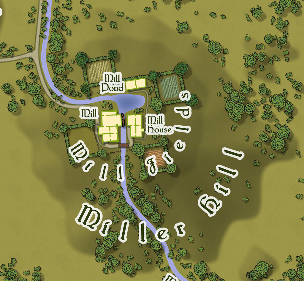
It has to be said I was delighted to see the random base map options had provided one that so obviously fitted the nature of a mill site of this, shall we say unusual, kind - those four square fields looking like the sails on a windmill. So there's a note in the PDF and text files for this map suggesting GMs could have the four fields, and their hedge/fence lines, rotate, flowing over the land surface like cloth, carrying anyone in one of the fields along with them, but only when the wind blows strongly. Everything else of course stands quite still; and not entirely by chance, the rotation centres more or less on the axle of the mill-wheel, where else?
![[Deleted User]](https://secure.gravatar.com/avatar/c75d9a245b74d9c59be0999ea81ca541/?default=https%3A%2F%2Fvanillicon.com%2F92add7f8c954488718110edc4896ad39_200.png&rating=g&size=200)

-
Community Atlas: Embra - Wooded Places
Wooded Place 2 is the Elfin Stone Ruins, now with extra map-border creatures (don't you just love "Mirror Copy" sometimes?):
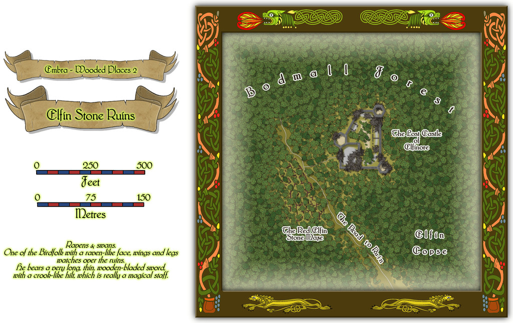
Which also shows I finally gave-in and decided to actually map one of the castles from the original base map as a genuine castle for once - or rather, a ruined version of one. Sort of... As a close inspection will suggest though, the castle doesn't seem to have had an actual gateway. A slightly better resolution image may help:
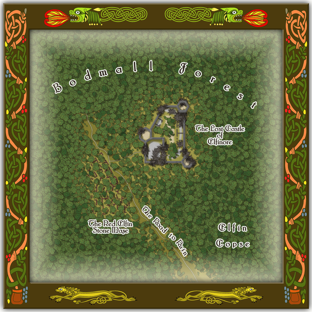
As for The Red Elfin Stone Maze, that's difficult enough to see on the actual CC3+ map, albeit quite deliberately so, since the adaptation of the original base map's features here called for something odder than just ruined walls of somewhat poorly-constructed peasant housing (my reasoning behind the wall-lines on the hand-drawn JG original not being entirely straight in places). If the ruins give the impression they may have been built that way, and are not of earlier buildings that have decayed and fallen apart, that might well be correct.
Oh, and there really is nothing to distinguish that part of the dense woods labelled "Elfin Copse" from any other part of the Forest nearby, incidentally. Come on - this IS Faerie, after all!
-
Ancient maps
That 22-foot Roman Empire map is the Peutinger Table, aka Tabula Peutingeriana, and the Wikipedia page includes a high-res complete image of the whole - may take a while to load, however, as the full-size JPG is about 15 MB. This is the direct link to that Wikimedia image.

-
Community Atlas: Embra - Wooded Places
Wooded Place 5 is Wistful Hollow Chapel:
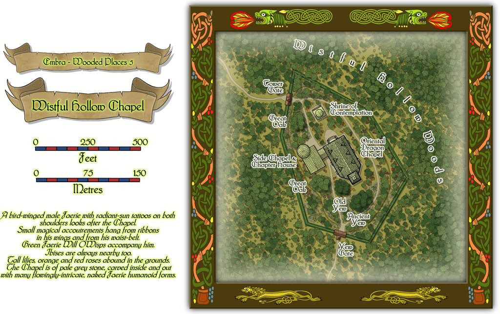
This was naturally somewhat easier as a drawing, with more random than planned vegetation, if still with a few substantial trees, and a lavish scattering of flowers across the Chapel's grounds. I picked the base map - yet another castle-form, who'd have guessed? - because the outline for what became the grounds looked like a very sketchy drawing of a prehistoric stone hand-axe, even though that has no bearing on the map or its contents at all!
Indeed, the Chapel's primary inhabitant (not even mentioned in the featured text) is a living, golden, Oriental Dragon that provides advice to the deserving who come here. That wasn't simply on a whim, but because there's a genuine church (the High Kirk of St. Giles) at the real-world city of Edinburgh that has a Chinese Dragon decoration in it. It wasn't hard to see that Embra needed something similar.
The map ended-up looking rather different to a lot of the larger Embra maps too, as the size of the buildings needed to be on a suitable "draconic" scale, so they almost look as if the map's in one of the smaller border frames, for all the map scales alongside clearly show it isn't.
Not all the illustrated structures are full buildings, as the "Interiors" toggle view demonstrates:
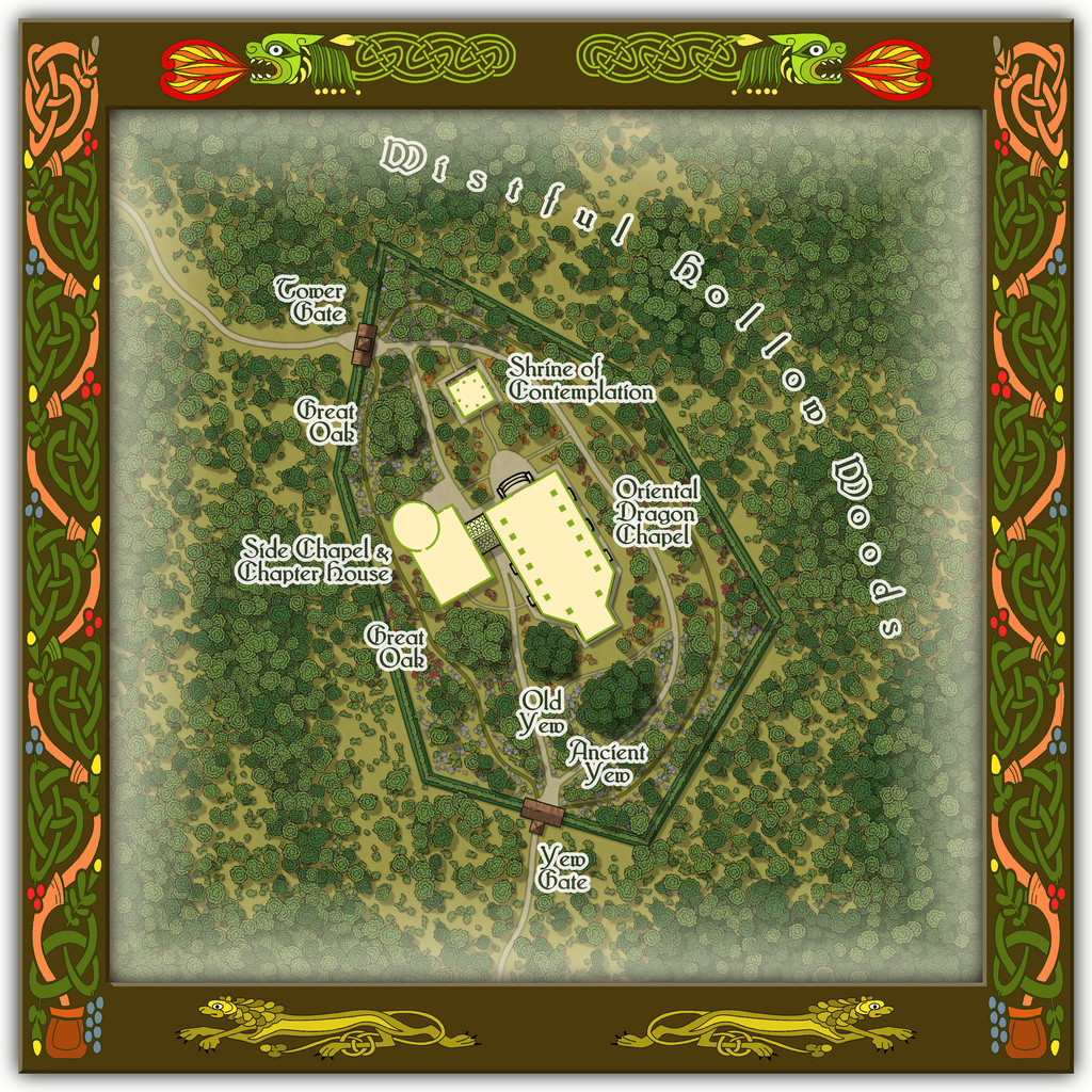
The Gates to the grounds are simply covered gateways, lychgate-style, while there's a tiled-roof walkway crossing the path between the Chapel and Side Chapel, not a linking building.

-
Community Atlas: Embra - Constructed Places
Constructed Places map 1 is that for the ruler's Crepuscular Palace at Embra. Well, I say "ruler", but she's actually more the physical embodiment of Embra made magically real and living, The Verdant Sorceress, who flies on wings made of summer flowers. Something like the Archfey of D&D, though really more like the deity of/being who is Embra in power and abilities here. The name and flower-wings came from random rolls using tables in A Wanderer's Guide to the Feywild, by Heavenly Spoon, available on the DM's Guild download site (Pay-What-You-Want). The rest is more "me", however. I'd added some details to the PDF and text files for the Crepuscular Palace map before I realised it would be feasible to provide a CA3 drawing of the Sorceress for the Atlas as well, something that needed quite a bit of late revision of both texts and the Palace map. Although there wasn't space to add the full CA3 drawing to the Palace one, I did want to add a suitable link-spot by it. So this is the final Palace map:
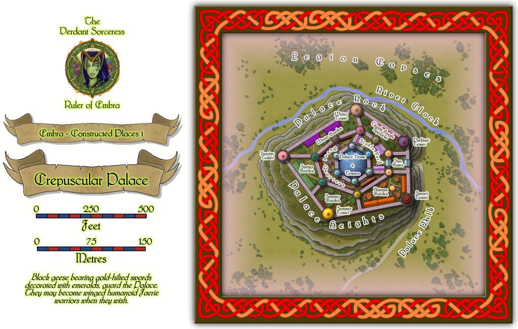
And this is the lady herself:
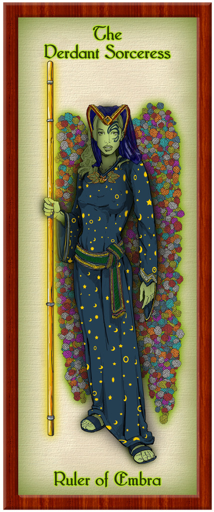
Of course, this is only how she appears in her Elf-like humanoid form, when out and about meeting people, and not trying to terrify visitors unnecessarily. She could seem equally to be anyone else in Embra, or anything at the city - such as a flower, a shrub, a tree, a building, a pond, a floral meadow, a path, a hill, a forest, a cloud, a rainbow, colours in a cloud, the River Clack, or a blade of grass. In a real sense, she IS Embra, in all its aspects, positive and negative. (Oh, and this means the final tally of Embra drawings for the Atlas is now 58, not 57...)
Those who've been following this lengthy series of posts regarding my Embra mapping closely may recall the Palace Heights map among the Hilly Places, and spot the resemblance to this Crepuscular Palace one. That would be scarcely surprising, as they're the same place, here with the Palace a living, still fully extant, building, rather than grassed-over ruins. With an interior:
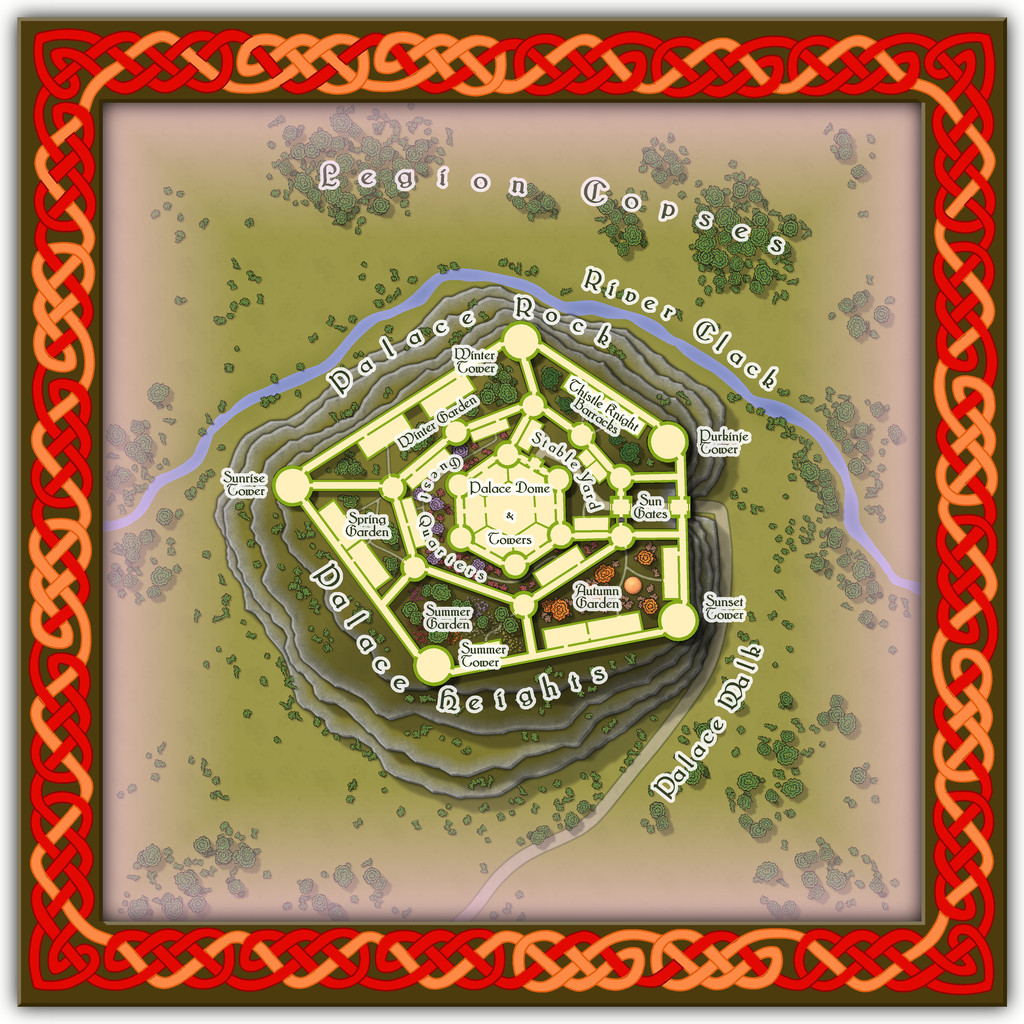
However, the interior is shown only for the ground level. The upper storeys - which all the towers, walls and great central dome have - are left for GMs to determine, if required, as the elements in it change from time to time.

-
Mythic Carpathia map by Free League Games
There's a good reason for that. It is!

-
Sinister Sewers - Style Development Thread (CA207)
@thehawk makes a good point about ancient sewer systems. I think the earliest definite sewer pipes date to around 4000 BCE in what's now southern Iraq, at the ancient cities of Eshnunna and Uruk, although more sophisticated sewer systems survive archaeologically from the Indus Valley civilization around a millennium later (c. 2300-1800 BCE). Most were of brick or clay construction in various forms.
-
Community Atlas: Embra - Wooded Places
The third map in the Wooded Places set gave me an opportunity to try something I've wanted to do for a long time, map some spiral patterns in woodland. Those sufficiently familiar with fantasy fiction might guess the idea originated in the "Mythago Wood" tales by Robert Holdstock (the original novel, "Mythago Wood", was published first in 1984), which made a lasting impression on me from when I read them back then. The final map though bore only a mild, passing resemblance to its original base. Thus came to be Spiral Glade Park:
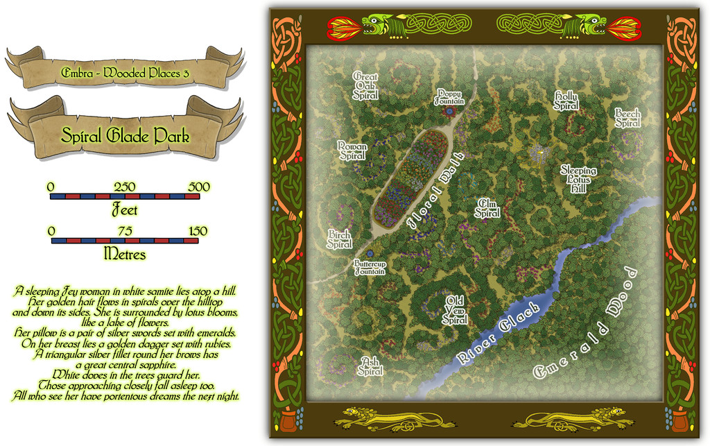
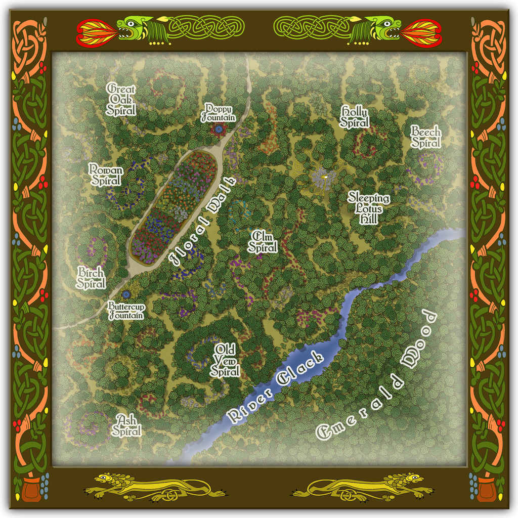
The details are a little tricky to see at this resolution, so again, we can try a somewhat closer view of just the map part:
For those wondering, yes, Sleeping Lotus Hill does have a simple sketch of the sleeping Fey woman in white of the map's featured text, and her spiralling golden hair, surrounded by lotus blossoms. There are also a lot more flowers scattered across this map, as with several other of the Embra Places, of course. The PDF and text file notes suggest some possible benefits from traversing the spirals, and a warning regarding the curious grassy hummocks mostly hidden by the lotuses...
-
And another small map, this time in SS2 / CSUAC2
So a bazaar of the bizarre? 😉


-
[WIP] Community Atlas, 1,000 Maps Contest: Villages in The Whispering Wastes of Haddmark, Peredur
Place four is from Hex 805, Toresk Village:
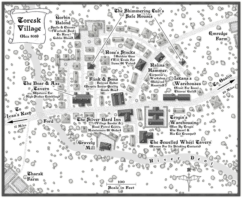
A somewhat more conventional, "open", layout for the next village in this group compared with last time's Ivan's Keep, if with more potentially untoward locations this time, including an overt reference to The Shimmering Cult, to add a little more linkage between features across the maps in this Haddmark mapping extravaganza. Those who read through last time's PDF notes here will have learnt the Druids from Hex 611 had a hand in creating the defences at Ivan's Keep (and may be responsible for the Goblin attacks on the place too, while The Shimmering Cult may be behind the Kobold attacks there...). Here, no similar problems, just a variety of dubious or curious goings-on. The map notes, as usual, have a little more detail.
Even so, I wanted the layout to be a bit odd, since the random rolls in the Shadowdark tables had come up with a Chaotic nature for the settlement (for those unfamiliar, most things in this RPG can be assigned an alignment - Law, Neutral or Chaos - as a keyword for GMs to apply as they choose to provide variant atmospheres for different places). So the village began nearer the river as a planned layout, but as more people came here, it spread more haphazardly eastwards, such that the older properties are now rather run-down and ill-favoured, despite also having a neater street pattern and fancy road-end walls.


