Monsen
Monsen
About
- Username
- Monsen
- Joined
- Visits
- 660
- Last Active
- Roles
- Administrator
- Points
- 8,858
- Birthday
- May 14, 1976
- Location
- Bergen, Norway
- Website
- https://atlas.monsen.cc
- Real Name
- Remy Monsen
- Rank
- Cartographer
- Badges
- 27
Latest Images


-
Too early for a CC4 wishlist thread, or is it timely?
Feel free to post wishes. It is always nice to know what the community thinks and wants. Please do be aware that some wishes may not be feasible due to technical limitations, so popularity here doesn't necessarily mean it will be implemented, and for the same reasons, not implementing a suggestion doesn't mean you are ignored.
ProFantasy staff, including the main developer, do read these boards, so suggestions will certainly be noticed when posted here.


![[Deleted User]](https://secure.gravatar.com/avatar/c75d9a245b74d9c59be0999ea81ca541/?default=https%3A%2F%2Fvanillicon.com%2F92add7f8c954488718110edc4896ad39_200.png&rating=g&size=200)


-
[WIP] - An audience with the King
@Royal Scribe wrote:
Although the FSC files are important for connecting symbols, are they strictly necessary for other symbols? Instead of navigating to the Monthly 13 FSC file, I navigate to the "Monthlies" folder and within it are subfolders descriptively named for each of the new symbols
Generally, opening the folder of png files instead of the FSC is not that a good idea. All the settings for the symbols are in the symbol catalog file. The folder only contains the raw images. This means that the symbols won't automatically go to the right sheet, settings like collections and random transformations won't be used, smart features won't be available, and the origin point may be different than the symbol. Not all of this is equally important for every symbol, but generally, opening the folder should really only be considered for cases where there are no symbol catalog available.


-
Compass Roses
Very nice. A few more, or maybe some other map decoration in the same style (Like boxes for titles & legends, scale bars, etc), and you have a great annual issue right there....


-
Live Mapping - Mastering your Fills
There seemed to be a bit of an interest in learning more about how to tweak the various fills to get more options, so I thought it might be a good topic for a live stream.
As always, you should be able to see the time in your timezone in the navigation bar to the left or by visiting the YouTube page.

-
Help! Nothing in my FCW will display
Something has happened that corrupted the current coordinates, so when zooming, it causes CC3+ to multiply numbers with illegal values, which won't work very well unfortunately.
The easy way to fix it is to just do a View -> Zooms -> To all Text, then pick any text entry in your map. That puts you back into proper coordinates, and zooms should now work fine.
-
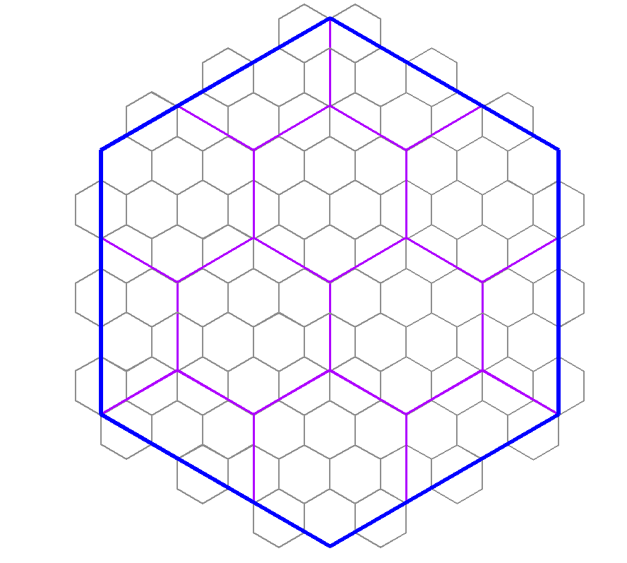
Please help with hex map scales...
Also, how do I know how big the hex is? Do I measure edge to edge? Top to bottom?
In CC3+, the size of the hex is measured edge to edge. (For a horizontal hex grid, that would be the same as top to bottom, since edges are at the top and bottom). [This means that the corner to corner size will be 1,15 times larger than the specified hex size]
The scale really depends on how detailed you want your world. Hex mapping, by it's nature, do make the detail level a bit simpler for a map. Hexes are also a bit problematic when you want different sizes, because you can't easily line up hexes inside a hex like you can with squares. But the best number is if you use a difference in scale that is a multiple of 3. (As such, your example of using 6 miles, then 24 miles doesn't work too well, because 24 is 4 times 6, and 4 is not a multiple of 3). As long as you use a multiple of 3, you should be able to have a tiling that only includes full and half hexes, as per my diagram below, and corners will line up with each other. (so 6 and 36 would be appropriate values for the two scales in your example)
As for the whole world scale, just continue multiplying by numbers that are a multiple of 3 and establish a size that feels comfortable for you. Generally, I would be very of any size that leaves more than a 100 hexes in any direction, but if you use 36 for regional areas, you could consider 216 for continents and 648 for world size. Those sizes would line up nicely with each other.
But, then there is the big question, do you even need them to line up properly like this? If you map each map individually, then you might not ever have the larger hexes of the regional map be a factor at all when making local maps. Sometimes, the value of having hexes of nice round sizes can be much more beneficial for the current map. Hexes for the main map could be 250 or 500 miles, continents could be 100 miles, regional ares 25 miles, etc. Unless the maps are going to be directly overlaid each other, you probably aren't actually going to need hexes that lines up with bigger scale maps. But of course, this is up to your own needs and desires.


-
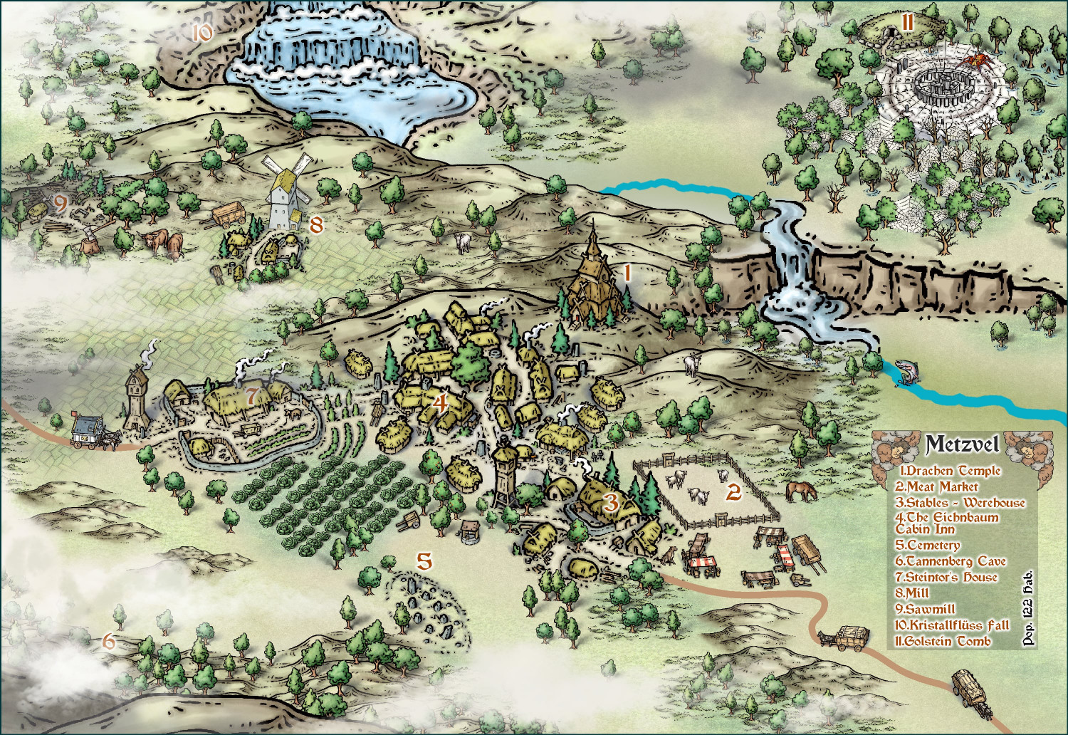
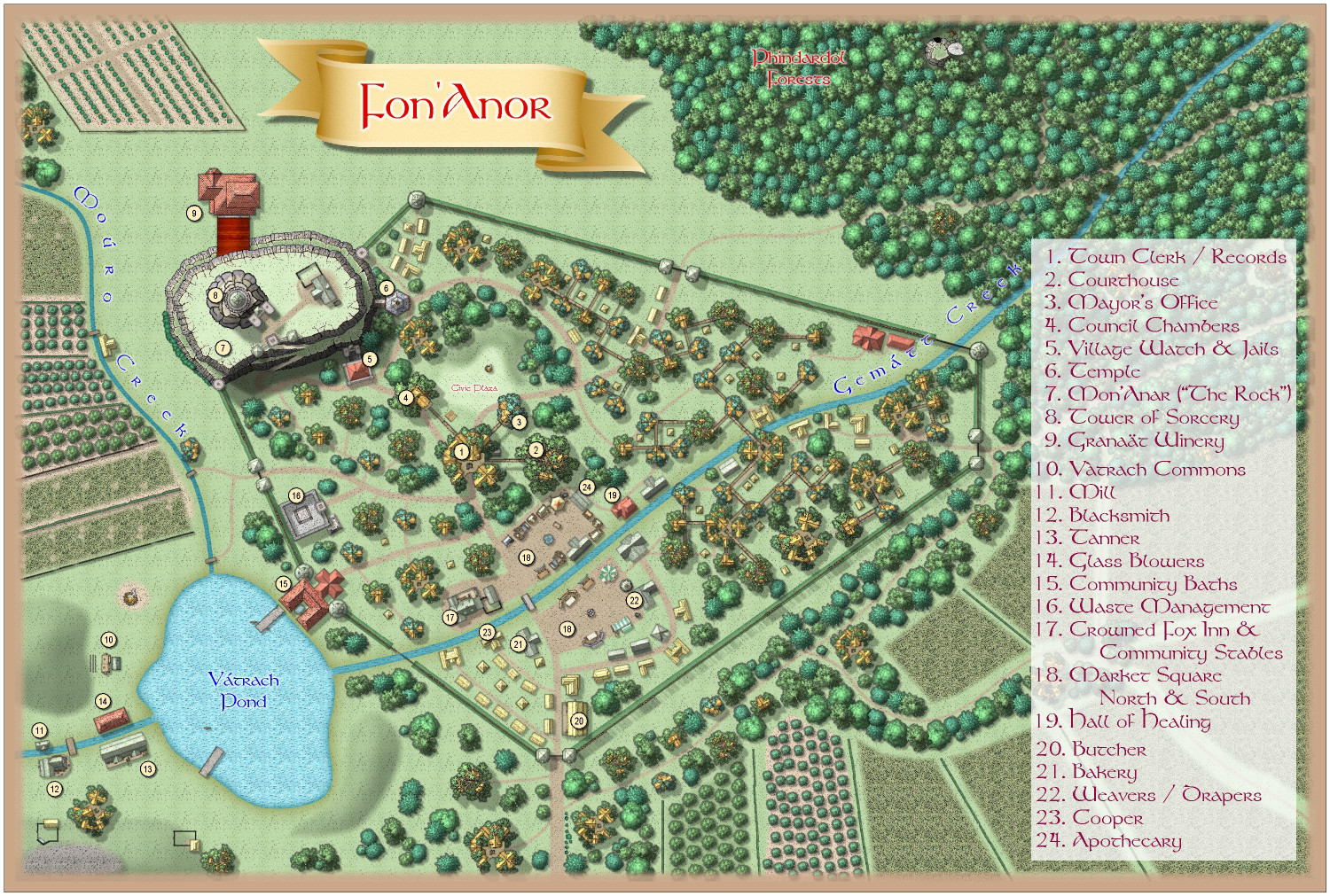
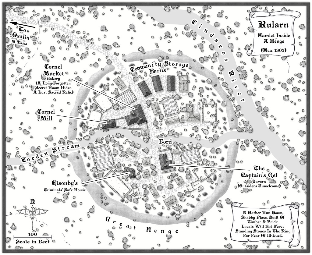
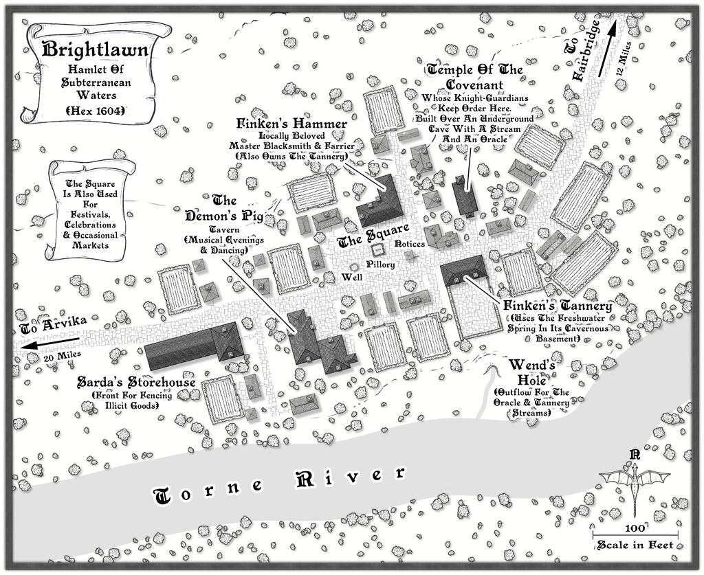
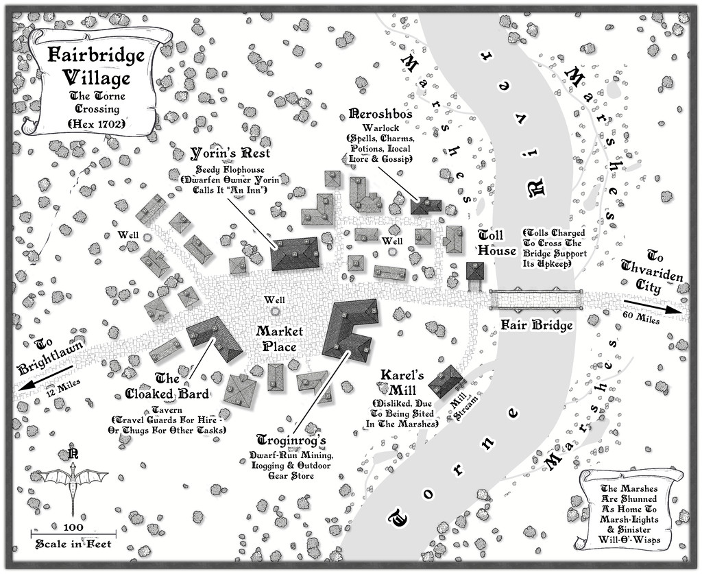
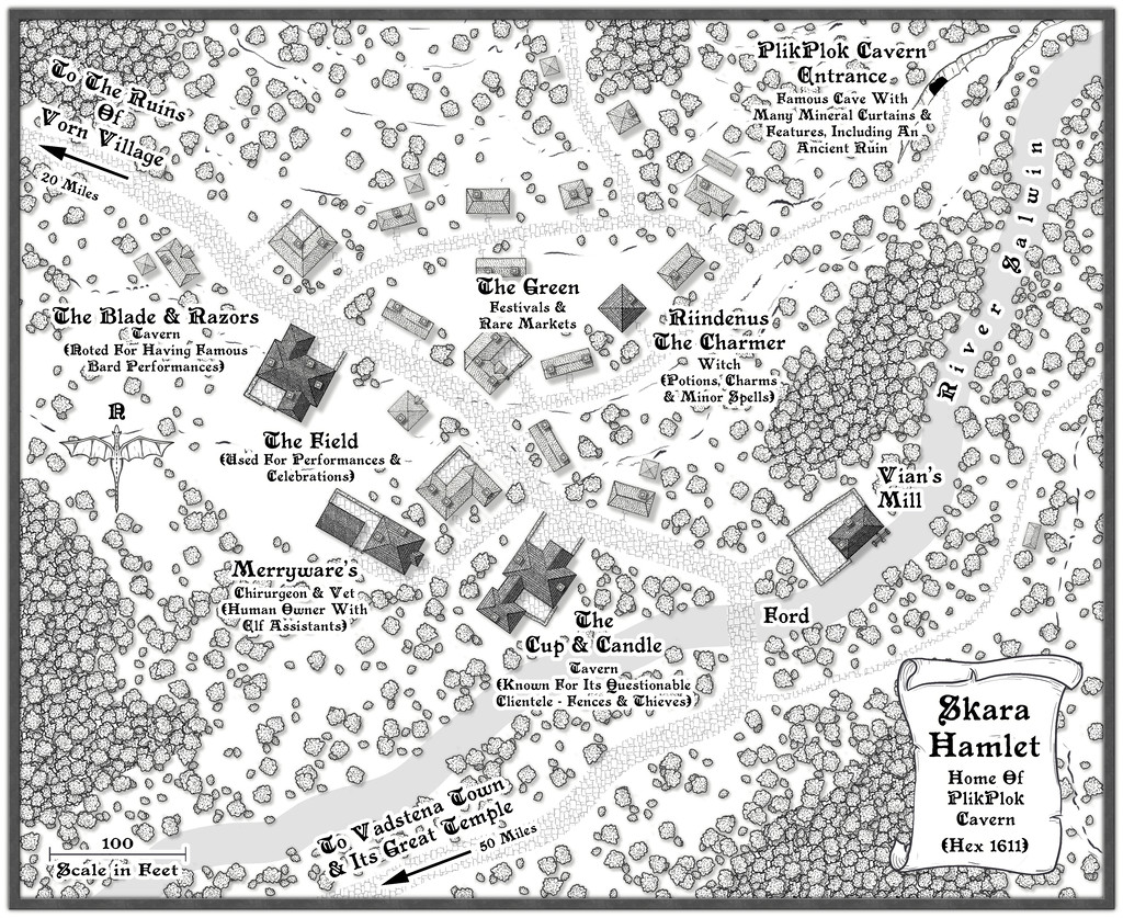
Community Atlas 1000th map Competition - Please Vote (Even if you didn't participate yourself)
1. Ricko Hasche - Metzvel
2. Royal Scribe - Fon'Anor
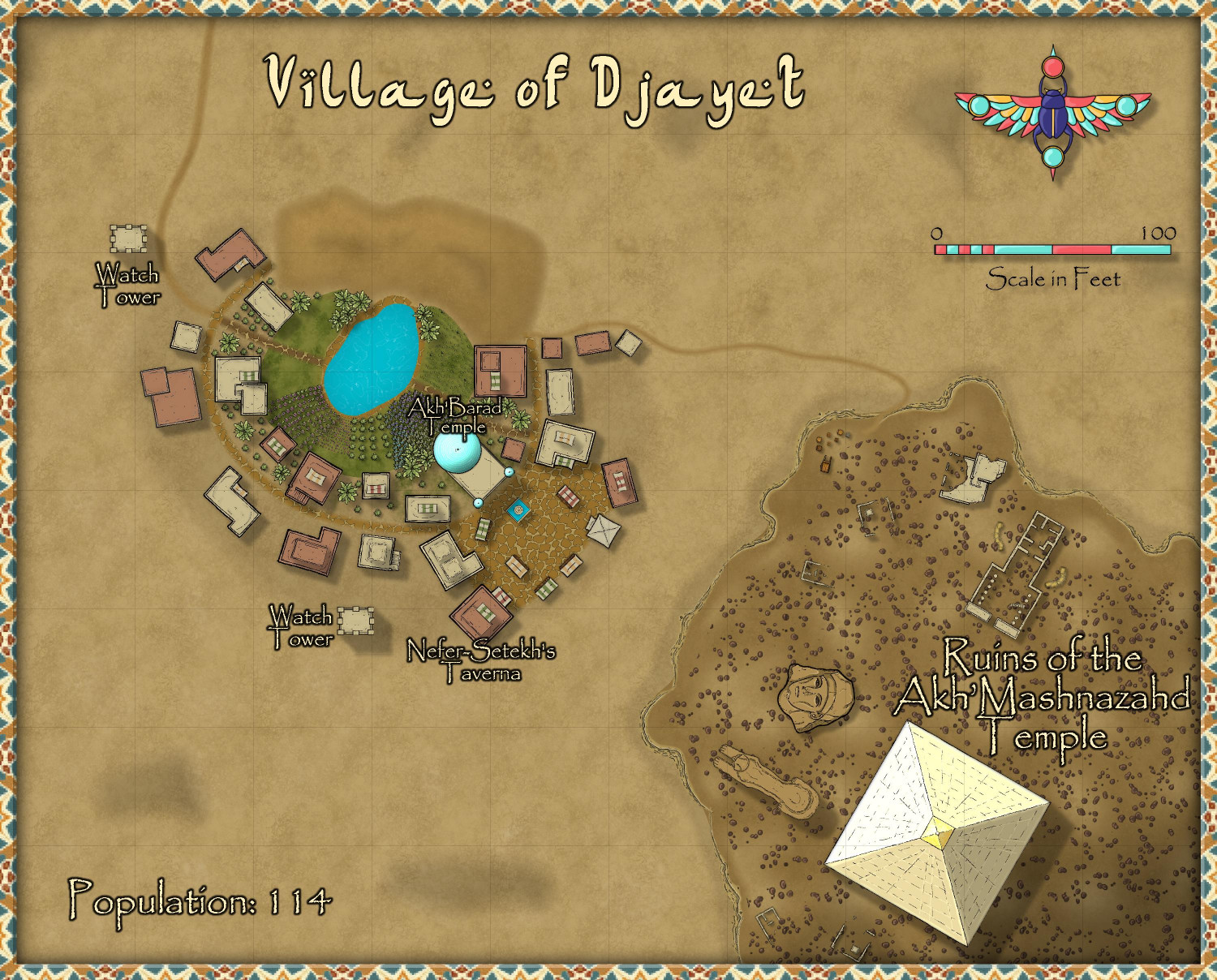
3. Royal Scribe - Village of Djayet
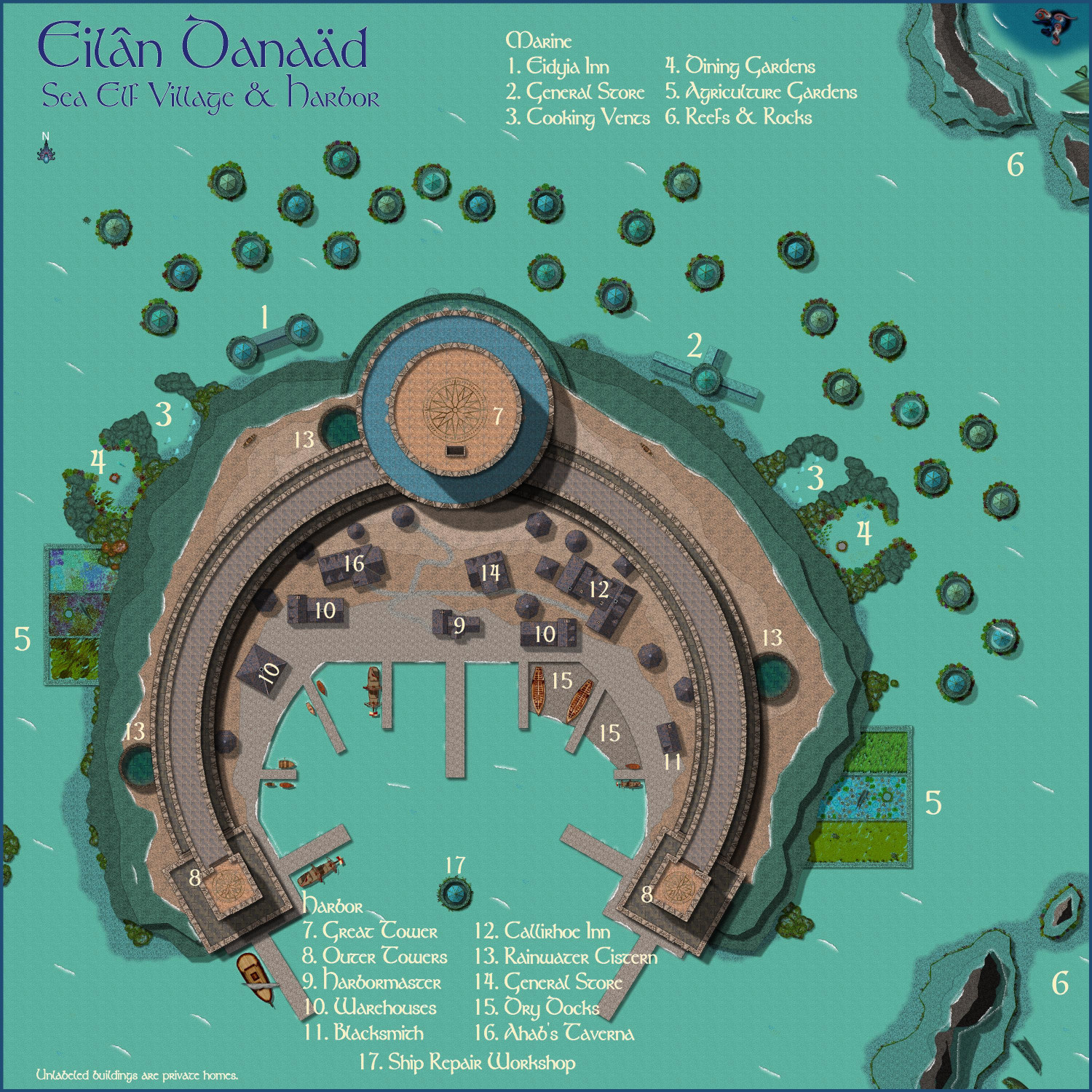
4. Royal Scribe - Eilân Danaäd
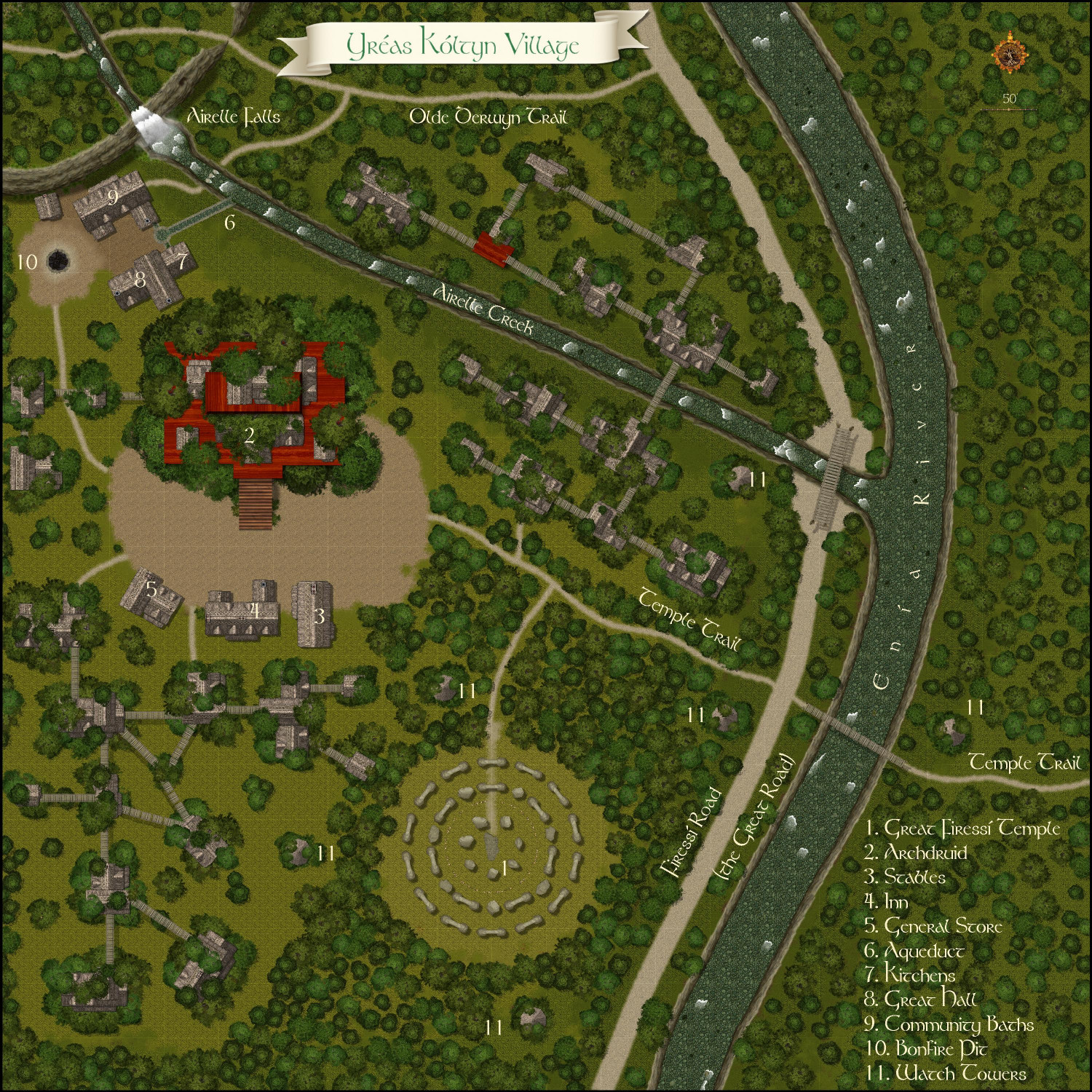
5. Royal Scribe - Yréas Kóltyn Village
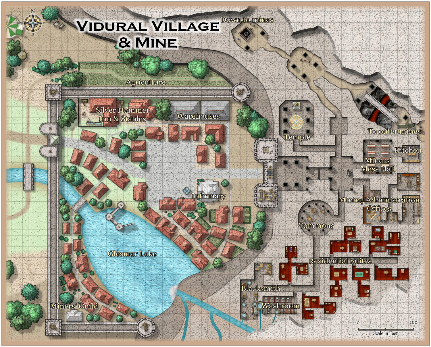
6. Royal Scribe - Vidural Village & Mines
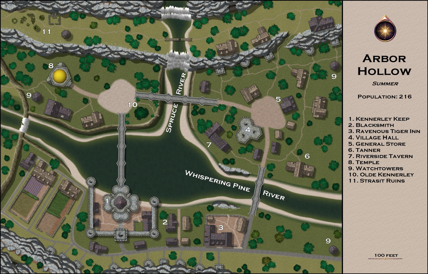
7. Royal Scribe - Arbor Hollow
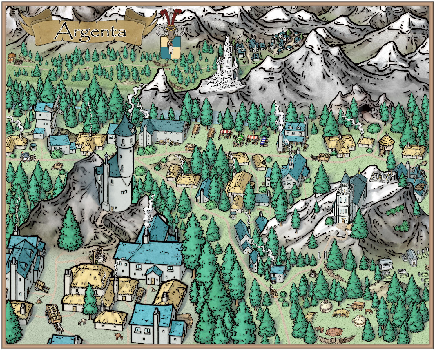
8. Mathieu Gans - Argenta
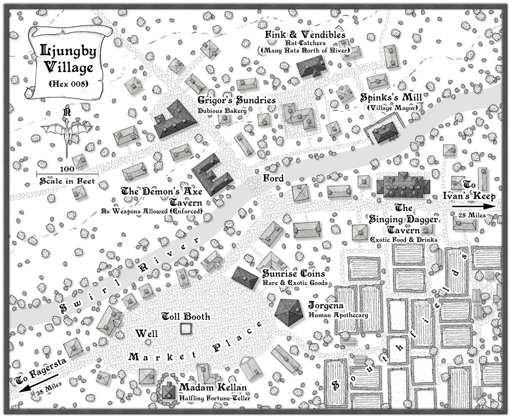
9. Wyvern - Ljungby Village
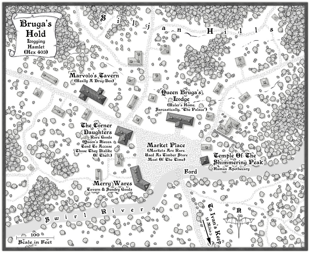
10. Wyvern - Bruga's Hold
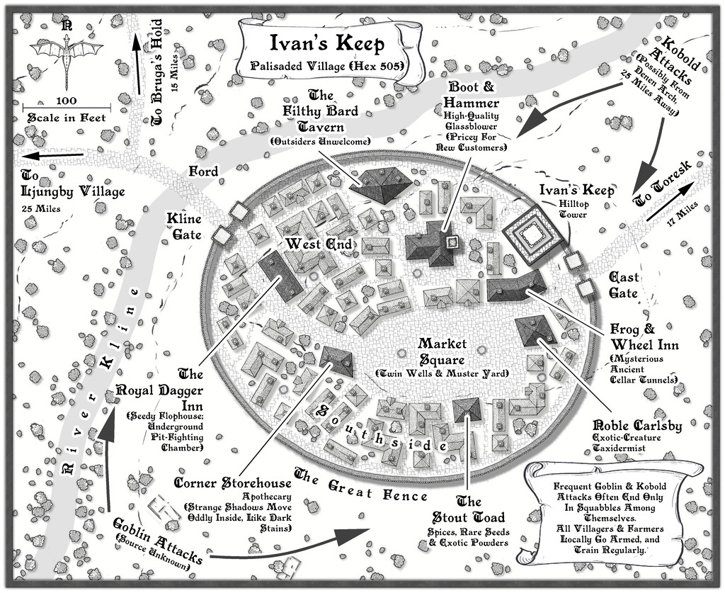
11. Wyvern - Ivan's Keep
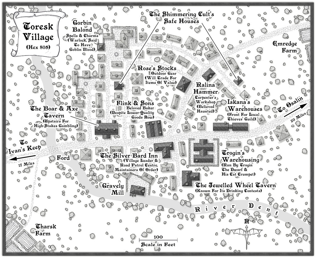
12. Wyvern - The Village of Toresk
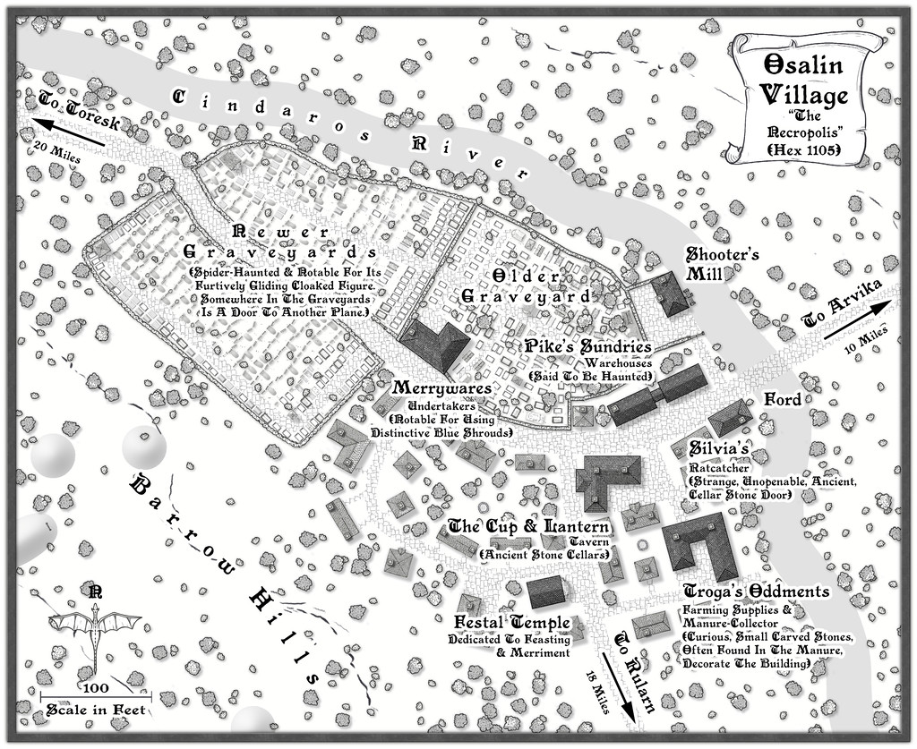
13. Wyvern - Osalin
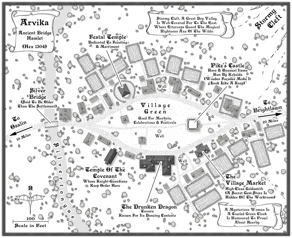
14. Wyvern - Arvika
15. Wyvern - Rularn
16. Wyvern - Brightlawn
17. Wyvern - Fairbridge
18. Wyvern - Skara
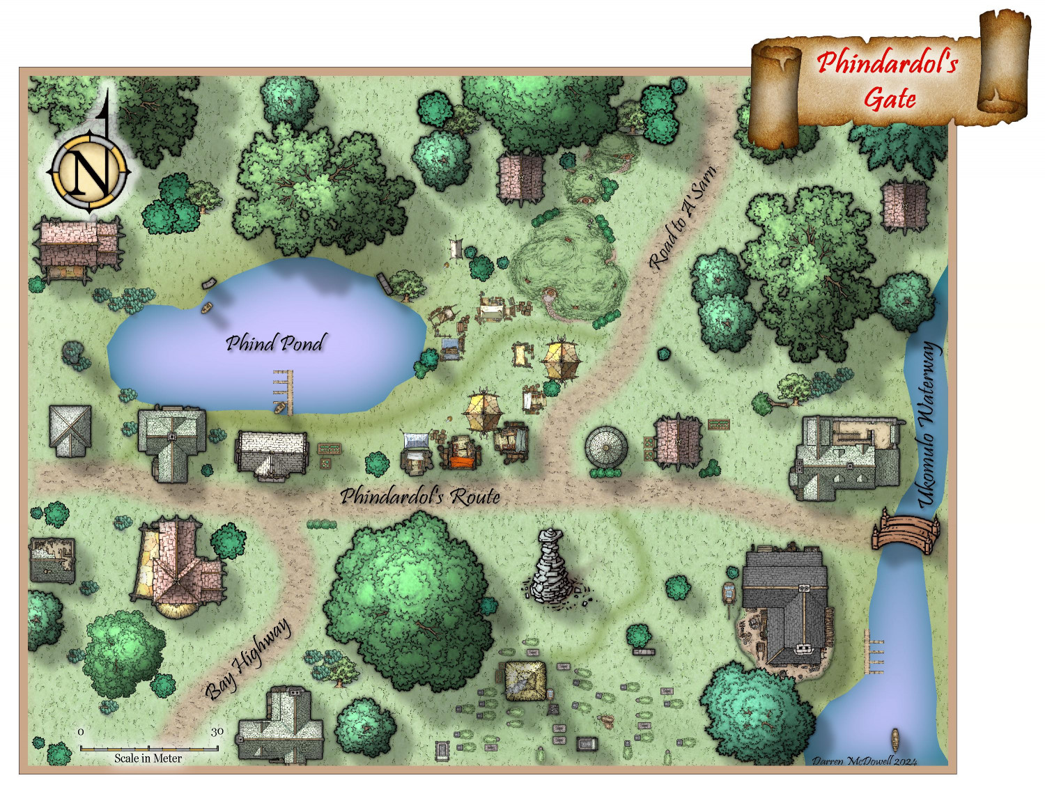
19. Quayuazue - Phindardol's Gate
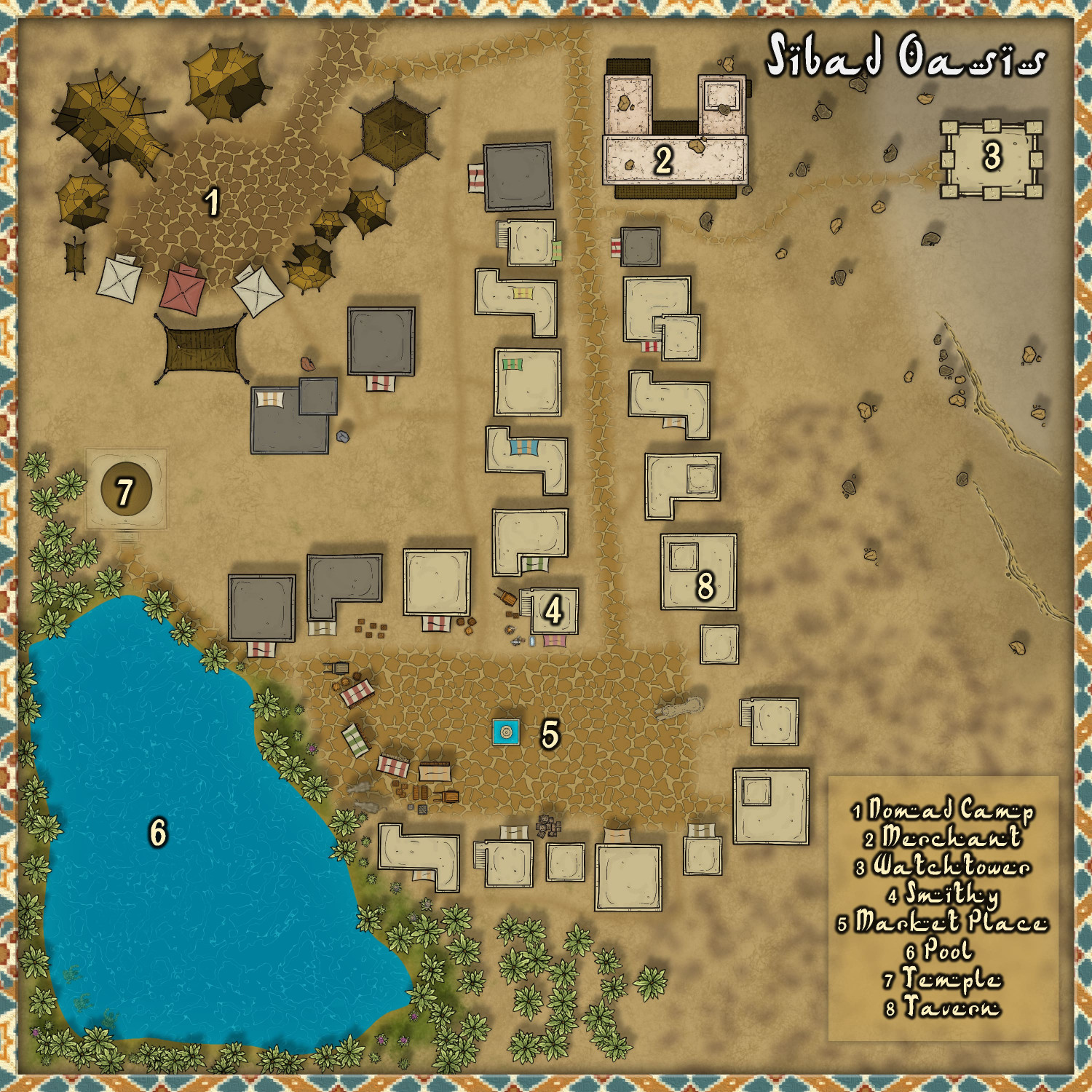
20. cyrion - Sibad Oasis
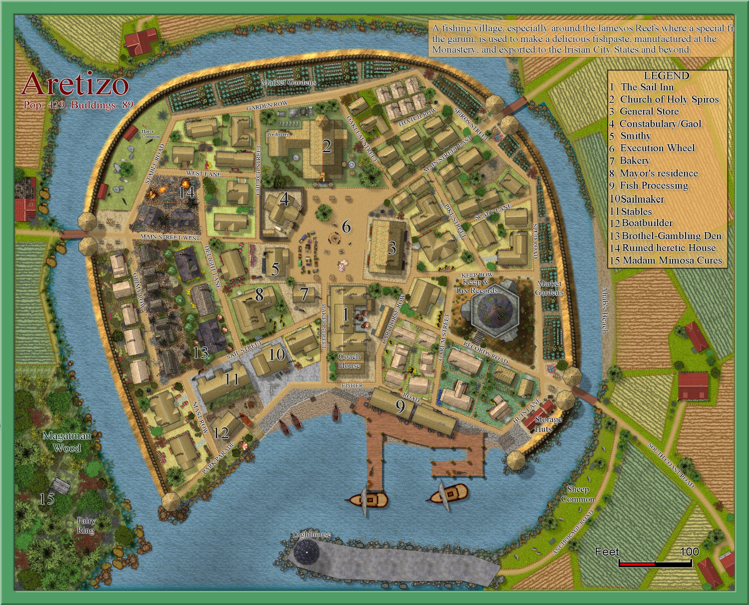
21. Quenten - Aretizo
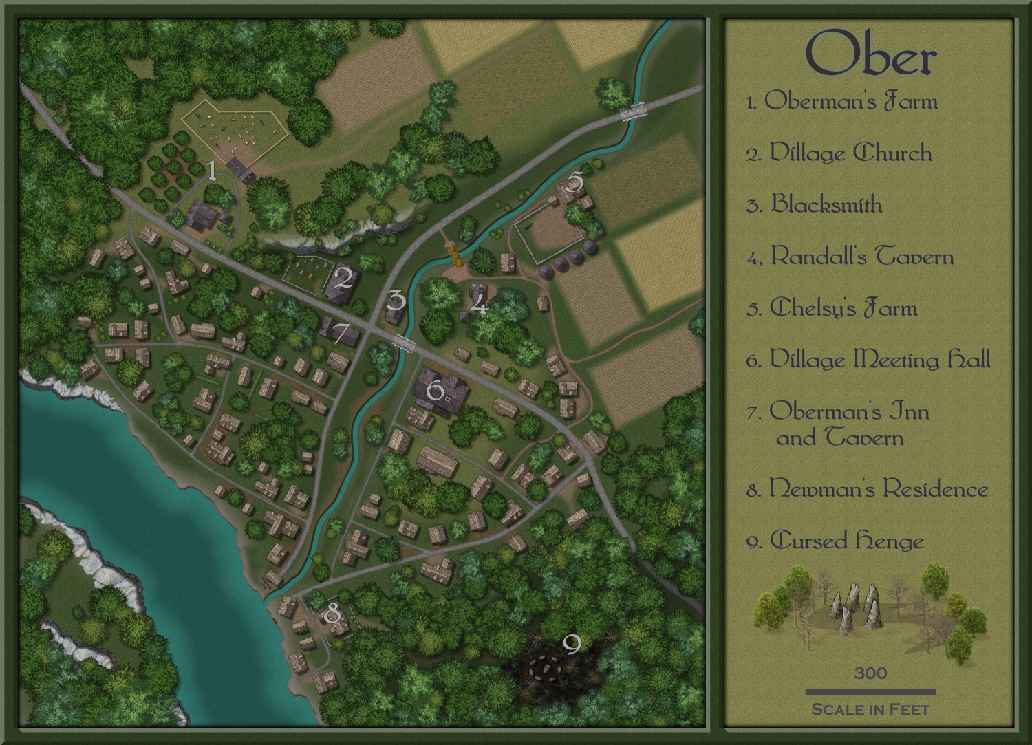
22. Shessar - Ober
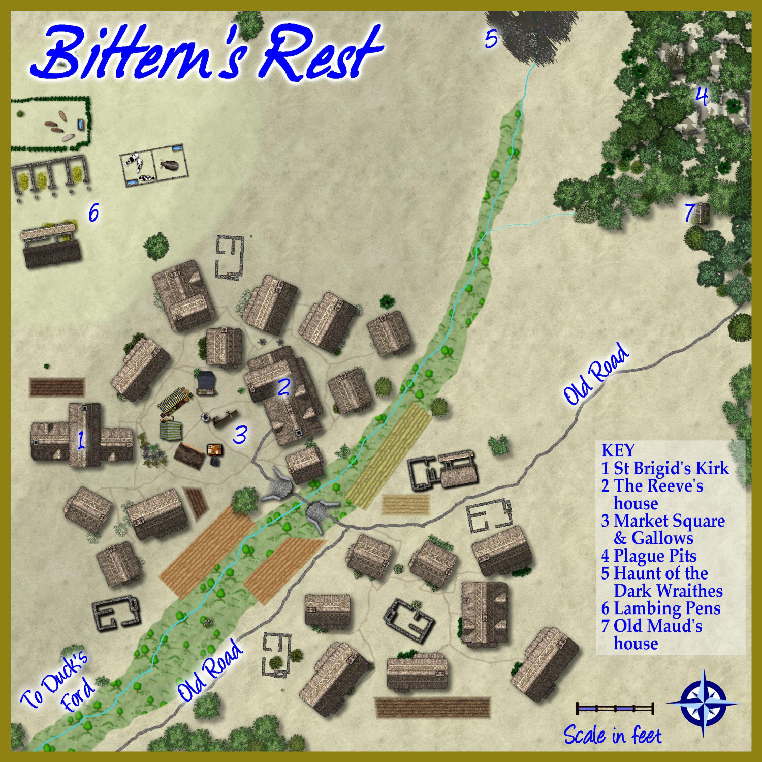
23. HelenAA - Bittern's Rest
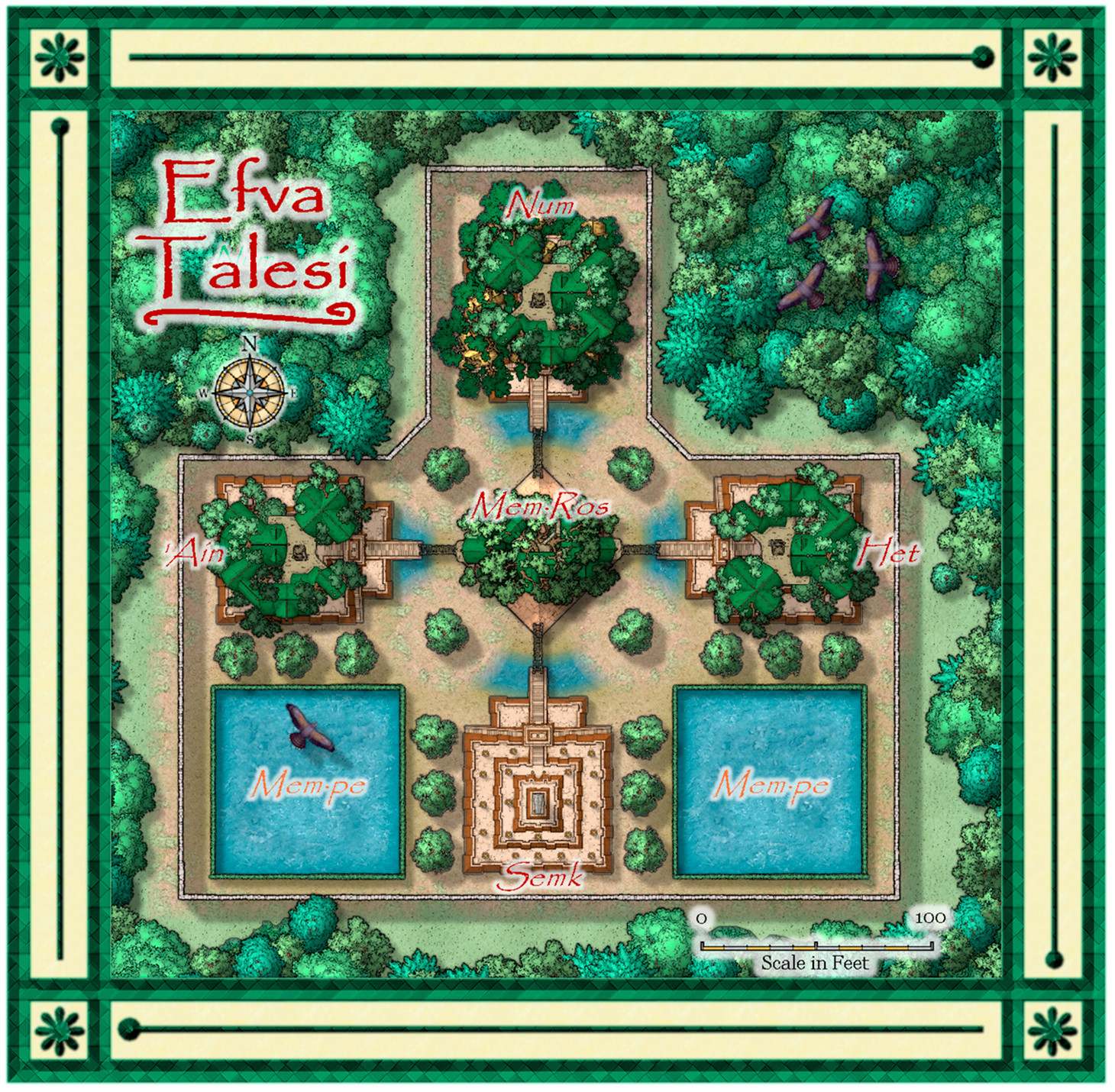
24. Daniel Pereda De Pablo - Efva Talesi
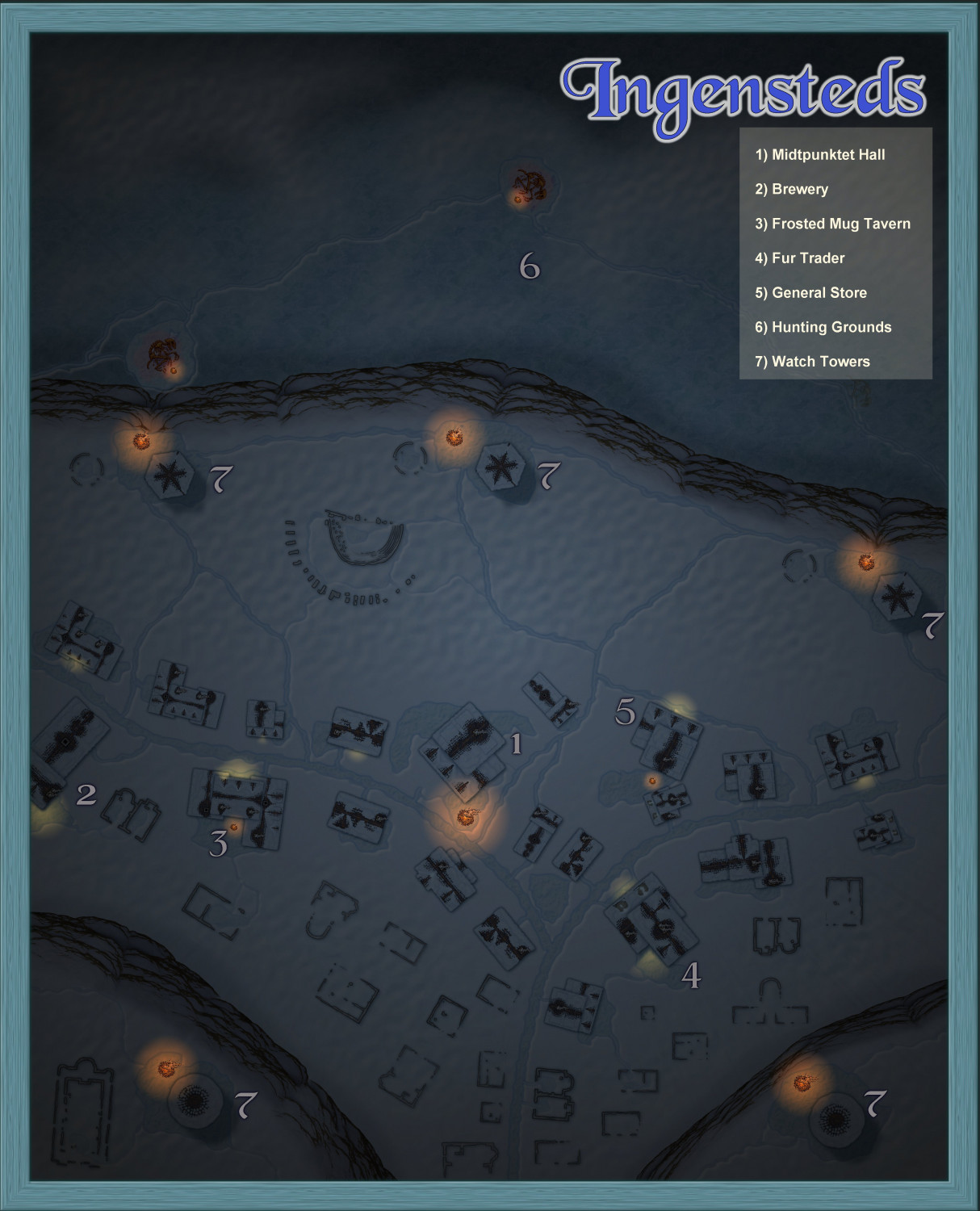
25. Jeff B - Ingensteds
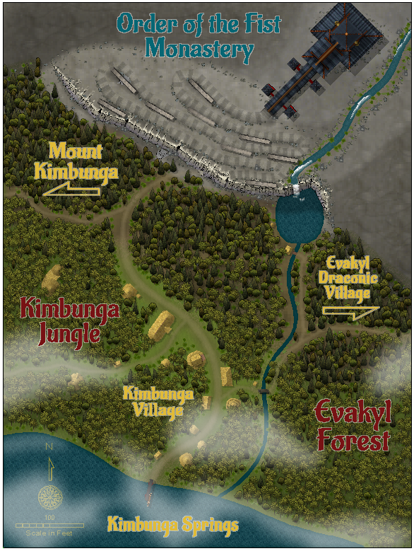
26. MakeWayForJebus - Order of the Fist Monastery
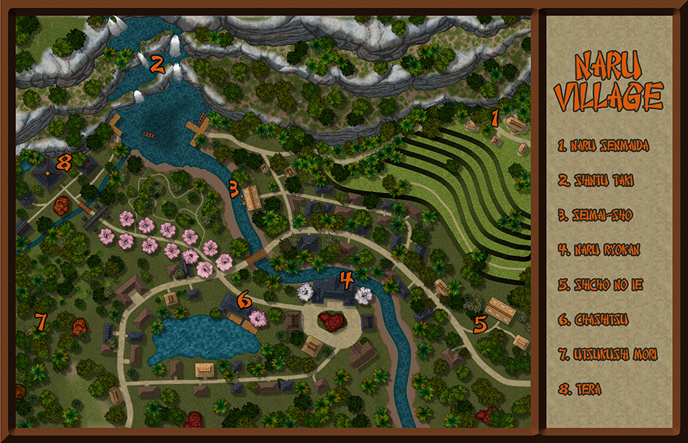
27. Lorelei - Naru Village
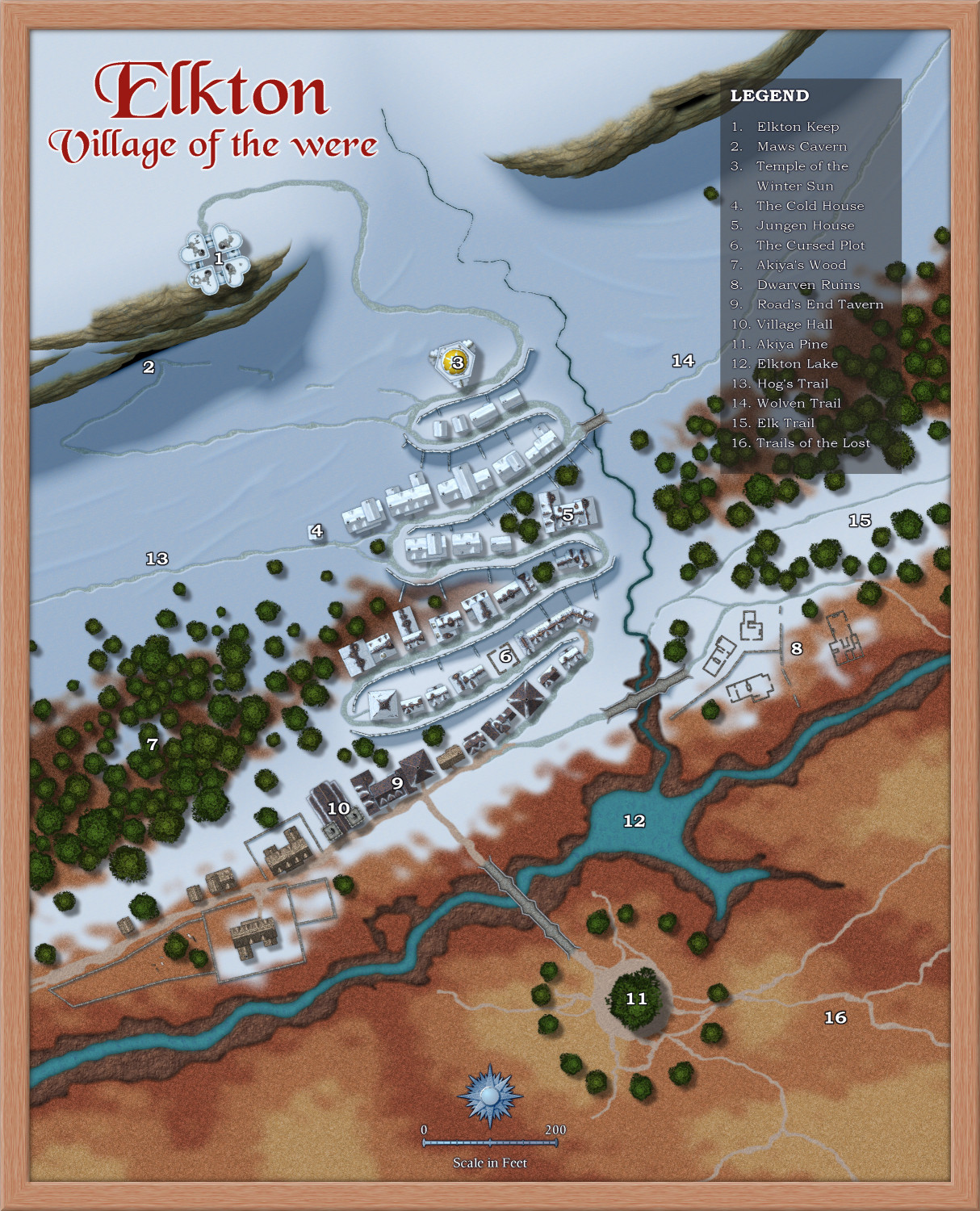
Loopysue - Elkton
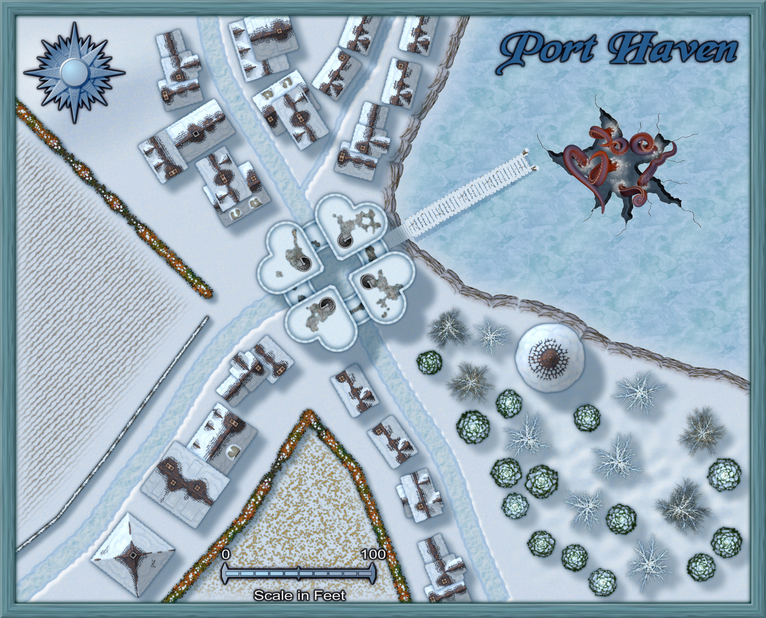
Monsen - Port Haven
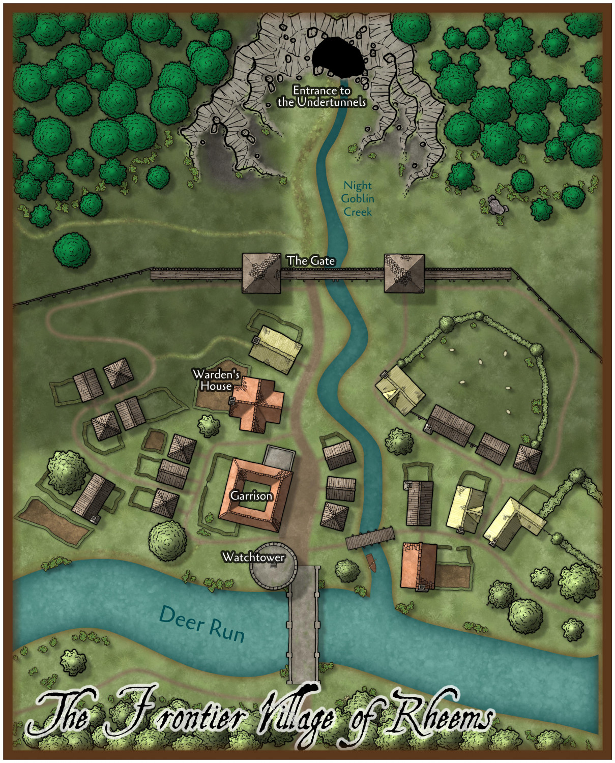
Ralf - The Frontier Village of Rheems


-
Easiest way to size and link a smaller scale map
I have some tips here:

-
How to I make a Square Wall Without Gap?
Basically two ways to handle it:
- Don't start in a corner, start in the middle of a side length. As long as the starting and ending point is the same (as well as the angle of the two segments) it will meet up seamlessly.
- Turn it into a polygon. Draw it as normal, but don't do the final connecting segment. The use Path to Poly [CLOSEPATH] on the wall you just drew.
This is basically the way to handle this when you try to draw a closed shape with a line-type drawing tool, being city wall or dungeon room.
-
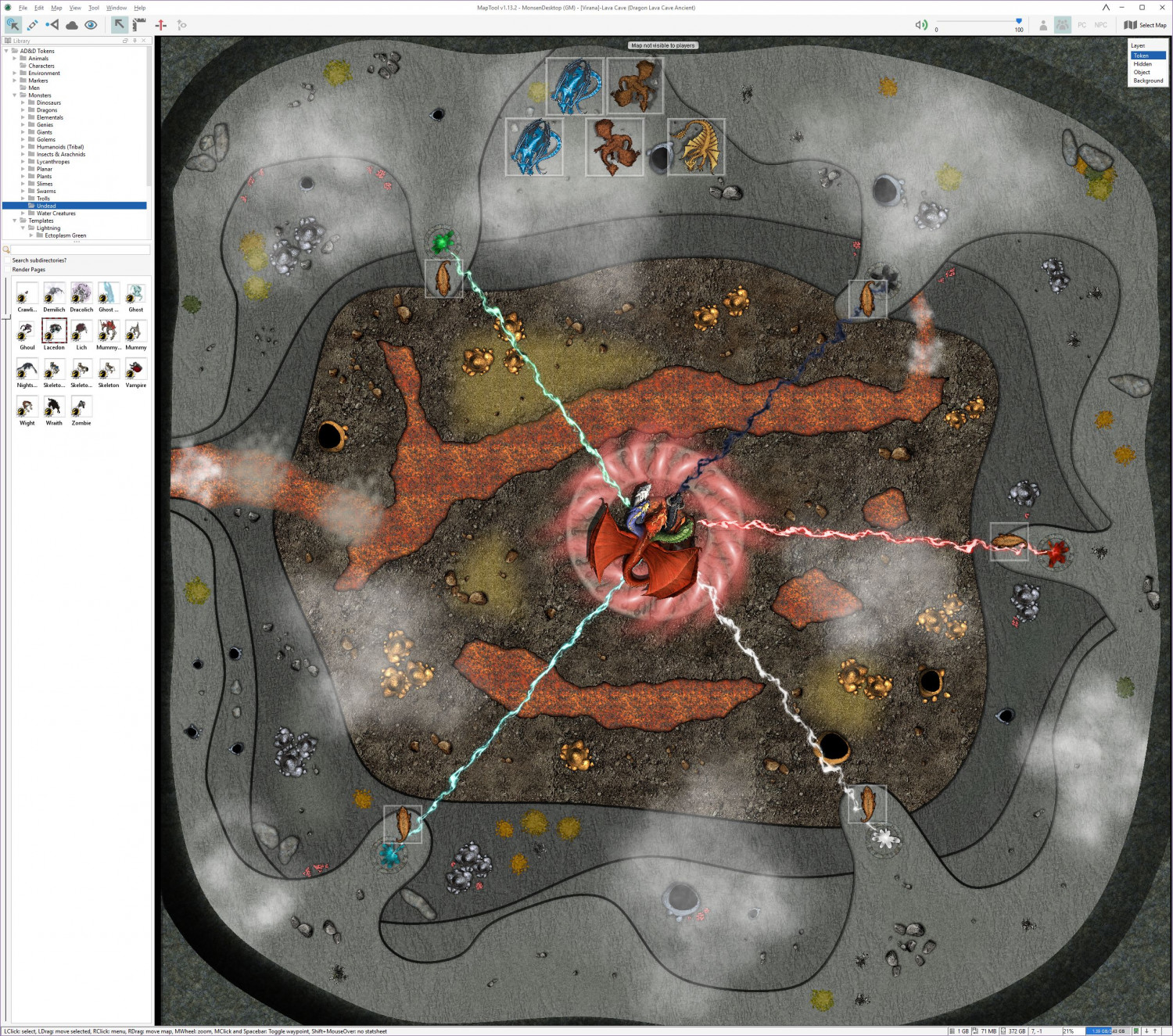
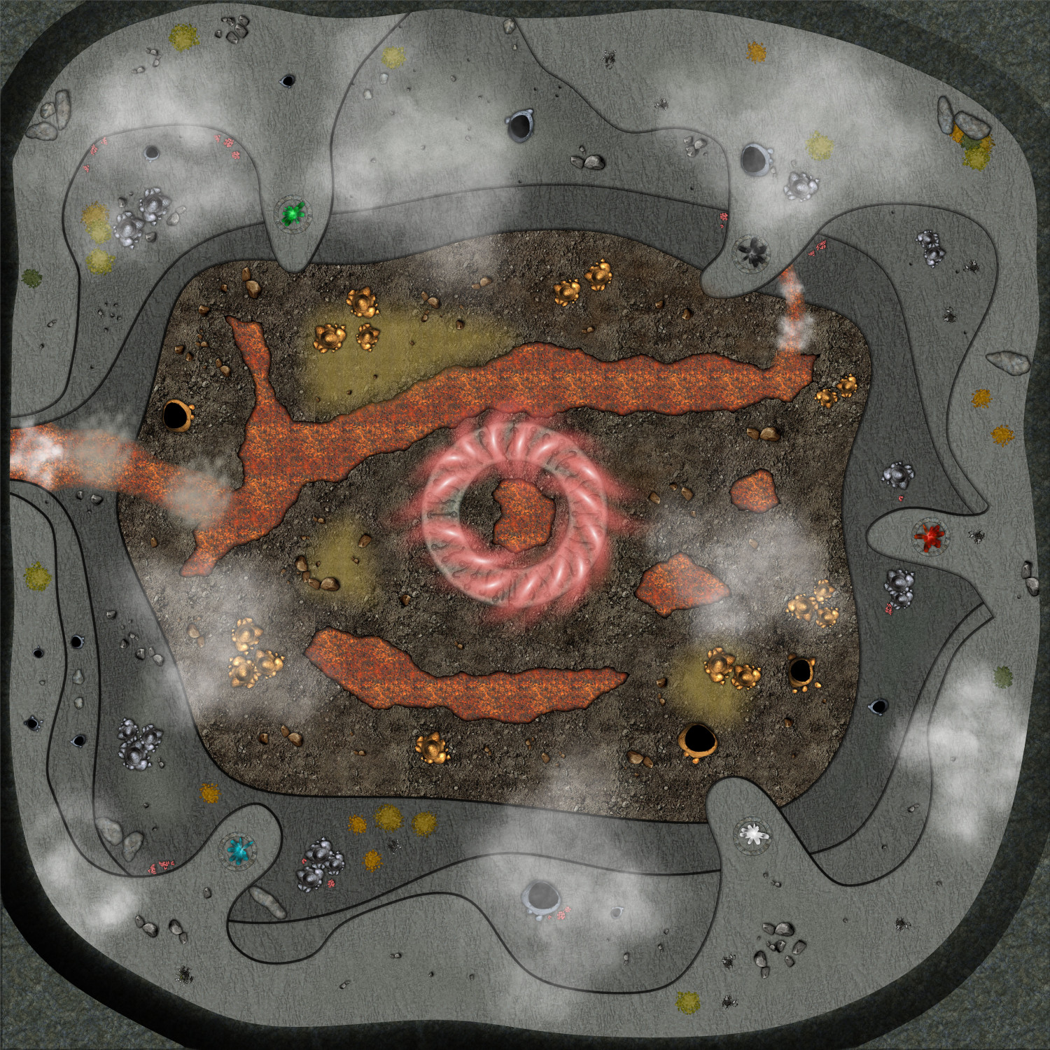
Live Mapping - Lava Caves & Virtual Tabletops
I didn't finish the map during that video back then (Nor did I really expect to, since I spent a lot of time talking about map usage, scale, and other VTT considerations), but as the session where I need this will be this weekend, I have finally finished it.
There are still several things I am not too happy about with this map, in particular the transitions between the different levels, and the symbols doesn't flow with the terrain nearly as well as I could have wanted, but I had to balance several considerations, among them making the map clear and easy to read when loaded into a VTT, how much time and effort I could reasonably use for a single encounter, as well as for the fact that while I am a master in the technical side of mapping with CC3+, the visual arts is not really my strong side. So I guess this is what I consider a "Meh, good enough for it's purpose" map.
I could have made the map a bit more atmospheric by making it darker, and perhaps used some dungeon lighting to make a nice glow from the lava, but I am using it on a projector in a lit room, which means it will be far more usable if it isn't too dark, and have a good level of contrast.
Note that this map is pretty huge for a battle map, 500 by 500 feet, which means 100x100 squares if using the standard 5' battlemap squares. A standard human character (movement 12) would need 4 full rounds just walking in a straight line from one side to the other, before considering any terrain movement restrictions.
I've put links for larger versions of each image.
Here's the finished map in CC3+ (Larger version [7500x7500 pixels])
Here's the CC3+ file for it.
And here is the finished map in MapTool, ready to play (Large Version [2544x2248 Pixels])