Royal Scribe
Royal Scribe
About
- Username
- Royal Scribe
- Joined
- Visits
- 9,536
- Last Active
- Roles
- Member
- Points
- 3,353
- Birthday
- February 5, 1968
- Location
- San Francisco, California
- Website
- https://legacy.drivethrurpg.com/browse/pub/31814/Royal-Scribe-Imaginarium
- Real Name
- Kevin
- Rank
- Mapmaker
- Badges
- 16
Latest Images


Reactions
-
What's your rank and points?
I used to work for a community-written search directory. Never underestimate the power of intangible psychological rewards! They work on me. 😉


-
Trouble with Layers, priority, etc.--help?
In fairness, it's an awfully long manual. It's great for reference, but I struggled when I tried to learn the software with just the manual. For me, the video tutorials were very helpful.
One of the things I struggled with, and this may be the same for you, was understanding how layers and sheets differ, and how layers differ from the other art design and desktop publishing software I was more experienced with.
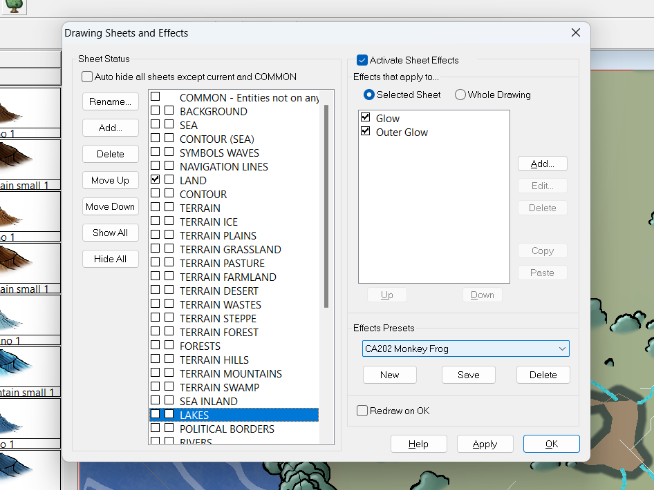
In CC3, layers help with organizing similar things so that you can hide, reveal, or freeze them, but they have no impact on the order in which things are shown. You'll notice that the layers are all listed alphabetically because the order they appear in the list doesn't affect anything.
Sheets have the big impact here. The software renders things in order they appear on the list. In this screenshot, the BACKGROUND would render, then BACKGROUND HILL, then OUTSIDE SHADOW, etc.
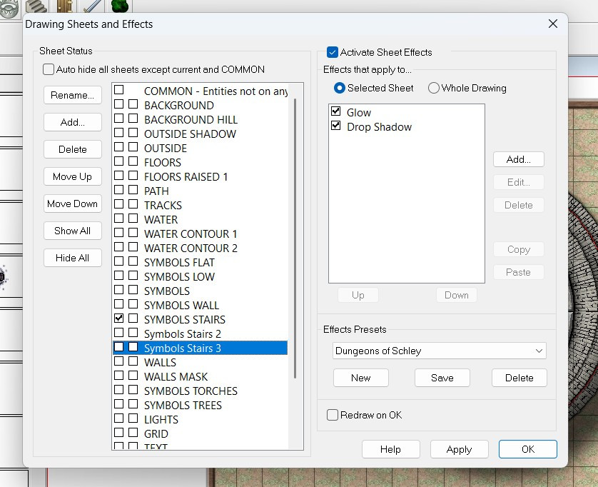
This allows you to control in how your symbols and drawn polygons sort, so that your floor will always be below your furniture, for example.
The Move to Front command only affects things on the same sheet (regardless of layer). If you have two symbols on the SYMBOLS LOW sheet, then the Move to Front command could force that symbol to be on top of the other one. Both symbols, however, will be above any other symbols on the SYMBOLS FLAT sheet (because the SYMBOLS FLAT sheet would render first, and then the SYMBOLS LOW). And both symbols would be below the regular SYMBOLS sheet, because it will render after the SYMBOLS LOW sheet.
Screen captures are always helpful, but I hope this gets you on the right track.


-
Creating a Raster Set dimensions.
So what you really want is a 24-hour long super-video that covers absolute everything so you only have to remember one video? :)
Yes! If it comes with a searchable transcript with timestamps. 😉

-
Fractal Terrains to CC3+ - Three Approaches
And here are some of the Mike Schley style:


-
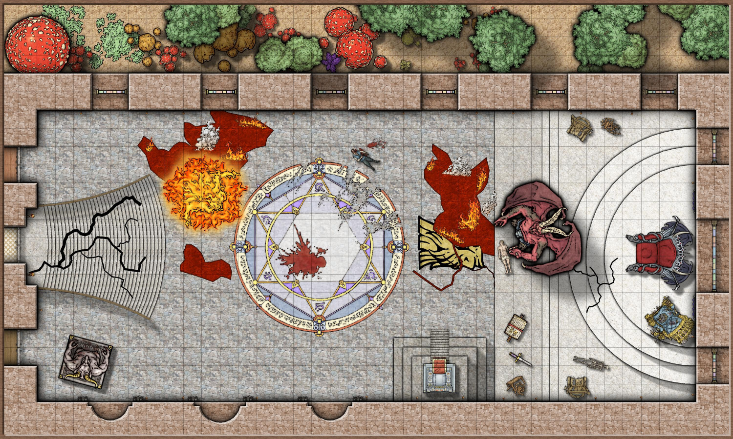
[WIP] Marine Dungeons Lighthouse (more May Annual Stairs & Steps)
If the ProFantasy Gods are listening: a future annual that I think could really complement the Marine Dungeons would be a "Jungle Adventures" dungeon. It would provide an opportunity to bring in palm trees and coconuts that could also enhance Marine Dungeons. Maybe some swamp building tools, including tree trunks with the ripples used in Marine Dungeons? Lots of colorful jungle foliage. Maybe some giant mosquitos or other bugs? Alligators or crocodiles? Think of the Indiana Jones-inspired adventures! Golden idols! Whips and fedora hats! Aztec-inspired ruins. Maybe a perfectly round boulder for traps. (The opening scene of Raiders of the Lost Ark is my favorite action/adventure opening scene of all time.) Just planting an idea....

-
Drawing lakes over forests and mountains sheets with 2023 MonkeyFrog Overland style
So, it looks like your lake is drawn on the LAKES sheet, but you want it to cut all the way down to the sea?
You have a couple of choices.
Option 1: Don't have your lake cut down to the sea. Instead, change it to a blue color, or the same fill as the sea, and let it sit on top of the other terrain.
Option 2: If you want it to cut through, you will need to:
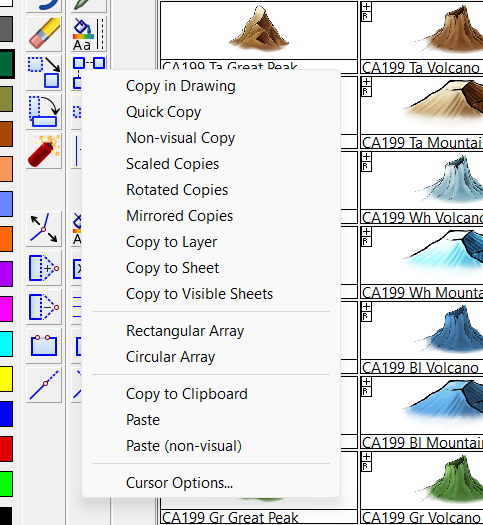
- Add the COLOR KEY effect to the LAKES sheet and move it to be the first effect.
- Change the color of your drawn lake to be the magenta color (#6)
- Make sure all of the other sheets between the lake and the sea also have the Color Key effect added as the first effect.
- And then, copy that magenta lake to all of the other sheets.
If you want to copy it to all of the intervening terrain sheets, the easiest way is to hide all sheets, then unhide the LAKES sheet and everything between it and the SEA, and then use the Copy to All Visible Sheets option (found by right-clicking on the Copy icon) to simultaneously copy it on all of those terrain sheets.
Please let me know if this is unclear, and I can try to do more screencaptures.
-
[WIP] - An audience with the King
Oh no! Calamity! In the immortal words of Nancy Sinatra:
You keep playin' where you shouldn't be playin'
And you keep thinking that you'll never get burnt, ha!
Looks like someone's been messin' where the shouldn't have been a messin'.
And it gave me an opportunity to use not only the evil and broken thrones, but also some of Mike's other symbols from this year that I haven't had a chance to use yet.


-
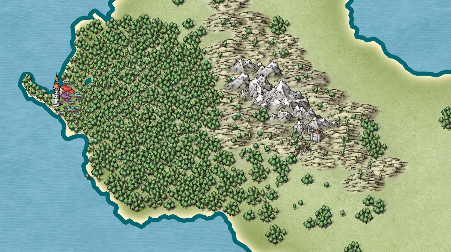
Community Atlas submissions: the Gold Coast (Doriant) and areas within it
I'm ready to submit this intermediate map for the Kingdom of Enía, along the northern edge of the coast for the parent map above. This map will be the parent (or possibly grandparent) for a few villages I will be submitting to the contest.
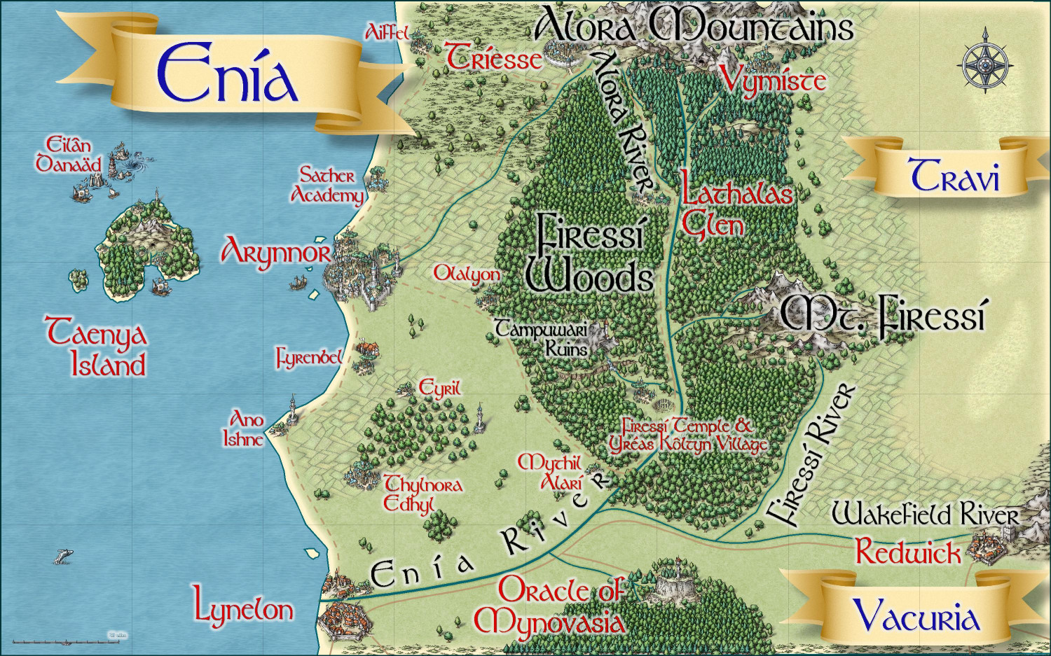
Primary Style: Mike Schley Overland
Toggles: BORDERS/POLITICAL to show/hide political borders
Here is the FCW along with a PDF of the description:
Should I do a plain text file that strips out the accent marks? Here's the text of the description (with accent marks):
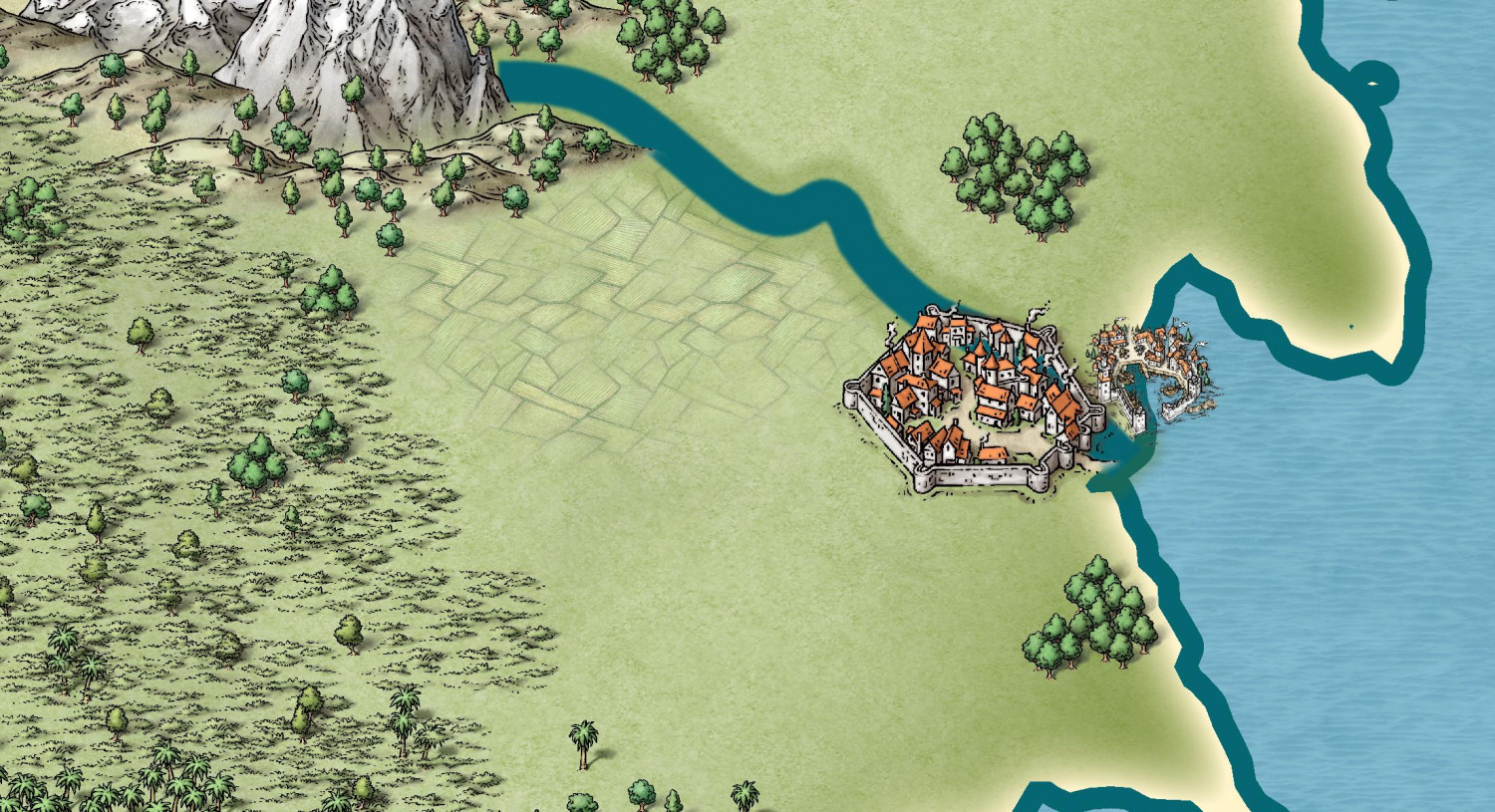
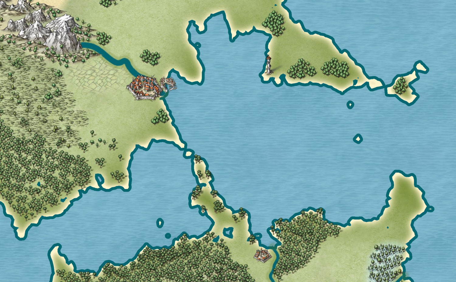
The elven kingdom of Enía is the northernmost coastal kingdom in the Gold Coast region of Dórian. The human Kingdoms of Vacuria and Travi lie to the south and east, respectively. Enía is significantly smaller in both population and geographic size than its neighboring kingdoms. The kingdom’s borders are marked by the Enía River along its southern border, and the Firessí River and edge of the Firessí Woods along its eastern border.
Enía is governed by a hereditary monarch who is advised by two political bodies: the Council of Adept Mages, and the People’s Assembly. The Council of Adepts consists of those archmages and adept mages able to cast the most powerful spells. The People’s Assembly includes a hundred citizens elected throughout the realm.
Major points of interest include:
Arynnor: The capital of Enía, called the “city of glass.” Here, elves pioneered glassblowing techniques both for ornamentation and practical purposes. This includes a technique to make glass nearly as strong as steel, which has allowed the elves to safely cover their towers with brightly colored glass domes.
Sather Academy: To the north of Arynnor, Sather Academy is an institution of higher learning with academic classes of all sorts, from history to astronomy, poetry to accounting, but it is most famous for two things: its Bardic Colleges, and its Arcane Academy for the formalized study of wizardry and arcane lore.
Lynelon: The coastal city on the northern bank of the Enía River, Lynelon is a bit smaller than the Vacurian city of the same name on the southern bank.
Firessí Woods: Much of the realm is covered by a mighty forest, the Firessí Woods. The woods are home to numerous tiny elven hamlets along with a few notable features. Towards the southern edges of the Firessí Forest lies an ancient henge of standing stones, the Firessí Temple, erected to honor the elven gods. It is the holiest place in all of Enía, and the seat of power for the Archdruid of Firessí, the most powerful religious figure in the kingdom. A small village, Yréas Kôltyn, provides a home for the elves who tend to the temple and provides accommodations for the temple’s many pilgrims. To the northwest of the temple lies the Tampuwari Ruins, the haunted ruins of a people so ancient, they disappeared long before the elves moved to the area. The ruins are best to be avoided. Farther to the north, Lathalas Glen is a town built up around a monastery of the same name.
Taenya Island: The small island is home to a few small villages and hamlets of wood elves Just to the north of the island among rocky reefs, Eilân Danaäd is a harbor village of sea elves with homes both above and below the waves.
-
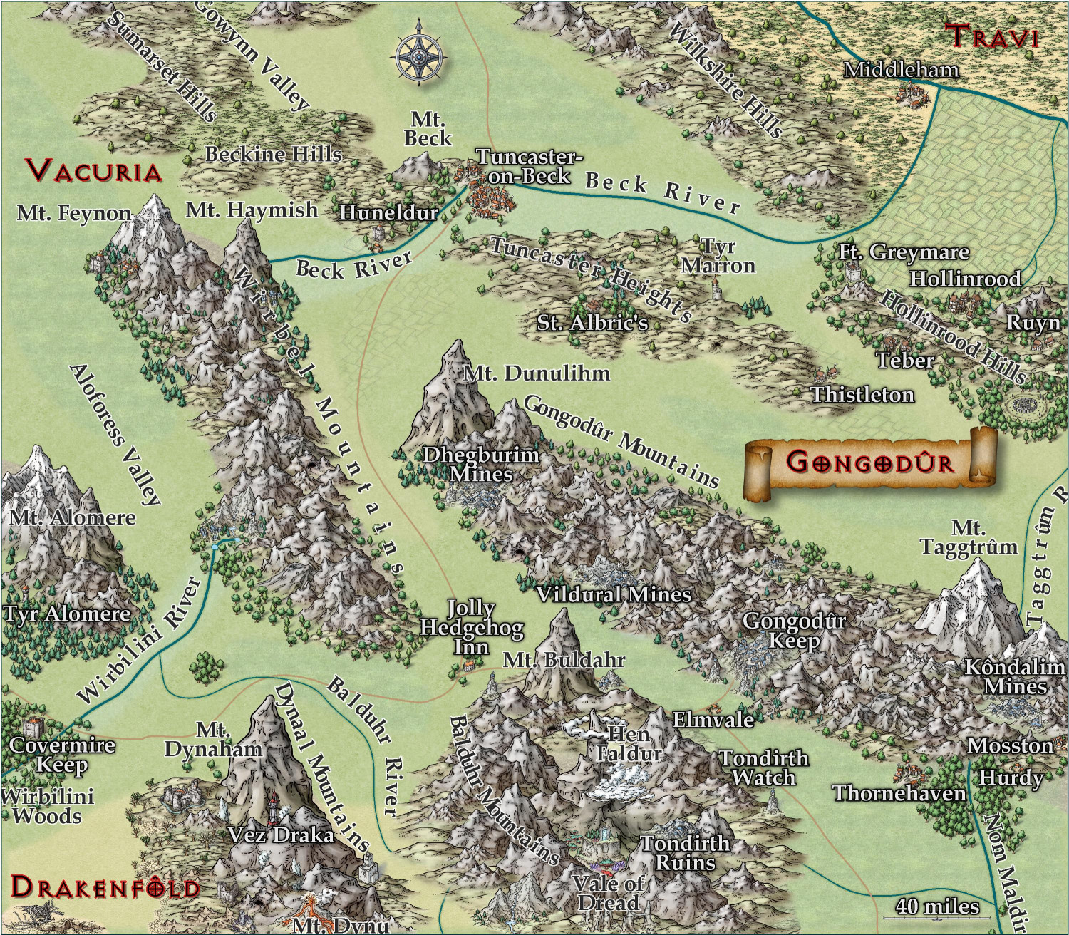
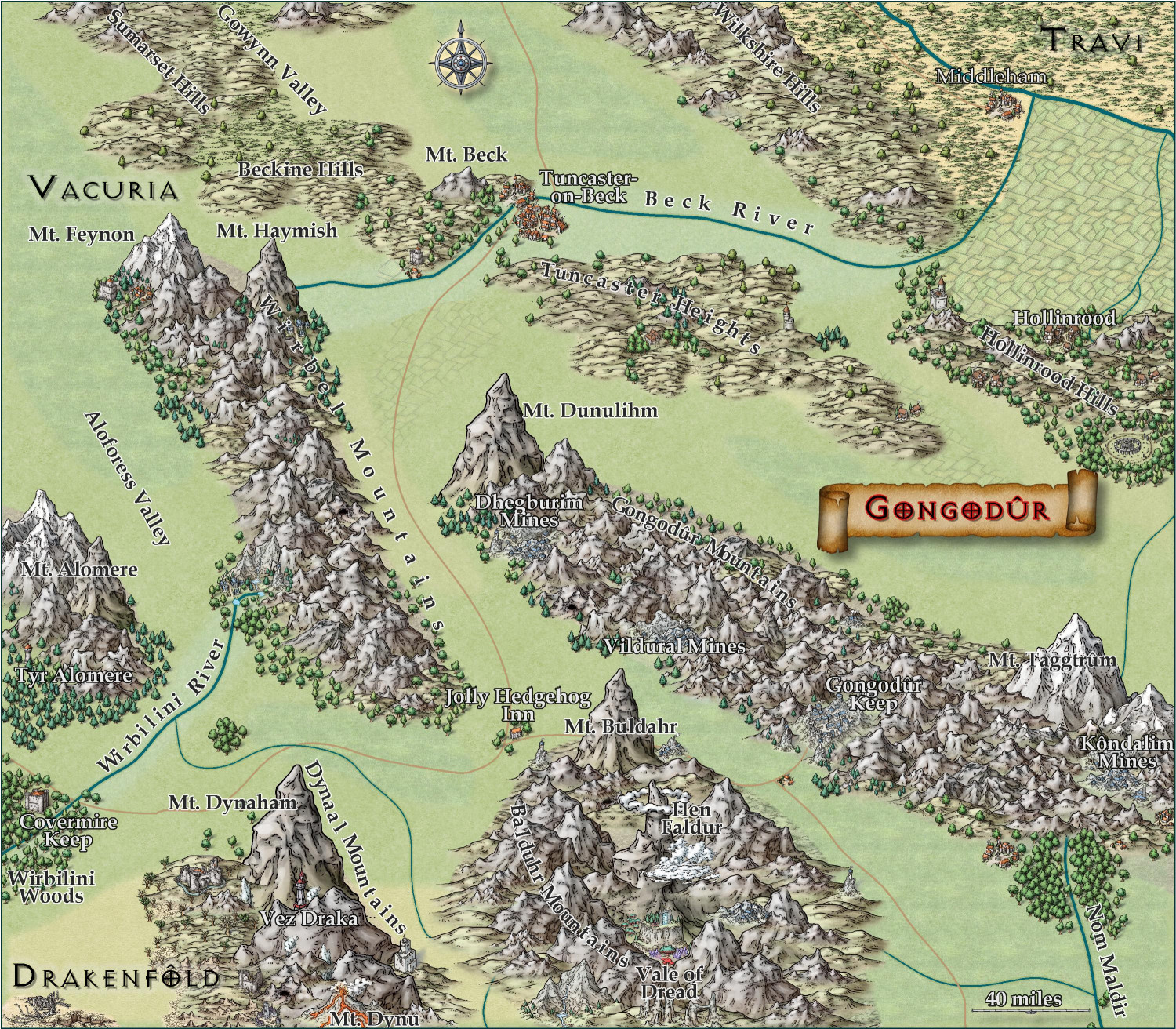
[WIP] Kingdom of Gongodûr
I changed the two labels to near-white for settlements and near-black for geographical names. (Let me know if you think I should reverse that, with dark names for settlements and light ones for geography.) Playing with text-along-a-curve for some mountain ranges and rivers, and moved some to the side to make them easier to read. (For a few of them, I had to explode the text and ungroup temporarily to adjust the kerning.) Made some effects changes to the political borders but I need to redraw them to reflect the river changes. Oh, and I embiggened the compass and moved it. It also has an inner glow to make it stand out a little.
May not have more time today to work on this -- about to head out to a family function for the day. Hoping to finish it this weekend.


-
[WIP] Kingdom of Gongodûr
Still working on this. Text is slightly larger, and the glow is as well. Added more names, though I still have a few more rivers and settlements to do. Should I be naming the roads, too?
I am think about putting country names, settlement names, and geographic names each on a separate layer so that end users can toggle them on and off as desired. They're already on separate sheets, though, so maybe that's sufficient for toggling individually, and a single layer for all of them to toggle all names on/off simultaneously?