Royal Scribe
Royal Scribe
About
- Username
- Royal Scribe
- Joined
- Visits
- 9,534
- Last Active
- Roles
- Member
- Points
- 3,353
- Birthday
- February 5, 1968
- Location
- San Francisco, California
- Website
- https://legacy.drivethrurpg.com/browse/pub/31814/Royal-Scribe-Imaginarium
- Real Name
- Kevin
- Rank
- Mapmaker
- Badges
- 16
Latest Images


Reactions
-
[WIP] Haunted Mansion
Ooops, I posted an older version of floor three. Here's the correct one.


-
Printing maps from PDF?
I think I found a good approach.
- Save a high resolution PNG file following the VTT specs Remy laid out in this blog post from 2020.
- Upload the image to an image splicer app that can automate splicing in a grid that you specify with customizable horizontal and vertical dimensions. I used Imagy.app.
- Take the spliced images and drop them in a desktop publishing or word processing program. I tried it in MS Word with margins set at 0.25", but with the images centered. Printed perfectly (nothing cut off and every square is 1 inch by 1 inch.)
So helpful with larger maps, like a town where you never know where the battle may go.

-
[WIP] Temple of Fah (May Annual: Stairs and Steps)
I've been playing around with Wyvern's great suggestions.
I tried to give the ziggurat a more weathered look by using the FRACTALIZE command. The default settings were way off but I played with it enough to think that with time, I could get it to look right. The problem was that I tried it on a single layer of the temple, and even with just that single layer, it added so many nodes that it slowed everything way down -- and that was just the first of eighteen levels of the temple! So I think my temple won't look weathered after all. Maybe the gods are preserving it. ;-)
Then I hid the desert symbols so that I could play with the different textures and effects to create the illusion of dunes. The Dungeons of Schley style has five sand fills (with 1 being the lightest) and five corresponding partially transparent textures to overlay. The main background in my map was the middle one, Sand 3_SS4. Over the entire map, I also added the Sand 2 T_SS4 texture on a sheet called SAND TEXTURE 1 BASE, which has an inner edge fade to soften it. I then added another sheet called SAND TEXTURE 2 PATCHES, where I drew patches of the textures 1, 4, and 5 (2 already applied to everything, and 3 being the same as the main sand).
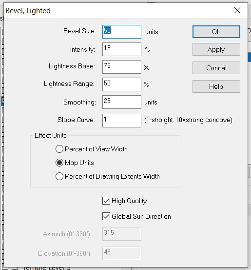
For the dunes, I added another sheet, SAND TEXTURE 3 DUNES. It has three effects: Edge Fade, Inner; Bevel, Lighted; and Blur. I then added dunes, trying with first the Solid 10 fill and then some of the sand ones -- but actually, I kinda think the Sand 3 blends in best.
Here's how it looks:

Here's my Bevel settings:
And here's the FCW:
Thoughts? More dunes? More sand patches? More anything else?
As an aside, learning these desert techniques is very helpful. Last November, one of the first maps I attempted was a Blue Dragon's desert lair. I abandoned it, but I've learned so much in the last six months -- time to revisit it!


-
[WIP] Inside the Temple of Fah
Level 12
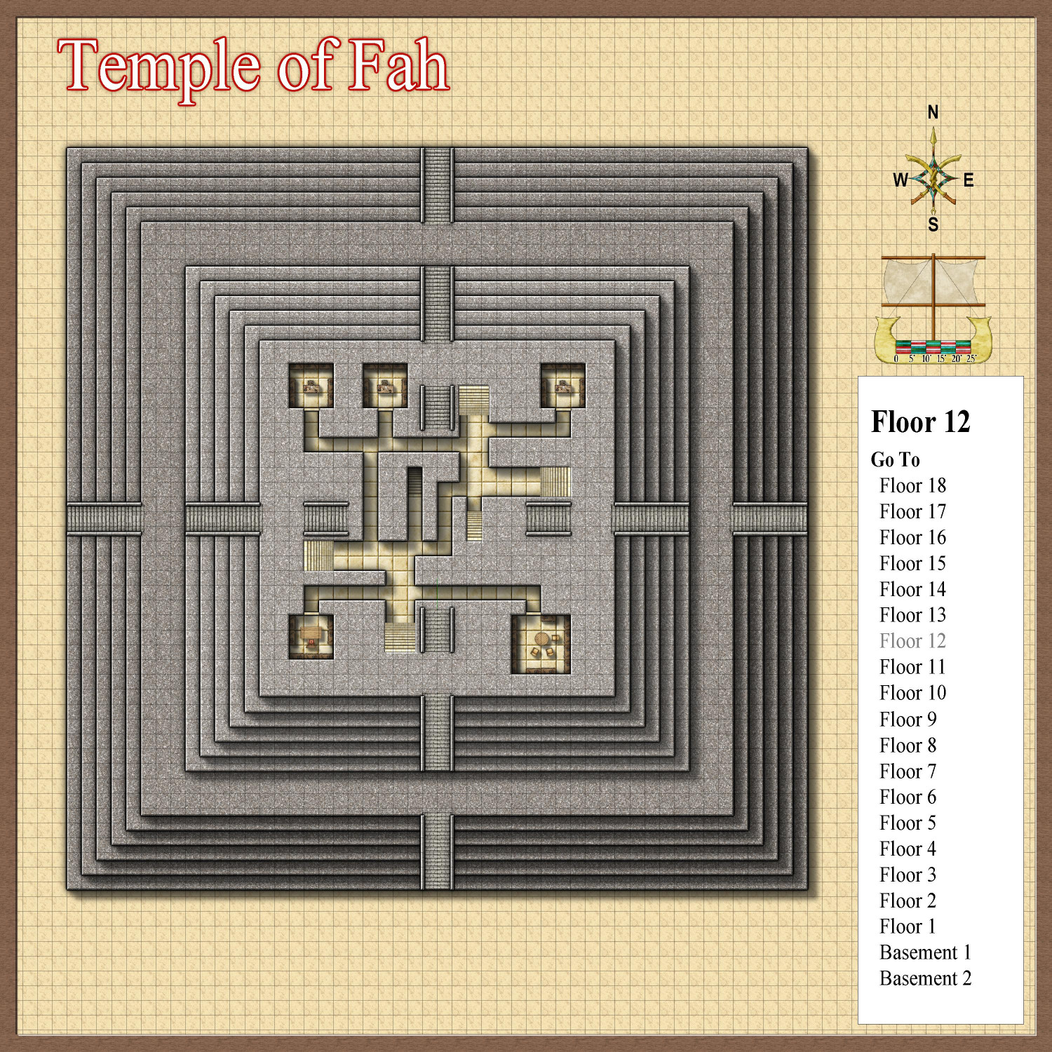
The Temple of Fah is also a repository for a great number of religious and government documents. Many of them are mundane and boring: records of flood patterns and agricultural yields, of famine and other disasters. Vital records for the population: records of live births, marriages, and deaths. Historical accounts of the pharaohs and their accomplishments, and of great wars and battles. Bestiaries, zoological treatises, and other studies of the natural world. Transcriptions of religious documents. Every official government and religious document is stored in the temple, along with a great many other written works.
On Level 12, the senior scribes have private offices to do their work and manage the work of junior scribes in the levels below.
Level 11
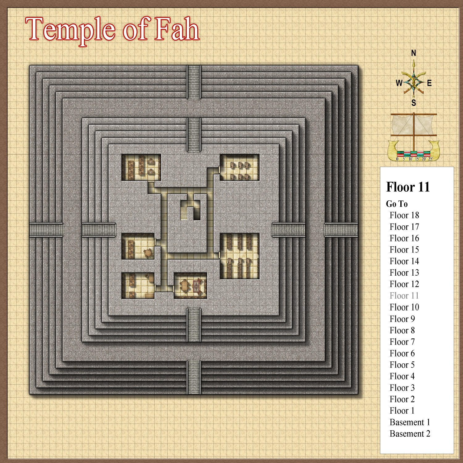
On this level, there are six libraries, each equipped with rows of bookcases and numerous desks for junior scribes to maintain records and transcriptions.
Level 10
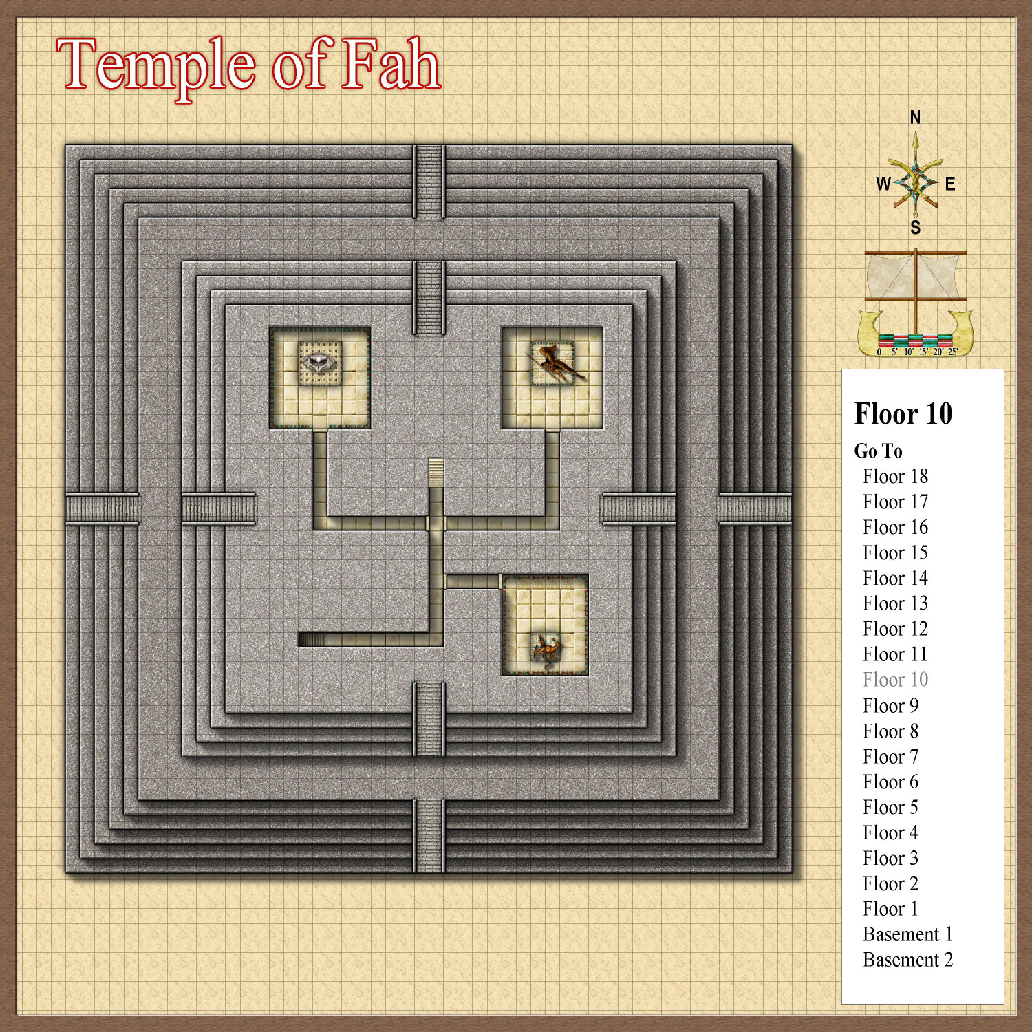
Level 10 has three shrines to different gods of the pantheon. These shrines may be visited by the pharaohs, top nobles, and senior government officials, but not the general public.
Level 9
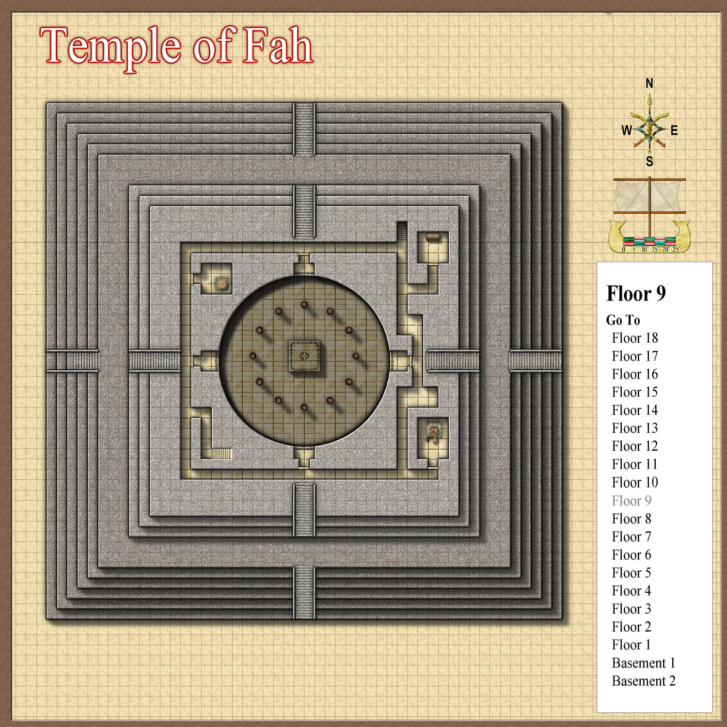
Level 9 has two shrines to different gods, and a small room for priests to get ready. Most of the level, however, is occupied by the top third of a massive circular room dedicated to semi-private religious ceremonies such as coronations and royal weddings. At the cardinal points of that chamber, this level has 10-foot wide balconies (with railings) to look down upon the religious practices below.
Level 8
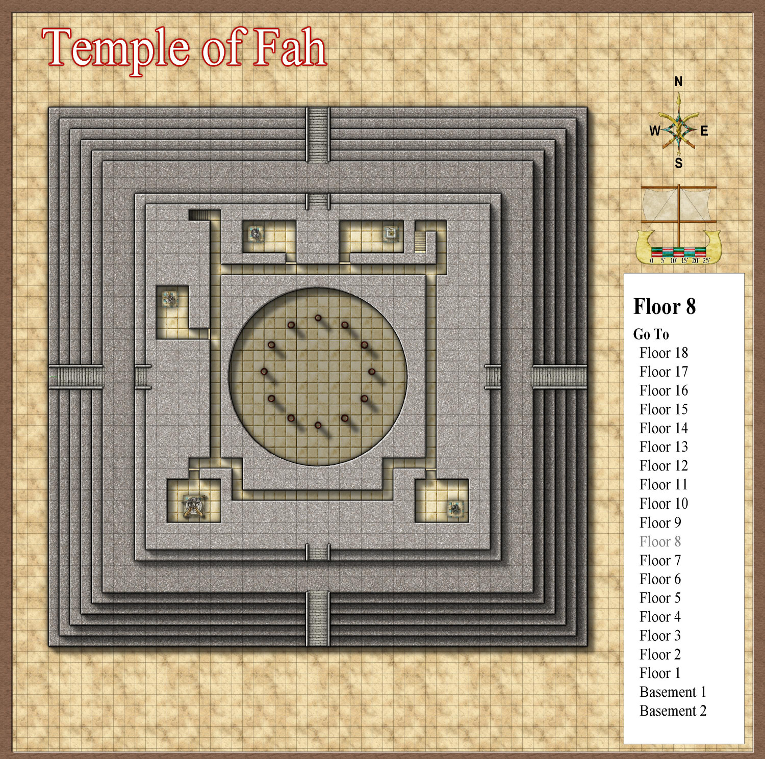
This level has five shrines to the gods. Although the great religious hall described above cuts through this level, there is no access to it from Level 8.
Level 7
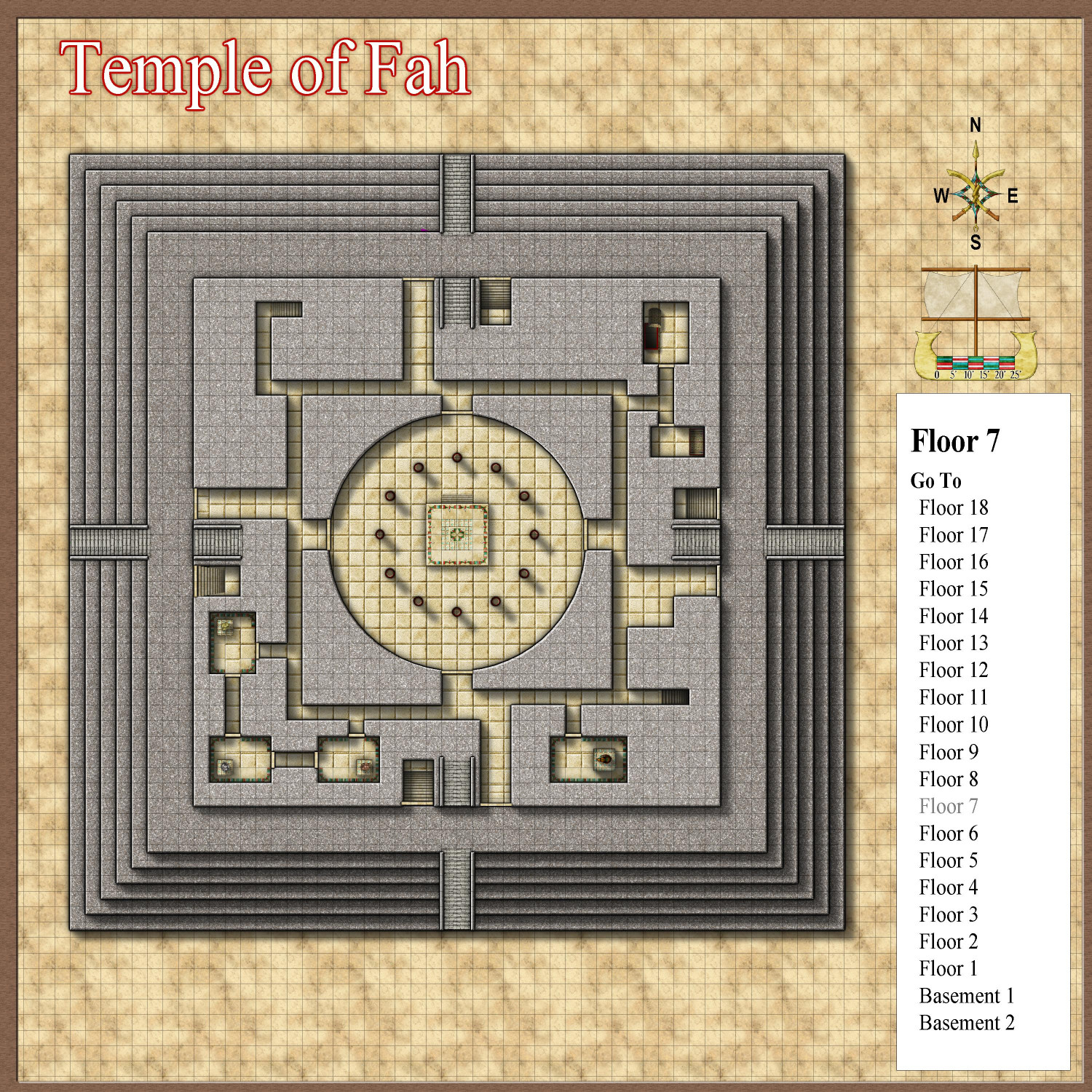
This is the main level that non-priests are allowed to enter. It has four entrances from the first landing of the ziggurat (where, outside, there are also four more entrances that descend to Level 6). The central chamber is the 28-foot-high chapel where coronations, royal weddings, state funerals, and other religious ceremonies for the powerful elite are held. Three connected chambers are shrines to the three-part triplet god, with a fourth unconnected shrine dedicated to their mother, the feline-faced cat goddess. Two other chambers are used for the priests to dress or prepare for religious services, or for elite guests like the pharaoh to wait in privacy.
From here we can descend to the tombs in the lowest third of the temple.

-
[WIP] Inside the Temple of Fah
A few months ago, I posted the Temple of Fah, a ziggurat I created to play with the CA209 Stairs and Steps annual. At long last, I have finally designed the interior.
I know this map is ridiculous. Egyptian pyramids only had a handful of rooms for the tombs of a pharaoh and their treasure. Sumerian ziggurats also only had a handful of interior chambers. But I decided to go whole hog and create a sprawling interior complex reminiscent of the classic dungeon crawls I first experienced with D&D in the early 80s. (My first introduction to the game was December of 1979.)
Here’s a side view of the exterior to give you a sense of the entrances:
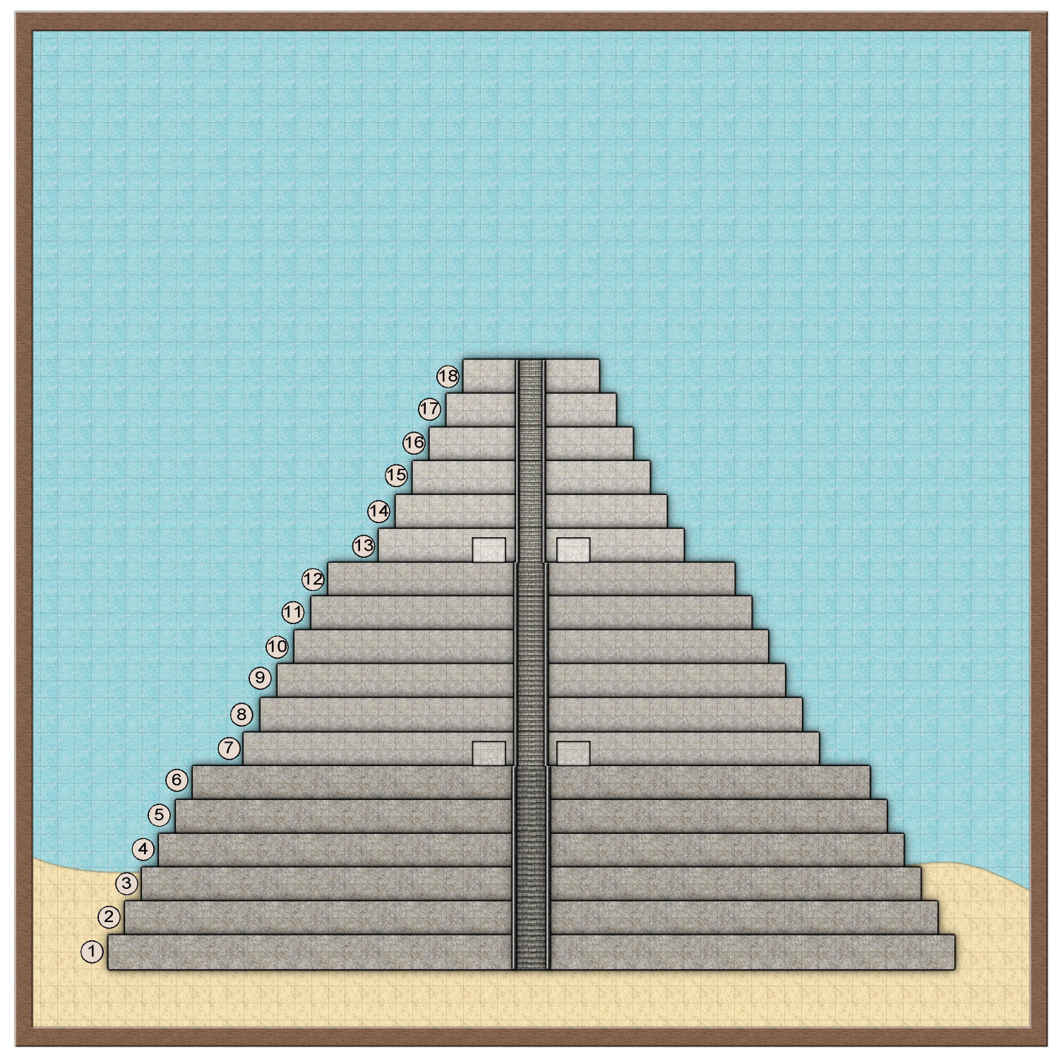
There are two landings before reaching the very top of the ziggurat. The first is on level 7, standing on the roof of level 6, and the second is on level 13, on the roof of level 12. The entrances on each landing are to the left and right of the exterior stairs continuing up. The 10 feet wide doors are designed to be concealed for aesthetic purposes, blending in with the side of the ziggurat when shut, but they aren’t exactly hidden or secret.
The landings divide the ziggurat into three sections. The top-most section is primarily used by priests and religious leaders. The middle section has chapels and shrines that the royal family, wealthy nobles, and elite government workers are invited to for private religious celebrations, including weddings and coronations. The general public is never invited inside. Instead, religious leaders stand on the first landing of the temple to lead the masses gathered before the temple in their religious ceremonies. The lowest section contains the tombs of great pharaohs and powerful religious leaders.
I decided to design the interior rooms and passageways using the color key knockout effect that @amerigoV describes in this thread. The walls are granite from the CA149 Beaumaris Castle annual. Most of the other fills and symbols come from the CA150 Ancient Tombs annual.
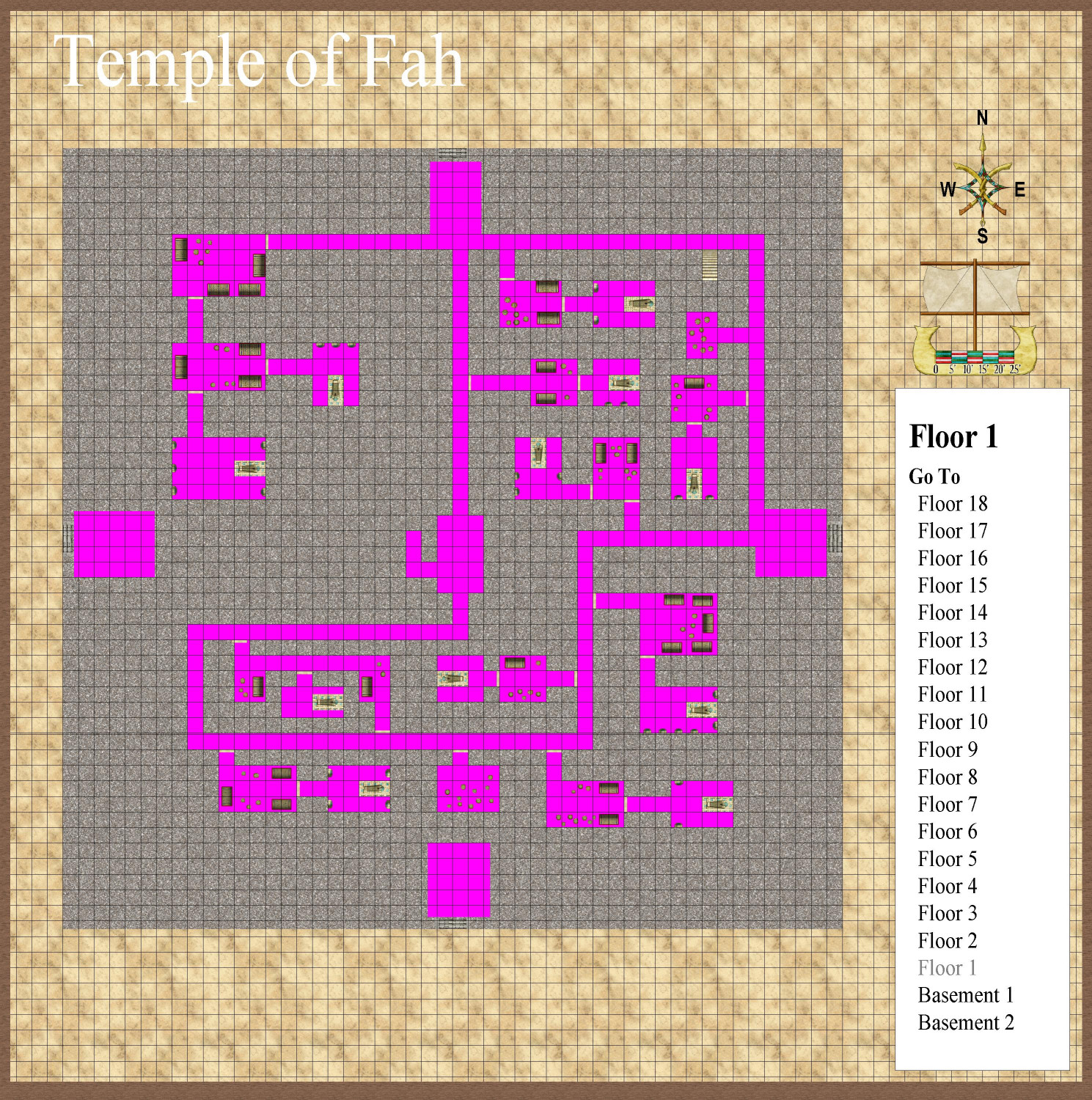
Here’s an example of a level with the effects turned off:
Each level of the ziggurat is 10 feet above the level below. The rooms and passageways inside are mostly 8 feet high, leaving two feet of stone for the ceiling (or the floor for the level above).
Let’s go inside!
-
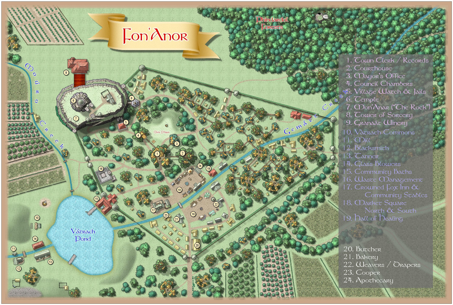
[WIP] Community Atlas Competition - Artemisia - Verinress Arl - Fon'Anar
Here's a version with a darker red:
And here's a version where I tried lighter text on a darker background. (The white ones at the end are the only ones that really work.) For this one, I moved the text to a different sheet so I could turn off the white glow that just made it look bolded in a way that made it harder to read.
-
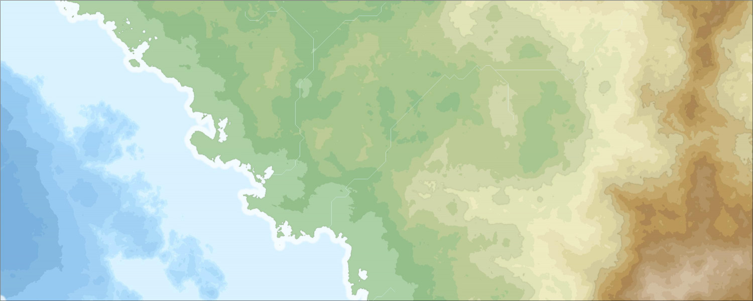
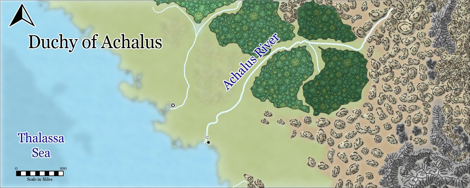
[WIP] Duchy of Achalus (Fantasy Realms Reimagined)
I was going to render a part of my Fractal Terrains campaign world in the new Sarah Wroot Revisited style, just to play around with the new style, but I decided to wait until Ralf has a chance to do a tutorial first. In the meantime, I went back to the January 2024 annual that I never really played with, Fantasy Realms Reimagined, to try it with that.
I was going to render the Republic of Lumadair area of my map that I have done before in the Parchment Worlds, Jerion Shading, and Mike Shley styles, but I decided that it was too massively oversized for this style. Those maps are 6,109 by 2,445 miles! (I think we calculated that Lumadair is slightly smaller than Australia, and the map includes part of the mainland continent of Lenoch, which I wanted to include to be able to do more mountains and rivers.)
So I picked a prominent river in the main kingdom I am developing, the Achalus River, and decided that it would run through a duchy named after the river. This is a much smaller map than Lumadair, but it is still 1,343 by 537 miles.
Anyway, here is the Fractal Terrains output in both the Jerion and Schley styles, just for frame of reference:
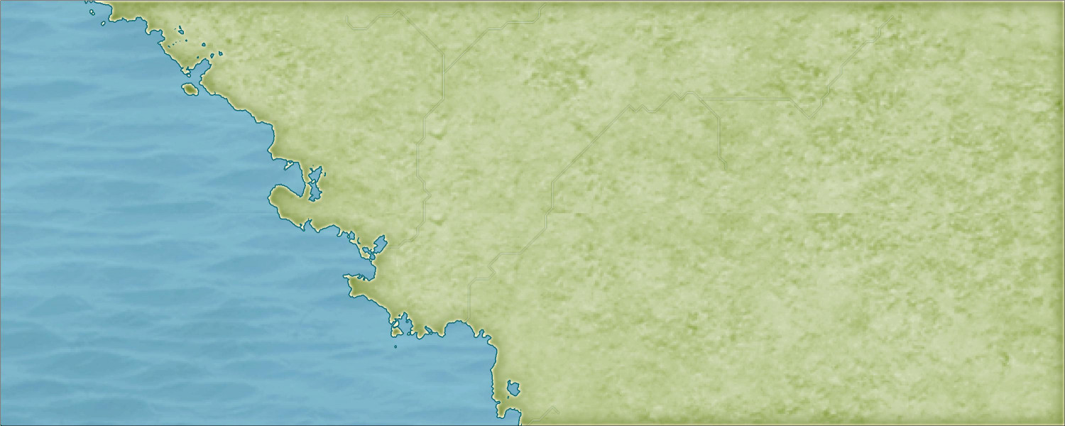
And here is what I did in Fantasy Realms Reimagined:
I copied over a mid-level elevation contour from the Jerion export to serve as a temporary drawing guide for the hills, and then another higher elevation as a temporary guide for the mountains. This style doesn't actually have a hills or mountains background the way the Schley style does (I mean, it does, but just for the individual hill or mountain itself: it renders onto a layer for the hill or mountain itself, with the ridge lines going on another layer). But I decided it was helpful as more than just a drawing guide, so I changed the hill background to brown and the mountain one to gray, put them on separate sheets, and added Edge Fade and Blur effects.
The coast looks blurry, but that's just because the map is so large. Here's how it looks zoomed in (it has a bevel effect on the LAND sheet instead of having a separate outline on a Coast sheet):
Even though I labeled this post as a Work in Progress, I probably won't do much more on this particular map. We'll see how much more I do when I have a chance to revisit it with the Sarah Wroot Revisited style. I may end up adding all the extra stuff when I flesh out the entire kingdom, which I suspect I will do in the Mike Schley style. This was just for fun and practice -- and it gave me a chance to use a style from this year's annual that I haven't really worked with before (other than using the hills in a back-burnered rendering of the Wizard of Oz map that I'm working on).


-
Live tutorial suggestions
In one of the recent Live video tutorials, Ralf asked for suggested topics for future Lives, as many of the mapping styles and annuals have been done. I thought I would create a thread here where people could add their suggestions.
Before adding my own, I wanted to mention (for the sake of completeness) the request from someone else for a tutorial about OSR Dungeons from the 2015 annual.
My request is to learn more about creating and using house symbols.
I'm not talking about the City Designer tools for creating houses, or drawing streets of houses. Ralf has shown that in a lot of tutorials (shown in this screengrab), such as the Big City Project tutorials from a few years ago, among others.
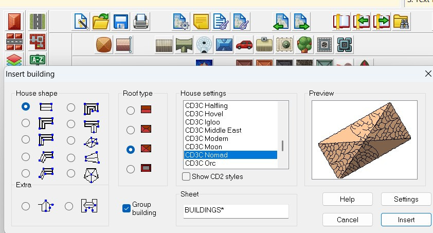
I am specifically curious about creating house symbols. They come with a shading file that I am curious about, and they respond to sheet effects in ways that many other symbols don't.
Here are some screen grabs of the symbols with the shading files to explain what I'm referring to:
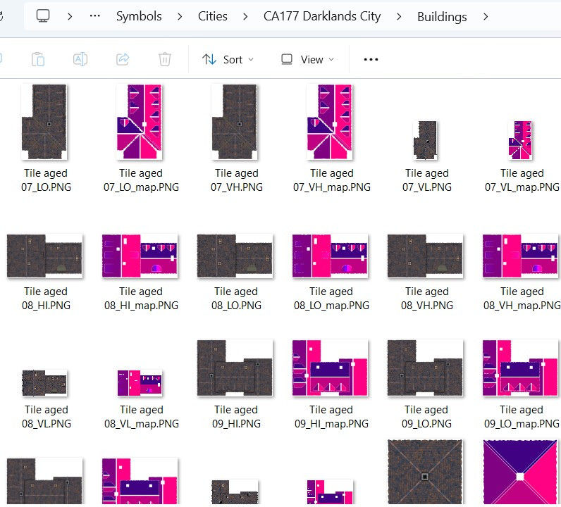
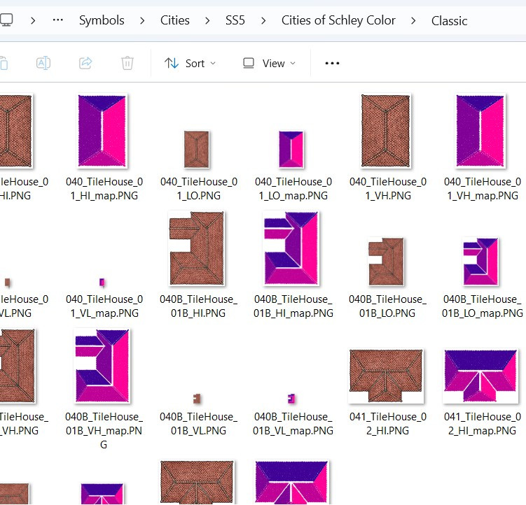
What are those shading files for? (I understand it has to do with how the building reacts to the global sun, but I am curious to learn more.)
These buildings respond to sheet effects that (usually) don't affect other symbols. For example, here's a mockup I did for use on this forum only* showing the RGB Matrix effect on building symbols from different styles. I also included some non-building symbols to show how the RGB Matrix doesn't always work on them (though apparently it does work on some but not all of Mike Schley's symbols).
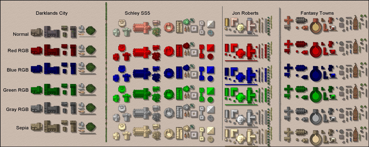
Anyway, a tutorial on how these buildings work and how to create building symbols would be different and super informative.
If folks have other ideas for Live videos they'd like to see, maybe this thread can be used for those suggestions.
Thanks!
* Please don't share this mockup outside of this forum, as it is a violation of the End User Licensing Agreement to share images of rows of CC3 symbols, as they could be used to steal ProFantasy's intellectual property. Admins: please delete this image or thread with my apologies if it itself would be considered a violation of the EULA.


-
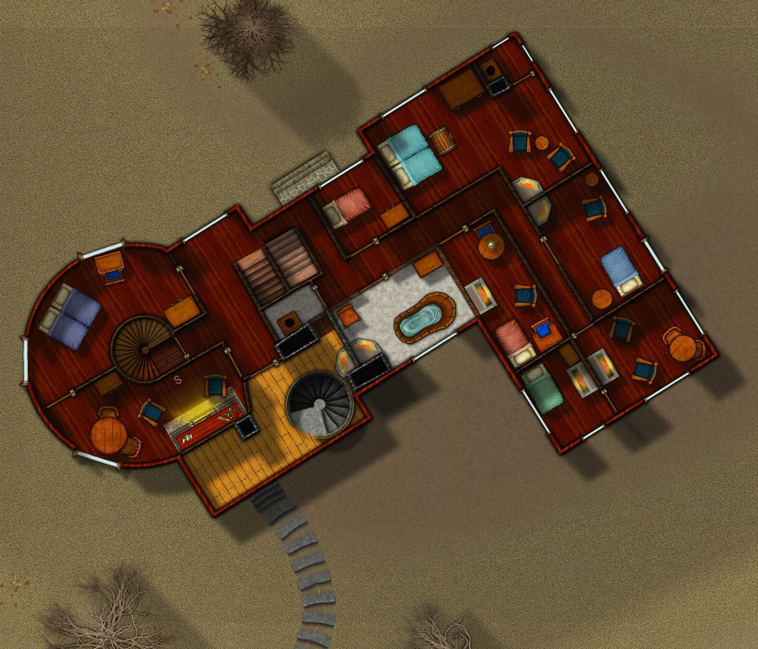
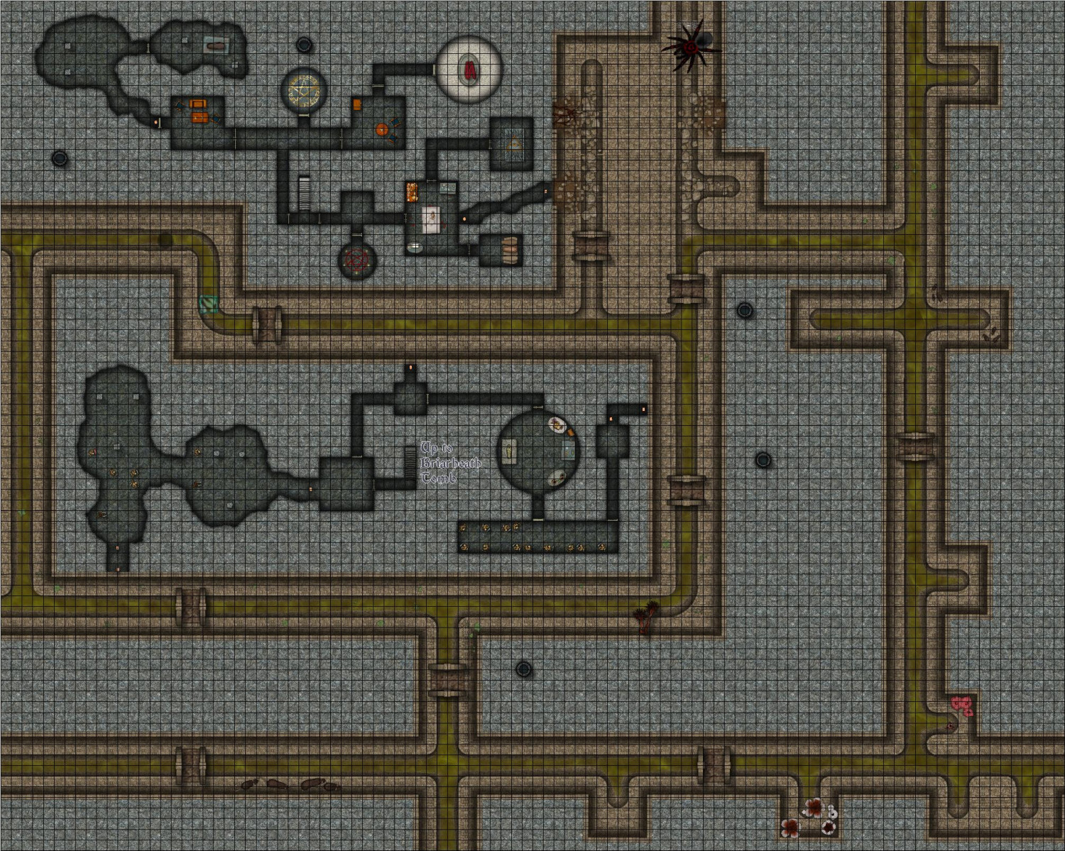
[WIP] Haunted Mansion
Still writing up the proper description but in the meantime, I figured I'd post what I think is the final version of the final map. More sewer encounters, including a giant spider, some rats (both giant and ordinary-sized), a gelatinous cube, and some hungry foliage. (Of course, a proper battlemap would use moveable tokens, but this is for flavor -- the creatures are on a layer that can be hidden.)
Oh, and a whole bunch of skeletons, and a few zombies -- an explanation for those empty crypts!
-
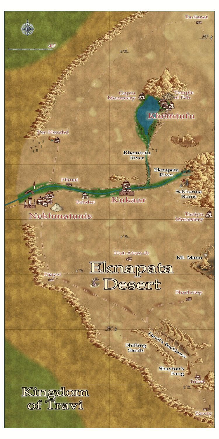
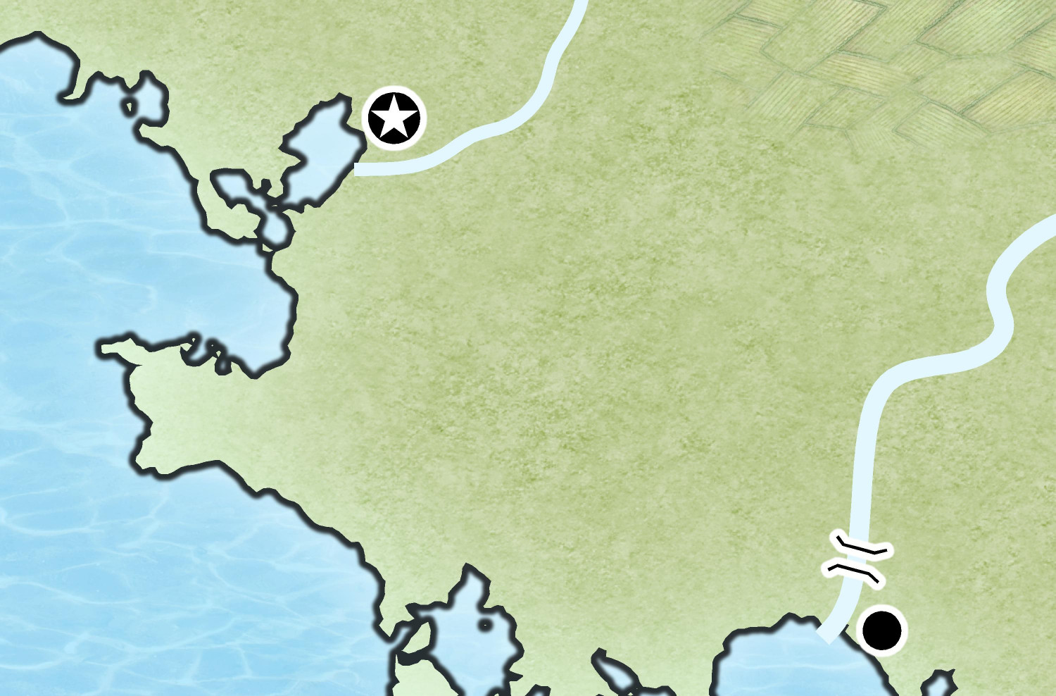
[WIP] Community Atlas - Eknapata Desert
Okay, here's the next iteration.
I tried to use blotchy lighter sands to suggest sand dunes, like the Sahara Desert, and darker blotches to show more solid, earth-packed areas. Not sure if I should try to get them to blend in more with a partial transparency or something?
Tried to make the roads show up a little more, but I can't tell if it was that successful. I liked the idea that the guys with the camels could be used on the trails roads to indicate that it was more of a general route through the sands, where most travelers would need an experienced guide to make sure they don't get lost, since a proper road would be blown away or covered with sand. There is a more treacherous area in the southern part of the desert called the Devil's Backbone, where a proper road on more solid land passes next to a 50-mile long fissure. It's a dangerous route, beset by foul creatures that creep out of the fissure, especially at night. But the road is on solid land, and without a guide, it might be a safer route than braving the shifting sand dunes. (I put a tower next to one of the villages down there -- maybe a wizard is there that the adventurers just have to visit?)
Thoughts?