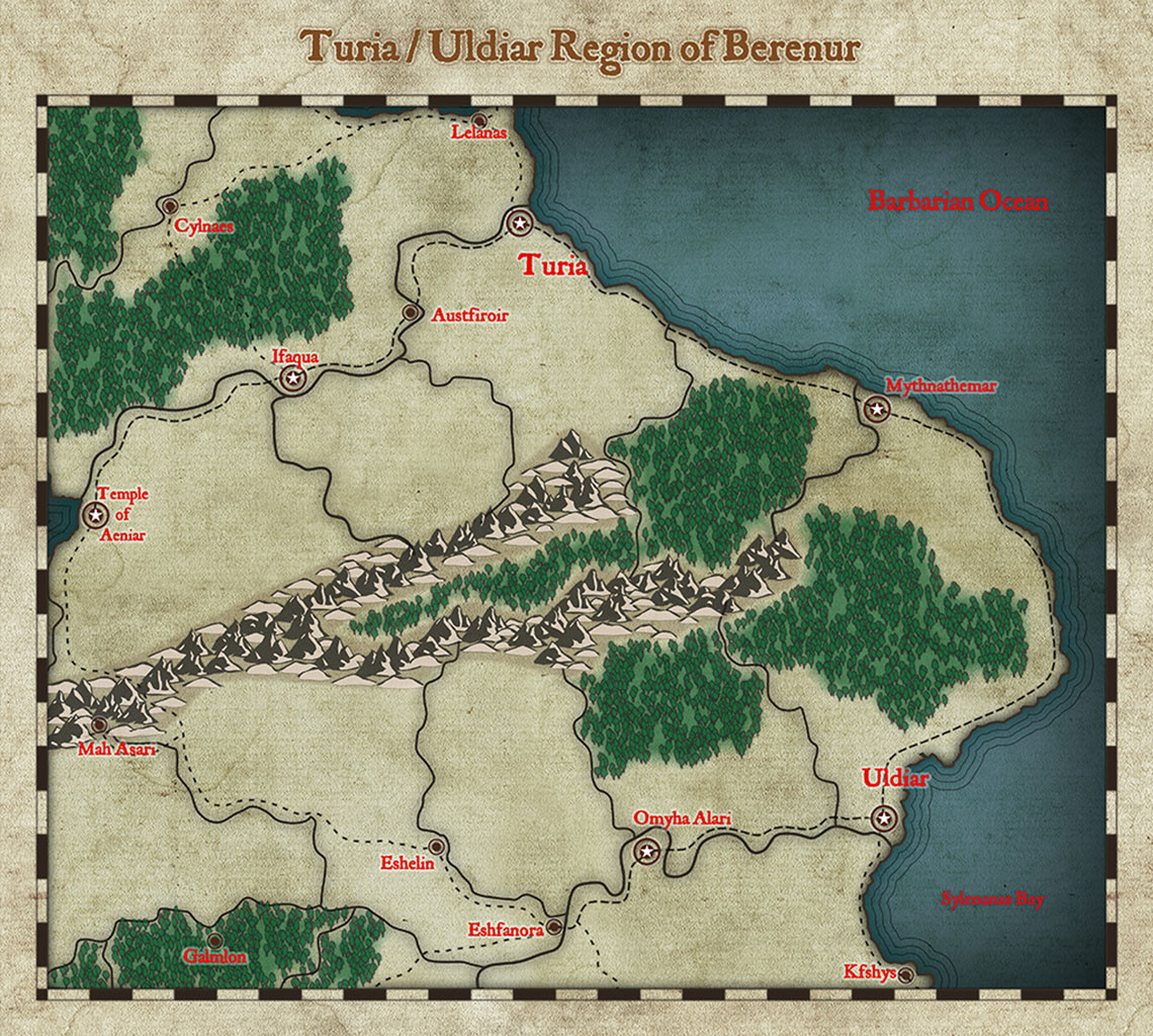
Turia / Uldiar Region of Berenur (Atlas)
I decided to use the World of Wonders style for my regional atlas map. At first I did not like the symbols but they are growing on me. Still has much more work to go but it is coming along slowly.
I have named the cities from the original map and have already added a few. I have placed a city so I can use the Mar-Goth city map (Mah Asari) in the atlas. Thinking of adding a spot for my Richardson Roadhouse map also, just so the regional map has some additional maps when it goes live.
Not sold on the text color but I'll deal with the text after the rest of the map is completed.
Comments and suggestions welcome.


Comments
Ok Almost done. Needs location names (maybe still undecided). Cities and towns added, roads and paths are done. Maybe add a couple of dungeon locations. Thinking of adding some small islands off the coast. Higher resolution image in gallery.
Comments and suggestions welcome.
Here is the final map. Added some exploration areas and added couple of islands. I also resized the fonts. Attached are the .FCW files for the regional map, Mah Asari and Roadhouse. Remy should already have the map for Austfiroir.
You did a great job there, Jeff :)
The map key for the Mah Asari map doesn't contain the actual text.
Ok I'll fix that real quick. It's link to a file. Should be fixed now.
Thank You Sue.
Here's the Turia/Uldar region and locations:
Thanks for the contribution Jeff.
Next up in my processing queue is Ricko's maps.