

Resizing the map area - trouble with the Screen

I'm back on a fantasy world map using the aptly named "Fantasy Worlds" mapping style (Annual from April 2009).
When I use the "Resize drawing area" command from the file menu, the "Screen" object doesn't get properly resized. The map border and the blue water background do, becoming bigger on the right side (I scaled X up but left Y the same), while the screen remains its old size, which means instead of covering the area just outside the map like it's supposed to, on the right side only it is instead hanging inside the map border (image attached).
I tried non-visual scale X/Y on the screen object a couple times with a couple different values, but this made it thicker, which I don't want. I just need to push its right side further to the right, essentially, but I'm not sure how to do that.
So another thing I tried is just... making a new map. Used File - New, and selected the Fantasy Worlds style, etc... just made a brand-new map in the same style but with the new dimensions that I wanted to change to. Then copied all my objects from the old map to the new one.
So I guess my two questions are:
- Is there any reason I can't just proceed with a new map like this as a workaround? Most of my custom sheets and layers made the journey as well, and any few that didn't can be redone manually. I can't see a major downside to this but I haven't tried something like this in a while and wanted to make sure I'm not forgetting some side effect of migrating to a new map that I need to account for.
- For the future, if I needed to resize again, is there some way to make sure the screen gets resized along with the map border and background? Or a way to properly adjust it after the fact?
Thanks! Image showing the right side of the screen now hanging inside the map border and creating a blank white space is below:
Comments
1. A new map usually works just as well, although if you have custom sheets and effects you need to copy the effects over as a separate operation, and also fix the sheet order.
2. This issue can arise if the screen isn't on the appropriate sheet. Especially a bit older templates from before this was standardized may have the screen on the wrong sheet. The easy fix to handle this is to just erase the old screen entiy, then make sure there is a sheet called SCREEN, and that it is the next to last sheet in the list (MAP BORDER) should appear after SCREEN, make sure the current line width in the status bar is set to 0, and then type COLLAR <enter> on the command line, this will automatically create a new screen for you.
Thanks for the reply Monsen!
Re: the new map strategy - thanks, that puts my mind at ease. I'm sure I'll run into a few things like sheet order, effects, etc. that I'd customized with the old map, but forgotten about, and will have to manually recreate on the new map as soon as I notice they're missing/different. But that's fine, that's not much trouble, my main concern was any kind of "permanent" potential pitfall that I wasn't remembering, and it sounds like there aren't any. So that should work
Another advantage of moving to a new map created with the new dimensions in mind: the snap grid was way off from the map borders on the old map, probably due to some changes I made at some point ages ago (this map has been around a long while in some form). On the new map, everything is lined up again without me having to do any work to figure out how to manually line them back up.
Re: the Sheet... Hmm. So I made sure that "MAP BORDER" is the very last (bottom in the list) Sheet, and that "SCREEN" is right above it, second-to-last. Then I deleted the existing "screen" object and made sure the LW is 0 and set SCREEN as my current sheet and layer... but typing "COLLAR" and then hitting enter just gives me a "CC3 does not understand the command" error. Then I thought maybe you meant to actually type the whole thing as you wrote it, so I typed "COLLAR<enter>" (with no spaces since hitting spacebar seems to function the same as hitting enter when typing in the command line), but, same error. So not sure what's wrong there.
Sounds like you haven't installed the latest update. COLLAR is a brand new command.
Thinking about it, you'll probably want to use COLLARAUTO instead though.
You're right, I hadn't updated, I forgot, haha.
I did so, and the "COLLARAUTO" command worked... kinda. It created a new screen, but it's absolutely colossal. Like twice the size of the entire map, at least. Is there a setting somewhere to control how big the screen will be when using this?
If I use just "COLLAR" then there are additional options ("Collar Surrounds: map border" and "Collar Width [calculate]"). I assume I can just hit enter through that first one (surrounding the "map border" is exactly what I want so it sounds like that's already set up to do just that), and for the width... I can look at the width of the map and then add X amount on either side to arrive at a total which will give me a screen sized similarly to the one that's created automatically with a new map?
COLLARAUTO tries to calculate a screen size that is certain to cover everything. Keep in mind it is just supposed to cover up everything around the map, so it shouldn't really matter if it is big.
The with parameter is the "thickness" of the screen itself, i.e. how far it extends from the map in map units.
If you just want to specify the width, you can also use the COLLARW command.
Hope that all works..does for me.
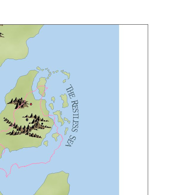
Meanwhile, sir, could we see the rest of that map? It's lookin purty good for such a small slice heh.
😁
Cal
Hmm, I may not have explained it well, and/or I am misunderstanding you now, but the main reason it was a problem is because it made "zoom to extents" kinda useless (unless the screen sheet or layer is hidden) because it would zoom WAY out. I migrated to a new map to continue working but I still have the previous map with the gigantic screen, so here is a screenshot from that map showing what I mean:
You can see how big the screen is cause it's highlighted/selected at the moment, and how much the "camera" is zoomed out; that's how far out it goes when I use zoom to extents, due to the zoom going out far enough to capture the now-gigantic screen (the blue square is the entire map; everything but the background is currently hidden).
But that's mostly academic at this point anyway, because the COLLARW command worked perfectly and is exactly what I'd been hoping to be able to do, so thanks! I'd already transferred my work to a new map and have been working on it since then, but if I ever need to make future adjustments to canvas size (or need to make changes to the screen for any reason), I can make use of this.
Aha, thanks. That IS only a small slice but I plan to post a full WIP soon, once I make a few more adjustments!
There are two possibilities when the map is small when using zoom extents. There might be others.
1) the screen as you say is too large.
2) there is a symbol or text outside the drawing area.