

Planet Nibirum goes November Annual 2019 - from FT3 to CC3+
 WeathermanSweden
🖼️ 3 images Surveyor
WeathermanSweden
🖼️ 3 images Surveyor
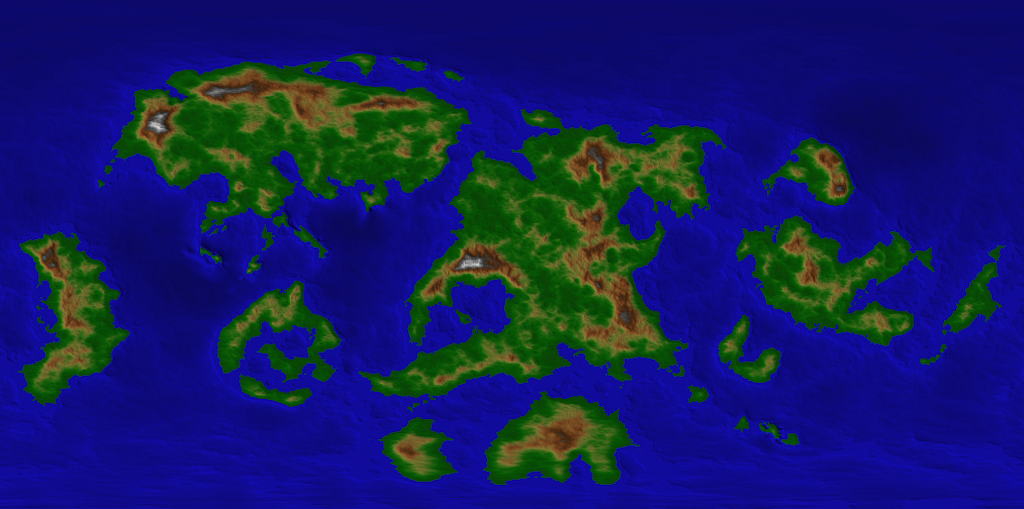
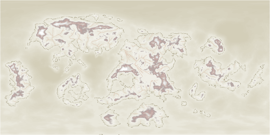
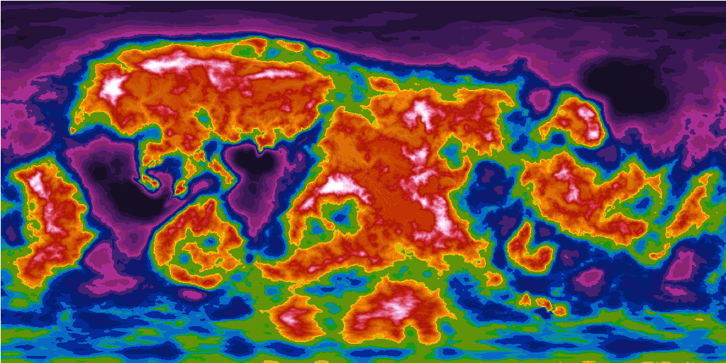
When you import the world.ftw file from Community Atlas Project you get something like this in Fractal Terrain 3 (FT3):
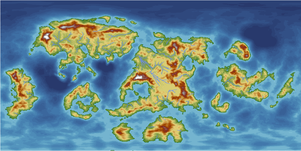
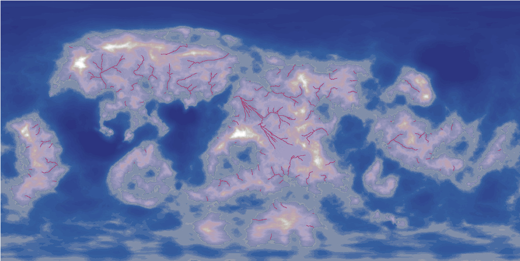
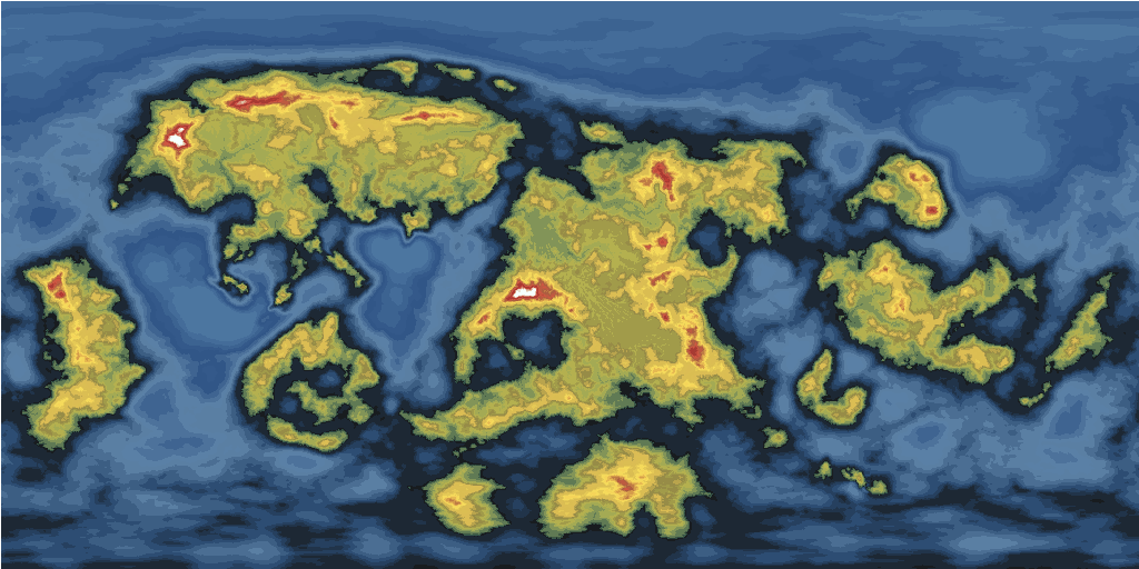
When you follow the excellent guide from this November Annual and use one of colouring exempels, you get something like this:

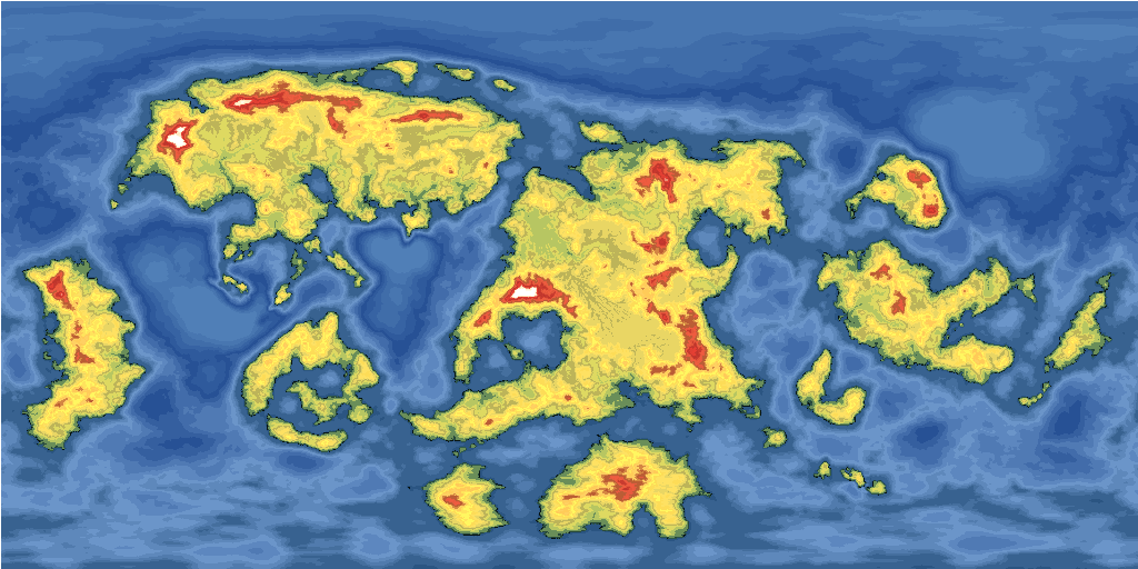
After exporting the map to CC3+ you can get almost whatever version you want (thanks to the new PALSAVE and PALLOAD functions...)
Here are the versions when you use the shader-sets of the Annual:
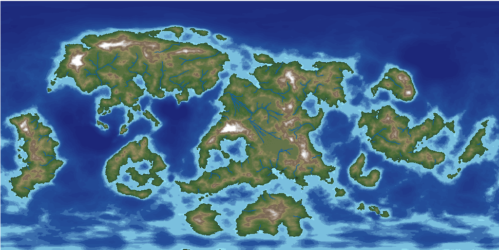
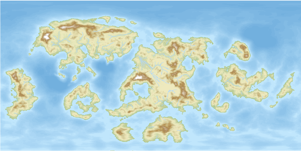
Let's start with the so called HC Blend shader (that I also used in FT3):
Keep in mind that this picture is a CC3+ export - a map that only consists of coloured polygons (except the rivers of course).
This is also true for the following versions:
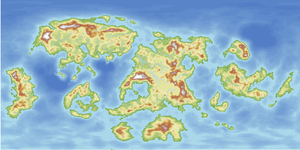
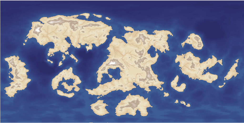
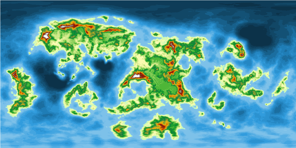
Here comes the "Natural" version:
Then we have the Atlas version:
...and here the "Old map" version:
So long the maps have almost the same "map"- feeling - maps that one usually can find in books or the Internet presenting the topography of the world.
Now we get to the special ones:
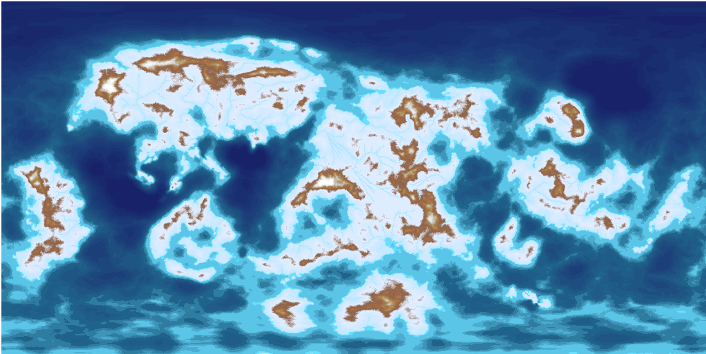
Desert (when it has gotten to hot on Nibirum...):
Arctic (when it has gotten to cold...):
Parchment dark - maybe a map that you use when you sail the seven seas...
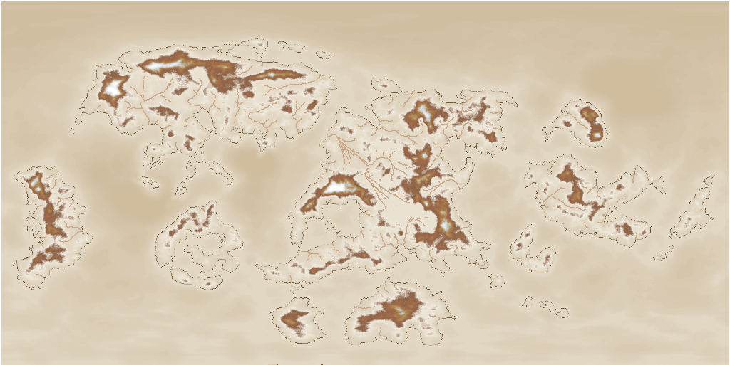
or Parchment light:
or why not get Vulcanic?
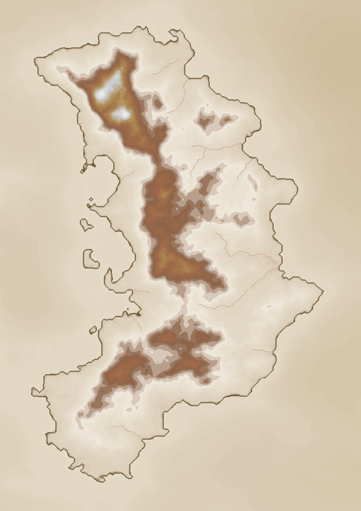
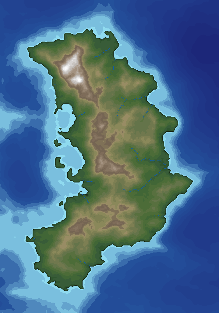
And here are two close-ups of the continent Berenur to show that the maps consist of contours (and river lines):
I must commit that I did not follow the part of the almost painful colouring of all contours in the guide.
I created instead an export file where I had to do the painful "colouring" of the alt- and sea- contours once.
And with the shaders from the Terraformer-Package for FT3 you get over 200 different possibilities to get your contours coloured...
...with some tricky conversion from LTG - files (FT3) to PAL - files (CC3+)
Maybe astronomers get excited with the CLEMENTINE colouring:
or the MAGELLAN colouring:
But in the end we end up with a topographical version again")
This is by the way the adaption of the T_129_TOPO_060 shader from Terraformer...converted to a CC3+ colour palette...
All maps use only 16 colours for the sea and 32 for the altitudes!
When you follow the excellent guide from this November Annual and use one of colouring exempels, you get something like this:
After exporting the map to CC3+ you can get almost whatever version you want (thanks to the new PALSAVE and PALLOAD functions...)
Here are the versions when you use the shader-sets of the Annual:
Let's start with the so called HC Blend shader (that I also used in FT3):
Keep in mind that this picture is a CC3+ export - a map that only consists of coloured polygons (except the rivers of course).
This is also true for the following versions:
Here comes the "Natural" version:
Then we have the Atlas version:
...and here the "Old map" version:
So long the maps have almost the same "map"- feeling - maps that one usually can find in books or the Internet presenting the topography of the world.
Now we get to the special ones:
Desert (when it has gotten to hot on Nibirum...):
Arctic (when it has gotten to cold...):
Parchment dark - maybe a map that you use when you sail the seven seas...
or Parchment light:
or why not get Vulcanic?
And here are two close-ups of the continent Berenur to show that the maps consist of contours (and river lines):
I must commit that I did not follow the part of the almost painful colouring of all contours in the guide.
I created instead an export file where I had to do the painful "colouring" of the alt- and sea- contours once.
And with the shaders from the Terraformer-Package for FT3 you get over 200 different possibilities to get your contours coloured...
...with some tricky conversion from LTG - files (FT3) to PAL - files (CC3+)
Maybe astronomers get excited with the CLEMENTINE colouring:
or the MAGELLAN colouring:
But in the end we end up with a topographical version again
This is by the way the adaption of the T_129_TOPO_060 shader from Terraformer...converted to a CC3+ colour palette...
All maps use only 16 colours for the sea and 32 for the altitudes!
Comments
I love it when things get adapted and improved like this.
I will try to combine this topographical map with Shessars rivers so that my map(s) get compatible to the other maps of the community.
It would be great if someone had some ideas how to get the topography to follow existing rivers and not vice versa...
I have already some ideas and have contacted Joe Slayton.
I'm speechless, so great maps and incredible works. What kind of work is behind this!
I am very impressed.
I also made such maps, but then no time. Now I start again.
Maybe one day I will be able to show my work.