

Google Maps terrain cutouts.
 kathorus
Traveler
kathorus
Traveler
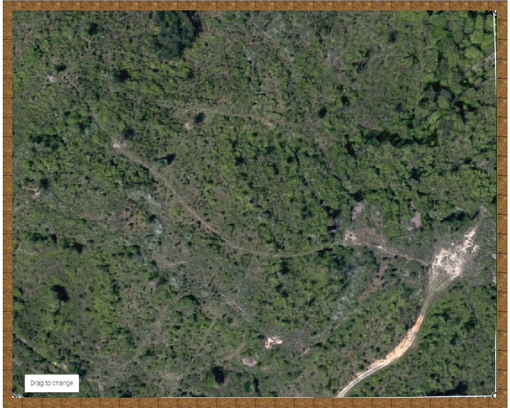
I am redoing a keep from an old D&D module for an upcoming campaign and wanted to share a bit of this process as I thought what I've 'discovered' is real neat.
A bit of background, I often redo maps so that I have files that I can modify and change, so while going through the adventure module I was reading about the keep, it's history, it's current bandit inhabitants, etc... and I thought it was missing somethings. The adventure talks about a clearing, but the map is just of the keep proper, there's no outer wall, no moat, things are placed a little haphazardly, etc... So I wanted a map that would show the surrounding area a bit and also more closely model the keep as a defensive structure with concentric defenses.
Now to the point. I am always at a loss for making close up overland designs, so I went into Google Maps and looked around my general neighborhood, which is hilly and wooded, and used the measuring tool to measure an area 1000'x800', clipped that into OneNote, copied it into Paint, save as .png, and inserted into my map using a 100' grid with snaps on. I wasn't that surprised at how well it lined up, as you can see the Google Map measuring tool's circles at the corners, but it was nice to affirm that this type of operation can be done. This will likely save me a bunch of time in determining some map elements as I'll use this for some inspiration for laying down paths, rivers, ponds, contours, etc... it also will help me to scale trees and the like to look 'natural' for the map.
All-in-all, I stay amazed at how awesome this software is.
Comments
(I am famous for getting the wrong end of the stick
I was beginning to wonder how you were ever going to make it look good when combining a blurred photograph with relatively sharp drawn symbols, but I get it now! LOL!
Looking good - and like Lorelei I watch with interest