

FT to CC3+ output

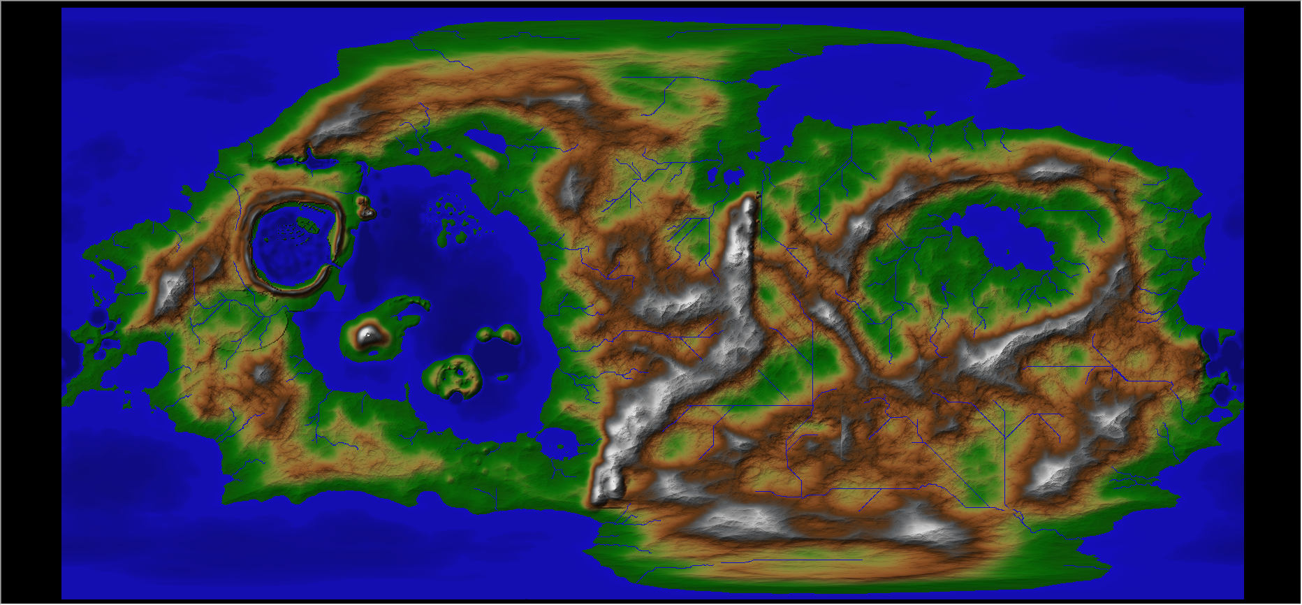
I need some help from the hive mind: I am trying to export/import a map from FT3 to CC3+ with the same level of detail/clarity. What settings down I need to have in order to do that? All the settings I have tried so far have turned out blocky or washed out. In particular, I am trying to get the blended contour lines without harsh/distinct separation of the contours. I really like how the FT map is almost photo quality (ie very blended colors). Anything I export/import into CC3+ tends to look like a map with very distinct lines.
I have tried the 'full' export to CC3+, but there are still very distinct contour lines in the final product.
I have tried the 'full' export to CC3+, but there are still very distinct contour lines in the final product.
Comments
One of the big differences between FT3 and CC3+ is that FT3 has a knowledge about the height of the terrain represented and understanding of what this means, CC3+ doesn't have this, it sees the map as a flat entity.
What the FT3 export to CC3+ does is to give you the actual map from FT3, which you can then edit in CC3+, but not not the visuals, for that you need to keep the map in FT3. Generally, you would normally take the output from FT3 and then change it to match the visual look of one of the many styles available fro CC3+, the visuals of the export is more of an intermediate step for you to turn into a CC3+ map of the design you want (from those available in CC3+).
I exported the world map from FT3 as an imagine. I've loaded it into Realm Works to connect all the maps together. I then took a screenshot of the grid section that was also loaded into Realm Works. I pin it all together so you can click to navigate the map. This works for the first 2 zoom levels.
The 3rd zoom level is where I export to CC3+ with the borders turned on. This allows me to TRACE the map ensuring I get the same shape. From there I recreate the map in one of the CC3+ styles.
The fourth and fifth zoom levels will be floor plans, dungeons, towns, cities, etc.
Lee Smith (aka the MadCartographer) is doing something very similar and have shared some of the best examples I have seen so far of FT3 being used to export into CC3+ and then recreating the maps in detail. Here is his FT3 map.
And here is his CC3+ map of a single grid section.
Thank you for the answer. I was afraid of that.
To me, it doesn't make sense to me since they are made by the same company and they state the interchange between FT and CC3+ in the FT description: "If you want to build entire worlds in seconds, or take real world maps then export them to CC3+, Fractal Terrains 3 is your tool." The implication is that they are fully integrated and compatible. /shrug.
Thanks again for taking the tie to answer.
Do remember that FT3 is a fully fledged editor itself though, if you like that style of map, you can work with it inside FT3 and manipulate it there.
Personally, the last thing I would want is for my CC3+ maps to look like they do in FT, that view is great for showing off the world in it's entirety (or large chunks of it), but it doesn't lend itself particularly well to all the details you wish to work with in CC3+. Just my opinion of course, I realize that people needs and desires are different and no less valid than my own.
I then edit that exported world in cc3. Adding a few large cities and a space port. Then I use the down port annual to make the space port.
Oh. I remember the scale between ft3 and cc3 is different.