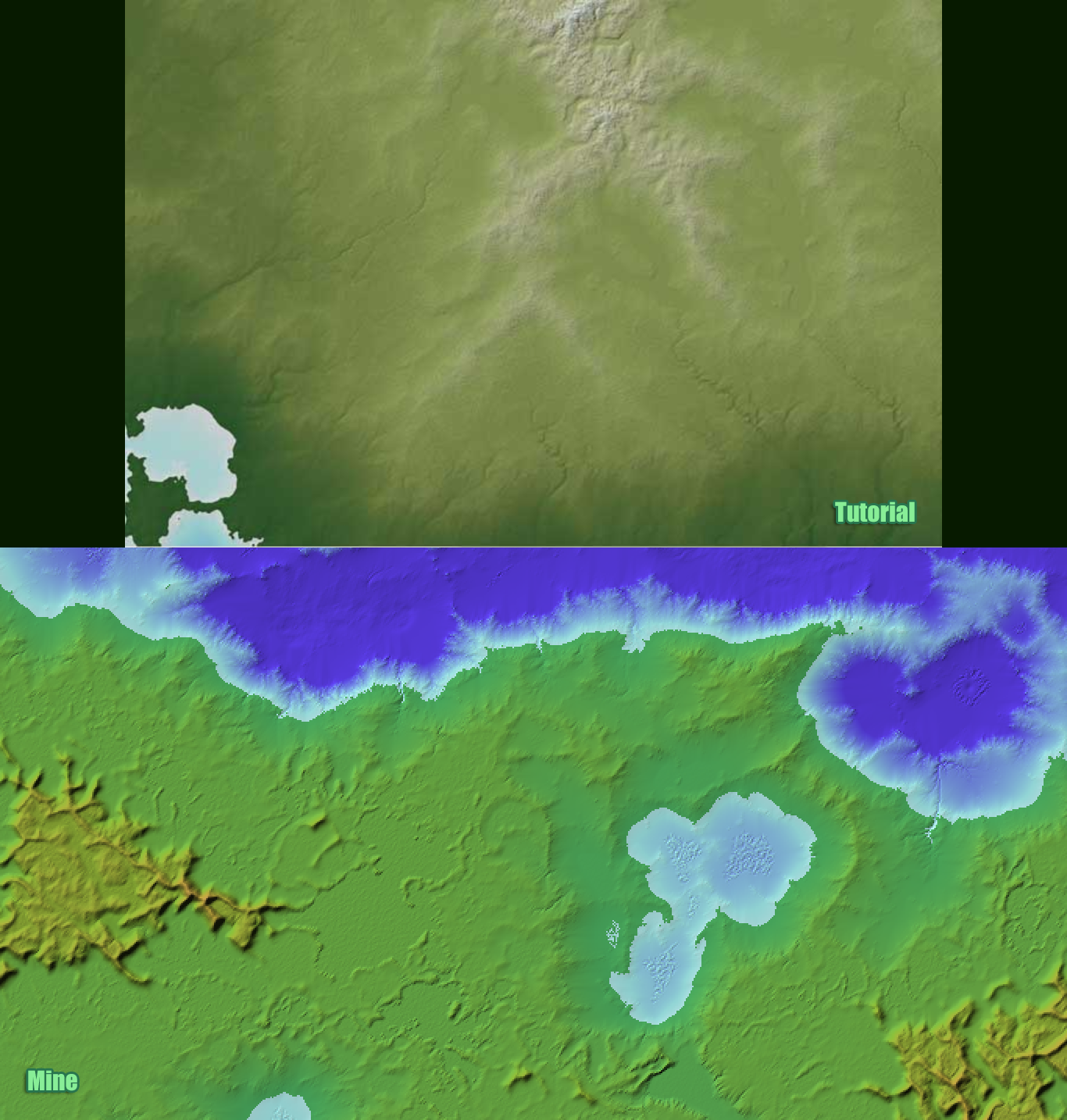
Anybody seen this or used it to make a map with FT/Wilbur?
Found a neat tutorial here that combines Fractal Terrains, Wilbur, and Photoshop:
http://www.worldofgotha.com/PF_TUTORIAL/israh_index.html
I've just started this part:
http://www.worldofgotha.com/PF_TUTORIAL/israh5.html
My big complaint/problem is that the 1st image shows nice top-down view of beautiful mountainous looking terrain. This is coming in from Fractal Terrains after an initial Wilbur pass. My map looks more like someone dribbled wax onto a green field than the nice ones shown at the last link. Has anybody else ever come across this tutorial and gotten similar results to him?
I've included a screen shot of my map as it stands at /israh5... I just can't figure out how I went so far astray, will try again from scratch, but was curious if anyone else had feedback from this tutorial.. I'll include both the tutorial and my result, you'll be able to tell them apart.. arg..


Comments
First I think you should use the Wilbur color palette provided so that you can have a more apples to apples comparison. The palette may make thinks look marginally better.
The problem is that Wilbur documentation was never really created and for most users they have no idea how the many of the settings will affect their maps.
Using too much or too little of something on an altitude range can cause problems later.
I tried different iterations many different top down and bottom up approaches and things never look right.
In the end I used 3 PNG outputs - one for Sea Mask, one for the Wilbur textured terrain and a grayscale height map which I imported into GIMP and did some work there. I use this as a background in CC3 and make my map that way.
Good luck!
One of them contains the color pallettes so all you need to do is load them in the Wilbur shader with the proper elevations set for Land and Ocean.
I did use the span command I don't think that's your problem.