

How to combine two similar terrains or expand a current terrain?

I have a very common problem, and can't find a solution online or in the manual.
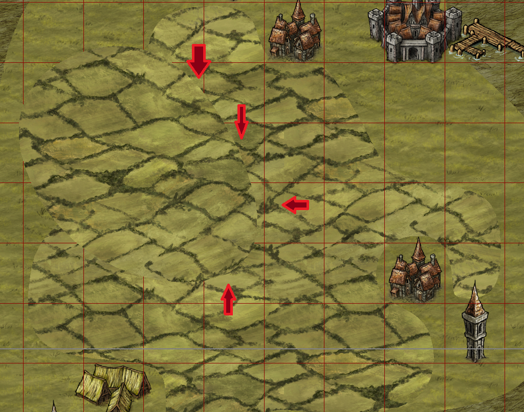
If I create a Default Terrain, sometimes I need to "add to it" or expand it to make it bigger. Sometimes, this works seamlessly. However, with something like "Farmland" or "Lava" in Herwin Wielink's terrain, it looks bad because the lava streams or farm squares don't line up correctly. This is due to there being two separately drawn Default Terrains of the same time, overlapping one another.
So lets say that I create a 10x10 squad of farmland. What if I wanted to make it bigger, say 20x10, but wanted it to keep the same fill?
I uploaded this image, showing two different "Default Terrain" farmlands drawn. The second, is drawn on top of the first, because I wanted the whole thing to be bigger. However, I can't find a way to combine the two, so that the fill works correctly.
Sorry if I did not explain the problem very well.
Comments
the existing polygon rather than try to overlay it with another.
Hope that helps
pdj's way would be the best on an elaborate shape (ie with many more nodes).
Your post saved me hours of searching and headaches, I am grateful!
It works for the continent, but how do I get it to work for this?
Edit: The "NODE EDIT" button works.
Step 1) Click the NODE EDIT button. It is in the bottom left section of buttons with the blue squares and blue/red lines. It is the top left button in that section.
Step 2) Click on an edge of the terrain blob. It only works if you click somewhere on the very edge. "Insert Node" may be used with this as well.
from the terrain icons top left. I don't know why that is.
The NODE EDIT works though. Thank you.
One thing you could use that the tool supports is the Trace functionality however. Assuming you have several polygons on top of each other as you have in your original screenshot, you can trace the outer edges of each polygon to create a new polygon following those edges. You can easily use Trace to trace multiple entities in a row (Trace needs to be ended and reactivated for each)