

Can't change coloring schemes in FT3.

Hello all,
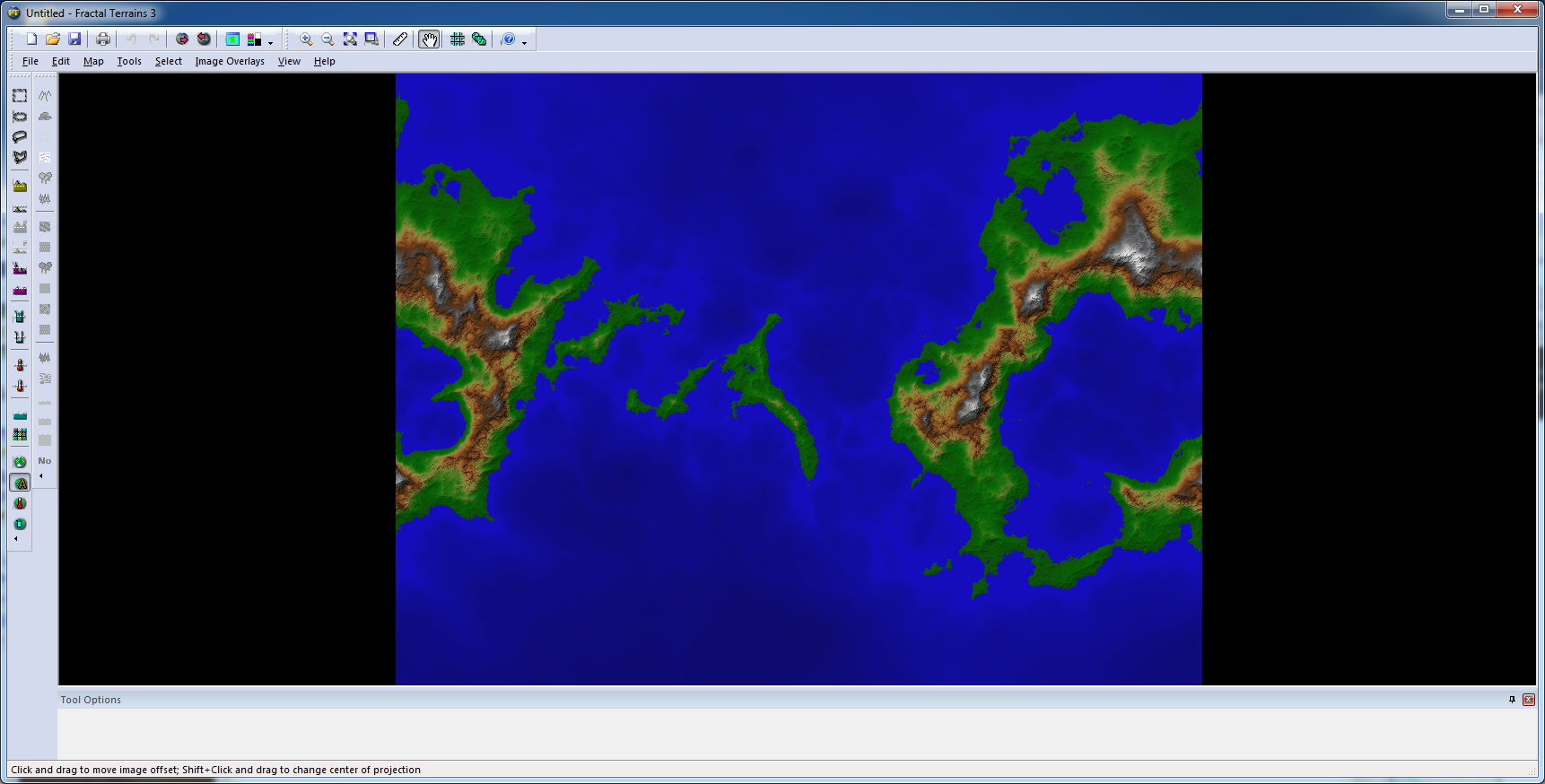
I'm playing with FT3 and I am attempting to create a map that I can export into CC3. I have two issues currently:
1. Changing the coloring scheme doesn't seem to change the map colors at all. No matter what coloring scheme I attempt, I still get the map as is shown in the attachment.
2. How can I get the map imported into CC3 to display as a standard CC3 overland map? i.e. I would like it to look as though I drew it myself with CC3 rather than using FT3, color-wise.
While it may make for a nice satellite map, it looks terrible as a map generated for a fantasy world...
Thanks
-- redmage123
Comments
2. Use "Change like draw tool" on the entities. You can find this command by right clicking the change properties button. (When the prompt asks you to select the desired drawing tool, remember that you can right click to get the drawing tool dialog up to select from). If you wish to use another style than the default CC3 style, you should start a new map in that style, then simply copy the landmass entities over to this new map, and then use the change like draw tool command on them, as this will ensure that the appropriate tools for the style is available. Note that if you plan on using a map style that uses mostly symbols and not contours, you should probably only export the coastline from FT3, and not all the height contours.
Unfortunately, after I load the map, if I try and zoom out past a certain point, CC3 crashes...
-- redmage123
-- redmage123
To try without the multipolies, you need to edit the FT3 export setting and uncheck the multipoly each contour level option in one of the steps in the edit export setting wizard. Note that doing this will cause lakes to "disappear" in the export, because the multipoly is normally used to "punch holes" in the landmass, but for most maps this is the better option, because you normally want your lakes to be a separate polygon on top of the landmass anyway, and not a hole down to the ocean. The lake polygons are still exported, but they can disappear behind the landmass, and since they are hollow, they might also be a bit difficult to spot.
The last option, which is more appropriate for some map styles is to export the FT3 map as an image, insert it into the the CC3 map, then use the drawing tools to trace over it. This is a little time-consuming though.