The Storm lands

ClerconClercon Betatester Traveler
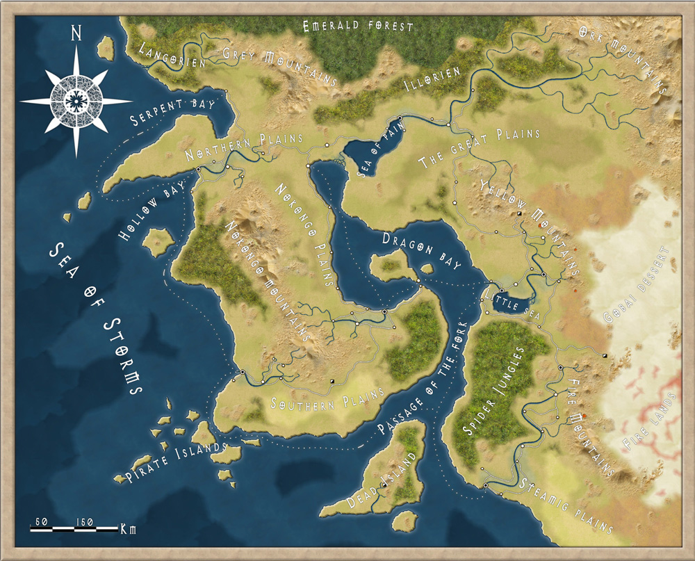
Here is a map I made trying out the new annual style from this month.
Everything except labeling and compass rose is made in CC3. The compass rose isn't from the style as well, but I thought it kind of fit in.
Hope you like it.

Comments

  • I do like it. it looks like a satellite image!

    one question though...why is it called the Sea of Pain...!
  • RalfRalf Administrator, ProFantasy 🖼️ 18 images Mapmaker
    Again, very nice to see the style in action. :)
  • DogtagDogtag Moderator, Betatester Traveler
    edited September 2012
    Beautiful map. I find that my eyes keep going to the the Passage of the Fork, Dragon Bay, and the rivers, especially. Very nice!

    Also I'm intrigued (always great when a map evokes that), what's going on, geologically, in the Fire Lands to the southeast?

    Cheers,
    ~Dogtag
  • My prefered part is the Passage of the Fork in conjunction with the Dead Island.

    Congratulations.
  • Beautifull.
    Especially the rivers. They look natural. Gratz.
  • ClerconClercon Betatester Traveler
    Thanks for all the nice comments. Unfortunately I have no idea why the sea is called the sea of pain or whats happening in the fire lands. I usually try to make up a story around the maps I make. But this time I just wanted to test the new style from the latest annual. So I concentrated on trying to make an interesting coastline, rivers etc.
  • DogtagDogtag Moderator, Betatester Traveler
    Well you certainly succeeded, especially with the rivers. I agree with Henrie61, they look natural -- or at least naturalistic. Great job!

    I'll just make up my own story about the Fire Lands! ;-)

    ~Dogtag
Sign In or Register to comment.